Toggle navigation
Mountains
Routes
Images
Trip Reports
Forum
What's New
People
Areas & Ranges
Articles
Trailheads
Canyons
Huts & Campgrounds
Albums
Logistical Centers
Fact Sheets
Lists
Custom Objects
Gear
Plans & Partners
WELCOME TO SUMMITPOST
SIGN IN
REGISTER
Kings Peak
Additional Parents
Highline Trail
Image
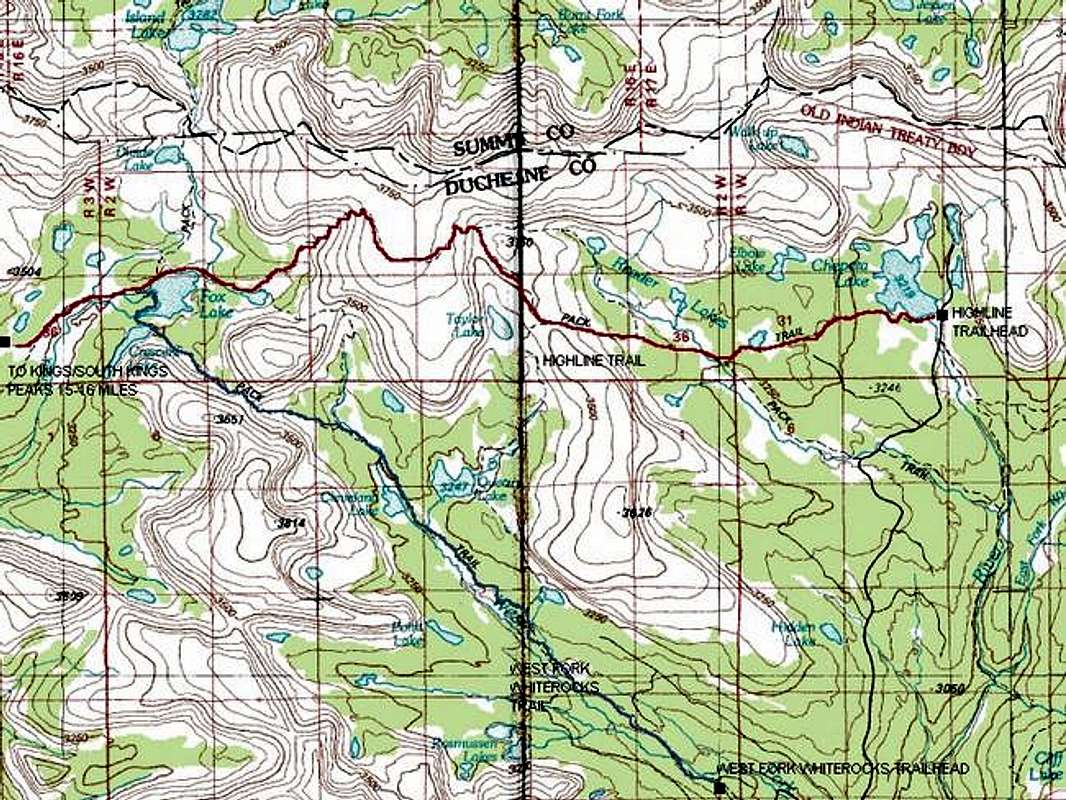
First half of the Highline...
View High-Resolution Image
First half of the Highline...
First half of the
Highline Trail
and
West Fork Whiterocks
Routes. The peak is still 15 miles west of the map! Map also prepared for South Kings Peak page. Credit: Topozone
« PREV
NEXT »
Scott
on
Jun 3, 2005 2:39 pm
Comments & voting
Other parents
Lat/Lon:
40.77650°N / 110.3723°W
Image ID:
108297
5903 Hits
71.06
% Score
1
Votes
Log in to vote
Comments
No comments posted yet.
to post!
Don't have an account?
Kings Peak
(Mountain/Rock)
« PREV
Viewing
#279 of 394
GALLERY
NEXT »
Scott's Image Gallery
« PREV
Viewing
#5272 of 8098
GALLERY
NEXT »
Highline Trail
(Route)
Loading....
×
You need to login in order to vote!
User Name
Password
Remember me
Forgot your password?
Log me out when I close my browser.
Keep me logged in all the time.
sign in as a user
Don't have an account?
Register now for FREE
Rating available
Suggested routes for you
People who climb the same things as you
Comments Available
Create Albums
Register Here


