Let me emphasise at the outset that this is not written by my obituarist. And while not exactly even in the evening of my life, it’s getting to be late afternoon, and some retrospectives are best handled sooner rather than later. Or, perhaps, I just felt like writing a story to provide diversion on a wet winter afternoon.
I grew up in the slums of industrial, smoke-blackened Manchester in the late 1940’s and early 50’s. Post-war rationing was still in effect and war damage was evident everywhere. People worked hard but were limited in both prospects and personal outlook. Apart from the weekly prospect of watching City or (God forbid) United on Saturday afternoons, there was little optimism to be found anywhere. I don't suppose I thought too much about the grime and poverty that was all around me. I had, after all, nothing else with which to provide a comparison.
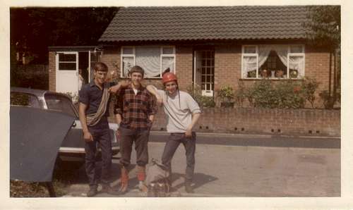
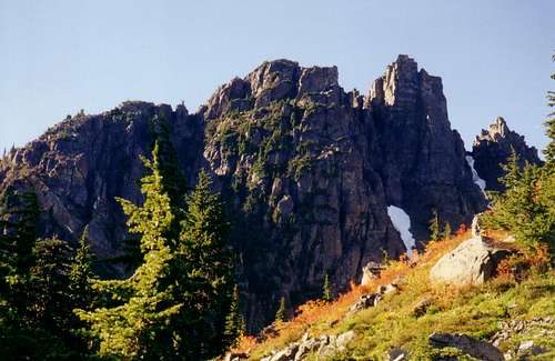
![Goin Climbin in 1965]() Goin' climbin' in 1965
Goin' climbin' in 1965
Gradually, however, the national trauma of almost 40 years of war and economic instability began to recede and ordinary working people in the UK began to acquire a little spare time and cash. Enough, at least, for the occasional trip to the sea or the countryside. This was the era so famously summarised by Harold McMillan, the Prime Minister of the time, as “You’ve never had it so good”.
I believe I was four years old when my parents made their Sunday treat a trip to Hayfield in Derbyshire. It was the first time I can remember seeing trees and fields. It must have felt like another planet rather than an ordinary little village only a little removed from the outskirts of Manchester.
Right above Hayfield, on the edge of the Pennine Hills, is a height of land known as Kinder Scout. The Ordinance Survey definition of a mountain requires a minimum height above sea level of 1,000 feet and Kinder just about conforms to the definition. It was certainly described by my father as “a mountain”. It was the first I ever saw and, at the age of four, I wanted to climb it immediately. My father, however, was more concerned about the fact that the pubs were about to close and dragged my mother and me off to the nearest establishment with the singular focus that characterised most of his life. The right seeds had been sown, however, and mountains have never been far from my thoughts from that day on.
For almost 50 years I’ve been out and about amongst the wild places of the planet. From South America to Nepal. From Europe to Asia, Oceania and beyond. Not to forget, of course, my beloved Vancouver Island. I’ve been privileged to enjoy a lifetime of adventures before I’m even old. There have been highlights aplenty along the way and in this article, I thought I’d share my opinion of the best day hikes that I’ve done thus far. Perhaps there’s still time to displace some from the list that follows? I certainly hope so.
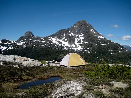
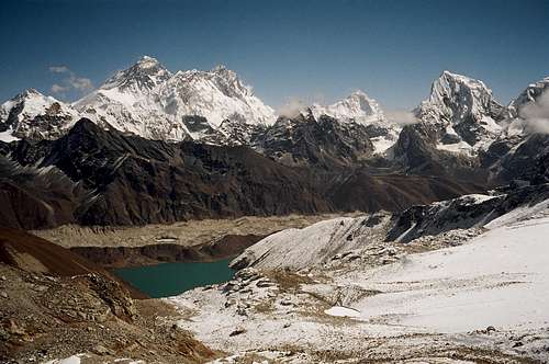
![Camp on Mt Burman]() The Golden Hinde, Vancouver Island. Not a day trip The Golden Hinde, Vancouver Island. Not a day trip | ![The Everest group]() Everest from the Renjo La, Nepal. Definitely not a day trip Everest from the Renjo La, Nepal. Definitely not a day trip |
First of all, what is a day hike? Any definition will apply to some people and not to others. I can only record what I mean by the term. The trip should be to and from a fixed base; cars or a hut accessible by public transport. It should be a hike – not a climb – and involve only minimal use of the hands. And it should be no more than 14 hours in length, which, for me, and depending on the terrain, means 30-35 km.
When thinking about this article I initially resisted the idea of ranking the five hikes I decided upon. Then I thought that people would probably ask me anyway. So, here they are ranked in true beauty pageant fashion from last to first. Don’t ask me what criteria I used to arrive at the ranking. It just felt right at the time and if you press too hard I might have to change my mind. I’ve deliberately ommitted a “Contents” table – so no peeking ahead!
Some of the following I’ve done many times, some only once or twice. All have delighted me.
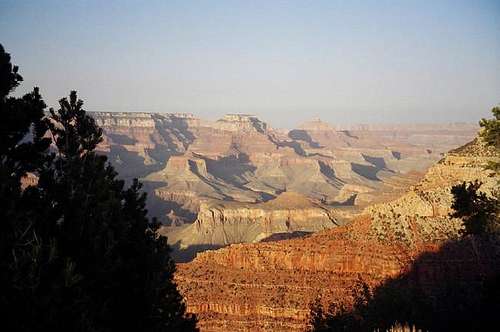
5. Arizona, USA. The Grand Canyon; South Rim to River to South Rim.
![Early morning start on the S Kaibab]() Early start on the South Kaibab Trail
Early start on the South Kaibab Trail
Descending only a few hundred metres below the rim of the Grand Canyon is to enter a different world. The tourist tack and kitsch apparent just minutes away fade rapidly and one enters a quiet and pristine place far removed from the stress above.
Is the light a result of the stunning, endless views of mesa and bluff or is it the other way around? The combination is unique and tangible. I well remember leaving the South Kaibab trailhead very early one April morning and feeling overwhelmed by such a feeling of contentment and well being. Perhaps it was a result of the prospect of all that downhill walking? But I doubt it.
![Looking West from the South Kaibob]() Looking West from the South Kaibob
Looking West from the South Kaibob
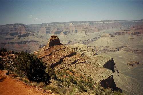
| ![Down from Cedar Ridge]() View down from Cedar Ridge
View down from Cedar Ridge
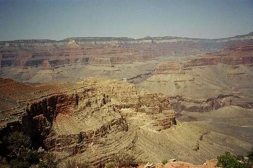
| ![O'Neill Butte]() View from O'Neill Butte
View from O'Neill Butte
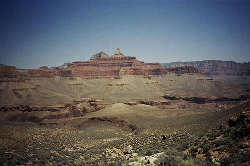
| ![Approaching Tipoff]() Approaching Tipoff
Approaching Tipoff |
Notices at every Rim trailhead pronounce negatively on the wisdom of hiking to the river and back in a day. Given the excess of blubber, candy and anti-social behaviour in the immediate neighbourhood, this is probably a wise move on the part of the authorities. Anyone likely to read this, however, shouldn’t have any problem with the trip provided they carry plenty of water, tackle it at the right time of year – I would suggest April and October as the ideal months - and move at a steady, unhurried pace.
The beauty of the walk is that you can make it as short or as long as you like. There’s lots to see and much of value in a simple out and back walk to Cedar Ridge on the South Kaibab Trail or to Indian Garden on the Bright Angel. It isn’t necessary to go all the way to the river to experience what the Canyon has to offer but, if you do go all the way, make it a round trip by hiking down one trail, along the Colorado and up the other. There is public transport between the two.
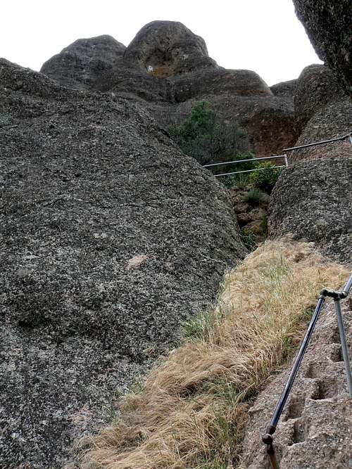
4. California, USA. North Chalone Peak and the Gabilan Pinnacles.
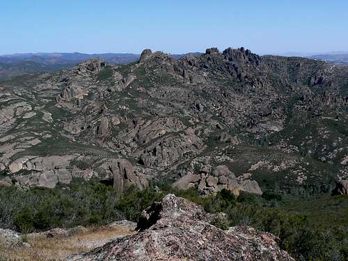
![The High Peaks from the North/South Chalone Peak Trail]() The Pinnacles High Peaks from the North Chalone Peak Trail.
The Pinnacles High Peaks from the North Chalone Peak Trail.
For many years my business took me bi-annually to the Monterey area to a conference held there. The conference organizers always scheduled a free afternoon and I rarely failed to invest it in a hike in the wonderful Gabilan Pinnacles.
The Pinnacles are believed to have been part of a volcano that once stood near present-day Lancaster, some 300 km to the southeast. Tectonic plate movement on the San Andreas Fault along the boundary of the Pacific Plate and the North American Plate split the original volcano and carried the Pinnacles north over 23 million years ago.
![North Chalone Peak]() North Chalone Peak
North Chalone Peak
| ![North Chalone Peak Lookout]() North Chalone Peak Lookout
North Chalone Peak Lookout
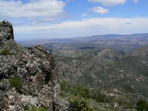
| ![North Chalone Summit View NE]() North Chalone Summit View NE
North Chalone Summit View NE |
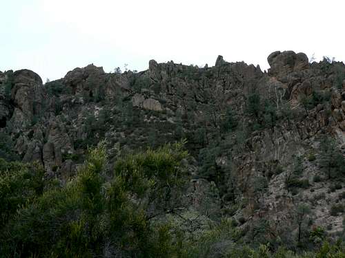
The Pinnacles are only 60km from the Pacific Ocean. However, the Santa Lucia Mountains to the west strongly moderate any maritime influence on the park’s climate and ecosystems. The resulting chaparral, woodland, grassland and rock habitats are unique and simply wonderful. I find it impossible to believe that anyone could ever tire of coming here.
Over the years I hiked every trail that the park has to offer and enjoyed them all. The following is my favourite out of many combinations possible.
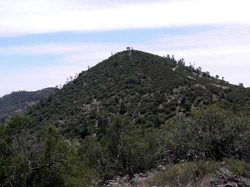
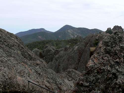
North Chalone Peak is the highest point on the park, so it
has to be on the itinerary. Unfortunately, it’s out on a bit of a limb in the south part of the area and has to be an out-and-back hike. However, it’s no great distance and offers wonderful views over the High Peaks – better, in fact, than when you’re amongst them – so there’s plenty of compensation for this small sacrifice.
Beginning at the Bear Gulch visitor centre, the hiker has the option of approaching the Bear Gulch Reservoir either through the Bear Gulch talus cave or over the Rim Trail. Personally, I’d rather be enjoying the views from the trail than dodging bats in the dark – but that’s me.
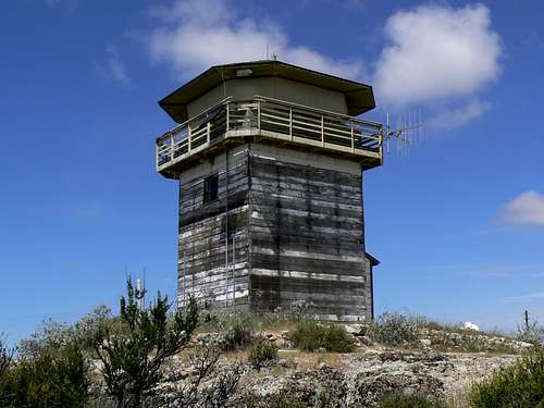
From the reservoir it’s all good news as views over the High Peaks to the north open up more and more the further you progress up towards the domed summit of North Chalone. The habitat here is oak and high grassland and, in season, colourful thistles line the track and frame the views beautifully. Compared to the rest of the area, few people come this way and you’ll likely have the summit area with its old fire tower all to yourself. Unless it’s winter, prepare yourself for a serious snooze whilst basking in the sun on top. Enjoy also the empty chaparral covered hills to the east and compare them to the busy agricultural corridor bordering US 101 below to the west.
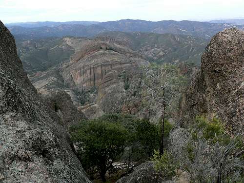
![High Peaks Staircases]() High Peaks Staircases
High Peaks Staircases
| ![North Chalone Peak from the High Peaks]() North Chalone Peak from the High Peaks
North Chalone Peak from the High Peaks
| ![High Peaks]() High Peaks
High Peaks |
An hour or so easy walk down, past the reservoir, back along the Rim Trail and you’re at the junction with the High Peak Trail. Turn left and pop up to Scout Peak in little more than 30 minutes. Below and to your west is Juniper Canyon and the west entrance to the park. Instead, turn right and take the steep, narrow High Peaks Trail as it winds in and out amongst the amorphous rock pinnacles that you saw from a distance on your way up North Chalone Peak a few hours before. If you’re fortunate, you’ll see California Condors floating high above. Note the staircases cut into the rock to ease your passage. These were built during the Great Depression of the 1920’s as a make-work project for the hundreds of unemployed men locally who were desperate for the dignity of honest labour even if only in return for a square meal. Some may question the presence of these stairways in such an environment. Perhaps, instead, we should be grateful that we have been given this facility in return for so little.
Descend from the High Peaks through a mix of chaparral and oak woods to the junction of the High Peaks and Condor Gulch Trails and take Condor Gulch back to your car in about half an hour.
![The Balconies from the High Peaks]() The "Balconies" from the High Peaks Trail
The "Balconies" from the High Peaks Trail
Could you ask for more variety in a hike of only 6 hours and 25 km?
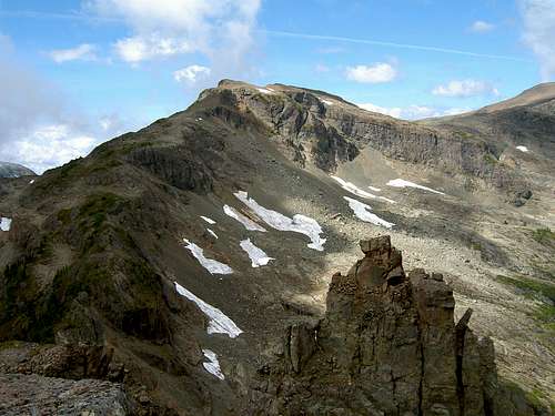
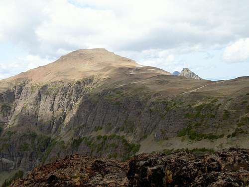
3. Vancouver Island, British Columbia, Canada. The Castlecrag Horseshoe.
![Mt Frink]() Mt Frink from the summit of Castlecrag
Mt Frink from the summit of Castlecrag
Any regulars on SP are only too aware of my shameful bias in favour of all things to do with Vancouver Island. It’s simply heaven on earth and I’m desperately sorry for all of you who have the misfortune not to live here. By small way of compensation I’ll only burden you with one contribution from our island paradise.
As a day trip, the Castlecrag Horseshoe is the longest on this list, involving almost 35 km of map distance and more than 1,400 metres of net elevation gain. Twenty of the kilometres, however, are on easy and well-made trail and this makes the trip viable in one, albeit long, day.
![Paradise Meadows]() Paradise Meadows
Paradise Meadows
| ![Hairtrigger Lake]() Hairtrigger Lake
Hairtrigger Lake
| ![Castlecrag Horseshoe]() Castlecrag Horseshoe
Castlecrag Horseshoe |
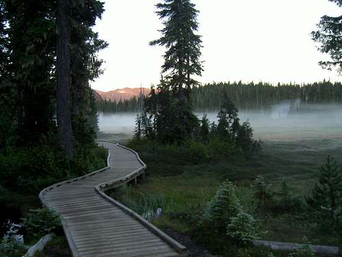
What better start point for a day in paradise than the Strathcona Park trailhead at the aptly named Paradise Meadows, the usual entry point for trips onto and beyond Forbidden Plateau. A little local history – although it’s more probably legend – attaches to the naming of this area. Before the arrival of Europeans, the Comox First Nations were accustomed to send their women and children up here to safeguard them against raids and abduction into slavery by other coastal tribes. On one occasion, after the raiders had left, the men returned for their families only to find that they had disappeared without trace. Thereafter the area became a place of evil spirits – “forbidden” to earthly mortals.
In fact, it’s a stunningly beautiful place. Gentle streams burble through flower decked meadows framed by sub-alpine forest. I’ve lost count of the number of times I’ve criss-crossed the Plateau trails and have never failed to be filled with a profound sense of peace. Alright, maybe not when I’m swatting mozzies and swearing at the 50lb pack I’m carrying – but you get the picture.
Two to three hours via Helen McKenzie and Hairtrigger Lakes brings most hikers to the foot of the mountains. I always prefer to take the left trail branch to Moat Lake here and do the circuit clockwise. This brings you later in the day to the spur route to the summit of Mt Albert Edward, which is when I prefer to assess my energy reserves and decide whether or not to add this option.
![Castlecrag Mountain]() Approaching Castlecrag
Approaching Castlecrag
| ![Summit view south]() Castlecrag Summit view S
Castlecrag Summit view S
| ![Moat Lake]() Moat Lake
Moat Lake |
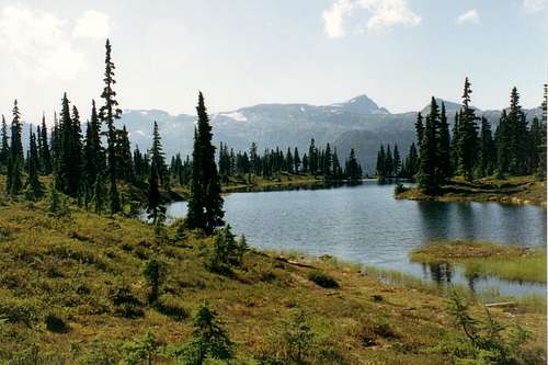
It’s a short 30 minutes up to Moat Lake with its curious A-frame cabins on Stuart Wood Island, one of only three fixed roof structures within Strathcona Park. Moat Lake lies in the base of a spectacular cirque defined by Castlecrag Mountain and the lower NE ridge of Mt Albert Edward.
The route now runs south to the end of the lake and up on to the shoulder of a ridge running NE off Castlecrag. Once across the shoulder the trail heads for a low point on Castlecrag’s east ridge before making a right turn and heading west on the opposite side of the summit block. A short scramble takes the hiker from the main route up to the actual summit.
Time and distance covered usually make this an ideal spot for lunch. You’re not yet high enough for the most spectacular views of the day – these require both higher elevation and westward progress – but Castlecrag is a nice distinct peak and does offer views south along the chain of mountains running down to the Comox Glacier as well as the steep drop-off down to Moat Lake.
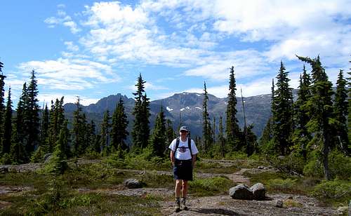
From Castlecrag a reasonable track heads west around the head of the Eric Creek drainage and up the east ridge of Mt Frink. Frink is a rather indistinct summit, there being several possible high points. The last time I was there, the true summit had a fishing pole stuck in it! The views, however, are far from indistinct. You now have enough elevation to look right over the SW ridge of Mt Albert Edward. Directly ahead is Augerpoint Mountain and Sid Watts Peak. In the distance; The Golden Hinde, the highest peak in Strathcona Park and its satellite The Combe, Rambler Peak, Mt Colonel Foster, Elkhorn and Kings Peak and more.
![Peak 1931]() Mt Frink view W to Peak 1931
Mt Frink view W to Peak 1931
| ![Mt Albert Edward]() Mt Albert Edward from Mt Frink
Mt Albert Edward from Mt Frink
| ![Upper NE Ridge of Mt Albert Edward]() Upper NE Ridge of Mt Albert Edward
Upper NE Ridge of Mt Albert Edward
| ![Mts Albert Edward and Regan]() Looking back at Mts Albert Edward and Regan
Looking back at Mts Albert Edward and Regan |
From the summit of Mt Frink a traverse north across the broad open ridge brings the hiker to the NE ridge of Mt Albert Edward at the point that it begins to turn north towards the summit. If time permits, head up Albert Edward. If not, go straight on and descend the lower NE ridge between Albert Edward and Mt Jutland. A marked route soon becomes an even better marked trail and brings you in a couple of hours to the junction where you went up to Moat Lake earlier in the day.
For me, one of the best parts of the day is still to come. By now you’ve already covered almost 25km and you’ve absorbed plenty of elevation gain and loss. Legs are tired and feet are sore. You may even be scratched up a little. There’s 10km still to go to the car. Grit your teeth and suck it up? Not at all. Let the balm of Forbidden Plateau wash over you.
The way is easy and well marked. The sun is going down and the air is cool and heavy with the scent of sap and sun-washed flowers. Insects that irritated you earlier now provide a soothing drone in the background. Let your mind wander as the miles flow beneath your feet. Tiredness drops away and you are aware only of the beauty of your surroundings. Evening, perhaps even darkness comes on. You hurry past the spot where you heard or felt a cougar years ago, hairs prickling on the back of your neck and arrive, at last, at the car. You drive down the mountain and head for home, incredulous that you actually live in such a place.
View W from the summit of Mt Frink
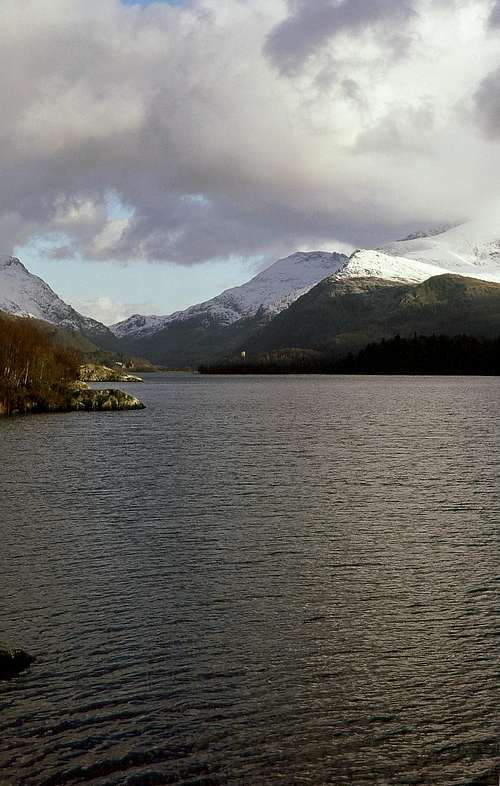
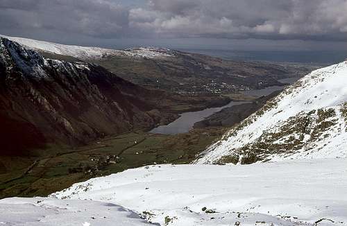
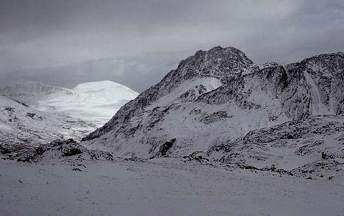
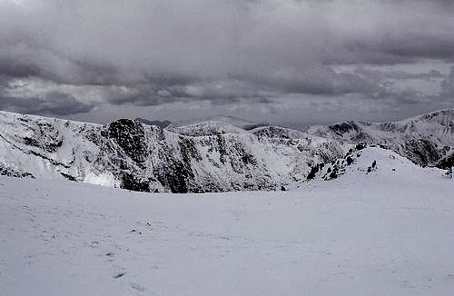
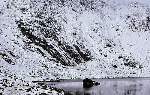
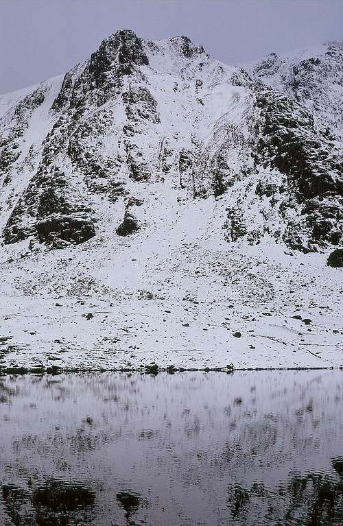
2. North Wales, UK. The Glyders Traverse in Winter.
![Pen Yr Ole Wen from Glyder Fawr]() Pen Yr Ole Wen
Pen Yr Ole Wen
From my earliest association with high places, North Wales has always held a special place in my heart.
It wasn’t long after my childhood epiphany at the bottom of Kinder Scout before I was able to join the Cubs, Scouts, the school outdoor club; anything, in fact, that would get me out into the hills as often as possible. I can’t remember under whose aegis it was that I finally discovered Snowdonia and the mountains of North Wales. I do, however, remember that we did the North Ridge on Tryfan and I was hooked.
Finally I was old enough to join the Mynydd Mountaineering Club in Stockport and weekend trips to Wales and the club’s hut in the Crafnant Valley became a regular event. Jim Perrin and Tony Shaw would drag me up routes at Tremadoc far harder than anything I’d done before and then regale me over dinner at the hut with tales of the legendary “Crafnant Sheepshaggers” – at least I’ve always hoped they were legendary.
Naturally, my first choice of all the universities I applied to was The University College of North Wales in Bangor. I was accepted and embarked upon three years of September to November climbing during the day and writing up missed lecture notes at night. Given today’s laissez faire attitude towards education, you can probably now undertake a joint degree in climbing and Chemistry – but not then. Happily, one of my teachers was a climber and common sense rather than expulsion prevailed.
There’s no finer a place on the planet in terms of the sheer number of day-hiking possibilities than North Wales. Compact enough to interconnect routes ad infinitum yet rugged enough constantly to offer challenge and pique interest. There’s nowhere quite like it.
![Snowdon and the Glyders]() Winter Llanberis Pass
Winter Llanberis Pass
| ![Llanberis and Llyn Peris]() Llanberis and Llyn Peris
Llanberis and Llyn Peris
| ![Tryfan from the base of Y Garn]() Tryfan from the base of Y Garn
Tryfan from the base of Y Garn |
Having decided on a North Wales contribution to this article, however, I had the hardest time of all in making the final choice. The Snowdon Horseshoe, Cader Idris (by any route), the Nantlle Ridge, the Carneddau traverse from the coast to the Ogwen Valley; all would have been worthy of inclusion. In the end I decided, with one rider, in favour of the traverse of the Glyderau. The rider is that the trip be made in winter. Only then are there few enough people about to offer the seclusion conducive to making this a truly great route.
Beginning in Nant Peris, the hiker makes his/her way almost due east up open slopes to the broad, boggy saddle between Y Garn and Glyder Fawr. The views back to the Llanberis Pass and Llyn Padarn are now supplanted by those forward to the Carneddau and the NE section of the Glyderau – Glyder Fawr, Glyder Fach and Tryfan.
Even at this relatively early stage in the walk, a choice must be made. North and down beside the Devils Kitchen to Cwm Idwal or carry on climbing southeast up to Glyder Fawr and thence along the ridge to Glyder Fach. Since this is a winter trip, let the conditions of the moment decide.
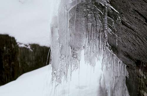
![Icicles in the Devils Kitchen]() Icicles in the Devils Kitchen
Icicles in the Devils Kitchen
| ![The Carneddau from Glyder Fawr]() The Carneddau from Glyder Fawr
The Carneddau from Glyder Fawr
| ![Idwal Slabs from Llyn Idwal]() Idwal Slabs from Llyn Idwal
Idwal Slabs from Llyn Idwal
| ![The Gribin Ridge]() The Gribin Ridge
The Gribin Ridge |
Once down into Cwm Idwal, it’s an easy walk to Ogwen Cottage and there are many options to get down there from the Glyder Ridge. Down the Unnamed Cwm, down the Gribin Ridge, from Bwlch Tryfan at the base of Glyder Fach; all are eminently feasible in winter with care and the precaution of an ice axe and, occasionally, crampons.
If you’re feeling really fit, take in Tryfan as well – although this is an option I’ve only ever done in summer or, at least, in snow-free conditions.
Be sure to leave enough daylight. I well remember running out of light whilst descending east of Idwal Slabs in January, dropping our one flashlight and resigning ourselves to a chilly night out looking at the lights of cars on the A5 far below. We did, eventually, find a gully that we felt our way down to the valley floor below, but it was a lesson learned.
There is one disadvantage to doing this as a winter trip. At this time of year, the traditional post-hike cup of tea at Ogwen has to take place without what is undoubtedly one of the world’s finest people-watching opportunities. You can’t have everything I suppose.
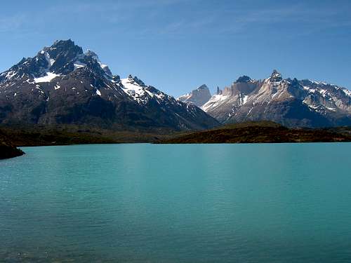
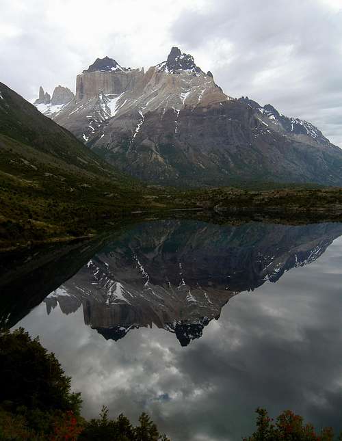
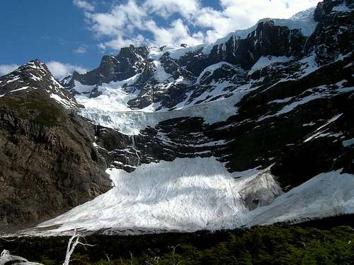
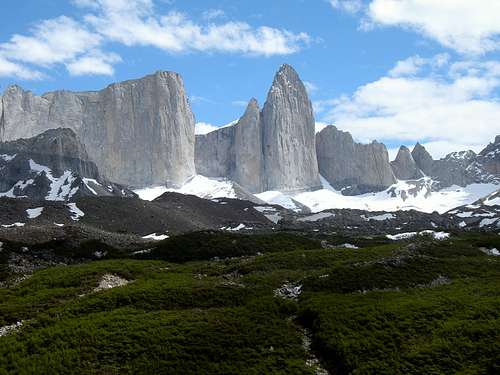
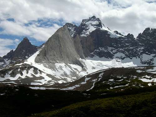
1. Patagonia, Chile. The Valle Frances.
![The Valle Frances]() The Valle Frances
The Valle Frances
Few would contest the opinion that the mountain regions of Argentina and Chile that border the southern and western termini of the Patagonian ice cap are amongst the most beautiful places on earth. Needle sharp towers and horns rising from glaciers almost at sea level and uniquely defined by the effects of glaciation, erosion and the every present winds are everywhere, most famously in Argentina around Cerro Fitzroy and in Chile around the Torres del Paine.
The most common way to see the Torres del Paine is as part of the “W trek”. As the name implies, the hike makes the shape of the letter as it penetrates the valleys of the Rios Ascencio and Frances towards the Towers and Horns and also parallels Lago Grey on its way to the terminus of Glacier Grey. In my opinion, the middle section of this journey is the most impressive leg of an already breathtaking trip.
![Cuernos Reflected in Lago Scottsberg]() Cuernos Reflected in Lago Scottsberg
Cuernos Reflected in Lago Scottsberg
| ![Paine Grande East Aspect]() Paine Grande
Paine Grande
| ![Horns through the trees]() Horns through the British Camp
Horns through the British Camp
| |
Public transport – bus and then boat – to the new Refugio at the north end of Lago Pehoe makes the Valle Frances and Glacier Grey legs perfectly viable as day-hikes from a fixed base.
Easy trail runs northeast from the refugio to the west shore of Lago Scottsberg and beyond to the foot of the Valle Frances in little more than an hour. If you’re lucky – very lucky – there will be no wind and you will be able to admire the reflection of the Horns (Cuernos) in Lago Scottsberg. With the right conditions, the photo opportunities along this stretch are incomparable.
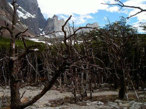
After turning north and crossing the river, the route arrives at the Italian Camp and then begins a steady climb up to the head of the valley. The way is never steep and next to impossible to lose, so there’s every opportunity to goggle at what is around you. You’re quickly into a part of the valley where the sheer scale of things becomes almost overwhelming. The east aspect of Paine Grande towers above to your left and the Horns to your right. Note the banding of the rock on the lower part of the Horns, compared to the peaks themselves. Only the very tips of the Horns escaped the passage of the glaciers.
Feeling small and insignificant is the order of the day in this place.
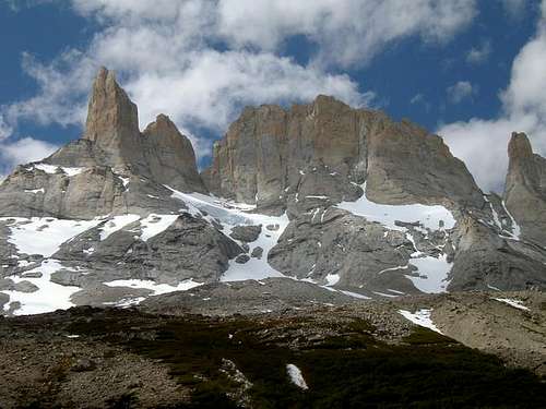
![View North from the Mirador]() Head of the Valle Frances
Head of the Valle Frances
| ![View W from the Mirador]() View W from the Mirador
View W from the Mirador
| ![Los Cuernos from the mirador...]() Los Cuernos from the mirador
Los Cuernos from the mirador |
Proceeding north, the west aspect of the Towers appear soon after reaching the British Camp in its weird stand of denuded austral birch. The head of the valley opens up and you make your way across flat terrain and finally up to the lookout (mirador) at the end of the trail. You are a kilometre or so from the head of the valley and almost completely surrounded by mountains. This is what you came all this way to see.
It’s quite possible to proceed beyond the mirador on use-trail or off-trail. Beyond here, however, nothing is maintained and you proceed at your own risk.
At least in my experience and to this point in time, the Valle Frances is the finest day-hike in the world.
![Lago Pehoe from the Valle Frances]() Looking down the Valle Frances
Looking down the Valle FrancesSome closing words
The foregoing, of course, is only one man’s subjective opinion. The trips are often a result of where the winds of fortune have blown my life. Only two - the Grand Canyon and the Valle Frances - I sought out deliberately. Many readers – most, in fact – will argue with my choices.
I expect that one out of my list of five will be on many peoples’ lists. Two and I would be very, very surprised. Three and I’d be frankly flabbergasted. Four and you’re just trying to get me to vote for your latest nice pictures. Five and you’re my long lost twin separated at birth. Contact me immediately.
SummitPost Links
The Grand Canyon
The Gabilan Range
Mt Albert Edward
Castlecrag Mountain
Mt Frink
Nanuls superb
Snowdonia/Eryri page
Torres del Paine
Page Visitor Statistics
Just for my personal interest - but feel free to have a look


Comments
Post a Comment