
-
 3382 Hits
-
 75.99% Score
-
 8 Votes
|
|
Mountain/Rock |
|---|---|
|
|
44.45483°N / 109.52834°W |
|
|
Park |
|
|
Hiking |
|
|
Spring, Summer, Fall, Winter |
|
|
6900 ft / 2103 m |
|
|
Overview
Just across the road from Signal Peak, Flag Peak also offers some great views of the North Fork of the Shoshone, but its summit can be reached with much less effort. From the highway, you can reach the summit via the north slope in about a mile with approximately 1000 ft elevation gain. The terrain is steep and loose but numerous big game trails crisscross the mountain and if you’re paying attention you should be able to take advantage of them. An alternative might be to request permission from the Rimrock Ranch to cross their land and ascend the gentler south slopes. I've been told that the ranch sometimes flies a flag from the summit, though I've yet to see this myself. NOTE: The map shows the summit at 6883 feet, but my GPS showed 6900 at the top.
Getting There
From Cody, take the North Fork Highway (14-60-20) toward Yellowstone National Park. After driving into Wapiti (approx. 18 miles from Cody), watch for the unmistakable profiles of Flag and Signal Peaks (below).
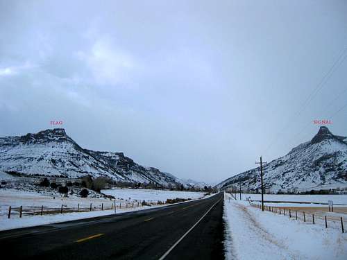
Park on the north side of the road at the base of Flag Peak. There’s a small turnout at UTM 06 16 834 | 49 23 880 (NAD 27).
Route
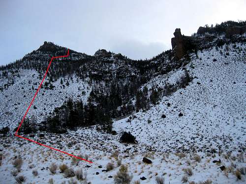 Suggested route
Standing at the base of the peak, you’ll see two drainages above you (see picture). It’s best to stay to the left and plan to traverse beneath some small cliffs near the top. Pick your way up the steep slope, using game trails as much as you can. If you do this in the winter, you might run into some Bighorn Sheep.
At first, you'll be hiking through sagebrush and rocks, but after about 600 feet, you'll enter some thin timber. When you reach the cliffs, traverse right (west) until you find a large obvious break in the cliffs and then continue about one third of a mile to the true summit.
Red Tape and Warnings
No red tape. Although this is a short hike, close to the road, it's still wise to hike with a partner, carry bear spray and make plenty of noise. There are bears, wolves and mountain lions throughout this area.
When to Climb
This would be a fun little hike at any time of year. In winter, you might have to do a short stretch of post-holing near the top, but it's probably not worth carrying snowshoes.
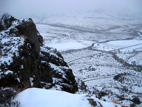 View east from Flag Peak
Camping
There are numerous established campgrounds along the North Fork Highway, but most of them are closed in winter.
External Links