Between Valgrisenche and Rhemes is an easy but long trip that asks for a good training. The wild environment and the proximity of the Becca della Traversière, attainable in little time from the Pass, they make this very suggestive excursion.
Tra le Valli di Valgrisenche e Rhêmes è una facile ma lunga escursione che richiede un buon allenamento. L'ambiente selvaggio e la vicinanza della Becca della Traversière, raggiungibile in poco tempo dal Colle, rendono questa gita estremamente suggestiva.
First Ascents
First on the ascent: R. C. Nichols and J. V. Favret, (Jul 30th, 1865).
In winter: Unknown.
Getting There
BY CAR:
From Torino, Milano, etc: Motorway A5. Exit at Aosta Ovest. Drive on SS.26 toward Mont Blanc as far as Leverogne (780m).
From Switzerland: through the Grand Saint Bernard Tunnel or the namesake Pass. Drive to Aosta, then follow the direction for Courmayeur on SS.n°26 as previously, reaching Leverogne.
From France: through Mont Blanc Tunnel or Petit Saint Bernard Pass. It is not necessary to take Motorway A5: you can drive on SS.26, in the direction of Aosta as far as Leverogne. Once close to the Village of Leverogne (780m),turn left if you come from Aosta or turn right coming from Mont Blanc, following along the Regional Route for Valgrisenche. Pass many small Villages, including Rochefort, La Ravoire, Chamencon, La Bethaz, and Valgrisenche (1.664m),the main center of the namesake valley. Turn right for the Village of Bonne (1.810m) located near the western summit edge of the huge dam that forms the Beauregard Reservoir, practically empty for technical reasons. Past the small Village of Menthieu (1.842m),continue for approximately 5 km along the paved road, which follows parallel to the western shore of the lake, running high above it, and then descend leading to the old Pasture of Surier (1.758m),near the Village of Usellières (1.758m) at the southern end of the lake basin. Before the village there is a ample parking space where you can leave the car.
BY PLANE:
Aeroporto "Corrado Gex" Saint Christophe (Aosta).
Route Description
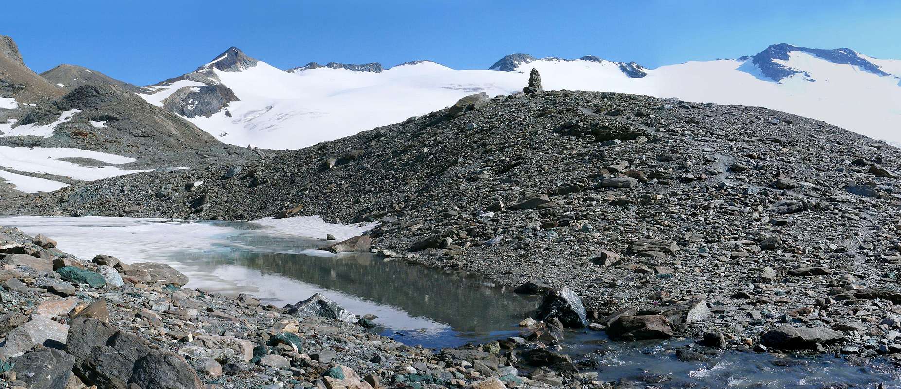
Starting from the parking near the Village of Usellières (1.758m), continue on foot on the dirt road that leads to Rifugio Mario Bezzi (2.284m; two hours from the parking lot). From Rifugio Mario Bezzi (2.284m) take trail n° 12c that gently rises through meadows in the southeast direction. Turn south and traverse a grassy slope below Pian di Vaudet; cross the stream named La Cuire and the next one that flows from Ghiacciaio di Bassac, below Grand Traversière, to reach a bench strewn with large boulders left by a rockfall. Climb SSE up ridges where grass alternates with scree. Following numerous cairns, surmount a broken rock band along a gully which is below the Glacier of Bassac Déré. The gully leads to a head with rocks and grass. From there, continue on level ground to pass three bends in the glacier with good views of several tarns below. To continue verse South and last steep stroke it is reached the Hill. (3h'45/4h'15) from Usellières.
Descent: from the same route or to the Refuge Benevolo in Valley of Rhêmes.
Da Usellieres (1.758 m), sino al cartello di divieto (1.784 m) e costeggiando la Dora di Valgrisenche si passa per l'Alpe Tsâle (1.931 m) per raggiungere quella di Saxe de Savoie (2.036 m), appena oltre un ponticello che porta a quella di Saxe de Ponton (2.047 m), al di là del fiume; continuare parallelamente a questo e pervenire all'Alpe Vaudet e, dopo un promontorio al Rifugio Mario Bezzi (2.284 m). Dal Rifugio Mario Bezzi (2.284 m) indirizzarsi a SE sul sentiero contrassegnato n° 12c per prati in falsopiano e quindi a S di traverso a SSE per un pendio erboso sottostante al Pian di Vaudet attraversando il Torrente La Cuire ed il successivo che proviene dal Ghiacciaio di Bassac sotto la Grand Traversière, si passa su una balconata con grandi macigni, residuo di una frana. Si risalgono a SSE i costoni detritico-erbosi, dopodichè seguendo il segnavia formati da numerosi ometti di pietra si supera una piccola fascia rocciosa frantumata tramite un canalone sottostante il Ghiacciaio di Bassac Déré raggiungendo, dopo il canale, un promontorio, roccioso-erboso che con percorso pianeggiante supera tre anse del Ghiacciaio medesimo dominando dall'alto diversi laghetti. Continuare verso Sud e, superato l'ultimo ripido tratto, si raggiunge il Colle. (3h'45/4h'15) da Usellières.
Discesa: dalla stessa via o al rifugio Benevolo in Val di Rhêmes.
Parents refers to a larger category under which an object falls. For example, theAconcagua mountain page has the 'Aconcagua Group' and the 'Seven Summits' asparents and is a parent itself to many routes, photos, and Trip Reports.

 5760 Hits
 81.84% Score
 14 Votes