-
 17637 Hits
-
 72.08% Score
-
 2 Votes
|
|
Custom Object |
|---|---|
|
|
46.35358°N / 114.231°W |
Overview
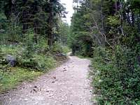
Fred Burr Reservoir is an easy-to-reach destination in the Bitterroot Mountains northwest of Corvallis, MT. For most of the route, the trail follows a service road. The trail is shared by hikers, skiers, people on show shoes, mountain bikers, and stock animals – no motorized vehicles allowed. The north side of the canyon provides the more spectacular vistas. The trail proceeds (foot traffic and stock animals only) beyond the reservoir to several lakes and can be combined with other canyon routes to provide point-to-point hikes for those so inclined.
Fred Burr Creek and Reservoir are named after Fred H. Burr, a horse and cattle trader who moved to the Bitterroot Valley from Salt Lake City, Utah, where he made money trading with emigrants moving along the Oregon Trail.
Getting There
Proceed west on Bear Creek Road (about 3 miles south of Victor) from US Highway 93 for 2.3 miles where it “tees” into Red Crow Road.Turn left (south) onto Red Crow Road and follow the road as it makes a 90 degree turn to the west.
Go straight (west) at the 4-way stop onto the gravel Fred Burr Road.
The road dead-ends at the trailhead loop after a couple more miles.
The trailhead has restroom facilities and parking for 10 or so cars, trucks, and stock trailers.
Route Description
Hiking is easy and the trail looks to be useable at any time of the year. The first section of the route from the trailhead does not use the service road as it passes over and near private property.
For the most part the trail is obvious but could be confusing to someone not familiar with the route where it crossed one private gravel road just before it converges with the service road leading toward the reservoir. One must be paying attention on the return trip or the point at which the trail leaves the service road (up a fairly steep bank to the south) could be easily missed. Give the junction a good look on your way out so you'll be able to recognize it on your return. It would be nice if the Forest Service placed a helpful sign at this point in the trail, but they don't seem to have money available for much of anything these days. Too bad!
The route follows the service road past one private structure then leaves the road to the south away from a private residence. No doubt the residents would prefer their privacy. After a short distance the trail returns to the service road for the remainder of the route to the reservoir.
There is a point of particular interest approximately 2.25 miles from the trailhead.
If you look left (south) and up-slope when you reach a field of talus which touches the trail, you will see an interesting outcropping on the ridgeline. It appears to be screaming to be climbed by those so inclined, and probably has.
Just before reaching the reservoir, the last section of trail crosses Fred Burr Creek on a vehicle-quality bridge. Several more hundred yards lead you to the dam end of the reservoir and a great over-the-lake view of the Montana-Idaho border.
If you want a really long point-to-point hike, follow the trail as it continues along the north side of the reservoir and beyond. As the trail approaches the Montana-Idaho border it turns south and will take the thru-hiker to Fred Burr Lake, Lockwood Lake, and Heinrich Lake. Finally, the trail leads to a junction with the Mill Creek Trail a few hundred yards before it reaches Mill Lake. Proceeding east on the Mill Creek Trail will take you back to a trailhead and the Bitterroot Valley - a trip of over 25 miles - pretty long for a day hike!
Essential Gear
As this is an easy hike, during the “normal” hiking season, nothing more than the standard good shoes, water, and a little food to snack on while you enjoy the views at the reservoir will be required. During the winter or if inclement weather is expected, a bit more “essential” clothing would be in order.


