
-
 4322 Hits
-
 73.06% Score
-
 3 Votes
|
|
Route |
|---|---|
|
|
36.02130°N / 115.4699°W |
|
|
Hiking, Scrambling |
|
|
Spring, Summer, Fall, Winter |
|
|
Half a day |
|
|
Getting There
From Las Vegas Drive West from I-15 on Blue Diamond Road (HWY 160). When you reach Mountain Springs Summit drive another 0.6 miles and turn right (north) onto Williams Ranch Road. Drive about 300 yards and turn left onto a dirt road. (There is a gate at the end of the road, so don’t get distracted, you’ll be able to turn left onto the dirt road). Follow this road for 0.2 miles and then make a right at a fork. (Right when you make this turn is the short section where a high clearance vehicle might be needed for this drive.) Drive another 0.3 miles going just past a turn to the left and the trailhead will be marked with boulders not allowing you to drive further up the pullout on the right.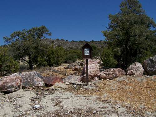 The trailhead.
Route Description
 |
 |
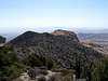 |
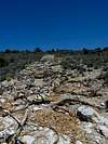
This is the easiest route to Windy Peak. It starts out along an old 4WD road. Then it reaches a saddle. From here you hike up a ridge. Then eventually you turn right off the ridge and follow another ridge to the east. Once on this new ridge it is about 1.3 miles to the summit. The last part requires scrambling up a short crack on the sandstone and then it's just a scramble to the peak from here.
This peak makes a good peak to get in addition with hiking close by Mountain Springs Peak.
Here is a list of WPTs along the way.
| WPT | Description | Latitude | Longitude | Elevation (ft) & Distance (mi) |
| WPT 1 | Park | 36°1'30.4"N | 115°30'12.8"W | 5,561'; 0.00 |
| WPT 2 | The Saddle | 36°1'47.4"N | 115°29'42.8"W | 5,917'; 0.70 |
WPT 3 | Pt 6,440'+ | 36°1'43.9"N | 115°29'08.8"W | 6,440'+; 1.43 |
| WPT 4 | Windy Peak | 36°1'16.8"N | 115°28'12.3"W | 6,246'; 2.75 |
 GPS Trace of Route
Essential Gear
Good Hiking Boots and water, especially if it is warm and the sun is out.Weather Report
