
-
 4415 Hits
-
 76.66% Score
-
 7 Votes
|
|
Route |
|---|---|
|
|
39.36948°N / 105.37052°W |
|
|
Hiking |
|
|
Summer, Fall |
|
|
Half a day |
|
|
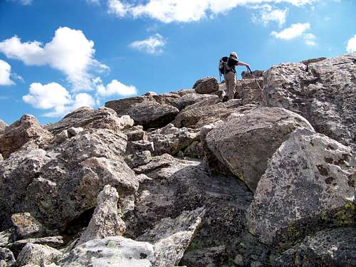
Class 2 scrambling |
|
|
Overview
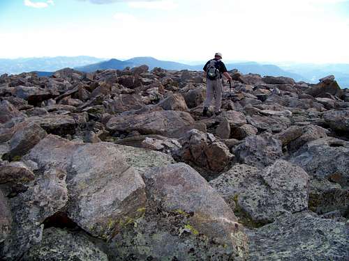
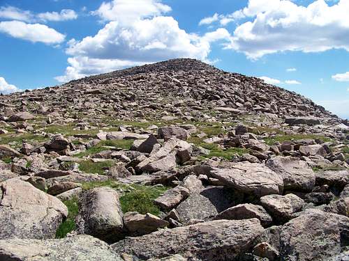
The route from Summit Lake to the top of Rogers Peak provides a quick, scenic tundra hop. The route is entirely above timberline and not burdened by a trail, not even a use rut. However, despite no evident trail, this route is easy to follow. There is no timber to block line-of-sight and the route continues on a steady northeast trajectory from trailhead to summit. The route involves some easy, mostly hands-free scrambling on large boulders. As a bonus, this route includes a summit of an additional 13er on route to Rogers Peak: Mount Warren (13,307 ft.)Mileage: 3.5 miles round trip
Elevation Gain: 557 ft. (which does not account for a loss of elevation between Mount Warren and Rogers Peak)
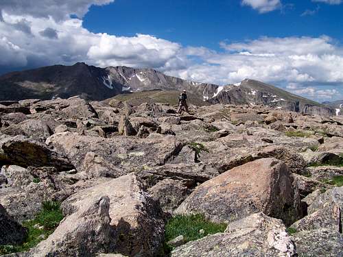 Looking across the rocky summit pleateau of Rogers Peak
toward Mount Evans (14,265 ft.) and Mount Spalding (13,842 ft.)
27 Jul 2008
Getting There
Rogers Peak shares the Mount Evans Wilderness with nearby neighbors Mount Evans, Mount Spalding, Gray Wolf Mountain, Epaulet Mountain and Mount Warren.- From I-70: Take Exit 240 in Idaho Springs. Follow Colorado Highway 103 (also called Squaw Pass Road) south to Echo Lake and Colorado Highway 5 (Mount Evans Road).
- From Bergen Park: Take Colorado Highway 103 (Squaw Pass Road) west to Echo Lake and Colorado Highway 5 (Mount Evans Road).
Continuing from from Echo Lake, ascend Mount Evans Road. Just before mile marker 10 is Summit Lake. Turn right into the parking area. (Restrooms are available in the parking lot.)
Route Description
- From the parking area, strike out directly across the tundra heading northeast. Alpine tundra is fragile. Please be mindful of your foot placement and opt for stepping on a solid surface (rock or bare gravel) over stepping on tender alpine plants.
- Climb toward the summit of Mount Warren. In less than one mile you will reach the Mount Warren summit.
- After admiring the Mount Warren Summit views, descend toward the Warren-Rogers saddle, still heading northeast.
- From the Warren-Rogers saddle, continue heading northeast, climbing upward through tundra and scrambling over boulders to reach the summit of Rogers Peak.
- The highpoint of this rock-strewn summit is an uplifted slab boulder. Perch yourself upon it to claim the summit of Rogers Peak!
- To return, depart the Rogers Peak summit heading southwest toward Mount Warren.
- From the saddle, either re-climb Mount Warren or traverse the southeastern slopes of Mount Warren back to the parking area.
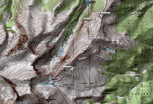 The Summit Lake Route is indicated in red.
Essential Gear
- Long pants to protect tender legs during the boulder scramble.
- Topographic map
- Compass
- Colorado Atlas and Gazetteer (or similar atlas for finding the trailhead)
- Trekking pole(s)
- Sturdy hiking boots with grippy soles and stiff ankle support
- Water and snacks
- First aid kit
- Other standard backcountry essentials