
-
 2671 Hits
-
 77.48% Score
-
 8 Votes
|
|
Route |
|---|---|
|
|
43.86980°N / 103.7439°W |
|
|
Download GPX » View Route on Map |
|
|
Hiking |
|
|
Spring, Summer, Fall |
|
|
Less than two hours |
|
|
Overview
 Wild iris on lower slopes
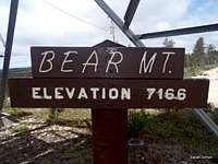
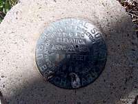
There are several ways to reach the summit of Bear Mountain, the 3rd highest peak in South Dakota, including simply driving your truck right up to the top. For many of us, however, a top-10 state highpoint is worthy of more than 4 wheels; it’s best achieved on two feet. (It’s noteworthy to say here that this route would make a fine fat tire bike ride for those so inclined.)
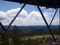
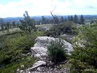
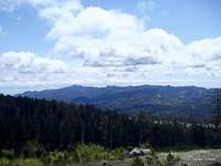
We visited this peak via this route on a chilly Memorial Day weekend and saw not a soul. The lower forest is dense and lush. The upper forest has suffered quite a bit of beetle kill. The views from the top are very enjoyable, and Harney Peak, of course, steals the show! Following forest serviced roads, the route-finding is mostly straightforward, but do pay attention at junctions to ensure you make the right turns on the return trip.
Roundtrip Distance: 4.4 miles
Elevation Gain: Approximately 1,000 feet
YDS Class: 1
Time allowance: 1 hour 45 minutes at a moderate pace
Planning Map: Trails Illustrated #238 Black Hills South
Getting There
Bear Mountain is approximately 11 road miles from Custer, South Dakota. Not all of these roads are marked, so please be prepared with a sense of adventure to find this “trailhead.”From Hwy 385 northbound out of Custer…
• Head west/northwest on CR 297, passing the Boy Scout camp, for several miles to FS 299.
• Turn left at the fork in the road onto FS 299 (Bobcat Road).
• Watch for a left/west turn (unmarked at the time of my visit!) between two pine trees. (Yeah, I know, these are total country directions). This is FS 1C (or FS 299 1C spur road). The turn onto FS 1C is just passed FS 477, which WAS marked at the time of my visit.
• We parked not far up FS 1C due to fallen trees blocking the road. See the attached .GPX file for details.
 Where we parked Where we parked |  Road is smooth but blocked by downed timber Road is smooth but blocked by downed timber |  Don't step in one of these Don't step in one of these |
Route Description
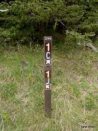 Signage intact!
 Wild iris
• From the junction of FS 299 and FS 1C, continue roughly one mile on mostly level terrain on a two-track ATV road / trail to another junction. Note a signpost (hopefully, if it’s still there).
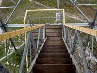
• Turn left (south) on FS 1J. This runs mostly seamlessly into FS 1K, which runs directly to the summit, which is marked by a lookout tower. From this junction (FS 1J / FS 1K) the route begins to climb more steeply, occasionally gently switchbacking.
• One final tug on a straightaway brings you onto the summit plateau, joining a more defined road to the top.
• Return the way you came, using caution to stay the correct way at all junctions.
 Along the lower route Along the lower route |  Lower route 2-track Lower route 2-track |
 |  |  |  |
 |  |  |  |
Essential Gear
 |  |  |  |  |
 Lush forest on descent
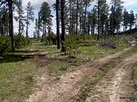 On the descent
• Outerwear appropriate to the season
• Map, compass & GPS
• Trails Illustrated #238 Black Hills South for road navigation