
|
|
Route |
|---|---|
|
|
39.97487°N / 105.29268°W |
|
|
Scrambling |
|
|
Spring, Summer, Fall |
|
|
Half a day |
|
|
5.0 (YDS) |
|
|
NOTE - This route currently crosses through a permanent bat closure and is clearly signed. You'll have to bypass a section of the route.
After the stream the Mesa Trail will head past Bear Canyon before bending up and back towards the canyon. Take the trail junction into Bear Canyon and towards Bear Peak.
As the trail heads along the side of Bear Canyon start paying attention to mass of rock on the side of Dinosaur Mountain. The stream is now way below you but will get closer and closer as you continue up the trail. Just about when the stream meets the trail you will pass a large flat rock on the right. Here is where you leave the trail and head down and over the stream.
Here it gets a little confusing and I'm going to start being vague. There is a faint trail in places but it does not always lead in the right direction so stay awake and look sharp.
You need to head up alongside a large rock and move over to the next gully over through a break to the right.
You will know you are on route when you see a large boulder forming a cave above you. This is the first of several and you bypass the first one on the left. The second cave you tackle head on a squeeze up through a fun chimney in the back and this is perhaps the crux of the route.
Now work your way up the ramp of rock you're on picking your way through the rocks/caves/brush making it as easy or hard as you want. There are a few awkward class 4 or low class 5 moves you can make but it is rarely exposed enough to worry.
Once at the summit (make sure you get on the right one, some other descriptions describe a lower block), you can descend the route past Mallory Cave as described here.
Overview
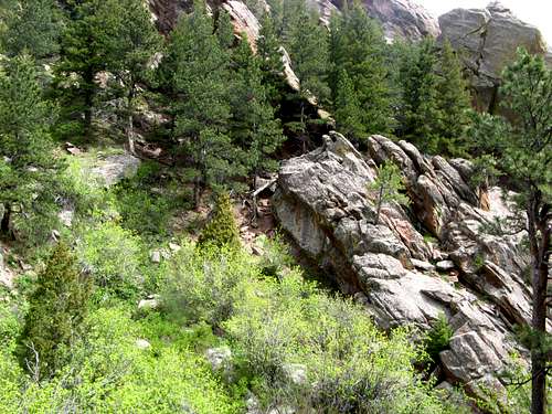
Fumbledeedum is an adventurous route to the top of Dinosaur Mountain. It starts in Bear Canyon and works its way up via a series of ramps and gullies passing obstacles like blocks, poisonous plant-life, chockstones and even caves along the way. The scrambling is difficult at times but is not exposed enough to cause alarm (in most places). This would be an excellent practice for people interested in alpine scrambling routes when the high country is still snowed in.
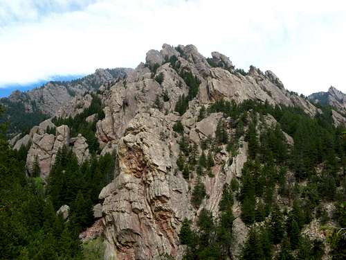 Fumbledeedum works its way up through a maze of rock. |
Getting There
Park at NCAR at the end of Table Mesa Drive in Boulder. I'm sure there are multiple ways to approach this but NCAR makes the most sense to me.
  |
Route Description
Getting up this route can be a bit confusing. The trail systems are very good while on the main trails but getting up into Bear Canyon seems very roundabout. Here is a map of the trails. The views are very nice and you should enjoy the hike in. I will explain how to get to the start of the scramble and a few hints. I'll try to leave some of the fun route-finding up to you to preserve the adventure of heading to somewhere new.
Starting at the NCAR trailhead, follow the signs towards Mallory Cave until you reach the Mesa Trail. Follow the Mesa trail south (left) towards Bear Canyon passing a stream along the way.
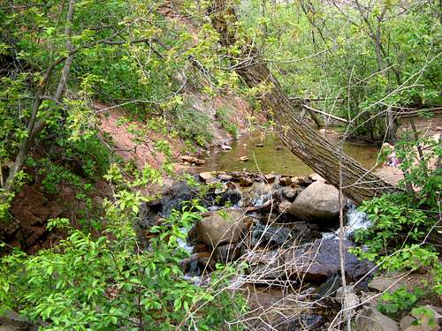 Nice place for a snack. |
After the stream the Mesa Trail will head past Bear Canyon before bending up and back towards the canyon. Take the trail junction into Bear Canyon and towards Bear Peak.
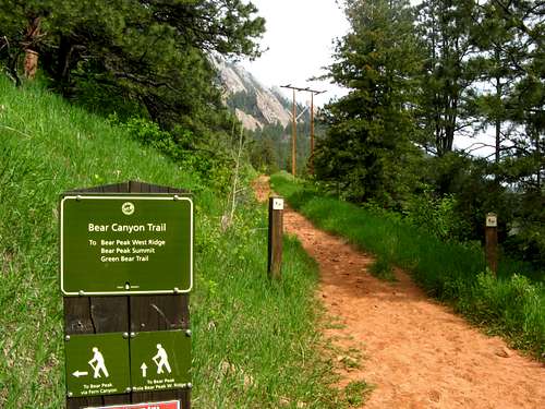 Go this way
 |
As the trail heads along the side of Bear Canyon start paying attention to mass of rock on the side of Dinosaur Mountain. The stream is now way below you but will get closer and closer as you continue up the trail. Just about when the stream meets the trail you will pass a large flat rock on the right. Here is where you leave the trail and head down and over the stream.
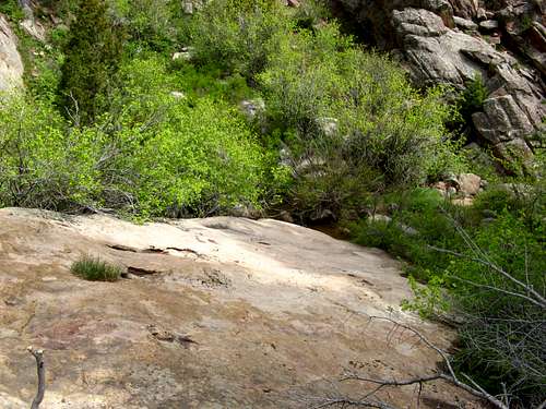 Walk down this rock and cross the stream.
 |
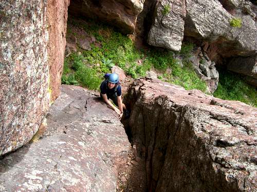
Here it gets a little confusing and I'm going to start being vague. There is a faint trail in places but it does not always lead in the right direction so stay awake and look sharp.
You need to head up alongside a large rock and move over to the next gully over through a break to the right.
 This is looking up from the main trail. The break you use to move gullies is clearly seen.
 |
You will know you are on route when you see a large boulder forming a cave above you. This is the first of several and you bypass the first one on the left. The second cave you tackle head on a squeeze up through a fun chimney in the back and this is perhaps the crux of the route.
 Passing the first cave on the left.
 | 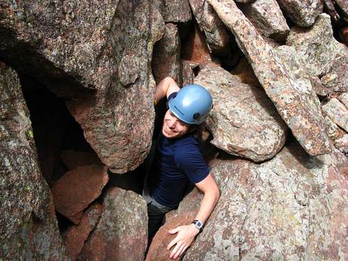 Squeezing through the second. Had to push the packs through first.
 |
Now work your way up the ramp of rock you're on picking your way through the rocks/caves/brush making it as easy or hard as you want. There are a few awkward class 4 or low class 5 moves you can make but it is rarely exposed enough to worry.
Once at the summit (make sure you get on the right one, some other descriptions describe a lower block), you can descend the route past Mallory Cave as described here.
Essential Gear
Ten Essentials.
A Helmet is not a bad idea to keep you from whacking your head in the cave sections.
Long pants for poison ivy.
 Not good toilet paper! |
External Links
This route is free of the regular annual closures in the Flatirons. Under unusual conditions the upper saddle of Dinosaur Mountain can be closed so check here before you go.
A map of the Flatirons trails isn't really needed but it is nice to know where you are on the main trails.
Other photos of the route that might help.