
-
 9821 Hits
-
 71.92% Score
-
 2 Votes
|
|
Route |
|---|---|
|
|
39.04250°N / 106.5969°W |
|
|
Hiking |
|
|
Spring, Summer, Fall |
|
|
Most of a day |
|
|
Class 2+ |
|
|
III |
|
|
Overview
Grizzly Peak is one of the most rugged peaks in the Sawatch Range. It is the highest of all six Colorado peaks named Grizzly. Grizzly Peak is 4.9 miles south-southwest of Independence Pass and difficult to see from paved roads. The East Ridge is Grizzly Peak's standard route, but climbing the South Ridge allows you to climb Garfield Peak. Garfield Peak is ranked 116 in Colorado and sits at 13,780 feet. In addition, Garfield is on the Continental Divide. Climbing the South Ridge also allows you to complete a loop by descending the East Ridge or East Face.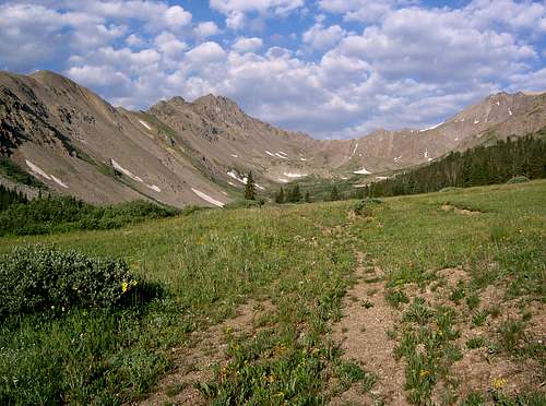 Point 13,740, Grizzly's South Ridge and Grizzly Peak from McNasser Gulch
Getting There
Travel 14.5 miles west on Colorado 82 from US 24 or 9.2 miles east from Independence Pass. Turn south onto South Fork Lake Creek Rd. (FS 371). Go straight at 2.7 miles. The roadhead (FS 394) is at 3.3 miles and 10,740'. High clearance vehicles can travel up FS 394 an additional 1.2 miles to road closure at 11,360'. Grizzly Peak's Routes. Submitted by Kane
Route Description
Continue up McNasser Gulch to a small lake at 12,700'. Climb up a steep scree slope to the 13,540' saddle between Point 13,740 and Garfield Peak. Garfield Peak and the Point 13,740-Garfield Saddle
 Grizzly Peak and its South Ridge
From McNasser Gulch Trailhead at 10,740'
Roundtrip Distance: 10.4 miles
Elevation Gain: 4,208'
With East Ridge Descent:
Roundtrip Distance: 9.3 miles
Elevation Gain: 3,728
From McNasser Gulch Trailhead at 11,360'
Roundtrip Distance: 8.0 miles
Elevation Gain: 3,588'
With East Ridge Descent:
Roundtrip Distance: 6.9 miles
Elevation Gain: 3,108'