Intro/Stats
Milwaukee Pk (13522')
Pico Asilado (13611')
Unnamed 13020
July 17-18, 2010
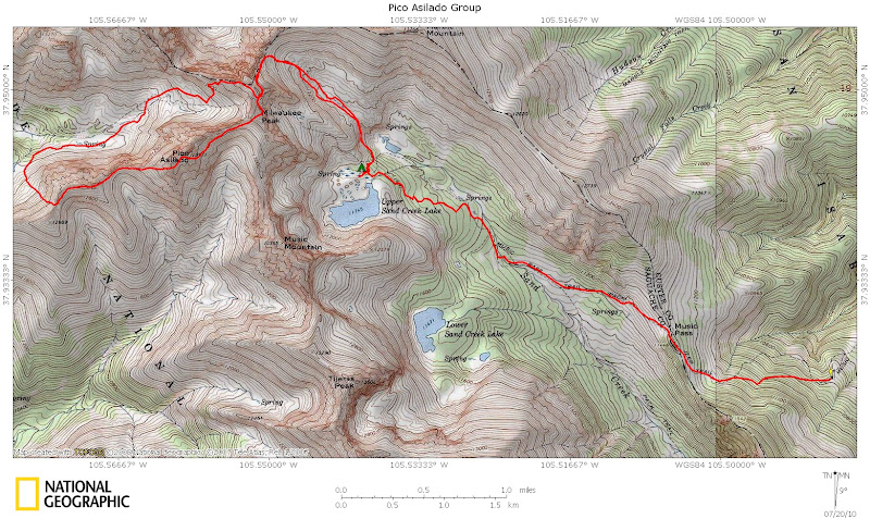
From Music 4WD TH (10680')
3.6 miles/1570' gain backpack to Upper Sand Creek Lake
10.6 miles/5100' gain climbing and pack out
Participants: Steve Mueller, Jeff Utz, & Kevin Baker
Slideshow
The Milwaukee to Pico Asilado traverse has been on my summer scrambling agenda for a long time. It is featured in Dave Cooper's fine Colorado Scrambles book, but seems to get put on the shelf until next summer. Both of these peaks offer class 2 routes to their summits, but with the Cottonwood Creek approach on the west side being closed, it makes sense to do them from the Music Pass trailhead. I sent out a fair amount of invites during the week, but there were no takers until I found out that Steve "Bi-Centennial Man" Mueller was planning on climbing nearby Tijeras this weekend! It didn't take much to twist his arm to join me on this traverse as Asilado is conveniently a bi-centennial. Jeff is more into "interesting" climbs, and these peaks certainly fit that category.
I was out in the Sangres early for some 13ers on Friday and killed some time Sat morning with a jaunt up 3 quick low peaks. One of these unmentionable peaks resulted in a confrontation with a landowner while I was on the summit! That was the quickest 4th class downclimb I've ever done! I leisurely hit these low peaks and made my way up to the Music Pass TH. The road is suitable for any stock 4WD vehicle. I thought I would be packing in by myself, but Steve and Jeff arrived as I was getting ready.
The approach is only 3.6 miles, but you lose about 490 feet of hard earned elevation gain dropping down from Music Pass. This comes back to bite you on the pack out! We enjoy the luxuries of a trail designed for the many horses that fishermen use to access the Sand Lakes. It zigs and zags its way gently up to the lake. We camp on a knoll above Upper Sand Creek Lake at 11760'. The pack in takes 2.5 hours and there's a few brief sprinkles before we arrive at camp, the only weather for the trip! Since we get there well before dark, I scout out the route down to the trail we'll access in the morning. We build a fire to keep the mosquitoes at bay and have a good time visiting.
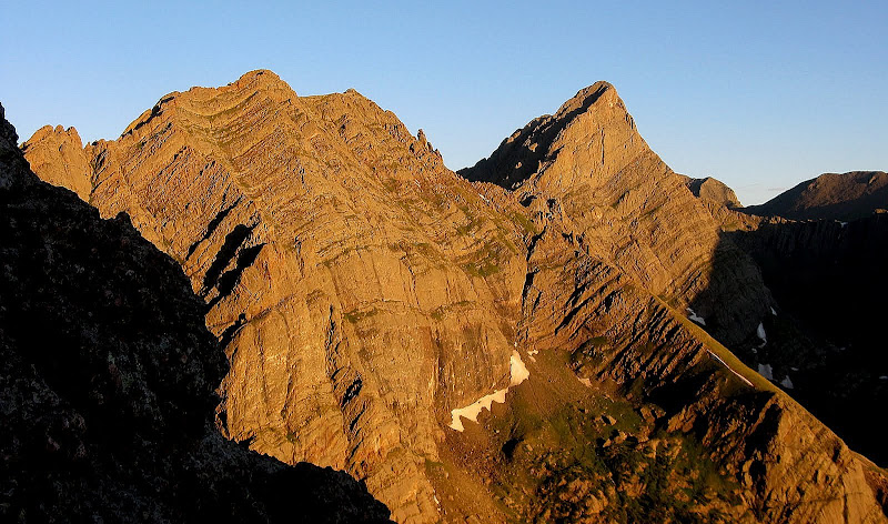
Milwaukee's East Face
We get a good night's sleep as it's perfect temps for sleeping. Ah, the comforts of summer camping! We set out at 5:20am and descend north about 240 vertical to a well defined trail. There is a cairned path leading down from camp, but it's hard to follow with limited light. We hit the main trail at 11520', which will take us to the basin n.e. of Milwaukee. The trail does a good job of avoiding the willows, but we end up losing it and manage to avoid most of the willows anyway. It is actually well cairned and we're able to follow it all the way on the return as it hugs the south side of the basin. We arrive at the Milwaukee/Marble saddle and are treated to a stunning view of Broken Hand Peak and Crestone Needle!
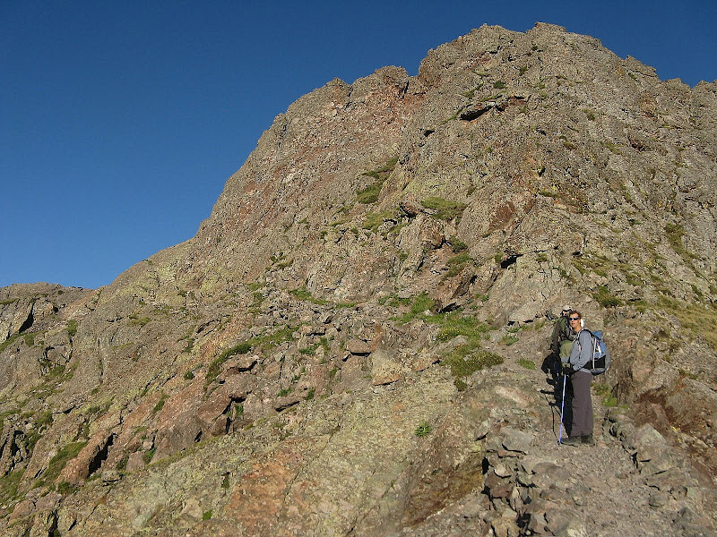
We hang a left at the saddle and head up the ridge, only to discover a new trail! This trail has been recently constructed and efficiently carries us to Milwaukee Pass. It is as well designed as a 14er trail, maybe the work of the CFI? We can see the old climbers trail that ends up merging with the new one.
Nicely constructed trail to Milwaukee Pass:
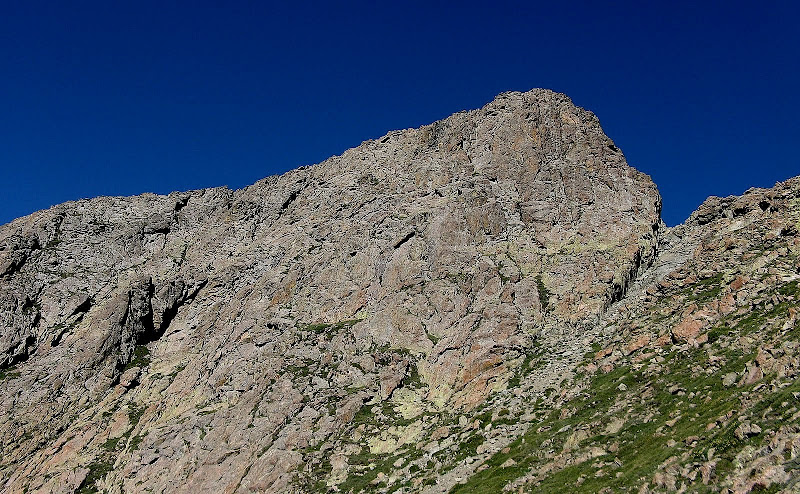
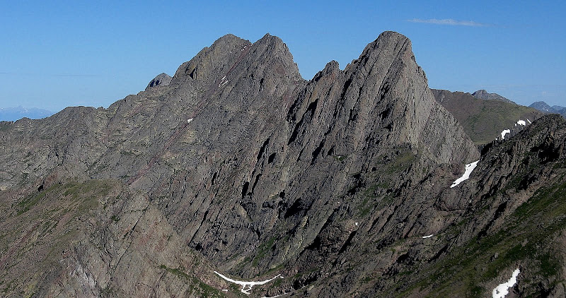
Milwaukee is a formidable peak, and it's east face looks very imposing as you approach it. Somewhere there's supposed to be a 3rd class route up this face, but we didn't find it!
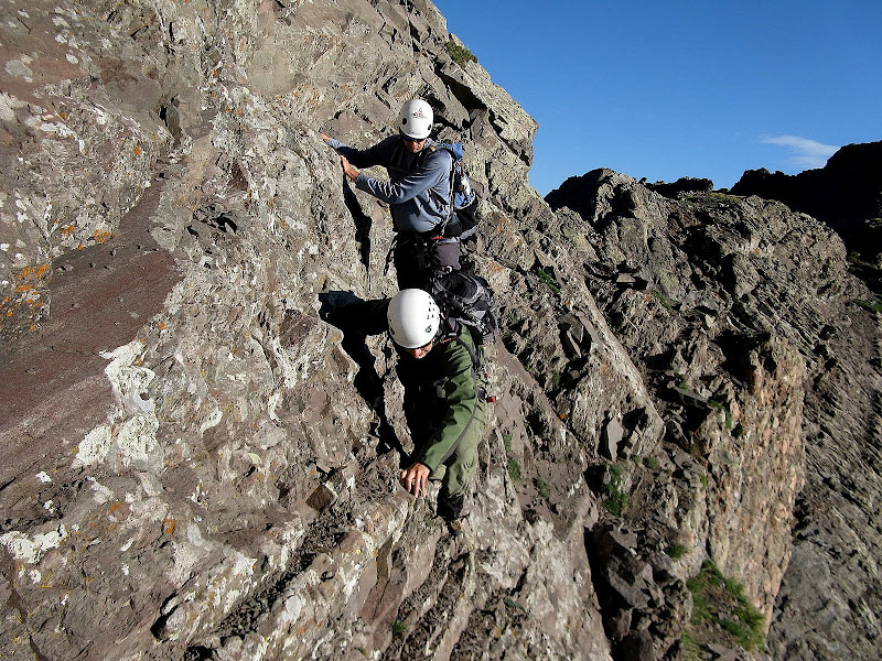
We traverse a ledge into a small notch on Milwaukee's north ridge. Steve tosses his poles to Jeff in the notch and I do so as well, only they don't quite reach Jeff and skitter down the steep chimney below the notch. They're close enough to retrieve, but Jeff knocks some rocks on them trying to retrieve them and they go down too far. Bummer, but Jeff saves the day and lets me have his poles for keeps later on! Those poles took a lot of abuse!
The climb out of the notch is 4th class and loose, but not too exposed.
Steve climbs out of the notch:
You are then faced with a very airy and intimidating traverse across a ramp. The low route has more space to scoot across, but there are loose rocks to deal with. The high route has smaller footholds, but better rock. We all choose the better rock.
Just don't look down, guys!
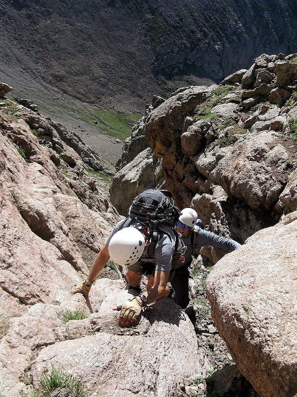
From here, the ledge widens to a comfortable level. The G&M guidebook states to cross the ledge until it ends. Cooper says to head up a gully after you round a corner. We follow a path through a notch, then it drops down and crosses slabs to a gully that Jeff says is very difficult to get into. We end up climbing the face to the right of this inset gully and do an ascending traverse right on steep grass and ledges up to the northern false summit. We pull some 4th class moves through here that are definite "no fall" moves. The rock is generally pretty solid, but I did pull out one handhold before I put much weight on it. We're not sure if we went too far or not, but it worked out. I think we were off a bit though, which is easy to do on this face.
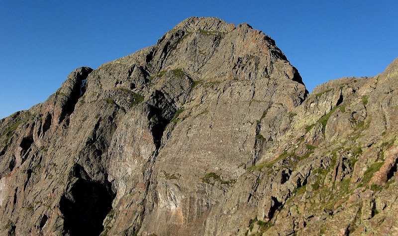
The view up from the end of the narrow part of the ramp. Not sure if we should have found a way up this or not.
The Wedgie
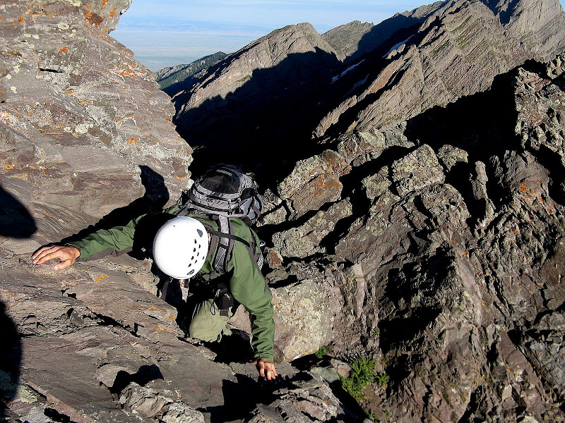
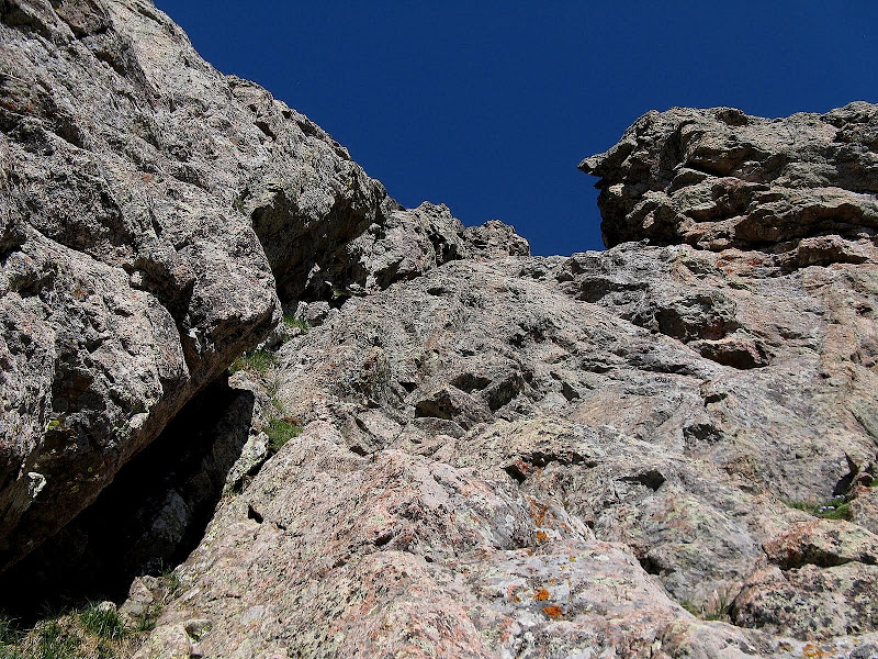
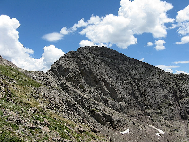
We top out at 8:08am, much sooner than anticipated and it is looking like it may be a bluebird day! We take a long break, then set out for Asilado down Milwaukee's west ridge. The ridge is easy with a few class 3 moves here and there. I have been highly anticipating the climb of Asilado as it offers a cool, inset gully right in the middle of the east face. The standard route zigs up exposed ledges to the right of this gully. Kurt Traksos aptly named this gully "The Wedgie" and it turns out to be a gem as it is very efficient with no routefinding to worry about. Just go straight up!
The entrance to the Wedgie is just below the prominent V slot in the rock:
The gully provides sustained class 3 and 4 climbing all the way to the summit! We all have a blast in this gully. We stick close together though as there is some loose rock to contend with.
The Wedgie:
Near the top it steepens and there are some fun challenges to overcome, including an angled slot that if you get in it is truly a wedgie-like experience!
Steve likes the climb because he's not hanging his butt out over so much air!
We top out at 9:28am, well ahead of the pace we thought we would be at. The view over to the Crestones is stupendous to say the least.
The Double Pass Whammy Descent
The options from Asilado back to camp are either to reclimb Milwaukee and go through all the routefinding issues or go over Unnamed 13020 to the west, descend a nasty gully, and reclimb nearly 1,500 feet back to Milwaukee Pass via Cottonwood Creek basin. Steve and Jeff decide to join me on 13020 even though it's not on their radar since it would be the less complicated route. Jeff hauled a rope up in case of the need to rappel, but it seems easier to drop into Cottonwood.
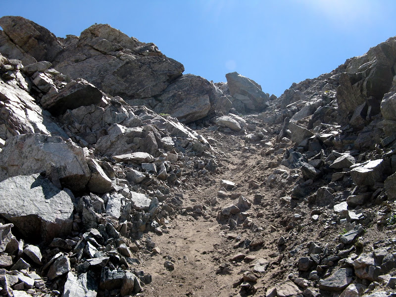
13020 goes fairly quickly and is just a steep 360' climb up grass and stable boulders. The descent gully is at the 13020/Pt 12989 saddle and is a horrendous mess of scree on top of hardpan and large talus blocks poised to launch on disturbance. We move one at a time initially, then fan out as it broadens and take our own lines down. The gully isn't a good way to break in new trail runners, but they hold up well! My camera pops out of its case, and skitters down 20 feet or so. Luckily, it still works fine!
Hardpan anyone? I thought this junk didn't exist in the Sangres!
We descend into the basin and as we take a break, the mosquitoes start to hit. I must have some appealing body odor, because those devils seem to flock to me! We apply some bug spray and it's clear that I need to move quick. We contour on grass on the south side of the drainage to avoid willows. Anytime you get close to water and the mosquitoes swarm. At times there are probably 50 hovering around me. We finally clear them well above treeline when the wind knocks them off. Now where is that blasted trail? It is easily visible from the summit of Milwaukee, but I don't stumble across it until I've climbed steep grass to about 12700 feet. The trail is welcome despite the endless switchbacks to Milwaukee Pass.
Milwaukee on the re-climb to the pass:
Clouds hover overhead, but nothing threatening. We break at the pass, but we're all out of water. We're all a bit dehydrated, but it's easy going down the trail to water high in the basin. I have iodine tablets, but we decide to drink the water untreated since we're so high. It was the best water I've tasted in awhile.
We follow the trail better on the descent and are back at camp by 4pm. Now all that is left is 3.6 miles of easy trail, but we have to go back over Music Pass. Luckily, it is just 500 feet of suffering and I arrive back at the trailhead at 6:30. Twas a memorable trip indeed!
GPS track:


Comments
Post a Comment