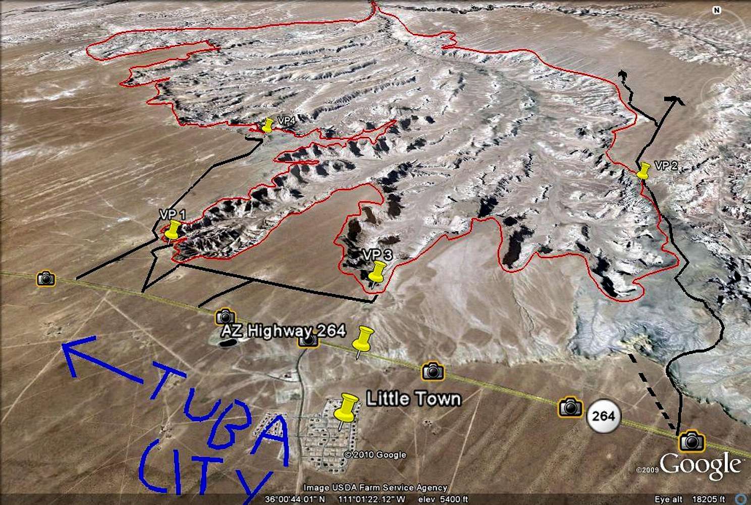
Here is a Google Overview of the Coal Mine Canyon Area. As you can see, the approximate area of Coal Mine Canyon is outlined in Red.
The black lines are Indian dirt roads. The ones marked are a few of the main ones, but there are many many more in the area.
Also, I labeled some of the popular view points with "VP". VP 1 refers to the most popular one. Those are just some of the main ones, but as said before, there are dirt roads all over so you can go find your own view point by either driving or hiking to it.
The dashed black line is the border between the Navajo and the Hopi. Navajo land is on the left and Hopi land is on the right.


