
|
|
Mountain/Rock |
|---|---|
|
|
43.67256°N / 74.04881°W |
|
|
Hiking, Skiing |
|
|
Spring, Summer, Fall, Winter |
|
|
3563 ft / 1086 m |
|
|
Overview
Gore Mountain is located in Warren County and, at 3,563 ft, is also the highest point in the county. The main attraction for Gore Mt is the Gore Mt Ski Resort, but there are hiking and mountain biking trails as well. Gore Mt is part of the Adirondack Fire Tower Challenge and is one of the longer hikes on the list at 5.8 miles one-way.
Getting There
The trail is located off NY28 in Ski Bowl Park, about 0.2 miles south of the intersection of NY-28N near North Creek, NY. There is a brown DEC sign, "Schaefer Trail to Gore Mtn" at the road entrance.
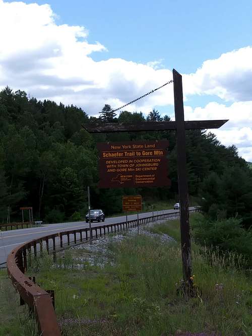
Follow the road about 100 yards and the trailhead sign is on right side of the road, right before the landfill. Park, and go through an opening in the fence to the sign-in register. The trail begins directly to the left of the register with blue trail markers.
Route
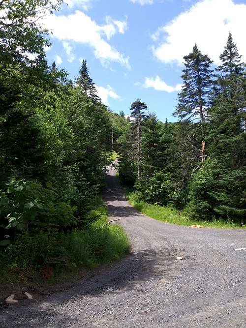
The trailhead and register are behind the fence at the parking area. Once signed in, the trail follows blue markers left into the woods.

Do not take the grassy area behind the trail register. The trail is very faint in places, so one must be careful to look for the markers and stay on the path. The trail winds through the woods and crosses straight across a couple roads (don't turn onto the roads) before intersecting with another trail and meeting Roaring Brook. The trail turns right and follows Roaring Brook up past very scenic waterfalls and comes to a first bridge crossing which you can either go under or over depending on water level. A little further is another bridge crossing and then a reservoir at 2.5 miles. The trail turns right at the reservoir and shortly comes to a trail sign in the middle of the woods, which seems oddly out of place since the trail is so faint.

At 3.4 miles you reach the Ives Dam clearing, which now appears as a small meadow. The trail veers left, crosses a small stream and reenters the woods. After this you'll begin noticing more elevation gain. You'll cross two ski trails on your way up before the trail lets out at 4 miles onto the service road to the summit.
This is the steepest part of the hike and also where some views begin to open up. There are signs directing hikers to stay on the road, so please do, as this is not public land. At the summit, you'll find a short road to the fire tower, which is covered in different antennas and is not accessible. Following the service road another 50 yards will bring you to some resort buildings, picnic tables to eat at and some outhouses. There aren't 360 views, but venturing around will provide some very nice views to the south and east.
Red Tape
No special permits or passes needed, but keep in mind that this trail goes through a ski resort. Please stay on the trail and heed the signs further up to stay on the road on the final part of the hike.
When to Climb
Any time of year is a good time to check out the Schaefer trail to the summit of Gore Mt. As this is a ski resort, there is really no activity in spring, summer or fall. Even in winter, there should be no issues since the trail is through the woods and follows the road at the top portion. There are a few places where the trail crosses ski trails, but no part of the hiking trail ever follows a ski trail. Be prepared for any weather on the mountain since conditions can change quickly any time of year. Snow shoes and crampons will be needed/required in winter.
Camping
Add Camping text here.
External Links
Add External Links text here.