
|
|
Mountain/Rock |
|---|---|
|
|
48.05737°N / 120.531°W |
|
|
Hiking |
|
|
Summer, Fall |
|
|
7297 ft / 2224 m |
|
|
Overview


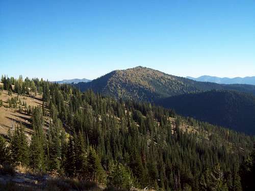
So you looking for a good summit with stellar views no one knows about. And you are not comfortable with hardcore scrambling but are comfortable bushwhacking to this mountain with stellar views. Well if you willing to go 300 yards off the Pyramid Mountain trail and climb up roughly 300 feet, Graham Mountain and it's stellar views can be yours. Graham Mountain is home to great views of Lake Chelan, Pyramid Mountain, Crow Hill, and many, many other mountains. It is quiet a beautiful viewpoint and a special can't miss summit, especially if you are doing Pyramid Mountain.
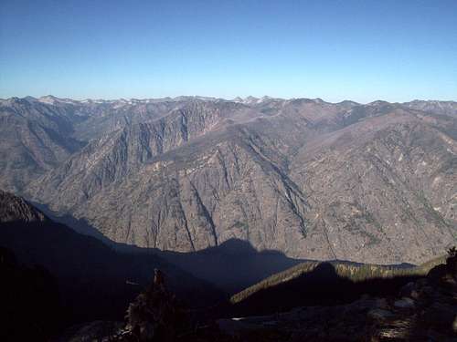
To get to Graham Mountain you must take the Pyramid Mountain Trail roughly 4.5 miles. The Pyramid Mountain will drop in elevation from 7000 feet down to 6400 feet. The trail will then rise again to around the 7000 saddle of Graham Mountain. There is nothing difficult in terms of exposed areas or scrambling here. When you hit an open field head directly up the ridge. Stay focused through the open fields, pine and larches until you reach the cairned summit (I did not find the summit log up there). Beautiful views await you especially of Lake Chelan.

Graham Mountain should be done in late summer and early fall. I personally would recommend late September and early October for this mountain because the larches on this summit are spectacular. Unless you want to make a very long trip of it don't come in winter and early spring. Your 9.25-mile roundtrip hike will turn into a dramatically longer hike due to the fact that the trailhead is at 6500 feet.
Getting There
VIA THE PYRAMID MOUNTAIN TRAILHEAD: Starting from the city of Wenatchee you want to head up U.S. 97 to the town of Entiat. You want to make a left on the Entiat River road and take it 28 miles. Make a right on Forest Road 5900 and take it up 8.5 up to the top of ridge to an area called Shady Pass once up continue until you run into Service Road 113 which is a very rough service road. Take that road to the very end where the Pyramid Trail starts.Red Tape
No red tape except to note that this is bear country. Though I came up in a normal car, I would highly racommend going to this trailhead in a 4 by 4 truck. The last bit of road to the trailhead is extremely rough.Camping
Backcountry camping is possible in this region. If you want you can even camp near the trailhead. There did look like a couple of places you could bivy on this summit or you could continue to the summit of Pyramid Mountain which had an established camping spot.Weather and External Links
Here is the best link to weather and conditions in this region at this elevationHere is a link to the best trip reports on Pyramid Mountain and other hikes in the Cascades