
-
 12444 Hits
-
 84.27% Score
-
 18 Votes
|
|
Mountain/Rock |
|---|---|
|
|
51.03880°N / 115.11612°W |
|
|
Scrambling |
|
|
Spring, Summer, Fall, Winter |
|
|
7140 ft / 2176 m |
|
|
Overview
A newly named peak (July 2006) Grant MacEwan Peak is really just a high point along the ridge east of Heart Mountain. It is however a great day (1/2 day) trip mountain to scramble near Canmore and Deadmans Flats, AB. With its close proximity to Calgary via the Trans-Canada Highway. Grant MacEwan Peak can be ascended year-round because of the Chinooks. This peak depending on your route is a steep scramble via Heart Mountain offering little in the way of relief till you reach the summit. There are 2 variations for descent .... the way you came up is one. The other would be to continue to follow the ridge that starts just behind the summit south (left as you reach the summit). Follow and obvious trail and decend at the south end of the bowl. This is a very picturesque route. As well as being less direct. You can also ascend via this route.I imagine the name is from former Lieutenant Governor of Alberta, the Honourable J.W. Grant MacEwan, in recognition of his regard for the wilderness of Alberta.
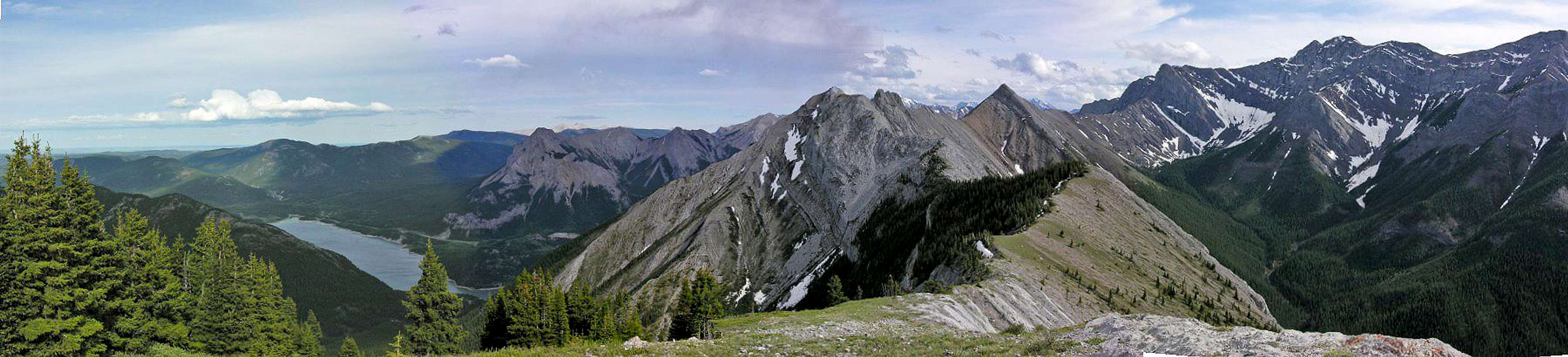  |
With views of Grotto, Yamnuska to the east, Mt. Lorette 2,487 m (8,160 ft.) and Mount McGillivray 2,450 m (8,038 ft.) to the west as well as the south view of Calgary and north view of Exshaw (which is somewhat less interesting unless you are an industialist)
Getting There
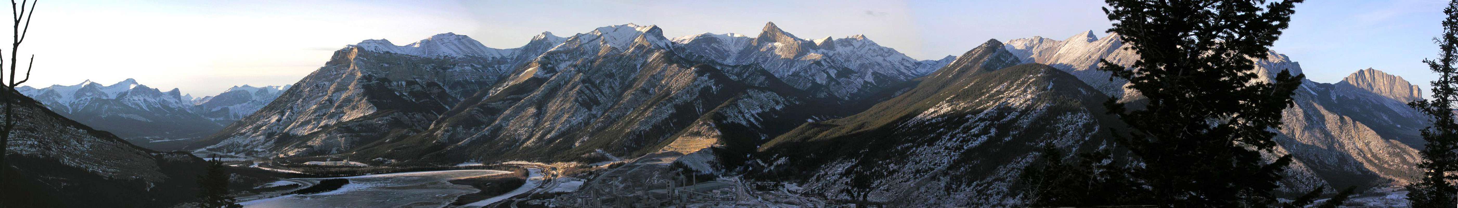 |
Head West from Calgary (about 75 km) on the Trans-Canada Highway towards Canmore. You will see this peak on the left (left of Heart Mountain) as you near Exshaw/ Dead Man's Flats. You will have to exit at "Val des Arcs" and cross over to the south bound service road. You will have to park on the side of the TransCanada just before Heart Creek. On a normal day other parked cars will point the way. If you prefer a signed parking lot is on the South-bound side of the Trans-Canada Highway about 37 km east of Canmore but this will require a longer walk. You can continue further south by the beaver lakes and park here if you wish to ascend via the south east slopes.
Red Tape
Look out for bear & fire warnings and postings. For closures ... look for yellow tape marking off trailheads in the area.Other than that there is no red tape for this day (1/2 day) trip.
Mountain Conditions and weather
Can be climbed all year long - thanks to the Chinooks.Dryness would dictate winter ascents.
SCRAMBLES IN THE CANADIAN ROCKIES
Author: Alan Kane
Year: 1992
For Heart Mountain and by extention Grant MacEwan Peak - see pages: 42 & 43. It is not named in the book as it only came into being July 2006.
Alpine Club of Canada
Joining a club such as The Alpine Club of Canada is recommended when climbing in Canada. While it is not obligatory, useful information can be had at any of their Clubhouse in Canmore, or at their website which is open to everyone.http://www.alpineclubofcanada.ca/
Staying at the club in Canmore is 21$ Canadian for members and 29$ for non-members. It can get quite crowded in the summer so a reservation is recommended.