"Hail Peak", "Mount Silverthorne", "Zodiac View" & Wingle Ridge

"Hail Peak", "Mount Silverthorne", "Zodiac View" & Wingle Ridge

Page Type Page Type: Trip Report
Location Lat/Lon: 
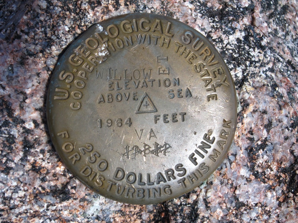
39.65400°N / 106.1892°W
Date Date Climbed/Hiked: Jul 30, 2011
Activities Activities: Hiking, Mountaineering
Seasons Season: Summer

Stats

Peak Name
CO Rank
Elevation
"Hail Peak"
710
12904'
"Mount Silverthorne"
351
13357'
"Zodiac View"

12505'
Wingle Ridge
1322
11977'

Distance: ~20 miles
Elevation Gain: ~6500'
Date: 7/30/2011

"Hail Peak"

John Kirk, Steve Knapp I met in Morrison at 5 am on Saturday morning. We met Mike Rodenak at the Gore Creek TH around 6:30 am. We hiked up the Gore Creek Trail, then up the Gore Lake Trail and finally left the trail to follow the drainage from Snow Lake north. We then ascended a gully east to a broad bench between "Hail Peak" & "Mount Silverthorne". From there, we ascended the southeast ridge of "Hail Peak" finding large, loose boulders and used caution not to knock any down on each other.


"Hail Peak". Photo: John Kirk


"Snow Peak". Photo: John Kirk


"Hail Peak". Photo: John Kirk


Looking west from "Hail Peak". Photo: John Kirk


"Mount Silverthorne".  Photo: John Kirk


"Snow Peak" above Snow Lake. Photo: John Kirk

"Mount Silverthorne"

We descended the southeast ridge of "Hail Peak" then ascended the southwest ridge of "Mount Silverthorne" finding more loose junk.


"Mount Silverthorne". Photo: John Kirk


Willow Benchmark atop "Mount Silverthorne". Photo: John Kirk


"East Thorn".  Photo: John Kirk


Zodiac Spires. Photo: John Kirk


Red Peak. Photo: John Kirk

"Zodiac View"

We descended the south ridge of "Mount Silverthorne" to the "Mount Silverthorne"-"Zodiac View" saddle. John and I made the quick trek up to "Zodiac View". I encountered more loose rock up here and managed to roll a rock over onto my ankle.


"Zodiac View". Photo: John Kirk


"Libra Spire", "Taurus Spire", "Scorpio Spire", "Gemini Twins" & "Cancer Spire" from "Zodiac View". Photo: John Kirk


"Sagittarius Spire" from "Zodiac View". Photo: John Kirk


Zodiac Spires from "Zodiac View". Photo: John Kirk


"Hail Peak". Photo: John Kirk

Wingle Ridge

We made the long hike out to the trailhead, said our goodbyes to Mike, then stopped briefly to get some cool fluids before heading to the Shrine Ridge Trailhead at Shrine Pass. We followed the Shrine Ridge Trail to just below the summit ridge, then headed directly for the peak. I was surprised to see most of this ridge was corniced this late in the year.


Shrine Mountain. Photo: John Kirk


Wingle Ridge. Photo: John Kirk


Ptarmigan Hill. Photo: John Kirk


Sugarloaf Peak in front of Elk Mountain. Photo: John Kirk


Wingle Ridge summit. Photo: John Kirk


"Hail Peak", "Mount Silverthorne" & "Zodiac View" Map


Wingle Ridge Map

Comments

No comments posted yet.


Parents 

Parents

Parents refers to a larger category under which an object falls. For example, theAconcagua mountain page has the 'Aconcagua Group' and the 'Seven Summits' asparents and is a parent itself to many routes, photos, and Trip Reports.