
-
 16599 Hits
-
 73.06% Score
-
 3 Votes
|
|
Route |
|---|---|
|
|
37.68953°N / 110.92278°W |
|
|
Hiking, Canyoneering |
|
|
Spring, Summer, Fall, Winter |
|
|
A long day |
|
|
Class 3 |
|
|
Moderate |
|
|
Overview
This route will allow for the Halls Creek Narrows to be seen as a day hike as well as providing a nice scramble for someone looking for a little more adventure. This route involves descending a "break" in the cliffs above Halls Creek that is further south than the official trailhead making the walk down the valley 3.5 miles shorter each way. Doing the shortcut route turns the 20 mile hike into a 12 mile hike (assuming you can drive to the south end of the airstrip, more on that in the getting there section).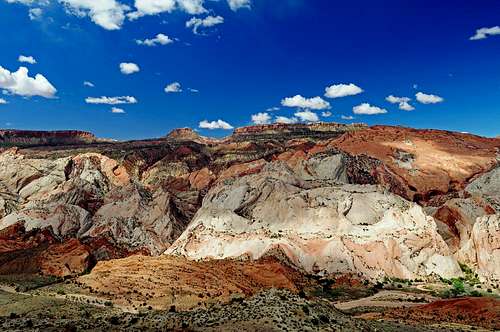
Halls Creek Overlook
Getting There
Instead of driving to the official Halls Creek Overlook trailhead on the spur road, continue south past the trailhead for about 2.5 miles. I don't know if passenger cars can drive this road as I have never driven this section. If it's like the part from the Burr Trail to the Halls Creek trailhead, then carefully driven cars can make it (I know Subaru cars will make it though). By this point you will come across a small fork in the road. Driving beyond here will require high clearance. Take the right fork and drive .3 miles down the old airstrip. At the end of the airstrip, continue down the old track as it turns right. It will end after another half mile (all this can be easily walked if your vehicle can't make it to the end of the old road). At the end of the road is the cliffs that tower over Halls Creek. This is where the shortcut route begins.
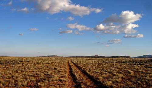
The old airstrip
The coordinates here are:
37 degrees 40.687 minutes North
110 degrees 54.884 minutes West
Fog in the Halls Creek Valley taken from Big Thompson Mesa
Another way to get to the airstrip that may be quicker is instead of taking the spur road turnoff from the paved Burr Trail road, go down towards Bullfrog another 6 miles where you will see another spur road on the right (these two spur roads are actually a loop and therefore the same spur road). Turn right here and head 4 miles until you get to the same fork described above except make a sharp left to get on the airstrip. This side of the loop however heads on the bentonite clay and is a particularly bad section. Impassible when wet but drivable to most cars when dry. The airstrip will come just after the transition from the bentonite clay to the flat yellow colored plateau that makes Big Thompson Mesa.
Route Description
This route from here to Halls Creek is all cross country. From the starting point described above, start descending as the slopes gradually get steeper. Enter a dry gully (wet during storms) and continue downstream this steep gully. You may see a small post in the ground marking the National Park boundary and telling people not to hunt beyond this point. If you do, you know you are on the right track. Here, at the old post you will notice the slopes turn into a series of cliffs. This is where the scramble starts. While staying on the right side of the steep set of cliffs and following a few cairins, work your way down each cliff band. There will be about 6 bands to descend and I recognized two or three class 3 moves. The exposure down each band is minimal and a fall will not be too harmful.
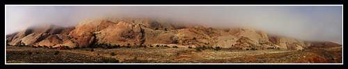
Foggy inside the Halls Creek valley
There may be a few ways down each cliff band but there will be one way down each one that doesn't exceed class 3. Once you get onto the red bentonite clays, look for an alluvial fan that forms a small ridge of red clay rocks and finish descending on that until you get to Halls Creek. Once you get to the creek, follow it downstream (left turn) until you get to the narrows. From here use the main page for more information and return the way you came.
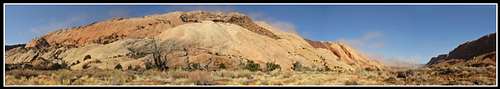
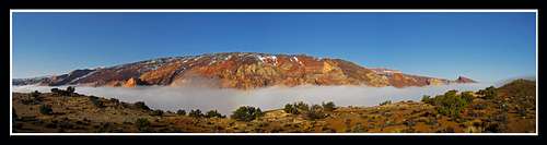
Panorama of the Waterpocket fold as the fog rises
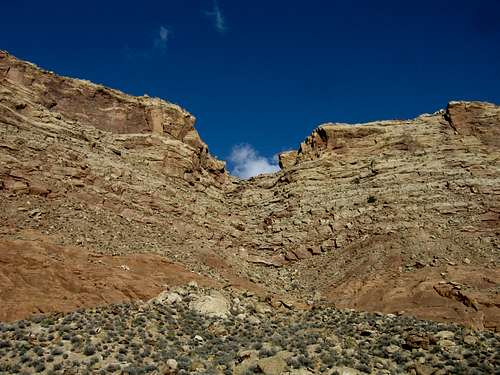
This break in the cliffs that allows a descent into Halls Creek
Essential Gear
Hiking gear (waders if the creek is flowing). Also be sure to have a water filter or enough water to last you the trip. This is the desert and everyone should drink about a gallon each day.External Links
See Michael Kelsey's book "The non-technical guide to the Colorado plateau"There is a set of pages for Capitol Reef National Park and one page describes the shortcut route for the Halls Creek Narrows. I wouldn't be surprised if he was the first to use this route and he built the few cairns we saw.
His books are great (if not the best) resources for canyoneering in all of Utah and Arizona. It was this book that I found out about this route and used it when I did the narrows in March 2010. I have not found any information about this route on the internet.