
-
 1927 Hits
-
 0% Score
-
 0 Votes
|
|
Route |
|---|---|
|
|
58.26499°N / 134.23946°W |
|
|
Download GPX » View Route on Map |
|
|
Hiking, Mountaineering |
|
|
Spring, Summer, Fall |
|
|
Most of a day |
|
|
II |
|
|
Overview
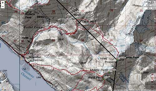
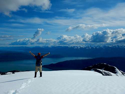
Hawthorne Peak is a 14 miles off trail hike off the Sheep Creek trail near Thane. It’s best done in the spring, summer, or fall when the trail to the cabin can easily be followed. While the hike over to Middle and West peak look close, the terrain is broken and very difficult. The summit gives you great views down Gastineau Channel and the South end of Douglass. You can also get a glimpse of the Taku Glacier to the East. There also is no 'official' trail, so route finding may be necessary.
Getting There
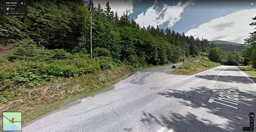
From Downtown Juneau, take Egan Drive South which becomes Thane Road for 4.5 miles. Parking area is on the Left side of the road near a fenced gate.
Route Description
The Hawthorne Route follows the Sheep Creek trail for 2.7 miles along the well-worn path. It first climbs steeply up from Thane Road and plateaus after about 800' of climbing at mile 0.5. From here the trail wanders along Sheep Creek near the old mine access road. After 2.7 miles the trail becomes unmaintained and climbs steeply for 2 miles up the hillside and to the cabin by the power lines shortly after tree line is broken and at 4,160 feet.
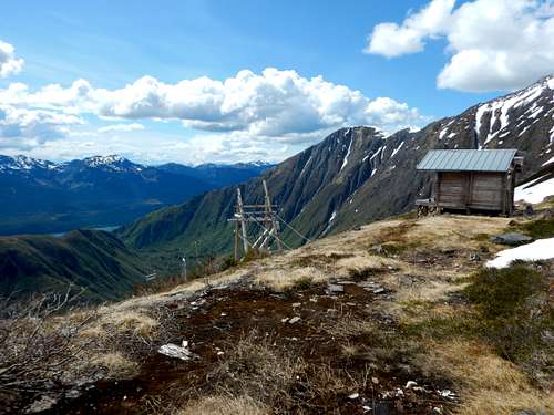
From here Hawthorne is easily seen. Generally follow the hillside South-East towards the peak trying to intersect the ridge at 2800' to avoid doing unnecessary climbing.
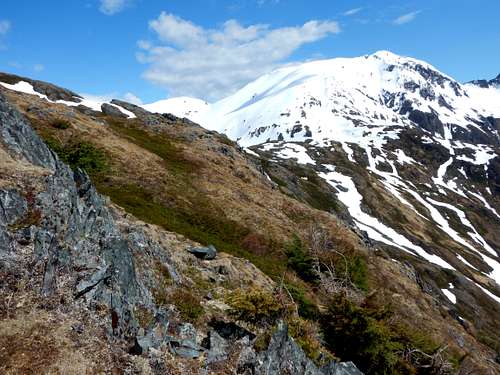
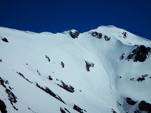
Once on the ridge, follow it South-West and up towards the peak. The hike gets steeper and inclines of 35 deg. are encountered. Just before the top of the ridge, head climbers Right (South-West) to traverse just below the ridgetop. After passing the prominent rock on the ridge located in the center of the picture below, climb up a very steep ramp to the summit ridge.
Climb up to the summit ridge and traverse to the summit.
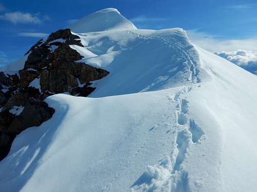
I have been on the summit in spring and summer. Spring involves a steep snow traverse below many hanging snowdrifts. In the summer a rock notch requires a short (15’) but awkward 5th class scramble. Exposure is limited, but a fall would still hurt. The summit is attained at mile 7 and return by hiking the same way back.
See attached .gpx for an exact route or check out the Juneau Hikes and Summits CalTopo page.
Essential Gear
Spring and early summer climbs will require crampons and ice axe. Additionally dress appropriately. The rains are very consistent and can easily penetrate through your gear. I recommend dressing in clothing that can get wet and still keep you warm- wool works great. Then, above tree line, change into dry clothes and rain gear. Waterproof boots are necessary and gators help keep your socks dry. Having a SPOT or InReach is a great idea. Bring extra dry/warm stuff. There is cell service for much of this hike.