Ten Peaks for Fathers Day
~16 miles, 7,800' gain, 9 hours RT.
| Name |
Elevation |
Prominence |
| Fossil Mountain | 12,749' | 209' |
| Square Top Mountain B | 12,985' | 245' |
| Henry Mountain | 13,254' | 1,674' |
| Broncho Mountain | 12,834' | 667' |
| 12446 | 12,446' | 306' |
| 12472 | 12,472' | 492' |
| Cameron Mountain A | 11,802' | 102' |
| Shaw Ridge | 11,740' | 120' |
| Fairview Peak A | 13,214' | 1,234' |
| Terrible Mountain | 12,100' | 120' |
Background
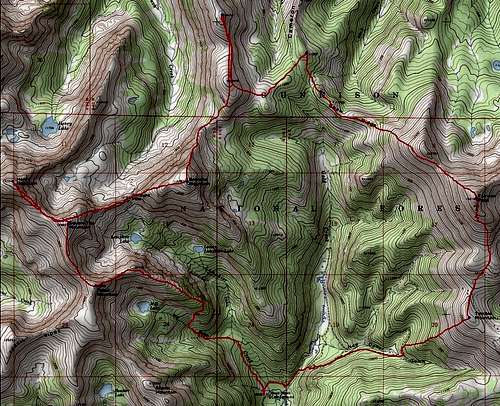
Typically, Henry Mountain is the only 13er on the agenda for those who arrive at the Gold Creek TH. The other 13er I added, Fairview Peak, is often accessed from the south on roads that start from a much higher elevation than Gold Creek TH. Gold Creek trailhead is accessed from Parlin on road 76, 12 miles east of Gunnison. After 8.5 miles northeast on this road to the townsite of Ohio, head north 6.5 miles of dirt road to Gold Creek Campground. A clockwise traverse from Henry Mountain to Fairview takes one over varied terrain and a lot of extra peaks. The best time to do this is July-August as I encountered a lot of deep post-holing at the lowpoint between Henry and Fairview.
![East Ridge - Fossil Mountain]() Approaching treeline on Fossil Mountain's East Ridge
Approaching treeline on Fossil Mountain's East RidgeThe Peaks
The previous weekend, I had done a five peak traverse in the Sangre de Cristos from "Silver Peak" to Electric Peak, involving 23 miles and 8,700' of gain, so I thought I'd keep up the pace with this Fathers Day hike. Arriving at 7 am, I prepared my gear and headed up the trail which I thought would require no attention. Things didn't go as planned when I found myself a good way up toward Mill Lake off-trail after losing the trail several times in drifts of snow. I intended to go up Lamphier Creek drainage to Gunsight Pass and I didn't have any interest in Fossil Mountain. I attempted to correct my course, but ended up above cliffs and decided I would go over Fossil Mountain to approach Henry Mountain. From here the view of Square Top Mountain makes the name very fitting, and the namesake Fossil Mountain is easy to interpret as well with the surrounding talus coated with small fossils.
![]()
Fossil Mountain |
![]()
Talus Fossils |
![]()
Square Top Mountain |
Square Top was easy enough and from there the drop to Henry went quickly as well. Henry Mountain ranks high on the Colorado Prominence list at # 123, and has a commanding view in all directions. I made my way back up to Square Top and began one of the more interesting sections of the day. To get to Gunsight Pass and from there on to Broncho Mountain required a bit of scrambling on the narrow ridge and for the first time I was glad I made my earlier "mistake" going over Fossil Mountain, since I didn't have to manage this section twice (I didn't have to go up it from the Lamphier drainage).
![]()
Henry Mountain |
![]()
Gunsight Ridge |
![]()
Broncho Mountain |
Once past the class 3 ridge, the remainder of the route up Broncho Mountain is a grassy walk-up. I found a register placed by Gerry and Jennifer, but not signed by anyone else as its location wasn't obvious. I moved it to a more conspicuous location and headed toward the two ranked 12ers that were next on the agenda. There were some rocky sections of ridge, but easy to negotiate. There was a register on 12446 left by Jack Dais, a Colorado 12ers completer. I wanted to skirt this 12er on the return toward Fairview Peak, but the cornices and angle looked bad everywhere on the east slopes of 12472 and its saddle with 12446, so I returned over the summit of 12446. From here, there it was a mellow post-hole east to the tree-covered saddle at 11,700'. It took a lot of determination to navigate the drifts and deadfall to get to Cameron Mountain.
![]()
12446 |
![]()
12472 |
![]()
Cameron Mountain |
The struggle continued as I made my way toward Shaw Ridge. First down the south slopes of Cameron then up the ridge in 2-3' of snow. These unranked peaks were by far the most time-consuming part of the day and I was sure I'd be going up Fairview slowly, with 1,600' of gain left to get up it. I wringed out my socks and pressed on up the NW slopes of Fairview. Surprisingly, it didn't take as long as I expected. I took some pictures of the lookout tower and began looking at my descent route to Terrible Mountain. A nice trail leads down of the south slopes of Fairview, eventually intersecting the road most people use to access this peak. Getting to Terrible Mountain wasn't terrible, although the notion of this being an actual mountain is a terrible example. The rest of the descent was straight-forward with a GPS in the tress, with not too much deadfall to contend with, reaching another road and the north fork of the Gold Creek road that continues north past the campground. I enjoyed a cold Rockstar at the truck and headed out at 4pm.
![]()
Shaw Ridge |
![]()
Fairview Peak |
![]()
Terrible Mountain |
![]()


Comments
Post a Comment