Toggle navigation
Mountains
Routes
Images
Trip Reports
Forum
What's New
People
Areas & Ranges
Articles
Trailheads
Canyons
Huts & Campgrounds
Albums
Logistical Centers
Fact Sheets
Lists
Custom Objects
Gear
Plans & Partners
WELCOME TO SUMMITPOST
SIGN IN
REGISTER
Arenig Fawr ( UNDER EDIT...! )
Additional Parents
Image
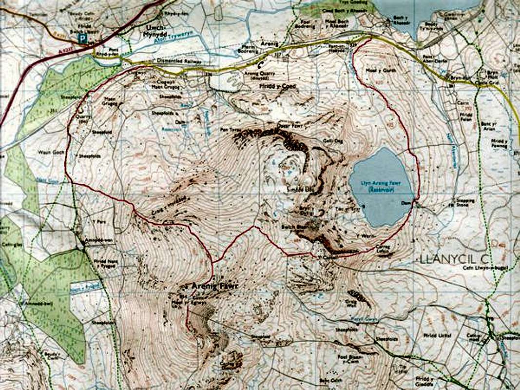
Here is a map giving mine...
View High-Resolution Image
Here is a map giving mine...
Here is a map giving mine (Daveyboys) route to the summit. You can park at either point where the red line meats the road and do the route either way. Either way part of the walk includes road.
« PREV
NEXT »
daveyboy
on
Jan 12, 2006 2:05 pm
Comments & voting
Other parents
Lat/Lon:
52.91660°N / 3.7459°W
Image ID:
145294
1724 Hits
72.08
% Score
2
Votes
Log in to vote
Comments
No comments posted yet.
to post!
Don't have an account?
Arenig Fawr ( UNDER EDIT...! )
(Mountain/Rock)
« PREV
Viewing
#9 of 27
GALLERY
NEXT »
daveyboy's Image Gallery
« PREV
Viewing
#621 of 1300
GALLERY
NEXT »
×
You need to login in order to vote!
User Name
Password
Remember me
Forgot your password?
Log me out when I close my browser.
Keep me logged in all the time.
sign in as a user
Don't have an account?
Register now for FREE
Rating available
Suggested routes for you
People who climb the same things as you
Comments Available
Create Albums
Register Here


