
|
|
Mountain/Rock |
|---|---|
|
|
48.15547°N / 121.63686°W |
|
|
Snohomish |
|
|
Hiking, Mountaineering, Scrambling |
|
|
Spring, Summer, Fall, Winter |
|
|
4879 ft / 1487 m |
|
|
Overview
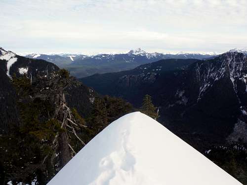
The narrow summit ridge of Higher Squire
Before I say anything I really have to thank StephAbegg for writing a great trip report on this cool summit. Without her writing a trip report about this cool summit I would have never even though of heading up to Higher Squire. Thankfully she did and I was able to go up this wonderful gem myself. I also owe her hiking party some sort of gift because our group (Zephyrus and I) did use their snowshoe tracks to get all the way to the summit. What a great find.
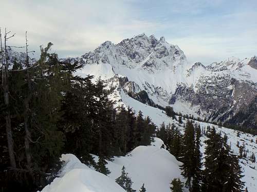
Three Fingers from High Squire
Higher Squire, located in the Mountain Loop Highway area of the Cascades is great peak to visit. The peak itself has over 790 feet of prominence and excellent close-up views of Whitehorse Mountain and Three Fingers. The side of the peak is also famous for Three O'clock Rock is side climbing destination which is moderately popular slab to climb in summer. Until now not too many came to visit this a great peak because it is overshadow by many of its larger neighbors. Being surrounded by Whitehorse, Three Fingers and in the area of Jumbo, Pugh and Sloan it is very easy to see why Higher Squire was passed up. There just are so many good mountains in the region and Higher Squire is just bound to be overlooked by the other mountains in the region.
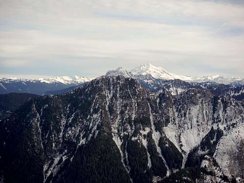
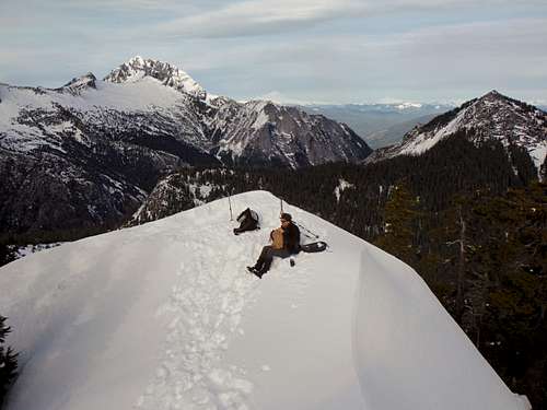
Glacier Peak from Higher Squire
But Higher Squire is special summit. Though the views on the top are not quiet 360 degrees, the close-up shots of Three Fingers and Whitehorse are some of the best that I have seen thus far on the Mountain Loop Highway. There is also good views of many other peaks in the area, including Glacier Peak, Mount Baker, Mount Shuksan and hundreds of other peaks in the region. The cool narrow summit of Higher Squire is great for making good summit shots. View start off about 3/4th of the way and get best as you get higher up the mountain.
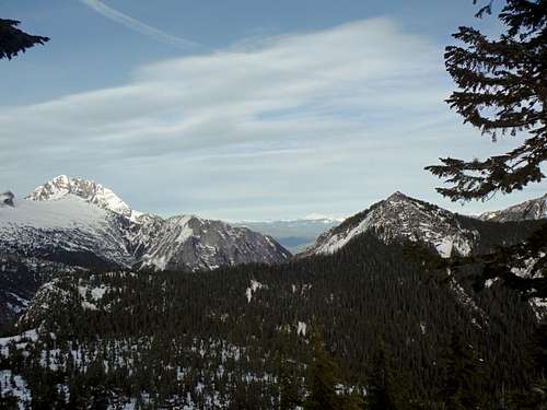
Whitehorse and Ulalach
It should be known that if you planning on going up Higher Squire you must know that this is the mountain of opportunity. If you go up this mountain in summit expect bushwhack through thick bushes on to run into a final narrow Class 2 scramble. Most try to hit this mountain in winter provided that the Eightmile Creek Trailhead is open. That is not a guarantee though because the trailhead starts around 1700 feet. This peak should not be attempted during high avalanche conditions not because of the summit area but because of lower steep slabs (aka Three O'clock Rock) located about a mile from the trailhead. That slabs go up quiet dramtically and if there is any snow sliding now the mountain they are going to go right down that right onto the Eightmile Trail. Keep that in mind when you are trying a winter ascent of this peak.
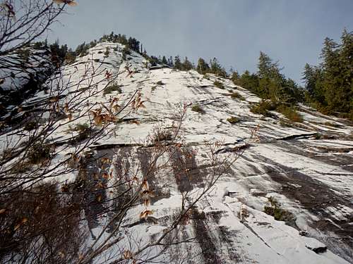
Three O'Clock Rock. The area could be interesting with a lot of snow on the slabs. In summer this potentially could make for some good slab climbing though.
Getting There
FROM DARRINGTON: Take the Mountain Loop Highway South from Darrington roughly 4 miles or one mile past the Clear Creek Campground on the left hand side. Once you pass the campground make a right on the Clear Creek Forest Road. Stay on the forest road for 8 miles where you will pass two waterfalls on your right and Frog Lake on your left. You will also hit a fork in the road where you will want to veer to the right. Eightmile Trailhead pull out will be on your right. Due to the number of potholes and the fact the road does go over a stream it is highly advised that you go up this road in a high clearance vehicle.
Route
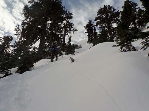
Going up the steep slopes
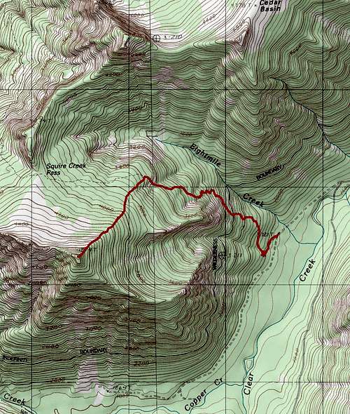
Higher Squire Route Map
Once you go about 2/2 miles you will notice enter a creek with steep walls on both side and what is a ridge behind it. Once you get to the top of steep wall on the trail head off onto your left and look for the ridge. My group was lucky and had track for us. If not a GPS would be a great help for the route finding. In summer though you might want to go a little further on the trail to find an open area to head up. From there head straight up the ridge If you are going in summer you want to head just slightly west of the summit for the easiest scramble. n winter we were content to head straight to the summit. It should be noted that the final summit area heading straight up was very steep and that we used our ice axe to get to the true summit.
Red Tape
There is no red tape at this trailhead pull out.When to Climb
Zephyrus enjoying a nice winter day
Camping
Leave no trace. It is possible to enjoy a winter bivy as there was a nice space in the summit area (not the true summit though). Personally at 7 miles max and 3100 feet of elevation gain keep this mountain strictly as a day trip. In summer I would not camp here due to all the rock and vegetation.External Links
Peakbagger Page on this PeakSteph Abegg's Trip Report On Her Website