Most years in the Salt Lake area, it’s still too cold in early March to do any snow-free hiking to the top of a nearby peak. With a nice weather window causing the snow to at least melt from the lower elevations for a short time, we decided to give Fray Peak a try on my birthday. It ended up offering some unique scenery, and is one that will definitely be added to the list of our family’s favorite local hikes.
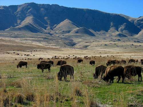
![Buffalo below Frary Peak]() Bison below Frary Peak
Bison below Frary PeakRe-Visiting Antelope Island
We left our house, met my Mom partway, and then drove up to Antelope Island together on Saturday morning. Despite growing up in Utah, she’d never been there before, and since it had been a while for us as well, it sounded like a fun way to spend the day.
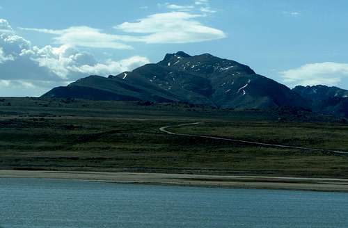
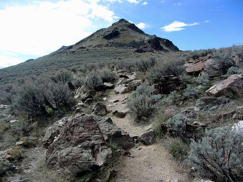
![Frary Peak over Salt Lake]() Driving towards Antelope Island ...
Driving towards Antelope Island ...![Frary Peak & Dooly Knob]() ... and Frary Peak
... and Frary Peak
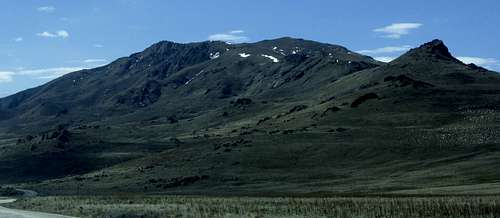
![Willard & Ben Lomond]() Willard & Ben Lomond
Willard & Ben Lomond
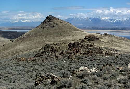
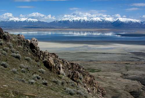
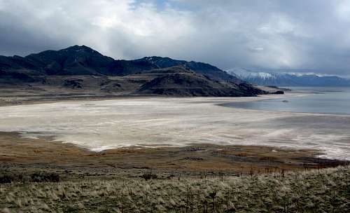
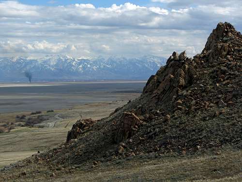
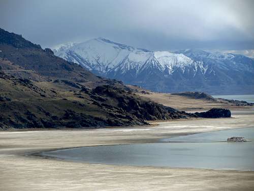
On the way there we could notice the lower water level of the Great Salt Lake, as this time there wasn’t any water on the south/left side of the road leading from the entrance road to the island until just before the island itself (last time there was water there). To the northwest were ocean-like views across the big lake though, with the land on the other side just barely visible if you looked closely enough.
![Wasatch peaks from Antelope Island]() Northern Wasatch peaks seen to the east ...
Northern Wasatch peaks seen to the east ...![Dooly Knob]() ... on our way up past Dooly Knob
... on our way up past Dooly Knob
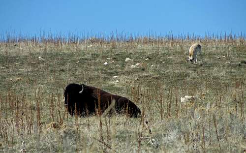
![Bison & Antelope]() We saw just one antelope ...
We saw just one antelope ...![More bison]() ... but several bison
... but several bison
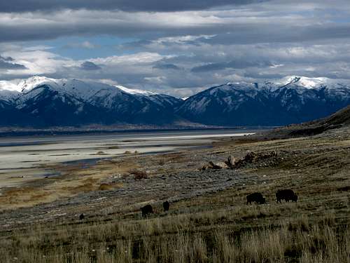
After a quick bathroom break for the kids, we encountered a few bison off to the side of the road on the way to the Frary Peak Trailhead. I had some slight reservations about the children hiking with animals as large as these ones roaming the island, but since I’d never heard of any incidents I figured it would be safe.
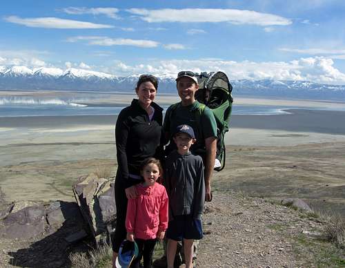
![Coast Scenery]() Taking in some coastal scenery ...
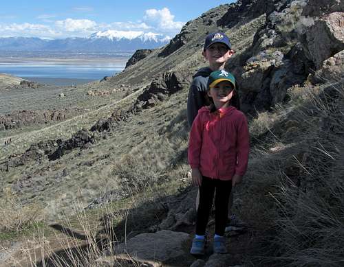
Taking in some coastal scenery ...![Frary Peak family pic]() ... with the family
... with the family
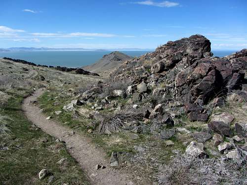
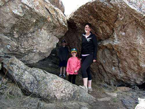
![Frary Peak trail]() Frary Peak Trail ...
Frary Peak Trail ...![Antelope Island boulders]() ... leading under/through some large boulders
... leading under/through some large boulders
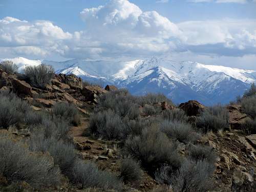
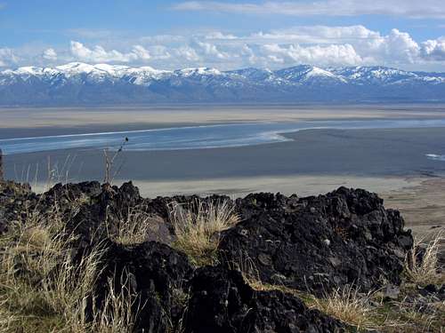
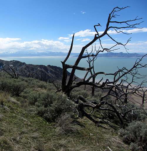
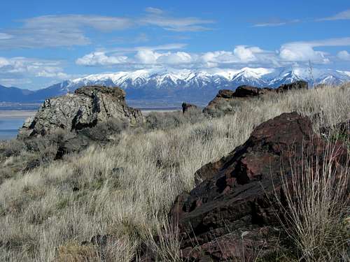
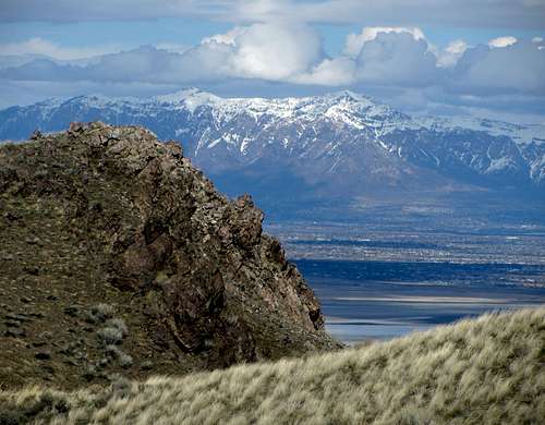
The first part of the trail leaving the parking lot was a little steep for my Mom, so we took a slower pace. The higher we got, the more expansive our views to the west became, with sandy beaches extending off into the distance and the still snow-covered Wasatch Mountains in the background to the east. Less than a mile into the hike, we also took in some great lake views to the west. Before the trail steepened again after about a mile of relatively flat hiking, we came across some tall grass and large boulders, adding more to the unique scenery of the area.
![Mount Ogden & Thurston Peak]() Impressive views of the Northern Wasatch ...
Impressive views of the Northern Wasatch ...![Antelope Island scenery]() ... and a large sea of sand to the east
... and a large sea of sand to the east
![Scraggly Antelope Island tree]() Looking west towards a scraggly-looking tree ...
Looking west towards a scraggly-looking tree ...![Antelope Island beach]() ... and the Great Salt Lake
... and the Great Salt Lake
It had been cool (mid 50’s) and windy most of the time, which is my favorite hiking weather, but at one of the steeper parts the kids were getting tired and said that they wanted to stop there to eat lunch before heading back to the car. Since we were already over halfway to the top (~2 out of 3.2 miles), they agreed to wait for me there while I quickly went to the summit and came back by myself.
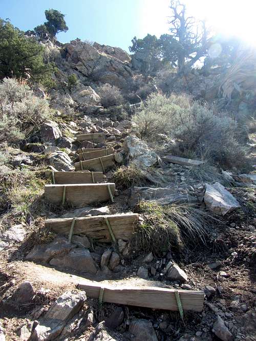
![Frary Peak summit]() Closer to the summit of Frary Peak ...
Closer to the summit of Frary Peak ...![Frary Peak stairs]() ... the trail steepened
... the trail steepened
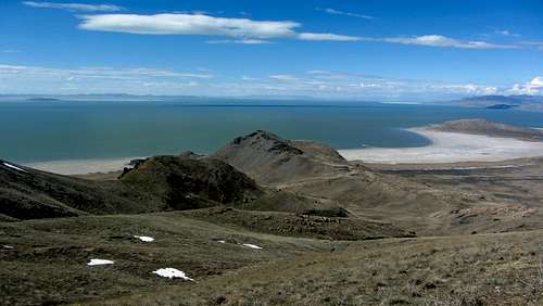
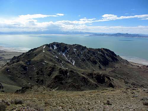
Slow-jogging the rest of the way, I made it to the point where the summit ridge narrowed just a few hundred yards from the top. While scrambling along the top of the ridge looked tempting, I figured I’d get there more quickly by following the trail that lost a couple hundred feet of elevation before leading back up to the summit.
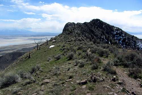
![Frary Peak summit view]() Some summit views ...
Some summit views ...![Frary Peak north ridge]() ... looking back along the north ridge of Frary Peak
... looking back along the north ridge of Frary Peak
![Antelope Island grass/rocks]() More long grass & boulders
More long grass & boulders
The final section of trail was steep and exposed enough that I don’t think I would’ve tried bringing the family this way, so I didn’t feel too bad about leaving them down below. After a few photos I jogged back down, meeting back up about half an hour after leaving them.
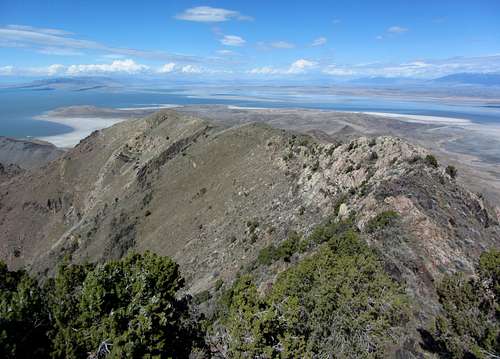
![Frary Peak beach/lake views]() More seaside surroundings ...
More seaside surroundings ...![Willard & Ben Lomond from Frary Peak]() ... on the way back down from Frary Peak
... on the way back down from Frary Peak
![Frary Peak over beach]() Frary Peak over beach
Frary Peak over beach
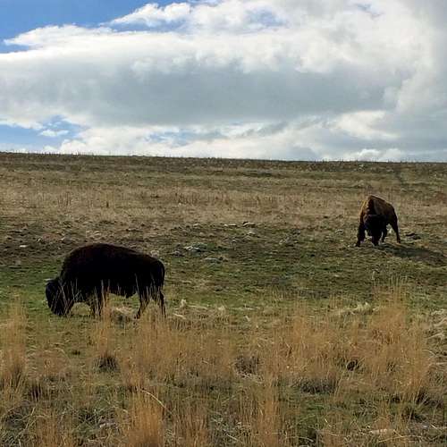
It became a bit overcast on our way back down to the car, but fortunately not too cold. We made the short drive over to the northwest corner of the island before leaving (see a few more buffalo along the way), catching a nice view of Frary Peak rising above some sandy beaches below, after which we made the drive back down to SLC for my birthday dinner.
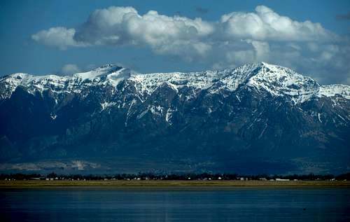
![Sea of sand]() Mount Ogden visible across the lake ...
Mount Ogden visible across the lake ...![Central Wasatch from Antelope Island]() ... along with several other Wasatch peaks
... along with several other Wasatch peaks
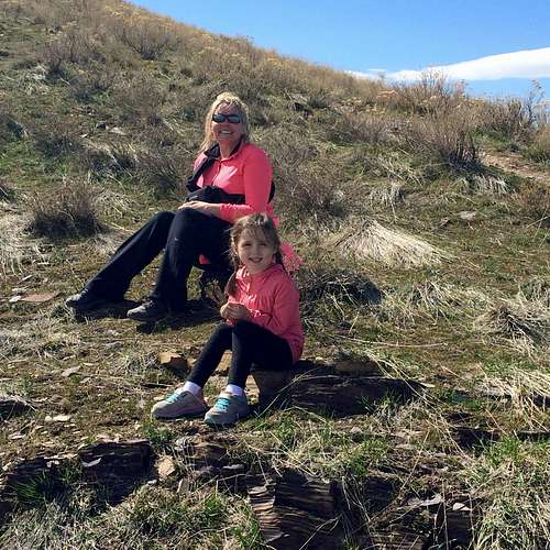
![Little Antelope Island hikers]() A fun little hike ...
A fun little hike ...![Hiking break]() ... for the entire family
... for the entire family
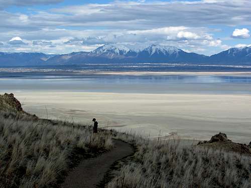
Frary Peak is a unique hike that I’d recommend for anyone living along the Wasatch Front, and is probably the most enjoyable when done in the cooler temperatures of early spring or late fall. It gives some nice island views similar to what you’d expect to see along an ocean coast, with the added bonus of bison and snow-covered Wasatch peaks in the distance. The vegetation on the island was still mostly dormant since it was technically still winter, but I guess the trade-off for more greenery would have been more bugs, which I was fine not having to deal with. The last .2 mile of trail was steep and a little exposed (probably not the best area for small children), but overall it was just a fun hike.
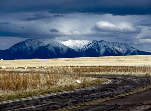
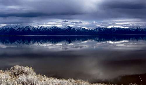
![Storm approaching Mt. Ogden]() We were fortunate in our timing ...
We were fortunate in our timing ...![Northern Wasatch reflection]() ... to avoid some minor passing rainstorms
... to avoid some minor passing rainstormsFrary Peak Stats
DISTANCE: 6.5 miles roundtrip
FRARY PEAK TRAILHEAD: 4,520 feet
SUMMIT ELEVATION: 6,596 feet
ELEVATION GAIN: 2,200 feet
DIFFICULTY: Class 1+
TIME: 3 hours
![Kessler Peak]() ... and sandy beaches
... and sandy beaches![Wasatch & Bison]() Antelope Island offers plenty of bison ...
Antelope Island offers plenty of bison ...


Comments
Post a Comment