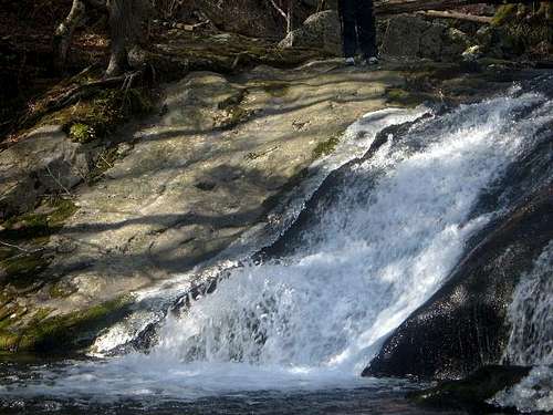
On Saturday morning, January 28th, 2006, I set out with two friends from Washington DC towards Shenandoah National Park. Conditions were sunny and nearly 60 degrees, with little wind. In other words, conditions were perfect! I set out to hit Camp Hoover, and do Cat Knob as a side trip. From Milam Gap, we crossed Skyline Drive, and about 20 feet later, we turned onto the Mill Prong trail. I was surprised by how much we descended. It must have been 700' in a little over a mile. We went really quickly with all the downhill walking. The first site to see was Big Rock Falls, which was basically a big rock covered by a waterfall. This trail goes along a creek for a mile or so, which is very pleasant. When we got to Camp Hoover, we checked out the view of Doubletop, a mountain with an electric tower on it, and might have set off the alarm near the cabin. Of course, we were not worried, but we just decided to get out of there.
![Big Rock Falls along the Mill...]() Big Rock Falls
Big Rock Falls
The next part of our trip was the Laurel Prong Trail which is basically just a continuation of the Mill Prong Trail. It started off as a wide trail, and looked like an old fire road. Finally it got a lot more narrow and we started to climb. We knew that from Camp Hoover, we'd be climbing 1,100 feet to Cat Knob in about 2 miles, with 700' of that going up to Laurel Gap. It was rather steep at points. The bigger challenge was the downed trees. There were lots of them, and it was apparent that the trail had not been cleared in quite a while. At one point we almost thought we lost the trail because there were so many downed trees, but we quickly found our way. The blue blazes were very helpful.
The last bit of trail up to Laurel Gap was really steep and really narrow, with dense foliage, especially for January. Once at Laurel Gap one of my friends collapsed to the ground. He rested for a few minutes, and then we proceeded on to Cat Knob. From Laurel Gap, the Knob was a steep 400' in 1/2 a mile. We felt every foot of the climb, especially because the views were only good through the trees.
On some hikes, you are in the middle of the woods with no views, and others the views are clear. This hike was one where you could see the other mountains, but only with trees in the way. The summit of Cat Knob isn't anything special, but it was still worth the extra distance.
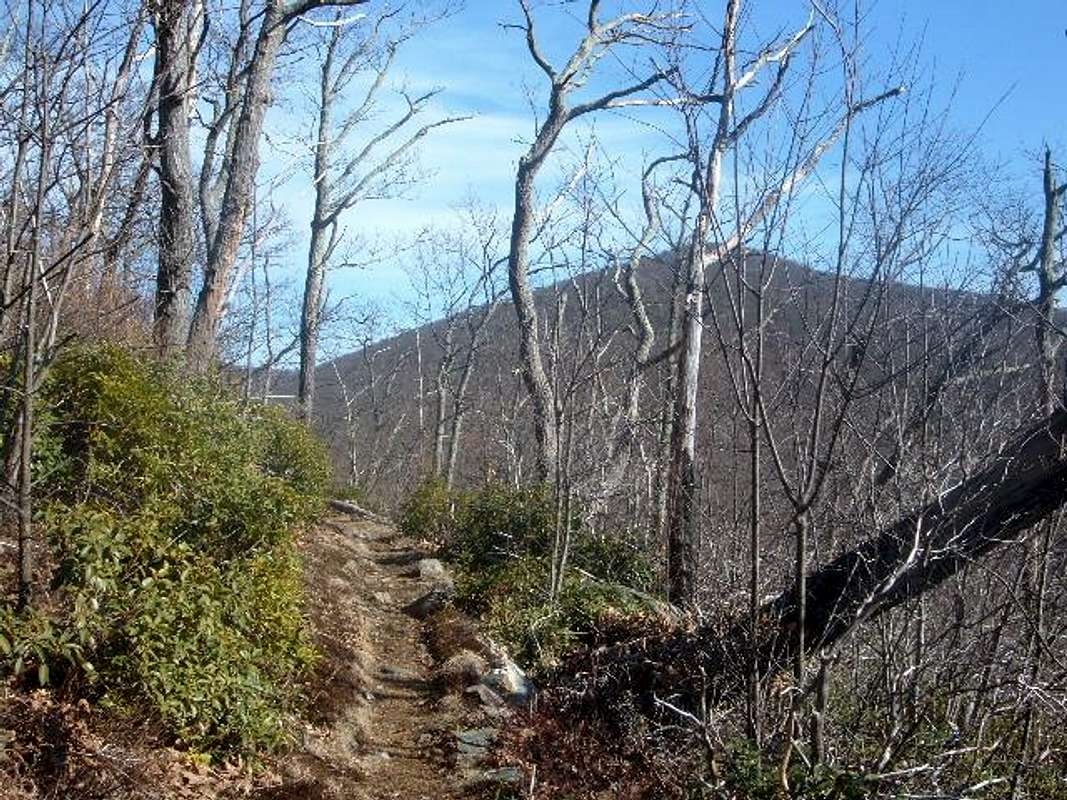
The most satisfying part of the hike was going back up to the Appalachian Trail on the Laurel Prong Trail. After reaching the summit of Cat Knob, we still had almost 4 miles to go to the car. But Laurel Prong was nice, because it was walking on the mountain side. The views back towards Cat Knob were excellent (see photo below).
Once on the AT, we hiked up to Hazeltop (3,812), and then took the nice smooth trail back to the car. The AT Northbound from Hazeltop is very easy on the legs and the mind. The perfect way to finish this hike.
Before the day was through, we climbed Bearfence Rocks, just down the road a mile. We took in the 360 degree panorama and headed home.
All in all a great day!
Comments
No comments posted yet.