Toggle navigation
Mountains
Routes
Images
Trip Reports
Forum
What's New
People
Areas & Ranges
Articles
Trailheads
Canyons
Huts & Campgrounds
Albums
Logistical Centers
Fact Sheets
Lists
Custom Objects
Gear
Plans & Partners
WELCOME TO SUMMITPOST
SIGN IN
REGISTER
Volcan Teneguia
Additional Parents
Faro de Fuencaliente
Image
Hiking up from Punta de...
View High-Resolution Image
Hiking up from Punta de...
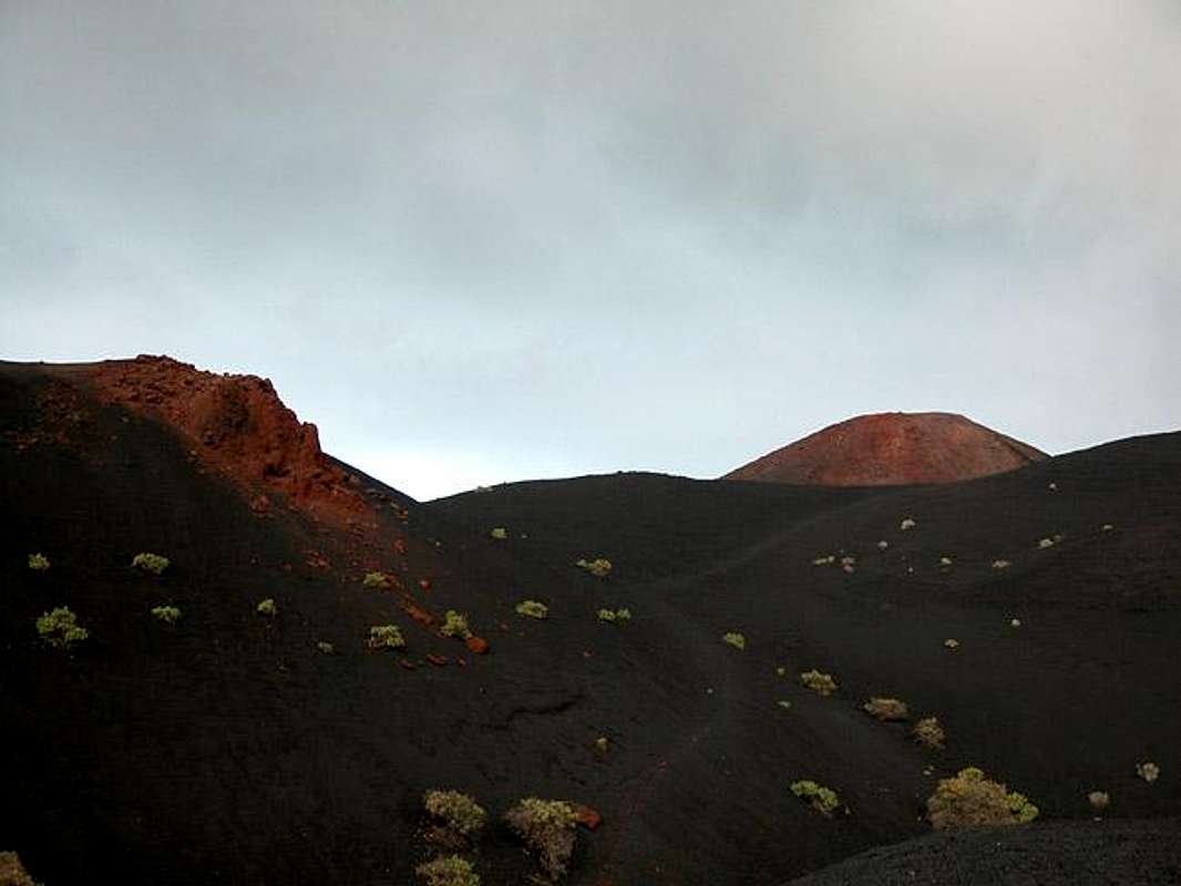
Hiking up from Punta de Fuencaliente you have to cross these black scree fields. Teneguía and several other rocks make for a great contrast with their red rocks. Feb 18th 2005
« PREV
NEXT »
Gangolf Haub
on
Mar 7, 2005 6:14 pm
Comments & voting
Other parents
Lat/Lon:
28.47350°N / 17.8513°W
Image ID:
93698
2787 Hits
73.05
% Score
3
Votes
Log in to vote
Comments
No comments posted yet.
to post!
Don't have an account?
Volcan Teneguia
(Mountain/Rock)
« PREV
Viewing
#15 of 22
GALLERY
NEXT »
Gangolf Haub's Image Gallery
« PREV
Viewing
#7545 of 13940
GALLERY
NEXT »
Faro de Fuencaliente
(Route)
Loading....
×
You need to login in order to vote!
User Name
Password
Remember me
Forgot your password?
Log me out when I close my browser.
Keep me logged in all the time.
sign in as a user
Don't have an account?
Register now for FREE
Rating available
Suggested routes for you
People who climb the same things as you
Comments Available
Create Albums
Register Here


