![Sitting on top of...]() Andy soaks in the views
Andy soaks in the views![Orange cliffs]() Orange cliffs & the La Sals
Orange cliffs & the La SalsSecond visit
The title of this trip report could really be called "Driving to Utah's Lands End" but who'd be interested in reading a trip report of that ilk. No, the hike itself isn't much but the drive, yes the drive, is where it is really at. It is hard to find more isolated spots in the continental U.S.A. than what is located in this part of Utah but if you've read the main page here on SP that is about Lands End, then you get the overall picture of where this place is located, pretty much in the middle of nowhere.
After visiting
the top of Mt. Ellsworth, Andy and I still had time enough left in the day to make the run out to Lands End. After getting back on highway 276, we headed north to Hanksville for some gas and goodies. From there, we headed north to the turn off
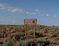
![Just off the highway]() Turn off
Turn off for the Hans Flat ranger station
![The Hans Flat ranger station]() Hans Flat Ranger Station
Hans Flat Ranger Station, a dirt road that takes you on a 45 mile effort to reach Hans Flat. From Hans Flat, it is another 18 or so miles to a spot beneath Lands End. Since I had driven this road just the year before, it held no surprises.
Andy and I made quick work of the minimal effort required to reach the highpoint of Lands End but the views from this spot are truly incredible.
I had forgotten how much I had enjoyed this area the year before when I visited the area with my son in law but sometimes you get to savor things so much more on a return visit. Strangely, both visits were made with a person named Andrew (or Andy if you prefer). It took an hour to drive the 45 miles to Hans Flat and another hour to do the 18 that put us close to Land's End.
It took less than 15 minutes to hike from where we parked to the summit so that should give you a feel for the time required should you ever want to visit this remote spot. The hike is no big deal, less than a quarter mile with under 400 feet of elevation gain.
So why visit the same place two years in a row you might wonder? I had made the offer to Andy (Martin) to visit Lands End as it seemed a logical thing to do. Most of us that are into chasing lists don't particularly care to repeat something we have already done but in this case, I felt it best to make an exception. He wouldn't have even asked for me to repeat it knowing that I had been to Lands End the year before and in all likelihood would have had to make it to the area another time on his own. It just made more sense to do it in my truck since that last 18 miles would have been a challenge for his Honda Accord and our early finish on Mt Ellsworth gave us a window of time to fit this one into our agenda. My guess is that a person could get to Hans Flat in a street vehicle but going beyond, that last 18 miles is not a good idea in a low clearance set up.There are some very rough sections to deal with. Our next goal on the schedule was San Rafael Knob but we'd have plenty of time to get that the following day so
it was not a problem to fit Lands End into our overall agenda.
Andy had parked his Honda a few miles off the highway from Hanksville and found a spot he was willing to leave it. He jumped in with me and we made the majority of the trip both ways in my truck. There was the slight advantage that I knew the roads and how to get to Lands End so he was able
to not have to deal with his maps for this one occasion. We really maximized the day and about the time we got back to his car, we were running out of daylight so we found a spot where we could park both vehicles and enable Andy to set up his tent. After grabbing a bite to eat out of our respective food supplies, we got in a decent nights sleep although the coyotes seranaded us from time to time during the night. The next morning, we
were up early and on our way to visit the summit of San Rafael Knob but that is another story and may well be the subject of a future trip report.
The big effort is the four hours of driving(round trip) from the main highway, not including a stop at the Ranger station (highly recommended) to visit with the ranger(s) on duty and to get up to date info on the road to Land's End. If a person has the time, it would be smart to plan for staying in the area and really exploring what this part of Canyonlands has to offer.
Visiting Lands End is only an appetizer, it just whets the appetite for more. I will be returning to visit Horseshoe Canyon, Cleopatra's Chair, drive the Flint Trail all the way to Hite and even hopefully get out to the Maze. I could go on but this is really a trip report about visiting Lands End but you get the idea.
A year earlier
My first visit to Lands End was part of a trip I made with my son-in-law Andrew who lives in Portland Oregon. We had already been to several peaks
and had included Lands End as an alternative to doing San Rafael Knob. We opted out of doing the Knob since the day before we had done two peaks and
my son-in-law was ready to take a "day off" from the vertical effort of the day before so I would save the Knob for another time. So we sandwiched Land's End in between the hikes of 1000 Lake Mtn/Hilgard Peak of the day before and Mt. Pennell, one of my main objectives of that trip.
After driving into Green River and spending the night at a camp ground there, we made the drive to near Goblin Valley since the turn off for Hans Flat was located. That turn off is less than a mile from the Goblin Valley turnoff on the east side of the road as you drive south towards Hanksville.
My first impression of the road to Hans Flat was favorable. Despite some sections of washboarding and a few sandy stretches, I could actually average about 40 to 45 miles an hour so thus I was able to get to the ranger station in right around an hour. There is a key junction about half way there but
a information kiosk helps you make the correct decision as to which way to go. Should you take the wrong road, you'd end up near Horseshoe Canyon but
we were going to save that for another day. After that junction, there was one more with a road that went to a ranch but staying on the main track was never a problem. Some wild burros provided some photo ops as we got to about ten miles from Hans Flat but overall, the road was good. We saw only one other vehicle during the whole trip and despite the fact that it was the 4th of July weekend, this area doesn't get hammered by visitors. We saw no others and the two rangers on duty said we were the first people they had seen in 5 days. That was amazing to my son-in-law and I so we figured that mid summer is not the tourist season for that part of Canyonlands (Hans Flat area).
We had a great conversation with one of the rangers on duty and he filled us in on so many aspects of the area and what to expect. He mentioned that he'd been out to the Lands End area a few days earlier and that the road was
going to be no problem for my Tacoma pickup. We also found out that there are three regular rangers that are stationed there and they have the duty to cover the whole western side of Canyonlands. During the summer, they also have a seasonal ranger or two that help out but they have permanent staff year around. All of their water has to be trucked in yet they have solar
panels that help in the generation of their electrical needs. They had the internet and phone service thanks to satellite uplinks so they are not isolated from the rest of the world in that regard.
After thanking the rangers for their service and input, Andrew and I headed out the last chunk of miles to get to Lands End. It turned out to be 18 miles or so and the road alternated from good to awful. It took an hour to
do that stretch but there are some places where you want to stop and take in the views. The view of the road that is known as the Flint trail is a must see as well as the overlook for Bagpipe butte. As we drove closer to Lands End, we could finally see it off in the distance. It just barely cleared the surrounding area and really didn't tower over much of anything and that didn't change much as we got closer.
We found a spot to park off of the road, less than a quarter mile from the summit and using care and judgement, found a way to not step on the cryptobiotic soil we encountered as we made our way upward. A foot print here and there indicated that some others had been up and when we read the register, it turned out that they could have been two of my friends from the Salt Lake City area, Greg and Kadee (both SP members) who had been there in April.
The top area consisted of a narrow flat area but the views were of the "wow" factor. As we made our way towards the cairn where the register and witness benchmark was located, we couldn't keep our eyes off the scenery that just really opens up for you. Views were expansive in all directions but my favorite views were the ones that looked over toward the Confluence, Teapot Dome and the Maze with the Flint road to Hite below us. Great views of the Henry Mountain range were there for the taking and the colorful landscape of the Orange cliffs and the land in front of us were enough to keep us oohhing and aawwwingg. We signed into the register and noted that there weren't many signatures in it, which would be expected as most of the folks who would make the effort to find this spot would be prominence peak chasers.
We noted the signature of a ranger so the park service isn't destroying or
eliminating the registers in this area which hopefully continue as I find registers to be a looked forward to aspect of visiting a lonely summit.
After our enjoyable stay, we headed out the way we came and later that same day were standing on the summit of Mt. Pennell, trying to pick out Land's End from there.
Welcome to 2010
Happy New Year to you all.
Five days of hiking
Day one -
Mt. Hillers
Day two -
Mt. Holmes
Day three -
Mt. Ellsworth as well as Land's End
Day four -
San Rafael Knob
Day five -Mt. Elliot
Comments
No comments posted yet.