
|
|
Mountain/Rock |
|---|---|
|
|
39.48126°N / 119.92403°W |
|
|
Washoe |
|
|
Hiking, Scrambling |
|
|
Spring, Summer, Fall, Winter |
|
|
6610 ft / 2015 m |
|
|
Overview
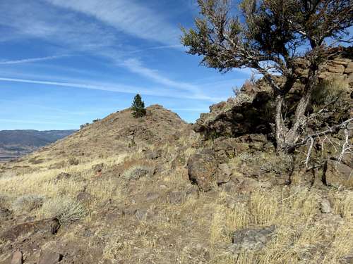
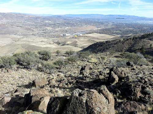
Heading towards the final summit
The Hunter Creek Trail is a popular hiking area in Reno, with a trail going straight through the canyon. The trail is accessed via the Michael D. Thompson Trailhead. The Hunter Creek Trail follows a canyon situated between two large ridges. From the trailhead, a road heads up the north ridge and leads to a trail that parallels the Hunter Creek Trail. The trail ends near the base of Point 6610, which I am referring to as the Hunter Creek North Ridge Summit.
With barely 115’ of prominence, the summit wouldn’t be much of interest if it weren’t for its placement. It is the terminus of the north ridge trail from the Michael D. Thompson Trailhead. It has an excellent view of the City of Reno and surrounding mountains. In cold weather months it is often just below snow-line, and is the highest summit on the ridge below the forest.
The Hunter Creek North Ridge Summit is best hiked in fall, when the weather is mild before the snow hits, and when the fall colors change. It is also a good hike in springtime.
Getting There
There are essentially two approaches to the summit: One from the east and one from the north. The east approach can be done using a rock climbing route up a gully from the Hunter Creek Trail, or from the trail up the north ridge. Both of these start at the Michael D. Thompson Trailhead. From the western loop of McCarren Blvd south off I-80, take the north entrance to Caughlin Parkway. Head west for about 1 mile to Plateau Road. Turn right on Plateau and follow it for about 3/4 of a mile to Woodchuck. Take a left on Woodchuck, passing the entrance to the Steamboat Ditch trail, and follow the road as it goes uphill. The trailhead is about 1 mile from the entrance to Woodchuck.From the north, head to the north end of Mayberry Park. From McCarran Blvd West in Reno, head west on Mayberry or 4th Street and you end up at the same place on 4th Street. Head west another 1/3rd of a mile, and take a left on Woodland Ave. Take a right on White Fir Street and take it for another 1/3rd of a mile. Before you cross the Truckee River, take a left and park. If coming from the west, take exit 8 off I-80 for 4th Street, and drive about a mile and a quarter to Woodland Ave.
Route
From the east, there are two primary options.Option 1 is to take the jeep road. This route requires that you avoid the Hunter Creek Trail, and instead follow the jeep road as it heads back up a hill behind you. Just before you get on the Hunter Creek Trail, the jeep road heads up the hill. Follow this road as it winds around the hill, and then heads back west below some telephone poles. The road curves around until it heads south, and eventually parallels the Hunter Creek Trail from above. Make sure to follow the road as it curves to the south. Although the road loses slight elevation early on, once it heads back up, make sure to follow it this way. The road eventually ends, and you follow a use trail up the ridge that fades in and out, but is generally easy to follow. After you reach the base of the ridge, you'll go straight up towards higher elevation, and continue up, using the trail where you can. The trail continues up towards Point 6247.
The trail continues past Point 6247 and drops down, and ascends back into a forest. Come out of the forest and you find yourself at the base of the summit.
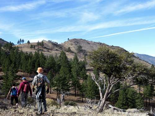
Group heading towards the Hunter Creek North Ridge Summit
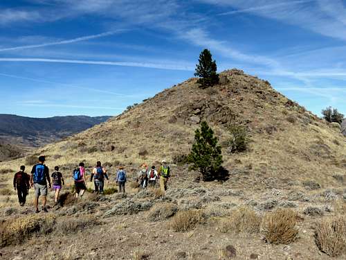
Group heading up the final summit
Total elevation gain via this route is 1,600’ and the round trip hiking distance is 6 miles.
Option 2 is to take the Hunter Creek Trail and climb up the gully towards Point 6247. This is a Class 2 route, and much more fun in part because it is a loop. Start by taking the Hunter Creek Trail. It heads up and down through a canyon on the right side of the Hunter Creek. After about 3/4 of a mile on the Hunter Creek Trail, you will see the large rock face about 600 feet above you. There is an obvious gully to the right. From here, the ascent is pretty straightforward. It is very steep, but manageable. It takes about 20 minutes and 650' to reach the top of the gully. From there, continue up to the ridge top towards Point 6247 and find the trail. Take the same route described above to the Hunter Creek North Ridge Summit. Descend via Option 1.

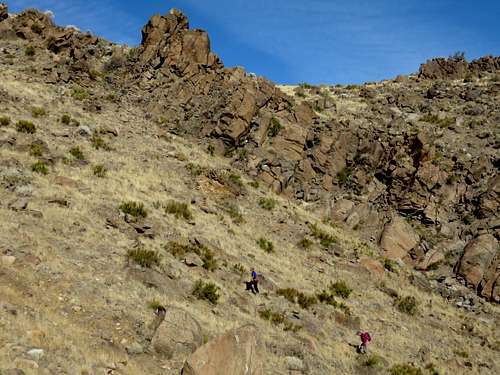
Heading up the gully
Group heading up the top of the gully route
Total elevation gain via this route is the same as Option 1, but the distance one way is 2 ½ miles and round trip is 5 ½ miles.
North Route
From the north, take a right and cross the Truckee River across a metal bridge. Take a right and head up a road/trail that switchbacks up the hillside, reaching the Steamboat Ditch Trail in about a half mile from the bridge. Once at the Steamboat Ditch, continue up a road for another half of a mile. Don’t be confused by any side roads. When this road ends, take a right on another dirt road and follow it for 1 ½ miles to the base of the Hunter Creek North Ridge Summit. There is a gully heading up the left side of the summit. Take the gully as it climbs 700’ in a half a mile. You are now at the base of the summit. A little more than 200’ in a quarter mile will reach the true summit.
View northeast and northern route
The elevation gain for this hike is about 2,000’ in a little over 3 ¼ miles one way.