
|
|
Area/Range |
|---|---|
|
|
39.15420°N / 119.8823°W |
|
|
Hiking, Scrambling |
|
|
Summer, Fall |
|
|
10881 ft / 3317 m |
|
|
Overview
The Carson Range is located along the border between California and Nevada. It runs to the east, southeast, and northeast of Lake Tahoe. It is about 50 miles north-south, but only about 5 to 10 miles east-west. Nearly ¾ of the range is in Nevada, with the rest in California – mostly the southern and northwestern part of the range. It is named after Kit Carson, the legendary American frontiersman.
The Carson Range is part of the larger Sierra Nevada Mountain Range, and represents the northern-most section of alpine territory in the Sierra Nevada. Further north, the Sierra’s continue to Fredonyer Pass near Susanville, California, but are much lower, rarely topping 8,000’.
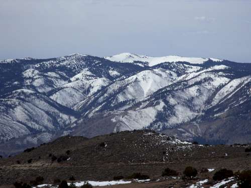 Snow Valley Peak 9214' from the Washoe Valley in late winter
The Carson Range rises high above the Truckee Meadows (Reno), the Washoe Valley and Carson Valley below. From the east, the Carson Range rises nearly 6,500' for Freel Peak and Mount Rose. Snow Valley Peak rises over 4,000' above Washoe Valley.
The range starts north of Hope Valley and Highway 89 in El Dorado County, California and terminates at the Truckee River in Washoe County, Nevada and Alpine County, California. The Carson Range tops out at 10,881’ at Mount Freel near the southern end. Further north, Mount Rose stands at a respectable 10,776’, but has the advantage of far greater accessibility than Freel Peak.
Unlike the Sierra Nevada Mountains to the west of Lake Tahoe, the Carson Range loses its snow much earlier, and gains it much later. In fact, it receives about half the snowfall as mountains west of the lake. This allows for a longer hiking and climbing season, typically starting in April and ending in early December for the foothills, with the high peaks mostly snow-free from June through mid-November.
The crest of the range is mostly above 8,000’, with some dips along the way with only two pass roads in between which are below 8,000’: US Highway 50 and Kingsbury Grade.
The southern 2/3rds of the range is accessible through the Tahoe Rim Trail. The Tahoe Rim Trail website has maps that can be downloaded, along with information about how to get to the major trailheads. This is a great way to tour much of the Carson Range.
Snow free hiking in the Carson Range can typically start in April in the northern end at the Michael D. Thompson Trailhead. Hiking at Spooner Summit, Kingsbury Grade, or Mount Rose Highway is typically late May/early June through late November. Mount Freel can be hiked typically starting in late June and through late October.
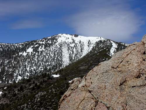
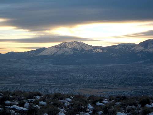 Winter view of the Carson Range. Slide Mountain 9698' in the center of the photo.
Primary mountains
The highest peak in the range is Freel Peak 10,881’, which is also the highpoint of El Dorado County, California. It is accessible from Luther Pass Road to the south.
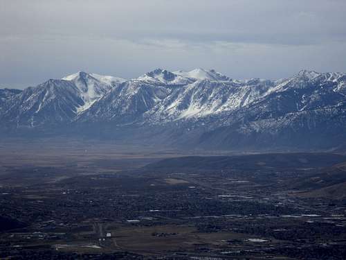 Freel Peak Massif seen from the east atop McClellan Peak. Rising roughly 6500' above the Carson Valley below.
Further north are Monument Peak just across the border in California and East Peak 9591’, the highest point in Douglas County, Nevada. These are accessible from the town of South Lake Tahoe, California.
Moving further north, is a long 23 mile extension of the Carson Range from Kingsbury Grade in the south to Tahoe Meadows in the north. This part of the range is entirely in Nevada and runs north-south rising to the east from Lake Tahoe below. Along this ridge are several distinct summits, most prominent of which are Genoa Peak 9150' and Snow Valley Peak 9214’. There are numerous rocky overlooks along the way that offer splendid views of Lake Tahoe, and east to the Pine Nut Mountains and the desert ranges in Nevada.
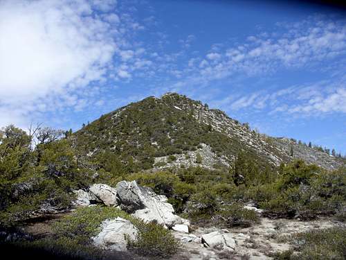
Snow Valley Peak is the first major summit north of the Spooner Summit trailhead off of US Highway 50. This summit can really be considered the center of the range, and is the point at which I have noted the latitude and longitude for this area/range.
Further north are several lower summits including Herlan Peak, Peak 8703, and Peak 9225 – Jessie’s Peak. Once at Jessie’s Peak, the range is northeast of Lake Tahoe. The Mount Rose Ski Area is just to the northeast of Jessie’s Peak, topping out at 9698’ at Slide Mountain.
 View north from Peak 8703 down the ridge towards Tahoe Meadows. The top of Diamond Peak ski run is visible.
On the north side of the Mount Rose Highway are the most accessible, and busiest part of the Carson Range – Mount Rose and its 10,000’+ neighbors.
This part of the range is considered the Mount Rose Wilderness and is discussed more extensively on that page. Major summits include Mount Rose 10,776', Church Peak 10,601', Mount Houghton 10,490', Relay Peak 10,335', and Snowflower Mountain 10,243'.
 Snowflower Mountain from the east
Primary trailheads and access roads
There are several trailheads and access roads close to the Cities of Reno and Carson City where you can access the primary wilderness trails for the Carson Range. Access points to the Carson Range vary from rugged dirt roads to major paved roads.
Luther Pass
Luther Pass offers access to the southern peaks, including Freel Peak and its neighbors, Jobs Sister 10,823' and Jobs Peak 10,633'. Forest Service Road 051, accessed before you get to Luther Pass, is a primary route to Freel Peak via Armstrong Pass. Luther Pass is about 36 miles southwest of downtown Carson City.
Mount Rose Summit
To climb some of the loftier peaks further north in the Mount Rose Wilderness (including Mount Rose, Church Peak, Mount Houghton, Relay Peak, and Tamarack Peak) the best trailhead is a well-developed parking area called the Mount Rose Summit, situated at 8911'. It can be accessed by taking the Mount Rose Highway (Rt 431), which winds through the wilderness with access to several ski areas. It should take no more than 35-40 minutes to reach this trailhead from downtown Reno.
Tahoe Meadows
Tahoe Meadows, about a mile south of the Mount Rose Summit trailhead, has at least three parking areas, and is an offshoot for the Tahoe Rim Trail and Ophir Creek Trail, as well as a way to bushwhack up to summits like Peak 9773, Rose Knob Peak 9710' and Rose Knob 9610'. Tahoe Meadows is a very popular snowshoeing destination, with the popular Chickadee Ridge rising to the south above the meadows, offering splendid views of Lake Tahoe, all year round.
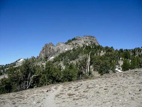 The rock spires at Peak 9773
The bottom of the Ophir Creek Trail can be reached from the Washoe Valley at Davis Creek Park, and climbs 8 miles one-way back to Tahoe Meadows.
Lower trailheads from the Mount Rose Highway
Galena Creek County Park is an entry way into the lower slopes of the Mount Rose Wilderness. The park sits at an elevation of about 6,200 feet, and is host to several trails including the very popular the Jones Creek/White Creek loop. The trail system was recently upgraded (in 2011). This is only about 15-20 minutes from downtown Reno.
About the same distance from downtown Reno is the Thomas Creek Trail, which takes hikers to a saddle up over 9,700' where Snowflower Mountain can be reached via a short 3/4 mile walk. The Thomas Creek Trail is reached by taking the Mount Rose Highway to Timberline Drive. The lower trail can be accessed from the trailhead up on Timberline Drive, with better access to the higher peaks reached by taking FS Road 049 for 2.5 miles up to 6950 feet. It heads into the Thomas Meadows, a gorgeous area tucked away in the Thomas Creek Canyon.
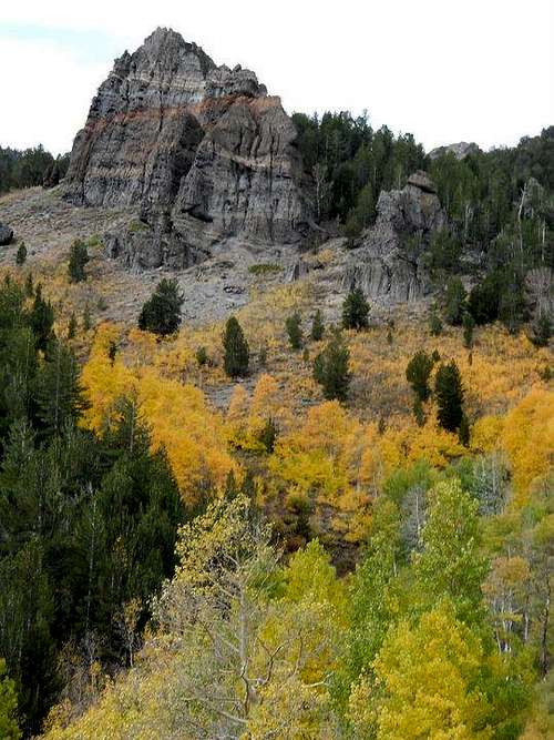 Painted Rock seen walking up Thomas Meadows in fall - Photo by Todd Horton
The White's Creek Trailhead is also reached from Timberline Drive, and is the best access point for Alpine Walk Peak and Dry Pond, and can be used for the Whites Creek-Jones Creek loop. Note that a hike up Alpine Walk Peak takes solid route-finding skills and some serious bushwhacking.
 Final 500' up to Alpine Walk Peak
Northeastern Carson Range
The northeastern extension of the Carson Range can be reached from Northwest Reno via the Mount Rose Substation area off of Caughlin Parkway from the Pinebluff Trail Road, or the Hunter Creek Trail off of Woodchuck, also reached off of Caughlin Parkway. These trailheads are about 10 minutes away from downtown Reno.
The Pine Bluff Trail is the entry way to Hunter Lake Road, which travels up to the small Hunter Lake on the wide plateau topping the ridge in the northern Carson Range. At a circle adjacent to a few houses, a dirt road starts at a little over 5,300' and climbs to the Mount Rose Substation. From here, the closest summit of note is Point 6312, a rounded summit which provides excellent views of the city below. Hunter Lake Road heads up to the plateau area in about 4 miles reaching a little over 7600' before leveling out considerably and views become more expansive. There are several points along the road with minor summits that offer excellent views.
 Heading towards Point 6312 from the east
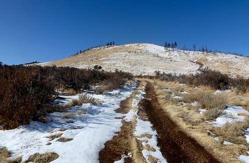
The Hunter Creek Trail is accessed from the recently constructed "Michael D. Thompson Trailhead Project". There are several opportunities for scrambling and boulder climbing off this trail in particular. The trail is still being built out, and should eventually connect to higher slopes. However, the existing trail was recently redone, replacing most of the rustic trail with a wider trail, that eventually heads into the woods and continues through the canyon past a waterfall about 3.5 miles up the trail.
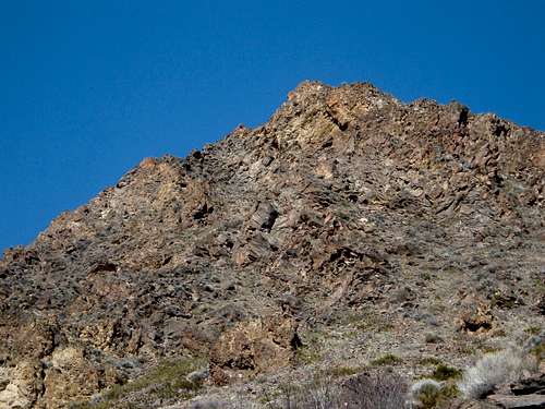 Rocky pyramid above the Hunter Creek Trail
 View on the way down the Hunter Creek Trail.
Carson City
Within Carson City there are a few options. Just to the north of Carson City is Hobart Road in Lakeview. That leads to the Hobart Reservior and peaks above it. There is also Ash Canyon and then Voltaire Canyon Road in southern Carson City. These access points are best to reach foothills and for workout hikes, and are not meant as access points for major summits in the Carson Range.
Spooner Summit
Spooner Summit 7150' off of US Highway 50 is a very popular access point for the Tahoe Rim Trail. From Spooner Summit, one can reach most of the major summits along the Tahoe Rim Trail east of Lake Tahoe within a day hike. Spooner Summit actually has trailheads on both sides of the highway. The north side is used for Snow Valley Peak and Marlette Lake (the closest major destinations to the north). A road up the North Canyon can cut the distance up to Snow Valley Peak if starting just down the road west of Spooner Summit at Spooner Lake.
If heading south from Spooner Summit, the trail climbs steeply up to the ridge where Duane Bliss Peak 8658' is the first significant summit that can be reached, followed by South Camp Peak 8866' and Genoa Peak 9150'.
 Duane Bliss Peak seen from the south along the Tahoe Rim Trail, south of Spooner Summit
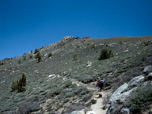 Upper slopes towards Snow Valley Peak, north of Spooner Summit along the TRT.
Kingsbury Grade Trailheads
Kingsbury Grade is a more out of the way access point to the Carson Range, but is a paved pass road between Minden, Nevada and South Lake Tahoe, California. There are two trailheads: Kingsbury North and Kingsbury South - both connectors to the Tahoe Rim Trail. To get to the Kingsbury Grade, take Route 88 heading south. Continue two miles south and turn right (west) on Mottsville Lane. In a little over three miles, the road continues up to Kingsbury Grade (Highway 207), which passes over the Carson Range at about 7350'.
From Kingsbury Grade to get to the Kingsbury North Trailhead 7,920', take a right onto North Benjamin Drive and follow as it turns into Andria Drive, which turns into Genoa Peak Road. All told it is about two miles up to the Tahoe Rim trailhead located to the west of the road. Or you can park near the trailhead and continue up Genoa Peak Road, which actually saves time and distance when hiking up the ridge towards Genoa Peak.
To get to the Kingsbury South Trailhead 7250', go just past the Kingsbury summit, and turn south onto Tramway Drive and follow signs for the Heavenly Stagecoach parking lot.
Brockway Summit
Brockway Summit 7,000' is an access point for the Tahoe Rim Trail and the northwest part of the range. There are no major summits easily reached from Brockway Summit, although the Martis Peak fire lookout is nearby. This heavily-forested part of the trail is a great place to hike in fall, to enjoy the colors and a different part of the range. One could argue that the Carson Range extends further across 267 all the way to the Truckee River along Highway 89. This is most certainly an offshoot/extension of the range, although it is typically considered North Tahoe.
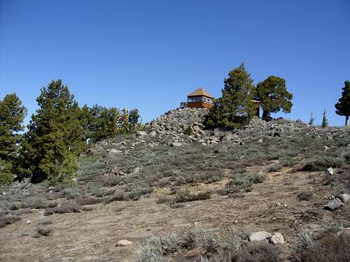 Martis Peak Fire Lookout
West side – East shore of Lake Tahoe
There are ways to access the range from the west side, including along Highway 28 and US Highway 50 as it heads south along the east shore of Lake Tahoe. However, these options are dependent on access, and there are no major trailheads from this side. The Diamond Peak ski area is an access point from the west, but is better reached from Highway 431 in Incline Village. For more details on access from the ski area, see the Peak 8703 page.
Indeed there is more to explore in the Carson Range should one want to venture out into difficult to access points off of I-80 or from Truckee. Any additions or suggestions on entry to the range from these locations is welcome.
Red Tape
For the most part, there aren’t any major access issues to get into the Carson Range, as long as you take the major trailheads or routes accessible from Luther Pass, Kingsbury Grade, Spooner Summit, Mount Rose Highway and its offshoots, or the northern end in Reno. All of these are either pass roads or accessible from the east side. The west side is more difficult, although there are approaches from Incline Village and Kings Beach. Approaching from in between these points is more difficult. Anywhere along the Washoe Valley is tough because of private land, and private landholders who are vehement about restricting access to hikers, particularly in Franktown on the west side of Washoe Valley. However, the existing entry points accessible to the public should be sufficient to explore pretty much all you want to in the Carson Range.
External Links
Tahoe Rim Trail maps and information
Carson Range - Wikipedia