Toggle navigation
Mountains
Routes
Images
Trip Reports
Forum
What's New
People
Areas & Ranges
Articles
Trailheads
Canyons
Huts & Campgrounds
Albums
Logistical Centers
Fact Sheets
Lists
Custom Objects
Gear
Plans & Partners
WELCOME TO SUMMITPOST
SIGN IN
REGISTER
Hidden Stream Canyon
Additional Parents
Image
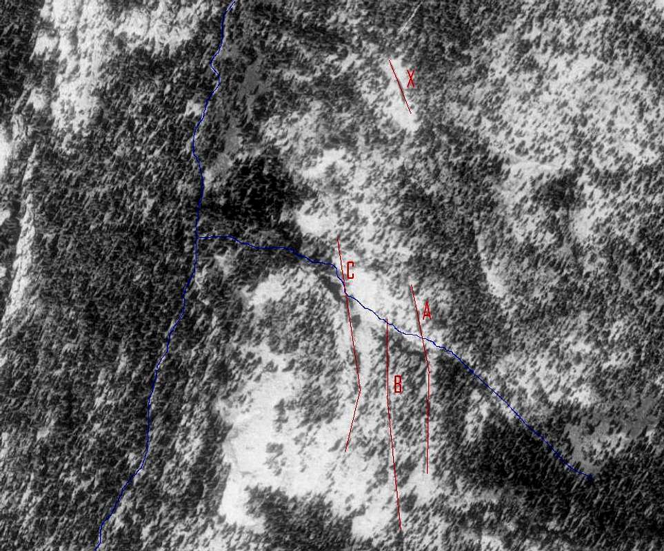
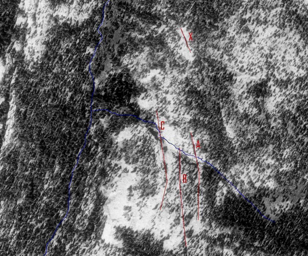
Annotated terraserver aerial
View High-Resolution Image
Annotated terraserver aerial
Creeks in blue (Mid Fork runs S to N on the left, Hidden Stream joins in from the SE), and the system of dry fissures in red.
« PREV
NEXT »
Dmitry Pruss
on
Jul 10, 2007 4:42 pm
Comments & voting
Other parents
Lat/Lon:
40.71468°N / 110.9953°W
Image Type(s):
Informational
Image ID:
310211
1983 Hits
72.08
% Score
2
Votes
Log in to vote
Comments
No comments posted yet.
to post!
Don't have an account?
Hidden Stream Canyon
(Canyon)
« PREV
Viewing
#7 of 14
GALLERY
NEXT »
Dmitry Pruss's Image Gallery
« PREV
Viewing
#1036 of 1384
GALLERY
NEXT »
×
You need to login in order to vote!
User Name
Password
Remember me
Forgot your password?
Log me out when I close my browser.
Keep me logged in all the time.
sign in as a user
Don't have an account?
Register now for FREE
Rating available
Suggested routes for you
People who climb the same things as you
Comments Available
Create Albums
Register Here


