
The Lower Marmot - Feb 14, 2005 8:32 pm - Voted 10/10
Wow!That deserves the Caption of the Week!

brenta - Feb 14, 2005 10:58 pm - Voted 10/10
Re: Wow!I second the motion. Also, B&W works very well for this type of pictures.
signorellil - Feb 15, 2005 1:59 am - Hasn't voted
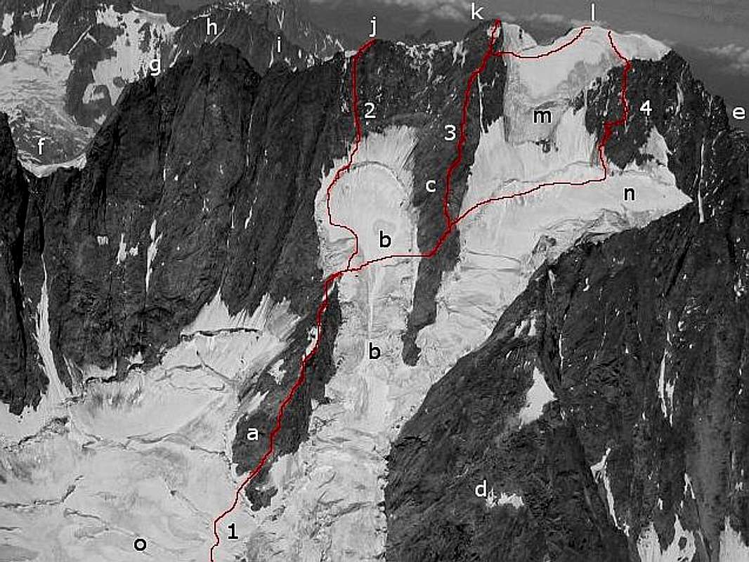
Re: Wow!Thank you! I'm going to continue posting those photograpic topos for a while, the goal being (in the end) covering every route opened on GJ with the best possible precision.
signorellil - Aug 31, 2005 11:19 am - Hasn't voted
Correction of the route to Pt. WalkerJust for the record - the normal route going up to the Pt. Walker from the upper plateau (marked "4" here) is not anymore the one shown in this picture. While going up through the small rock/snow barrier was the traditional choice, the changing nature of the seracs above suggest a slightly longer variation, now the route of choice.
The correct route now goes 100m towards the R border of the upper plateau (on the R of the "N" in this picture) on a small snow col between the upper slope and the point of connection of the Pra Sec ridge below. To go up, stay as much as possible on the E (right hand in this picture) trying to stay away from the seracs above. The line goes more or less straight through the number "4" of this picture.
I'm going to post a revised picture as soon as I can.


Comments
Post a Comment