
-
 12054 Hits
-
 81.84% Score
-
 14 Votes
|
|
Route |
|---|---|
|
|
33.29250°N / 116.4303°W |
|
|
Hiking, Scrambling |
|
|
Winter |
|
|
Most of a day |
|
|
trail and mostly x-country |
|
|
Overview
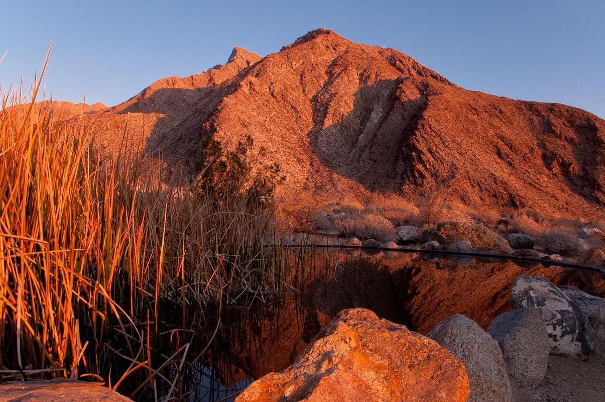
For many people visiting the Anza Borrego Desert State Park for the first time the Borrego Palm Canyon trail is one of the first destinations. And rightfully so, as it encompasses and easy approach to the trailhead on a paved road, a gentle hike up a desert wash leading into the canyon, and a palm oasis awaiting you in a mere 1.5 miles from the start. For the novice or the seasoned desert hiker alike an excursion up Borrego Palm Canyon leaves one with a memorable view to Indianhead Peak, the sharply pointed mountain dominating the canyon to the north.
|
There are several possible routes up to the lofty summit via its long east ridge, the southeast ridge, or the south ridge. All those ridge ascents involve a fair amount of scrambling and class 3 and sometimes class 4 climbing. However, a less technical, but still demanding route exists further up the Borrego Palm Canyon, which can be considered the “standard route” up to Indianhead Peak. It involves hiking and scrambling up Borrego Palm Canyon past the main Palm Oasis for about 3 miles, gaining access to a ridge from the canyon bottom, which leads to the west ridge of Indianhead Peak, and following that ridge to the summit. But make no mistakes, even on this “standard route” you will encounter sustained scrambling on class 2 and sometimes class 3 terrains. Most of this route is trail-less but route finding should be no issue. The scenery along this route is absolutely breathtaking: a canyon littered with house-sized boulders and sprinkled with majestic palm trees; a steep climb with ever expanding views into the twisted canyons and to the ridges and peaks of the Anza Borrego Desert; and a summit with commanding and first-row views of the Borrego Valley. You will encounter, sometimes painfully, a variety of typical desert vegetation, including fountain grass, brittle bush, cheese bush, creosote bush, chuperosa, catclaw, southern cattail, cholla, beavertail cactus, barrel cactus, and many, many more.
Indianhead Peak is listed on the Sierra Club’s Desert Peak Section. The route described here totals to about 8.5 miles out and back with approximately 3,500 feet of elevation gain. The going will be mostly slow due to the terrain, so plan accordingly and allow plenty of time.
Route Description
From the trailhead (820’) at the southwestern end of the Palm Canyon Campground (day-use area) a signed nature trail leads across the desert wash towards the mouth of Borrego Palm Canyon. The trail is sometimes easy to miss, but you basically aim straight towards the canyon. After about 0.5 miles you bend around a prominent spur and head in northerly direction into the canyon. The trail stays mainly on the eastern (right) side of the stream. After about one mile you cross the stream (1,100’) and approach shortly thereafter the first (main) palm oasis (~1.4 miles, 1,260’). After the oasis there is essentially no further trail leading up-canyon. In spots you will make out signs of a trail, which will vanish very shortly. The travel here in this part of the canyon involves some climbing over boulders, jumping down boulders, balancing on tree logs, and crossing the stream multiple times. If you think you cannot continue on your side of the canyon, look for a spot to cross the stream and try on the other side. Although it sounds fairly difficult, is really isn’t and actually is a lot of fun. Eventually, you will approach a small grove of palm trees at an elevation of about 1,825’ and ~3 miles from the start (33.289, -116.4435).
| Small grove of palm trees | Start of the climb |
|---|---|
 |
 |
At this grove a small tributary canyon joins the Borrego Palm Canyon from the north. A seasonal steam is shown on the maps. To the east of this tributary canyon is a ridge, which leads northeast and joins the main northwest to southeast leading ridge of Indianhead Peak. From the palm tree grove it gets strenuous with about 2,100 feet of elevation gain in a little over one mile. We gained access to this ridge by scrambling directly over the cliffy section at the palm tree grove. It looks more difficult than it is but nowhere exceeds class 2. The terrain is quite loose here and requires some careful footing. Once on the ridge, the route is obvious. Luckily, the ridge is not infested with cacti that make your life miserable and that are so abundant on many other desert climbs. That does not mean that you don’t have to be careful with the occasional teddy bear cholla, beavertail, barrel cacti, yuccas, and other prickly vegetation, which are of course present here. If you stay directly on the ridge there are some fun rocky bumps that can be climbed directly. Again, the climbing here does not exceed class 2. You can of course side-hill them preferably to the east as the western side looks much steeper. If looking ahead you notice a prominent peak (P3560) with a saddle to the right. You will actually join the main ridge above the saddle to the right (east). After 0.8 miles of climb (3.8 miles from the trailhead) and at an elevation of about 3,305’ you join the main ridge that leads from Indianhead Peak in northwesterly direction towards Palm Mesa. From here you have fantastic views north over Henderson Canyon all the way to the Santa Rosa Mountains. Even San Jacinto Mountain is visible to the northwest.
| Ridge climb | Ridge climb |
|---|---|
 |
 |
Once you regained some energy you turn right (southeast) and follow the ridge. Here you will encounter some huge boulders and some spots that require a few class 3 moves. You can also traverse this part to the south and climb one of the steep and loose gullies back to the ridge. After about 600 more feet of elevation gain in ~0.5 miles you reach the final, almost level summit area. A short walk now leads to the true summit of Indianhead Peak. In this area there are many signs of recent fire. I assume that those were lightning-caused, given the prominence of the area. Once on the summit, you will feel a great sense of accomplishment and will be in awe from the magnificent views. To the east the Borrego Valley with the Coyote Mountains and the higher Santa Rosa Mountains behind. In the far distance you can even see parts of the Salton Sea. To the south the broad massif of San Ysidro Mountain and the deep-cut Borrego Palm Canyon with its south, middle, and north forks. To the west a maze of ridges and canyon leading to mostly unnamed peaks. To the north Henderson Canyon and the Santa Rosa Mountains all the way to the San Jacinto Mountains. Enjoy, relax, and re-energize as you will need it on your steep descent rather sooner than later.
| Indianhead Peak | View west from summit |
|---|---|
 |
 |
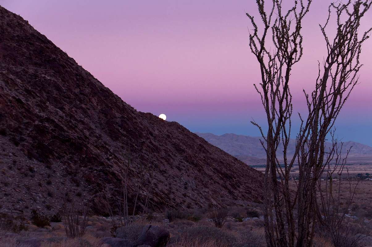
Retrace your steps. Be aware that you won’t be too much faster going down than up because of the steepness of the terrain. Once in the canyon bottom at the palm oasis, you have a beautiful shaded hike down-canyon back to the cars. If your timing is perfect, you might be greeted by a beautiful moon rising above the Santa Rosa Mountains.
|
Getting There
From Palm Springs
Take Highway 111 South to Highway 86 South past the Salton City area to Country Road S22. Take S22 West (Borrego Salton Seaway) for 28 miles to Borrego Springs.
From Brawley
Take Highway 86 to Highway 78 West. Proceed on Highway 78 through Ocotillo Wells to San Diego County Road S3 (Borrego Springs Road). Continue on S3 all the way into Borrego Springs.
From San Diego
Take Interstate 8 East to Highway 67 North. Proceed on Highway 67 North through Ramona (Highway 67 becomes Highway 78 East). Take Highway 78 East to Highway 79 North at Santa Ysabel. Take Highway 79 North to San Diego County Road S2 (San Felipe Road). Proceed on County Road S2 to San Diego County Road S22 (Montezuma Valley Road). Take S22 through Ranchita to Palm Canyon Drive and Borrego Springs.
From Temecula
From Interstate 15 take Highway 79 East through Warner Springs. Take San Diego County Road S2 to S22 (Montezuma Valley Road). Take S22 through Ranchita to Palm Canyon Drive and Borrego Springs.
The trail begins at Borrego Palm Canyon Campground, located one mile north of the park headquarters outside Borrego Springs. Trailhead parking is available at the west end of the campground near the campfire circle. There is an entrance fee for day-use ($7).
Informational Section
| Everytrail | Google Earth |
Indianhead PeakEveryTrail - Find the best Hiking in California |
 |