
|
|
Route |
|---|---|
|
|
49.18883°N / 20.18500°E |
|
|
Hiking, Scrambling |
|
|
A long day |
|
|
Class 3 |
|
|
Intro
Starý Smokovec – Priečne sedlo
|
The resort of Starý Smokovec at approx. 1,000m is a convenient access point to trails towards a number of High Tatra peaks including Široká veža. The waymarked trail from Starý Smokovec to Priečne sedlo via the Malá studená dolina, one of the most scenic Tatra valleys, is the shortest route to the pass from the outskirts of the Tatras. 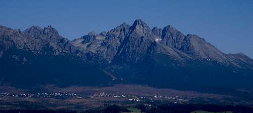
The first section of the trail (green marks) is a fifty-minute walk up, along the tracks of a funicular railway, to the top of the ridge which extends east from Slavkovský štít. The place where the trail reaches the crest is called Hrebienok (1285m) and has the upper station of the funicular, paid parking, a hotel and restaurant. 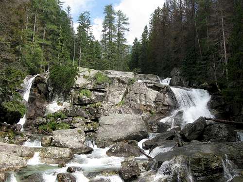
From Hrebienok you can continue via green marks down to Studený potok with its waterfalls, but this would add a quarter of an hour and some fifty metres of elevation gain to your hike. The quicker and more comfortable option is to switch to the dirt road (red marks) that runs northwards more or less along the contour line. It is wheelchair accessible and offers fabulous views of Lomnický štít at 2633m and Lomnický hrebeň towering over the Malá Studená dolina. 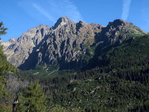
Farther up this section of the trail (closed from time to time due to rockfalls), on the left shows up the Veľká Studená dolina, over which towers another important Tatra figure – Prostredný hrot (2441m) topping out Prostredný hrebeň. 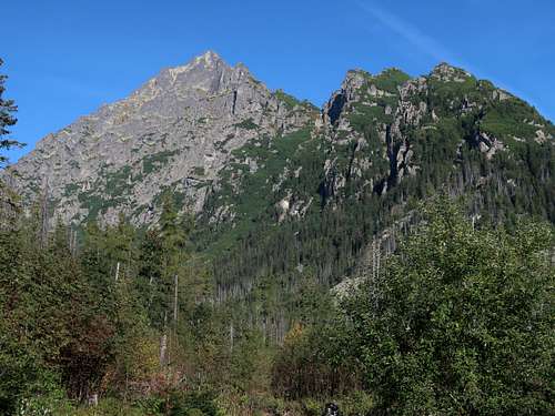
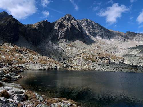
Soon our red trail crosses a blue trail which runs up the Veľká Studená dolina and could also be used to get to Priečne sedlo. However, a more sensible option, especially considering the last several dozen metres of ascent, seems to be sticking to the red marks and crossing Veľký Studený potok. Just before the bridge on the brook the red trail joins the green trail we parted with at Hrebienok. Half a kilometre past the bridge on Veľký Studený potok you stand on a bridge over Malý Studený potok, where you can admire its falls named Obrovský vodopád (Giant Falls). 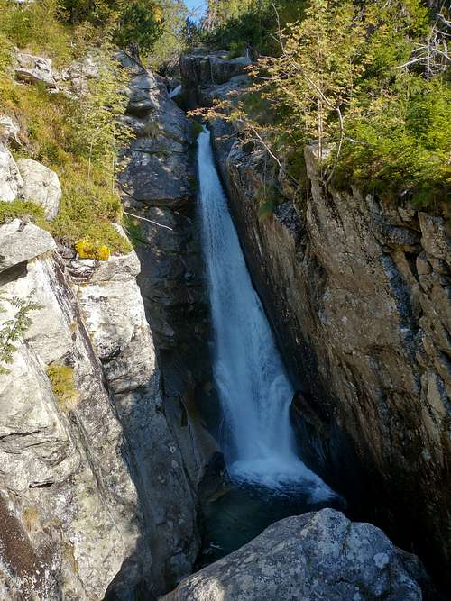
A view of the Veľká Studená dolina unfolds. We will be coming back down that valley. 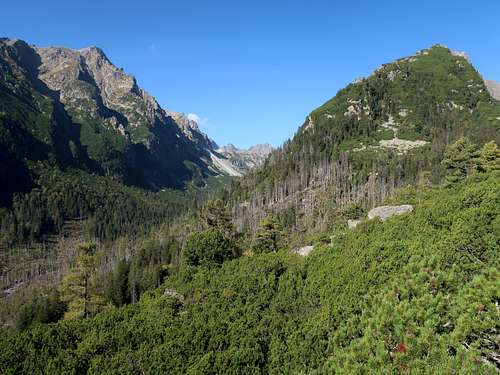
Just after parting with the red marks, which head for Skalnaté pleso, you get to Zamkovského chata. 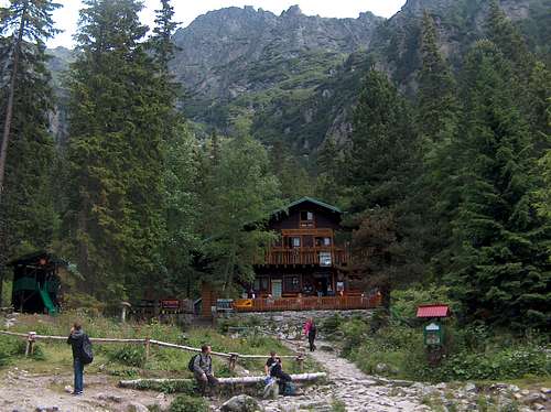
A few hundred metres past the hut our trail reaches timberline and mugo pine takes over, enabling you to soak in the fabulous scenery without limit. On the right are the jagged slopes of Lomnický hrebeň. 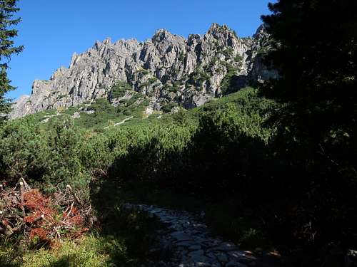
On the left the ESE face of Prostredný hrot holds your attention. 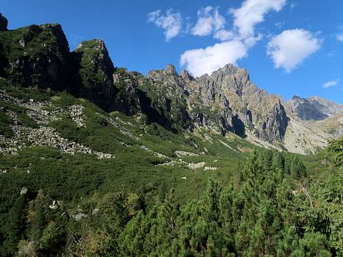
Arolla pines (also known as stone pines) add more beauty to the landscape. 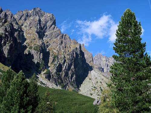
Ahead, beyond a flat area which once must have been a glacial lake, rises Jazerná stena - a huge, roughly two hundred metres high, step in the postglacial valley. 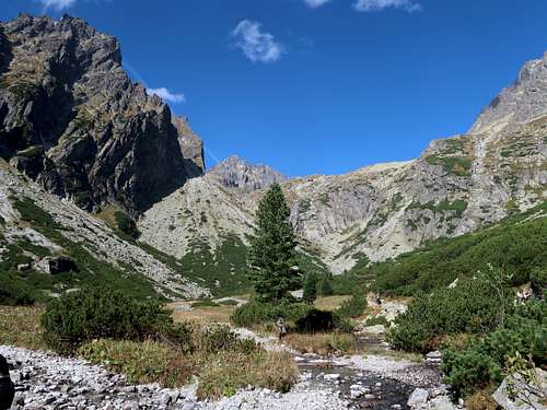
Down this step cascades Malý Studený potok watched by the bold tower of Žltá stena. 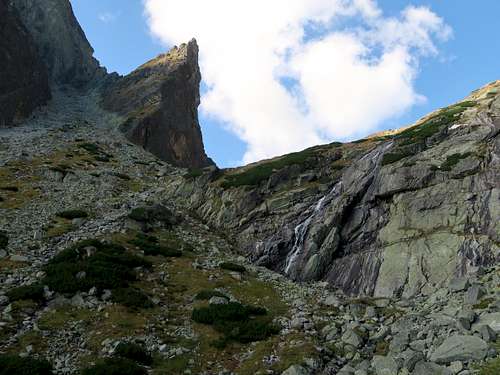
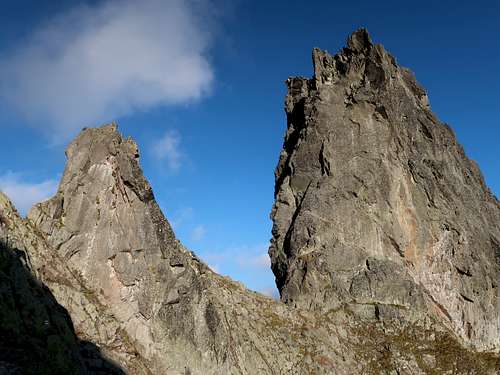
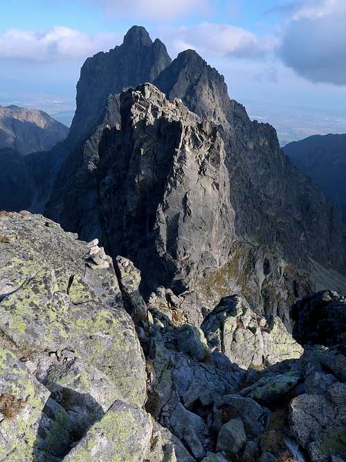
When you have climbed Jazerná stena, Široká veža and Priečne sedlo come into view. 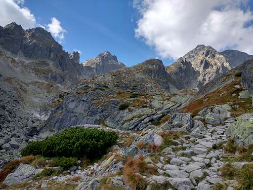
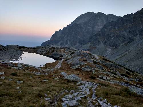
You are entering the uppermost part of the Malá Studená dolina known as Kotlina Piatich Spišských plies, which means the Valley of Five Spiš’s Tarns. In a couple of minutes you will see Téryho chata. The walk up from Starý Smokovec to the hut takes roughly 3.5 hours. 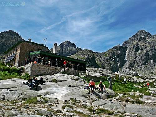
The surroundings are impressive. Three out of the four highest Tatra peaks can be seen (Lomnický štít at 2633m, Pyšný štít at 2622m and Ľadový štít at 2628m). 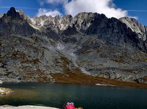
The trail between Téryho and Zbojnícka huts, which crosses Priečne sedlo, is marked in yellow. The yellow and green marks run together for about half an hour, then at the foot of the northeast wall of Široká veža the green trail turns right and heads for Sedielko pass separating Široká veža from the massif of Ľadový štít, whereas the yellow trail turns left towards Priečne sedlo separating Široká veža from Priečna veža. 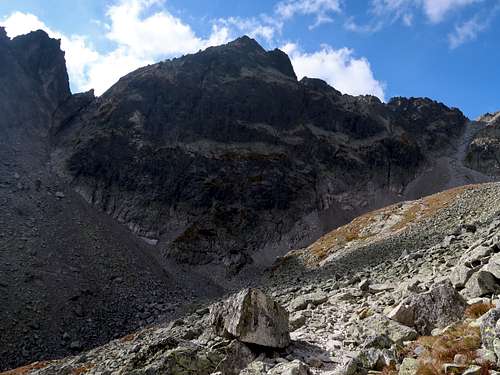
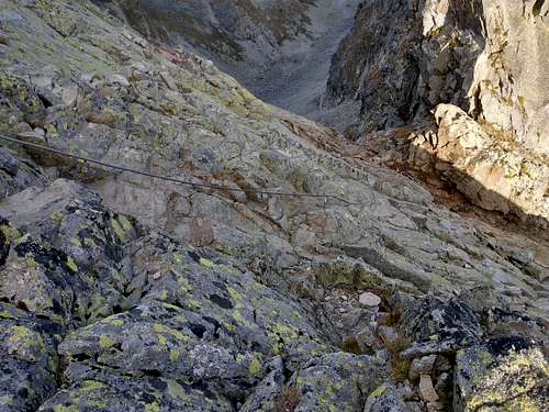
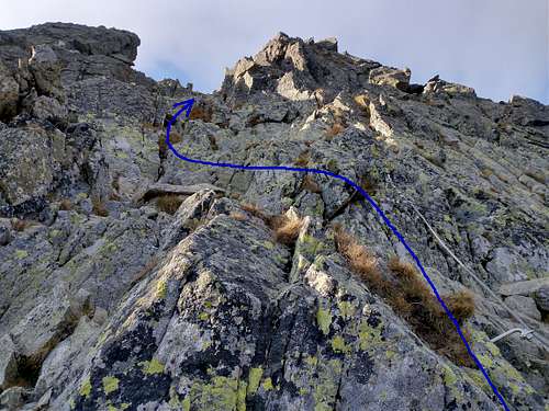
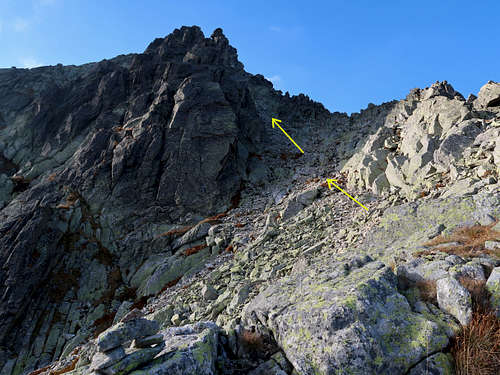
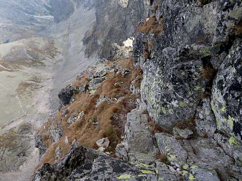
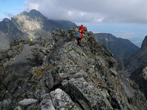
Our (yellow) trail used to be one-way but now (year 2023) you can hike, then scramble, in either direction. The path zigzags up the talus slope towards the base of the couloir falling from Priečne sedlo, then before reaching the couloir starts to climb the wall of Široká veža. Here begins – assisted by the old-style steel chains – what is said to be the most difficult stretch of a waymarked trail in the Slovak Tatras. (If you do not touch the metal aids, the rock difficulty is YDS class 4.) The lower end of the chains is also the start of the first Tatra via ferrata, which was installed here in 2021. The via ferrata is rather easy (rated A-B) and one-way: in the direction we are going (from Téryho Hut to Zbojnícka Hut). Without many hikers around, this last part of the ascent of Priečne sedlo takes fifteen to twenty minutes. (But bear in mind that in high season and at weekends it generates massive queues of hikers.) 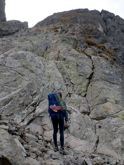
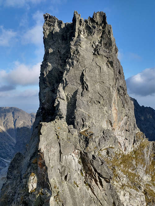
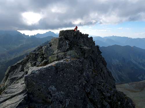
Priečne sedlo is composed of two cols divided by the pinnacle of Priečna vežička (2318m). The trail runs through the upper col at 2309m. The lower col is four metres lower. Interestingly, many maps give the pass the wrong elevation of 2353m, which is in fact the elevation of Priečna veža. 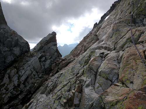
|
Priečne sedlo – Široká veža
Priečne sedlo – Starý Smokovec
|
The trail to Priečne sedlo from the Veľká Studená dolina is less demanding than that from the Malá Studená dolina. The rock slope is less steep and the chains are shorter. The stretch across the talus is awfully degraded by heavy traffic. That is why, for a more comfortable descent, I would recommend using the via ferrata, which skirts most of the talus (and is also less demanding on this side of the pass). 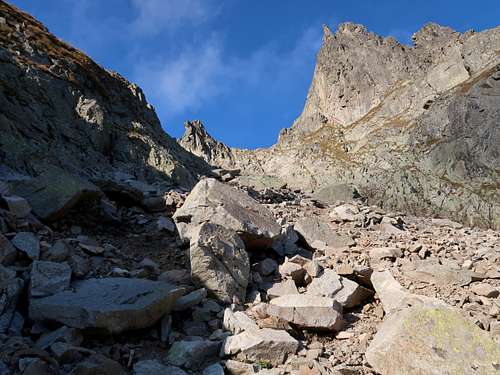
Anyway, a quarter of an hour after leaving Priečne sedlo you will be on solid and gentle ground at the south foot of Široká veža. This is the northeast end of a large postglacial amphitheatre at the head of the Veľká Studená dolina. You will be walking southwest, slowly losing elevation, across what is known as Strelecké polia, which means ‘Hunting Grounds’. The name reminds us of the days when the local highlanders shoot chamois here. 
There are good views of Široká veža and Ostrý štít to your right, 
and of the ridge linking Široká veža and Prostredný hrot to your left. 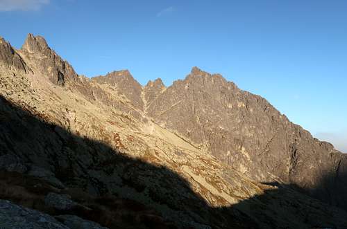
Over half an hour after leaving Priečne sedlo you get to Prostredné Sivé pleso, which lies at an elevation of about 2010m. Ahead stands the wall of the ridge the Veľká Studená dolina is bounded by on the south. The outstanding tower on the right is Bradavica at 2489m. 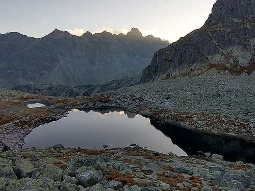
Past Prostredné Sivé pleso the trail skirts the southeast spur of Javorový štít and – trying to keep to the contour line – heads WNW towards the source of Veľký Studený potok for over half a kilometre, crosses the stream and turns south to Zbojnícka chata, which sits one kilometre away. Javorový štít (2418m), now behind you, looks majestic from this last section of the yellow trail. 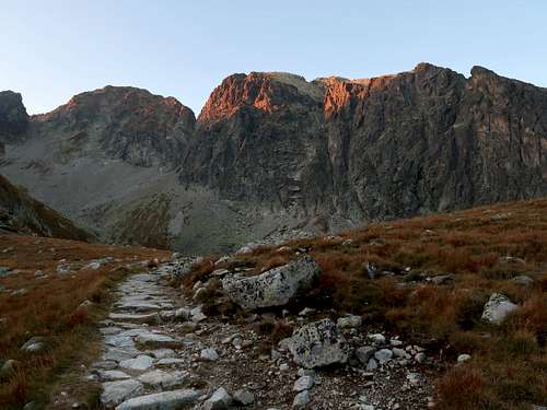
From the vicinity of Zbojnícka chata you get panoramic views of the whole amphitheatre carved by the glaciers of the Ice Age at the head of the Veľká Studená dolina. 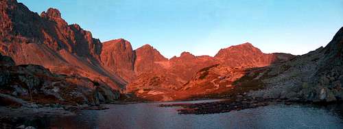
Much of the trail from Priečne sedlo you have come along is visible. 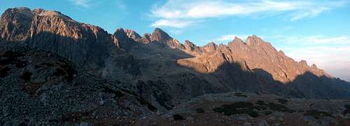
To go down the Veľká Studená dolina, you switch from yellow to blue. It is nearly 5km from Zbojnícka chata to the trail intersection at the mouth of the valley of Malý Studený potok, where you were several hours ago. Just after the hut the trail passes one more tarn. There is little left of it as it has been reduced to a narrow stripe of water by debris from the adjacent slope, hence its name Dlhé pleso (Long Tarn). 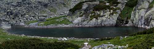
Where the trail gets close to the brook flowing out of the tarn, a chain secures the passage – sensible when the rocky path is icy or wet. The path goes past the last, tiny tarn on your right, then drops down to the floor of the valley of Veľký Studený potok. When you get to the intersection of the blue and the red marks, there will be less or a little more than 4km left (depending on which option you chose to get to Hrebienok; they are described at the beginning of the first chapter) to Starý Smokovec. 
|
Red Tape
The off-trail section of the route (Priečne sedlo – Široká veža) can be legally done only in descent or with a licensed guide. More info about the red tape is to be found on the parent page.
Essential Gear
Hiking boots or approach shoes. Consider taking a helmet and a via ferrata set. In winter conditions: crampons and ice-axe.
Other Information
For other information please see the parent page.
Reference: J. Nyka. Tatry Słowackie, przewodnik, Latchorzew 1997.
Cumbrowski - Jul 29, 2007 7:07 pm - Voted 10/10
Be Aware! Not for Beginners!The Prieène Sedlo is located in the mountain range that separates the valleys Mala Studená Dolina (eastern side) and Vel’ká Studená Dolina (on the western side). The trail leading up to the saddle on the Mala Studená Dolina side is very steep, because it is attached to a high angle slope. Using the provided chains that are attached to the stone is highly recommened. Passing hikers from the other side is not always easy and can become very complicated in situations when an unexperienced hiker "freezes" in fear, unable to further climb up nor down and letting go of the chains. The trail is not recommended to beginners or people who are afraid of heights. It is suggested to approach the saddle from the Mala Studená Valley side to climb up the steep slope, rather than down.