


Viewing: 1-1 of 1

MikeLJ - Oct 3, 2020 8:34 am - Voted 10/10
Great TRHi Neufy, Great trip report and I love the pictures. Looked like a beautiful day.
Mike
Viewing: 1-1 of 1
|
|
Trip Report |
|---|---|
|
|
31.17236°N / 7.83095°W |
|
|
Download GPX » View Route on Map |
|
|
Feb 7, 2020 |
|
|
Mountaineering, Trad Climbing, Scrambling |
|
|
Winter |
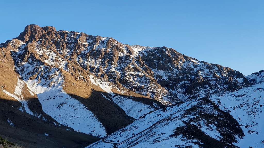
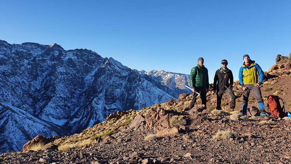
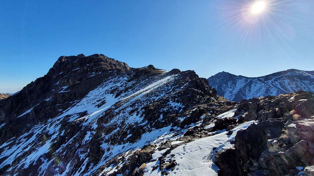
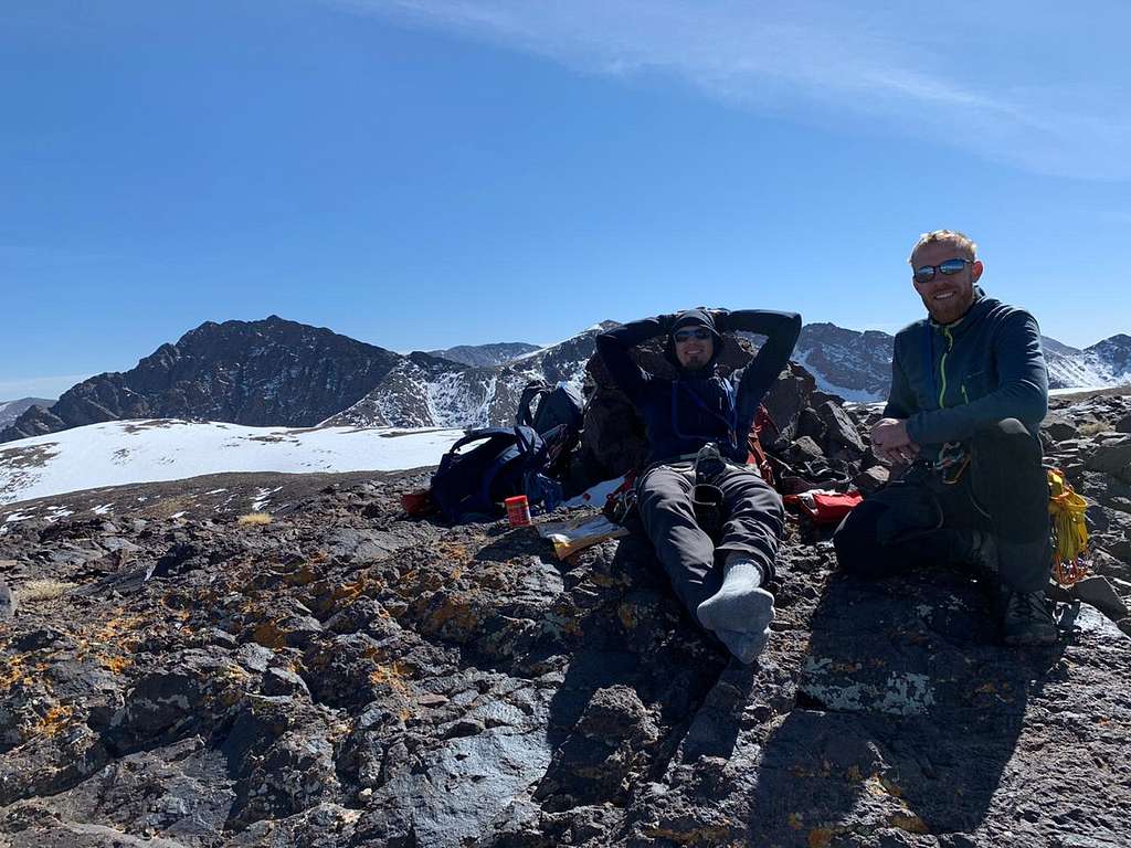
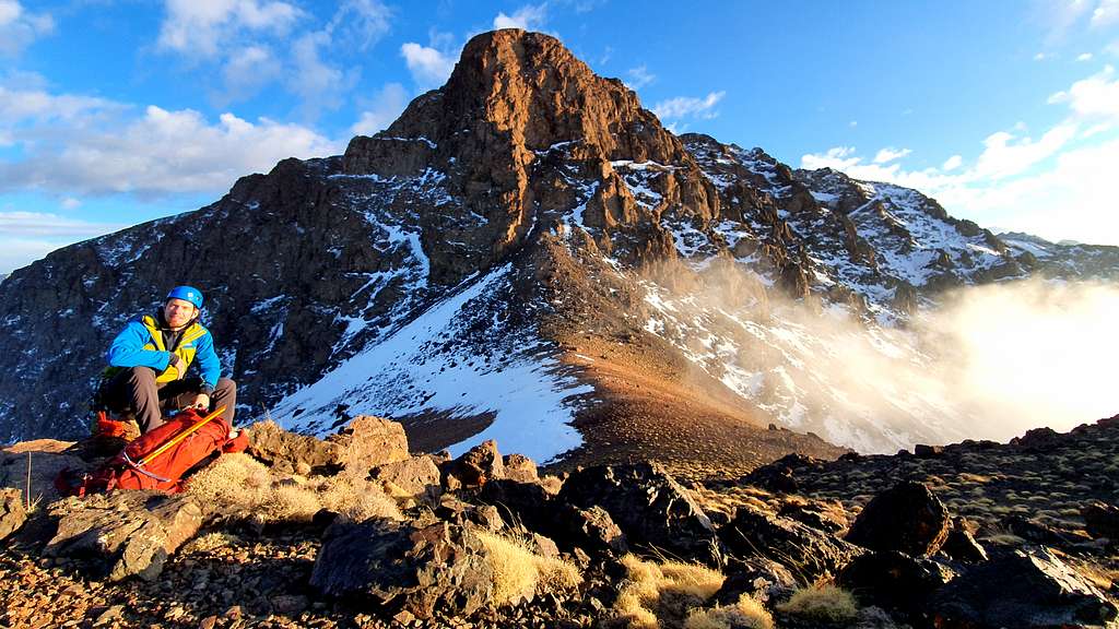
Oukaimden, 7th of Feb 2020: It was warm for winter. It had not snowed for 20 days and the temps in the village of Oukaimden (alt. 2,600m) had barely dipped below 0 C most nights. But, the north facing slopes of Angour looked like they still had some snow on them. Paul, Jeremy and I had arrived in Oukaimden at about 4 pm. We could see part of the Angour ridge from the CAF but there were some smaller peaks that blocked much of the view so we chose to take a quick hike to get a better vantage point where we would familiarize ourselves with the next days objective. Paul had hiked up to col below the north face on a previous visit and so he was our most valuable source of information. Our intent was to ascend the West Ridge (PD+) and descending the North Ledges (PD). From our better vantage point at about 2,800 meters we decided that crampons and a mountaineering ice axe would be worth bringing for the couloir/slopes that we would ascend to gain the West Ridge. On the East we could just make out the thin line of snow that we presumed to be the north ledge system that we would use for our descent. I was excited that we were making a loop rather than retracing our steps for the descent. We spent the night at the CAF (Club Alpine Française) so that we could get both a good night of rest and an early start the next day.
Paul had called ahead to reserve bunks for us which was probably a wise thing to do on a winter weekend. We were fortunate to get a whole room (6 bunks) to ourselves despite the school group as well as some others staying there. There were some classic 1:50,000 maps and a library of Spanish and French guide-books. We only used the 1:50K map that night. The topo was really only helpful for an overview of the main ridges, tizi’s (Tamazight for col/pass) and coulouirs. We were also using Cicerone’s guide “Mountaineering in the Moroccan High Atlas” which was a useful description if short. I appreciated the brevity as it left an element of adventure to the navigation on the climb. Perhaps you should stop reading this trip report if you want more adventure!
The food at the CAF was European with a flair of Moroccan spicing – squash soup followed by pasta topped with kefta-tagine-meets-bolognese-sauce with a classic Moroccan dessert – fruit. The school group from Casablanca was lively (ok, the dining hall was deafening!). Once in our room it was quiet, and we were able to pack our bags for the morning. The guidebook called for crampons, ice axe, a rope and some slings. We selected a 60 meter 9.8mm single rated rope, 8 alpine draws and 3 triple length slings. We also opted to add some nuts and 5 cams (#.5 - #2). Paul had calculated 9 hours round trip and we added 2 hours for contingency. Based on those numbers we each packed 2 liters of water (we would each chug an additional .5 liters at the car before starting out).
I was still experimenting with fueling on climbs. I haden't tended to feel very hungry with altitude and exertion but also noticed that my energy dropped later on in the day on climbs. I wanted to do a better job fueling on this climb. Jeremy and I were sharing food so the list below was half of the food that we packed:
2 small cliff bars 65 gram pack fruit mix 2 la vache qui rit triangles 1 apple ½ jar peanut butter 3 tortillas 6 Slices of Cheese 10 slices of smoked turkey 100 grams milk chocolate 8 Oatmeal-honey balls 250 ml Coke (hydration and sugar!)
I actually only ate: 2 small cliff bars 1 Apple and some peanut butter 1 tortilla with 3 slices of cheese and 8 slices of turkey 15 grams of chocolate 3 oatmeal-honey balls and drank the coke. If we had been benighted it would have been nice to have some of the extra food but I do think I will cut back on the carbs and pack peanut butter in a smaller container rather than taking the whole jar on future day-long objectives.
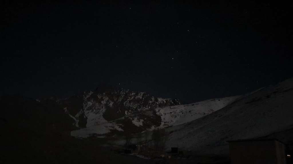
With the sun rising at 7:30 we opted to leave the CAF around 6:15. We drove as far as the ski lifts where the pist (unpaved road) was blocked off – this shaved off 1.5 km from the CAF. We could just make out the silhouette of the mountain contrast against the starry sky looming over us. The snow-filled couloirs and the sunbaked sandstone streaked like white and black piano keys under the setting moon. It was invigorating to see the ridge even as we hiked in the dark.
The pist that we followed lead all the way to Tizi-n-Eddi at 2928 meters. This was clearly improvement on the trail that used to be there according to the marking on the 1970 Oukaimden-Toubkal 1:50K. These Tizi's have been crossed by Amazigh shepherds and traders for generations. We followed this piste for 3 km (using two key trail short cuts from the road that were marked with painted cairns – these were fairly easy to see even in the dark). We hiked at a brisk pace, sharing with each other thoughts that we had been reflecting on over the past months. I had been intrigued by the analogical power of climbing anchors and how they related to trust and faith. Speaking of two different promises that God gave Abraham, Hebrews 6:19 says, “We have this [the two promises] as a sure and steadfast anchor of the soul, a hope that enters into the inner place behind the curtain, where Jesus has gone before us.” Though I am sure that there were no rock climbing anchors 2000 years ago and ships had very little to do with the vertical environment that we found ourselves in, the imagery was powerful and the underlying promises fulfilled in Jesus that both pointed toward was cathartic. It was good to be out here with two brothers in faith, enjoying God’s creation and digging deep—physically and spiritually. In life, profound moments meet the mundane at the most unexpected places. The energetic pace accompanied by great conversation made the kilometers roll by but also activated my colon. Abruptly I called for a nature break. Concealed by darkness I relieved myself, grateful to feel my body lighten before I had put a harness on and I could feel the nervous energy of our early morning start fade slightly though our objective was still shrouded in darkness.
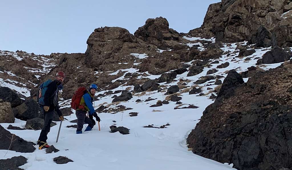
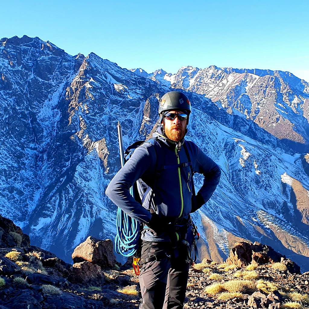
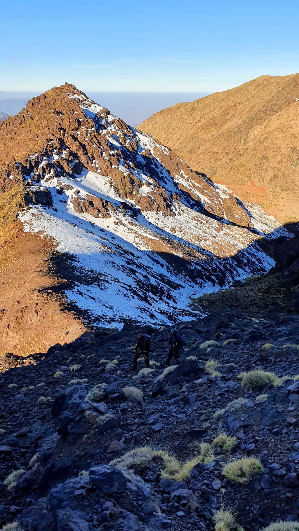
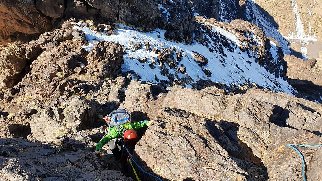
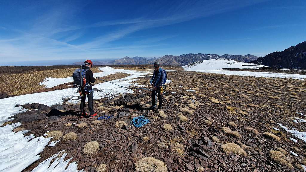
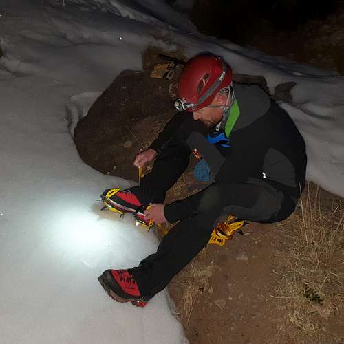
There were no clear markings that we could make out to indicate where we should drop down into the narrowing river valley to climb the north-facing slope that subsequently would allow us to reach Tizi-n-Gruden where the west ridge proper starts. Tizi-n-Gruden was the next tizi to the east of Tizi-n-Eddi that allowed easy access to the west ridge. These mountain adventures are such an intriguing mix of grand courage, somber evaluations, and giddy play. Unsure where to leave the pist to drop across the valley, we made a calculated guess. Slipping and sliding down scree between dome shaped shrubs with surprisingly sharp twigs poking at us, we made it to the valley floor where the dry south-facing slopes met the snowy north-facing slopes. We paused to strap on crampons and gaiters. The mood of careful navigation decisions gives way to playful excitement – mountaineering hardware! I was excited to use my new BD Raven Pro ice axe which was gifted to me by my brother… 3 years ago. I would finally get to use it.
|
|
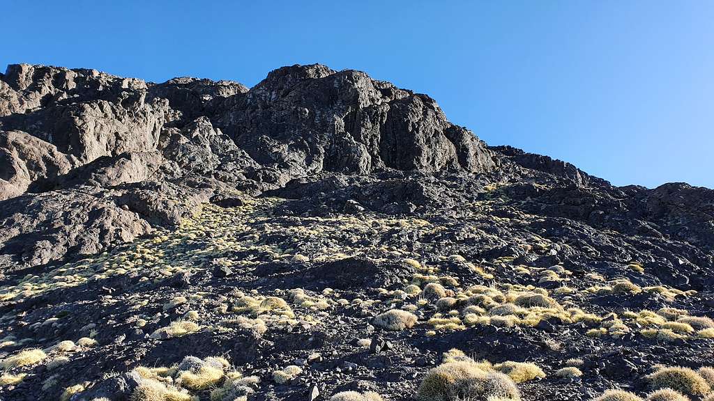
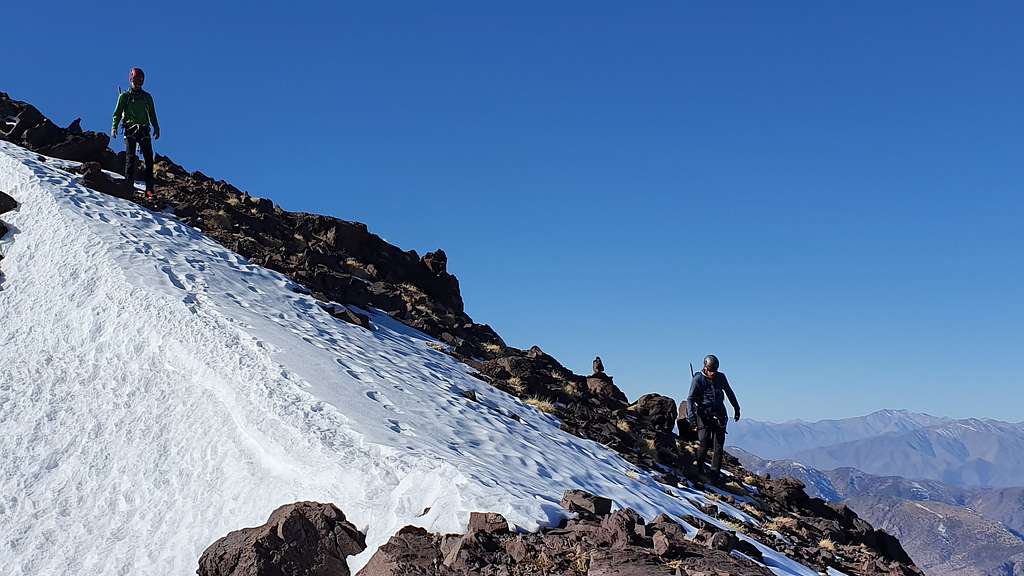
There was a 5 cm thick crust on the snow with powder underneath. Having extremely limited experience in snow conditions, I was unsure how these different snow layers formed or what they might do. There were definitely sections where the thought of avalanche crossed my mind and I had no clue how much or how little snow it would take to trigger a slide. I should really educate myself more on this in the future I thought, and we continued to push forward. We alternated between post-holing up to our knees and benefitting from our crampons where the crust held. As we started climbing the Tizi was hidden by some significant spurs. We were unsure but navigating by our best judgements. We climbed south and up for about 150 meters up one gully before traversing south-east across the slope toward steadily rising toward Tizi-n-Gruden.
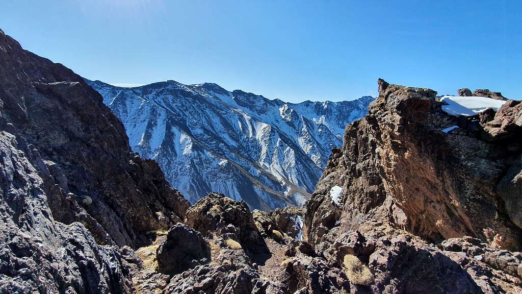
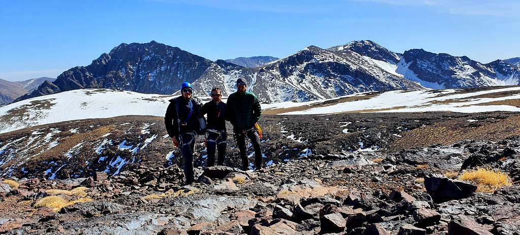
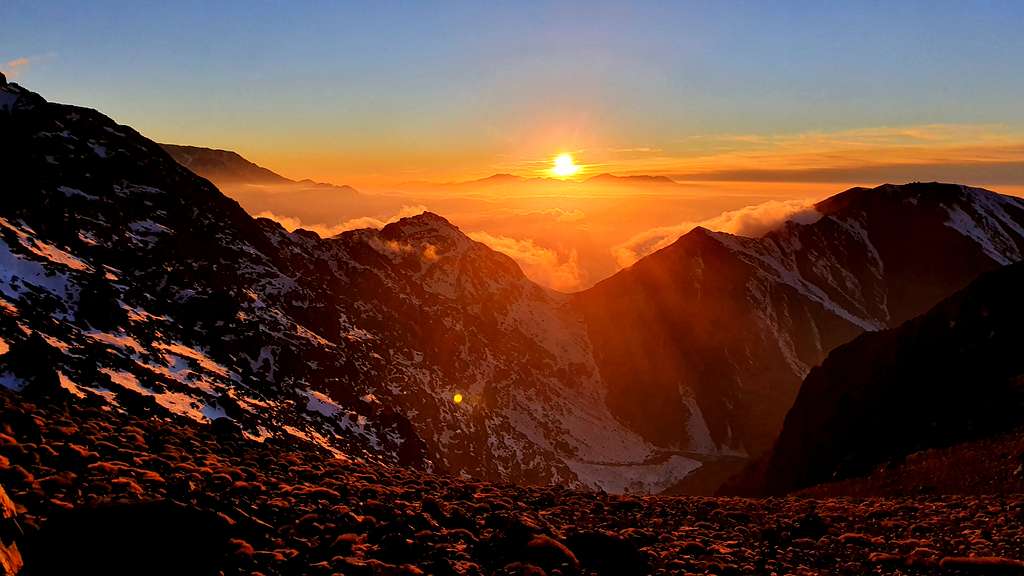
We stepped off the snow of the northern facing slopes onto the exposed rock of the tizi and with that, out of the shadow of the ridge and into the warmth of the sun which had already risen. Looking south, we could see Jebel Toubkal in the cluster of six of the seven 4,000 meter peaks of the High Atlas mountains. At 4167 meters, Toubkal is the tallest peak in North Africa.
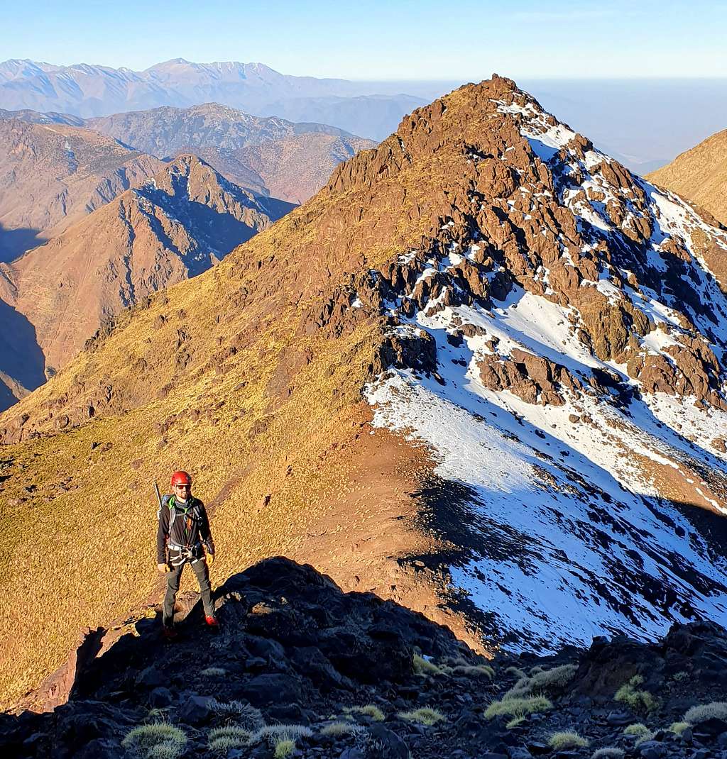
After some pictures on the tizi we turned East up some easy 3rd class scrambling. There were some cairns on this section of the route but they disappeared once we cleared this 3rd class section.
013_looking_down_at_tizi_n_gruden
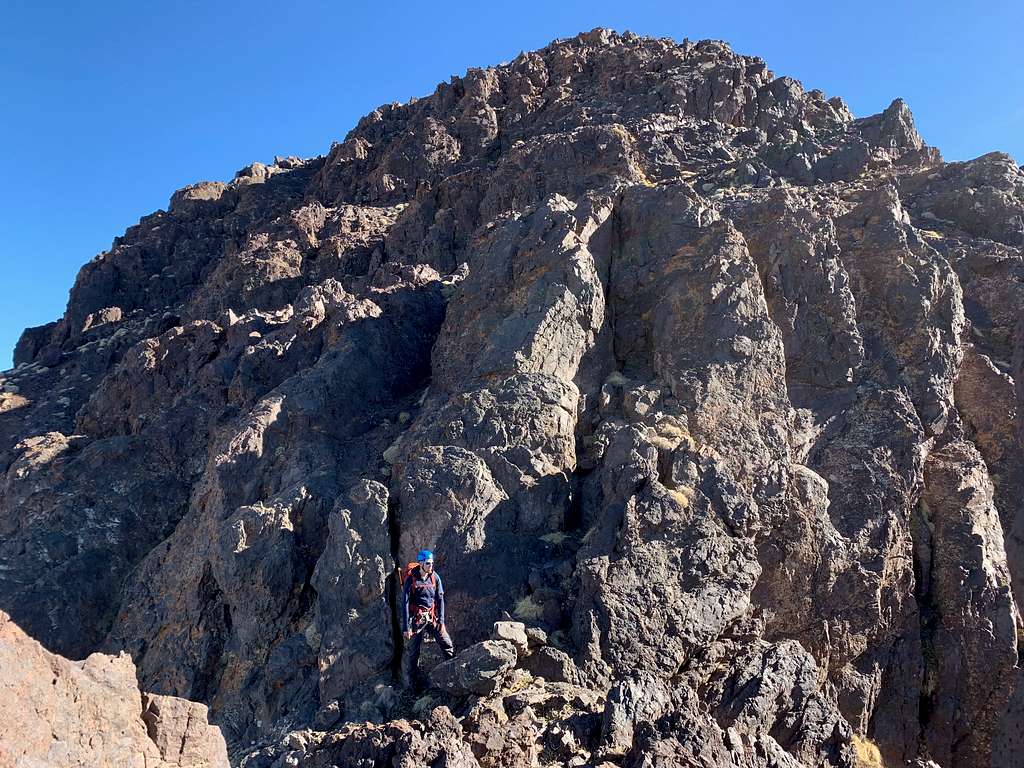
The ridge mellowed out but ahead we could see some steep cliffs. These did not seem to be the rock steps mentioned in Cicerone. Rather, we would skirt this dome climbers right. Once around the bottom of the cliffs we would venture up and climbers left again to regain the ridge.
By now we were also starting to feel the altitude. A few steps and then a pause. All three of us had been doing cardio several times a week in the months preceding this climb but as I have found out in research since then, running on relatively flat roads in running shoes is only marginally helpful when you plan to climb steep slopes at altitude in mountaineering boots with an 8 kg pack. As Scott Johnston and Steve House say, we should ideally train for mountaineering by hiking in the mountains wearing a backpack. They have a great article summarizing their strategy for training for mountaineering. But, I digress…
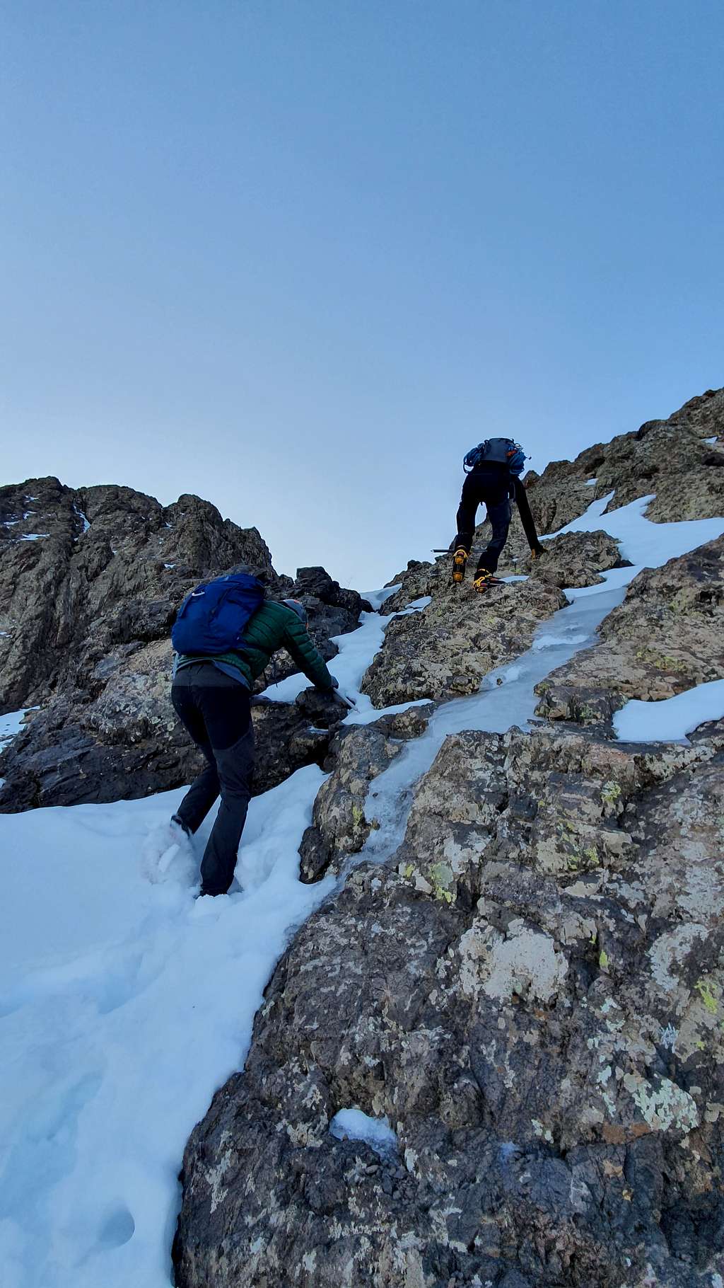
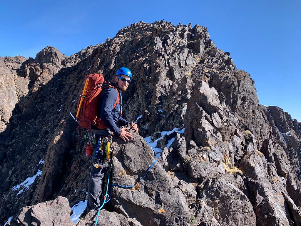
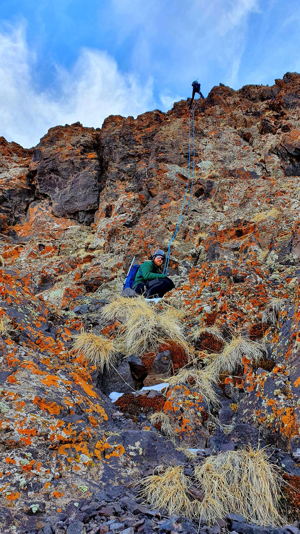
One boot in front of the other, a little scrambling here and there, and the odd snow patch and we reached the first rock step – about 15 meters high with easy 5th class moves.
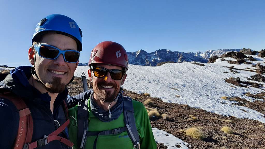
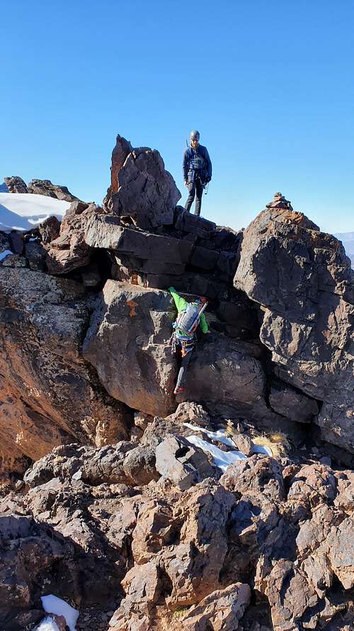
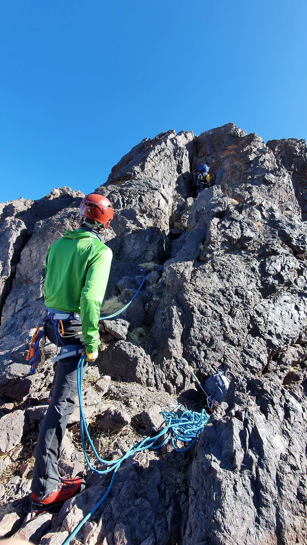
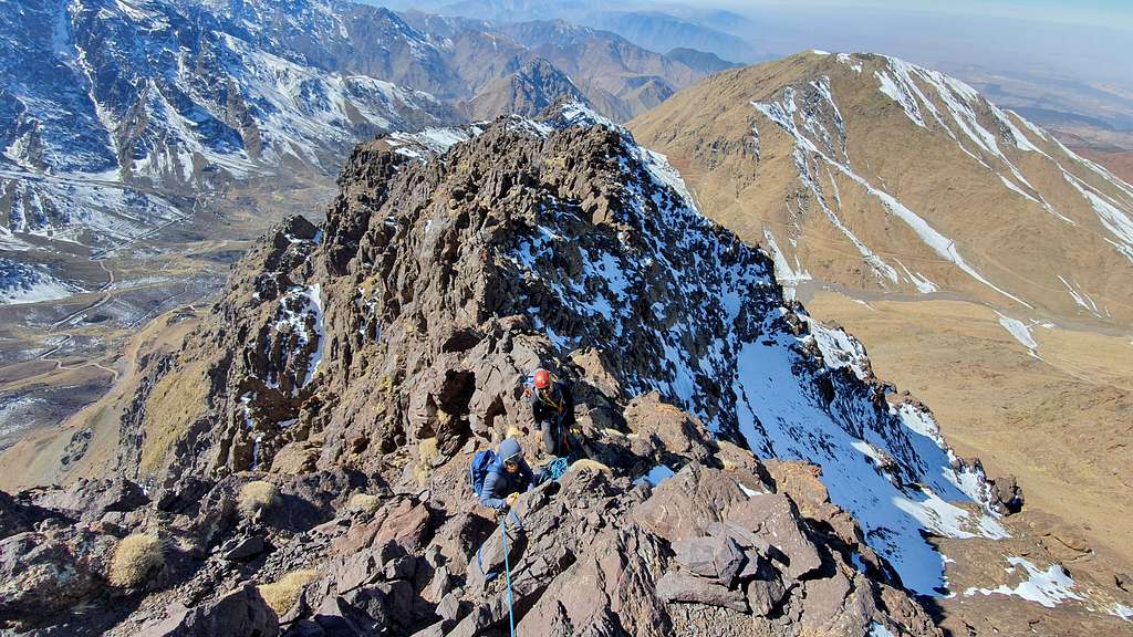
After a few inevitable “you go”, “no, you go”s we agreed that Jeremy would lead the first step. Though it would have been possible to protect with the slings, the cams offered better placements – he placed 3. This was the first time that Jeremy and I were trad climbing since the climbing accident in the French Alps. On the surface, I gave a cool, “you good with this?” but my pulse and breathing indicated that this pitch would be pivotal in building confidence in climbing together again. He did not show any signs of emotion. After topping out the section and high-fiving Jeremy said this was just the right mix of technical climbing and hiking.
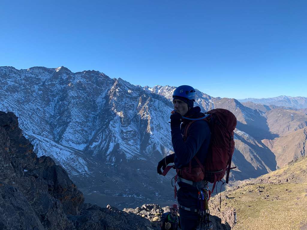
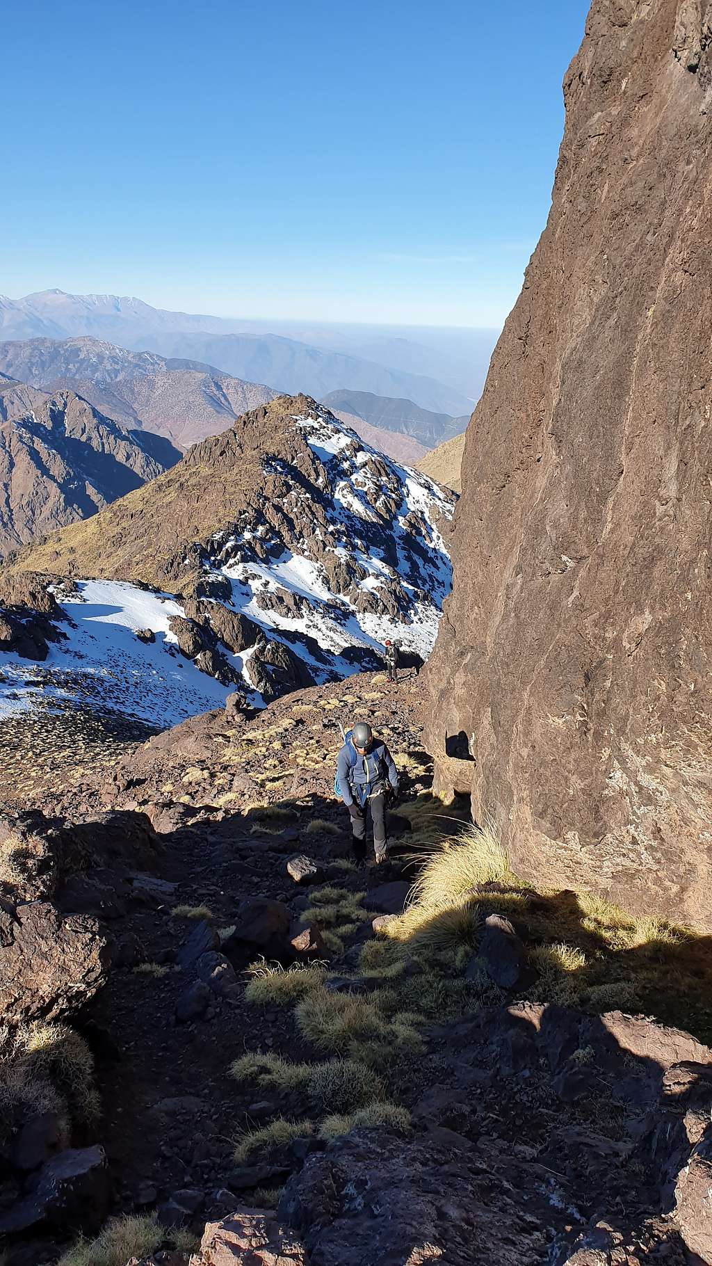
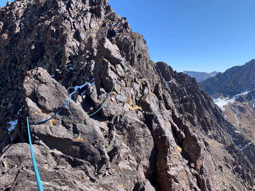
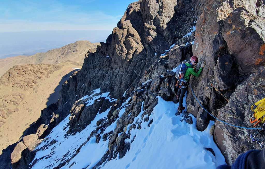
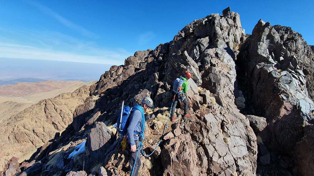
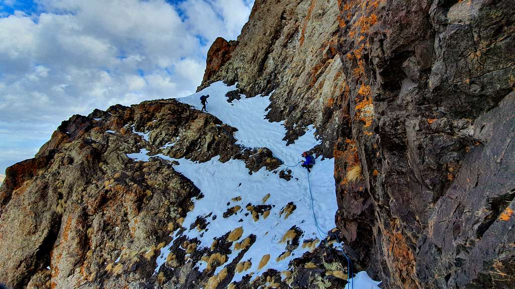
With the technical terrain our pace slowed. The ridge narrowed to a knife edge. Snowy couloirs dropped to our left and jagged sun blackened sandstone punctuated the slopes to the south. We opted to pitch out this section as well slinging horns as we went. This did slow things down a bit. Though I would probably have opted to traverse un-roped, it was a good opportunity to work as a team and practice some methods that I had not used much in the past. This did slow things down a bit but the banter was fun and it did give some rest.
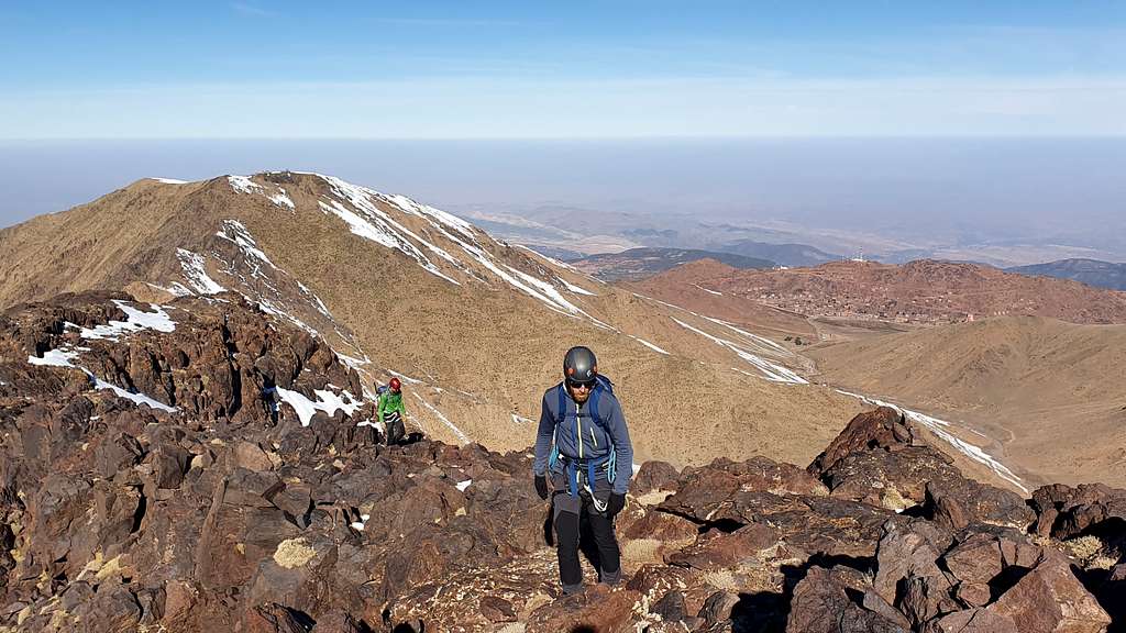
These were the two most technical sections of the route. There were a few other exposed sections that we short-roped through before reached the plateau to the southeast of the summit.
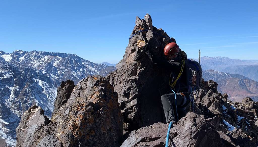
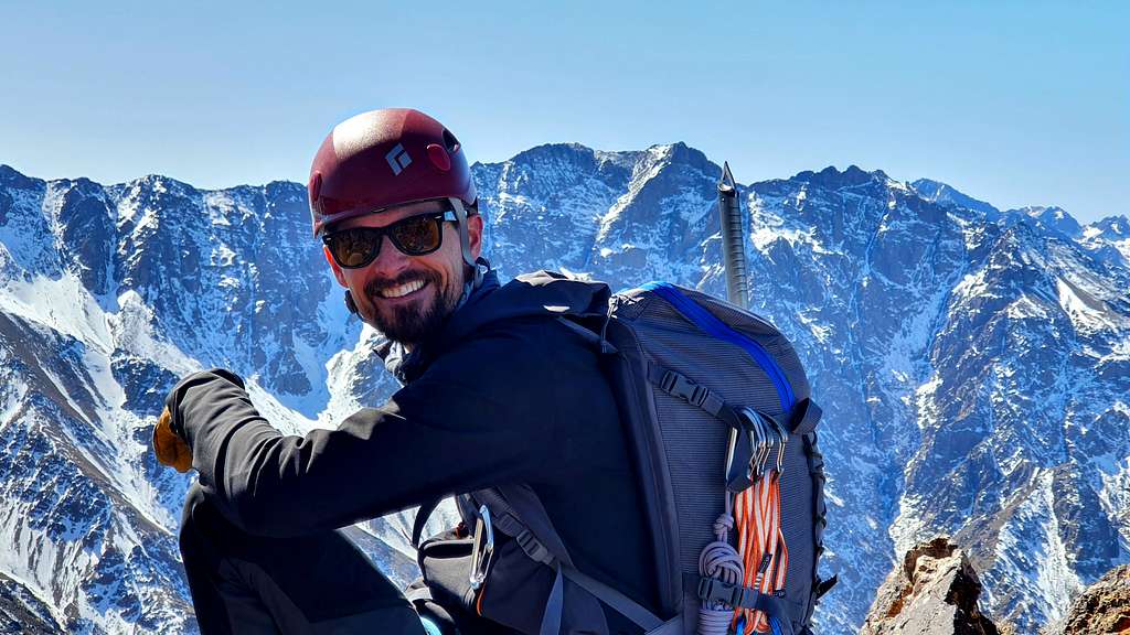
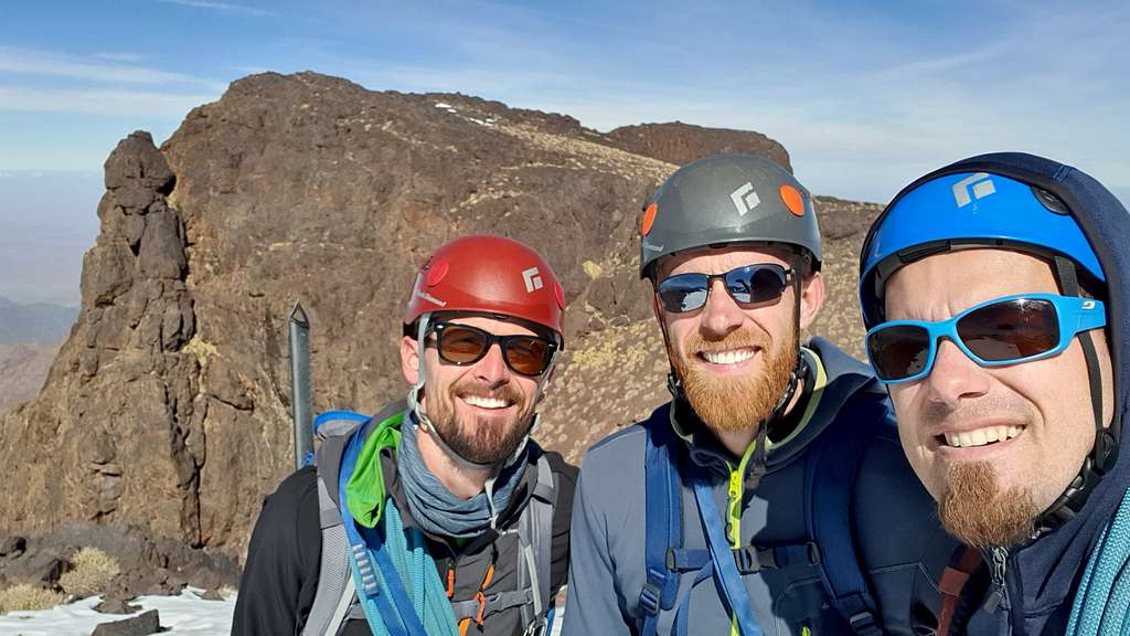
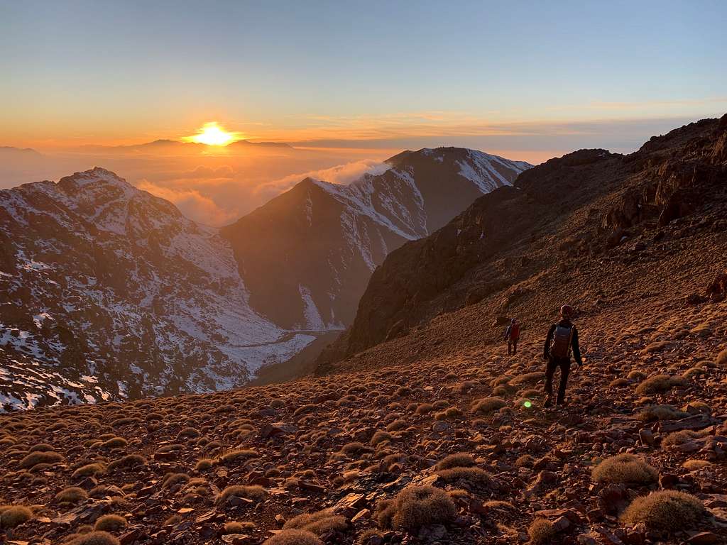
It was a strange feeling to come off a knife-edge ridge onto the Tissi plateau – about 3 kilometers long and up to half a kilometer wide amongst the jagged peaks of the High Atlas. From this vantage point we could see two summit domes with a deep notch separating them. The true summit is the northern one. The final steps to the summit was an easy scramble. Not much more than steep knee high steps but a slip would not be good here. Once on the summit dome the views to Oukaimden and Marrakech opened up and we could still enjoy views ot Toubkal as we had along the whole ridge. Absolutely gorgeous.
We enjoyed sharing a coke at the summit – if one is going to carry water, one might as well enjoy some carbonation and sugar as well! The summit photos were somewhat underwhelming compared with the ridge photos because the plateau behind us made it look deceptively benign. I let my toes air out and then swapped out socks. A bit of a luxury but I certainly felt the difference in both warmth and comfort as we started to descend.
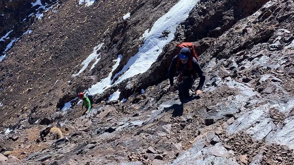
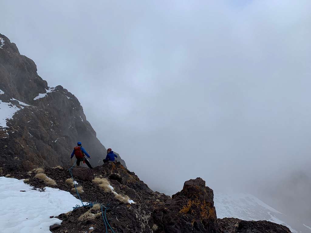
We used Paul’s compass to determine our heading and began navigating the rocks down. It is somewhat of an unique rock formation being no more difficult than third class but the continuity of it and the drop-offs farther down made it feel precarious. There was not much in the way of protection so we each navigated down separately. Vince Lombardi said that “fatigue makes cowards of us all.” That combined with the building clouds, the cold, shadowed north face and uncertainty as to whether we would get stuck somewhere on the face due to navigation errors made us edgy. Once we got off the third class slabs and could see the ridge that hopefully would lead to the north ledge system Jeremy said that the piece we had just completed was a bit more exposure than he had been comfortable with. As we evaluated our position, we decided that rappelling would be better than downclimbing. In retrospect I do think we should have followed the ridge further down rather than rappelling down the eastern portion of the north face. But we were able to make it down in three rappels though they were not as straightforward as we had hoped.
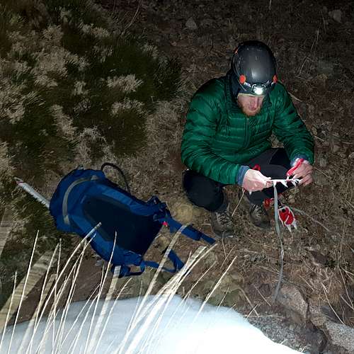
At each rappel we double checked, and triple checked our systems and communicated with each other carefully. We were aware of how tired we were, and we did not want to make any foolish mistakes. It is in some ways, if I am honest, embarrassing to think that some mountain runners would be doing this in shorts and trail runners. But it is important to remember that we each come with our ability levels and risk tolerances and we all share the objective of descending safely. Between the second and third rappel our rope got caught when we were trying to pull it down. I had read about numerous accounts where people had to precariously ascend up a rope that they hoped would remain as stuck during their climb up as it had been while they were just minutes before trying to yank free. We were not excited about the thought but knew it was a possibility. Finally, Jeremy decided that praying would be a better step. He paused and prayed and then we tugged one more time with just as much force as we had before, and the rope pulled free! Praise the Lord! Completing the final rappel brought great relief but our navigation was not over yet.
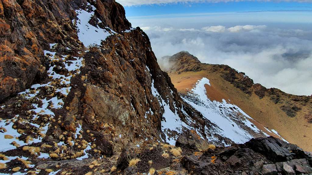
Now we needed to figure out how far we followed the north ledge system before descending further to the tizi below which we could see clearly though off to the side. The ledge system narrowed and in some places was only a half meter wide. Though I prided myself in navigation I let Paul take the lead here as he had stood on the tizi below before. It was very good that I did listen to him – I would have tried to descend earlier than he. We did not pull out our crampons, but we did use our ice axes as we carefully made our way along the ledges. The clouds were playing on the air currents and it was spectacular. The sun was lower in the sky and that brought a beautiful glow to the cliffs above. We gave each other hip belays where necessary. Overall, the walk along this ledge was quite secure but the exposure and scale made it exciting for us.
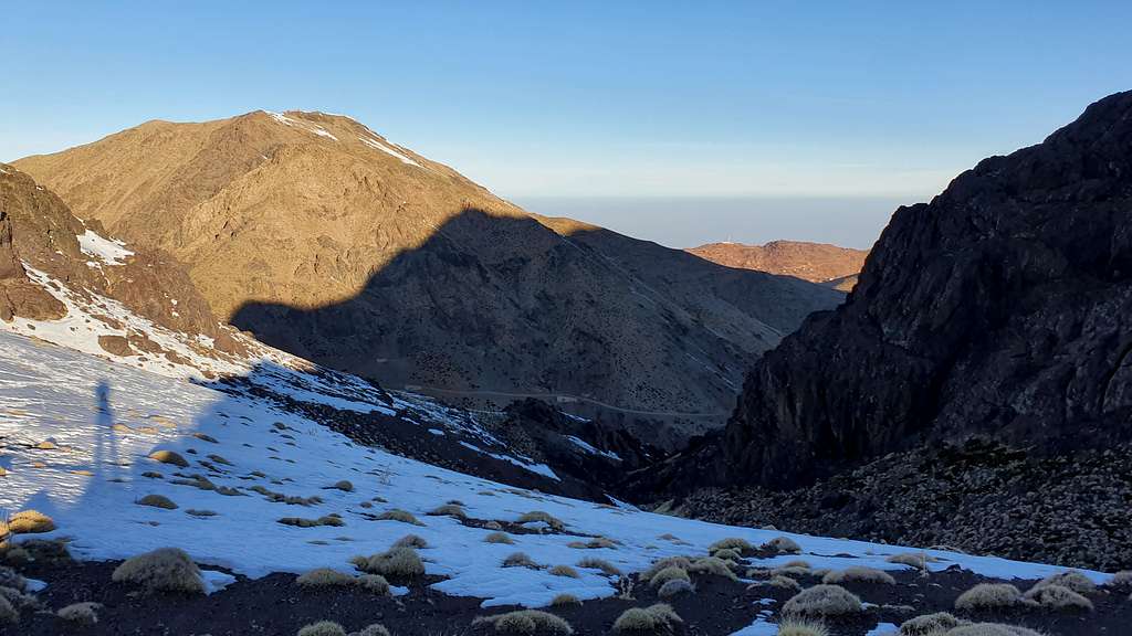
Finally, we could see the tizi directly below us. We began to navigate down the gully un-roped. But the terrain got steeper. I opted to downclimb the last 15 meters, but Jeremy and Paul decided to set up a rappel. Once I was down on the tizi, I could see that just around one more outcropping there was a gentler decent that would not have required any downclimbing. See the picture below.
What remained was to descend one seemingly endless slope into the valley where the pist we had started on in the morning awaited us. Those 45 minutes of descent gave our knees and hips a pounding and though we were descending, the sun had set and temperatures dropped. It is amazing how time slows down but we marched on with gravity to help. When we finally made it to the car it was 8:40 pm. We had been out for fourteen and a half hours. My phone said that we had been moving for five hours and ten minutes. So that gives some sense of the time it took for us to navigate, protect our climbs and of course, the break times/photo times/layer and unlayer times. If we are going to do any bigger objectives in the future, we will probably need to gain some efficiencies and some mountain stamina!
Hi Neufy, Great trip report and I love the pictures. Looked like a beautiful day.
Mike
Comments
Post a Comment