
-
 2098 Hits
-
 71.06% Score
-
 1 Votes
|
|
Route |
|---|---|
|
|
38.96514°N / 106.54298°W |
|
|
Download GPX » View Route on Map |
|
|
Hiking |
|
|
Spring, Summer, Fall |
|
|
Half a day |
|
|
Class 2 or less |
|
|
Overview
This is an easy way to climb Jenkins Mountain. You can avoid all class 3 and most class 2 terrain via this route. There are also multiple options for the descent. The route in the attached gpx file is 6.3 miles and 3250' elevation gain.Getting There
Follow the directions for the Wilderness Route and park near the gate.Route Description
From the parking area, follow the gated 4WD road from the trailhead sign that says Timberline no. 414. The trail curves around to the right (south) initially but soon makes a big bend back to the northeast. In approximately half a mile, you will come to another gate and the actual trailhead for the Timberline Trail. Follow the Timberline Trail to the right. Continue on this trail until you cross a stream that runs most of the year. After the stream crossing, the trail ascends to a ridge. Near the edge of the ridge look for a cairn with a log in front of it and a faint trail ascending the ridge behind the cairn. Follow this trail up the ridge. The trail will eventually disappear but continue up the ridge until you are overlooking a large valley to your left. At this point make a right turn and stay on top of the ridge for a short while. Soon you will need to drop down to avoid a rockfall - see photo below left.
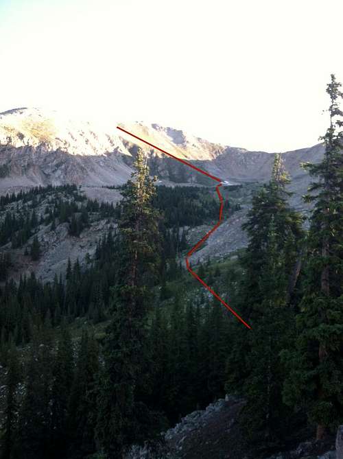
Jenkins route - drop down from first ridge here
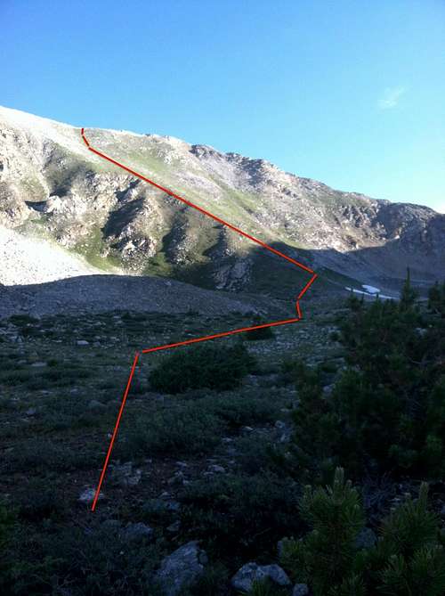
Jenkins route - ascend the grassy slope to the ridge
Near the bottom of the rockfall, a climber's trail passes through the rocks, then continues up the hill.
Ascend the steep grassy slope (above photo on right). When you reach the top of this ridge you have done most of your climbing and you will be able to see your final destination. There are a couple of choices at this point. You can stay on the ridge line to the summit. This involves some class 2 rock-hopping. Or you can cut across below and to the left of the rocky outcrops. The accompanying GPS track ascends along the ridge top and descends below it.
There are many options to descend. Return the same way, or go down another grassy ridge and you will eventually run into either the road or the trail, both of which will take you back to your vehicle.