The climb of Mt Kun began at Shafat Roadhead,altitude approx. 3300m, in the Zanskar region of India on 9 July 2015.
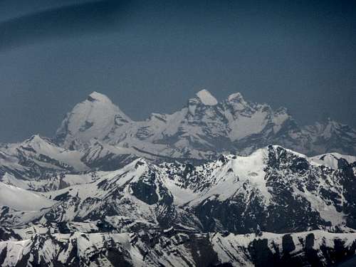
Nun 7135m Left and Kun 7077m Right, from the air, en route to Leh
![]()
![]()
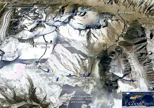
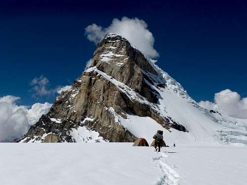
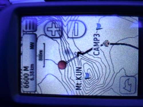
![Kun Map]() Map of route (note there are some false pre-saved camp locations marked, as well as the actual ones from the GPS )
Map of route (note there are some false pre-saved camp locations marked, as well as the actual ones from the GPS )Aftercrossing the Suru River, the firstnights camp was made 6 km up the Shafat Glacier valley near the terminalmoraine of the glacier at an altitude of 3500m. This was due to late arrival ofmule transport for the camping gear.
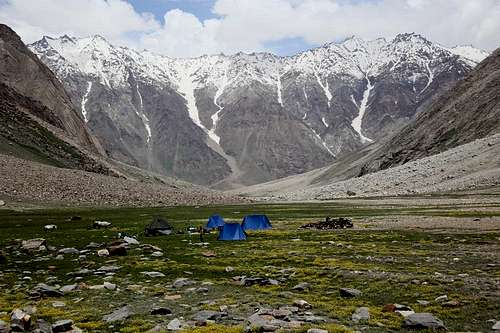
Shafat Camp
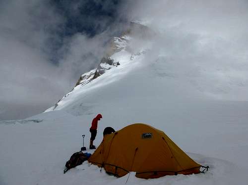
The following day the party continued to Kun Base Camp, at 4300m.
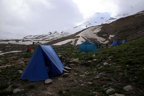
Kun Base Camp
Base Camp was established, but the horse transport was unable to continue due to difficulty negotiating the glacier crossing. The camping gear was thentransported by porters.
The group was well acclimatized , as we had spent a week in Leh at 3600m and then made a 2 day crossing of the 4900m Matho La, nearLeh several days prior to starting the Mt Kun climb.
We spent 2full days at Kun Base camp, as Ken had a bad chest cold which needed attention.This extra rest day gave him time to recover. We spent one of these days takinggear to a mid point “Gear Stash “ at 4700m on the map where we load ferriedsome of Camp 1 equipment to be taken up the next day. This also aided acclimatization.
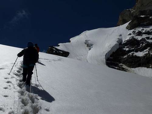
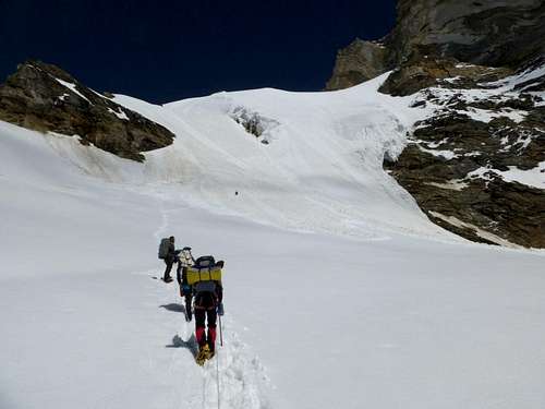
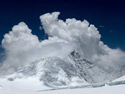
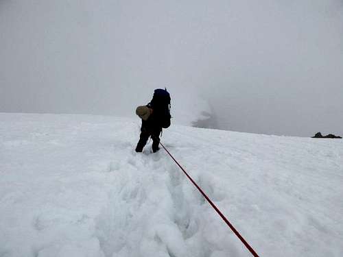
12 July - Wemade the trek to Camp 1. Conditions were fine, although many days were hamperedby wet and cloudy weather. We noted many avalanches falling from 6000m Z1 peakopposite our Base Camp, although they were too far away to pose any danger tous.
Another fullday was spent at Camp 1. We used this time to further acclimatize and it gavetime for the Sherpas to establish a fixed rope to Camp 2. The route followed aridge line and avoided any avalanche risk nearby. A number of avalanches wereseen during the day as the snow softened. Our camp was well clear of any risk from them. The team did a short walk in the afternoon above camp as trainingfor the next day. Small crevasses were noted.
Sherpas dwarfed by the Kun Ice Wall
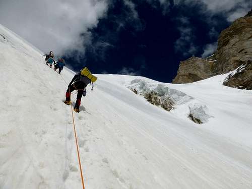
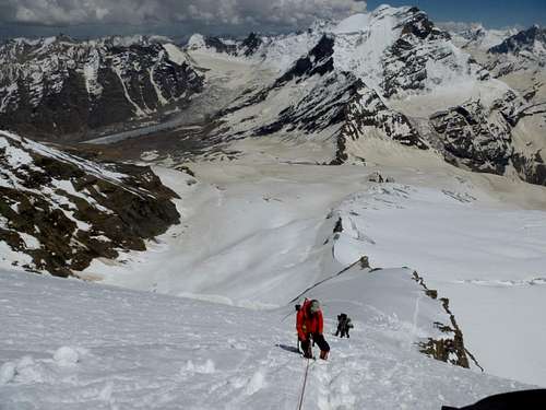
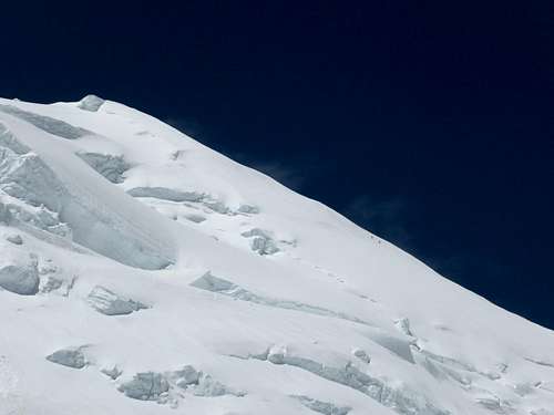
13 July -The team set off for the 900m climb to Camp 2. Snow conditions were very soft,but the climbing pace was steady. Everyone coped well with the altitude gainwith no significant problems. We used a fixed rope all the way to the plateauat 6100m. Some crevasses were forming on the upper slopes.
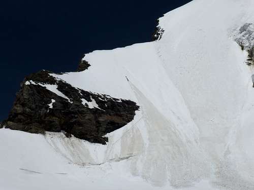
Approaching the Ice Wall
The second half of the Ice wall , approaching the 6000m mark
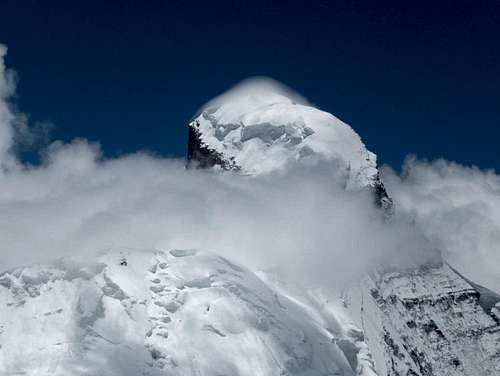
Camp 2 was reached at about 3.30pm. This part of the mountain is regarded as the crux of the whole climb. I would agree although i would not say it was incredibly hard. The conditions are the big factor plus the low oxygen levels menat progress was very slow. The weather was good although storms were forming to the North East, which caused me some concern.
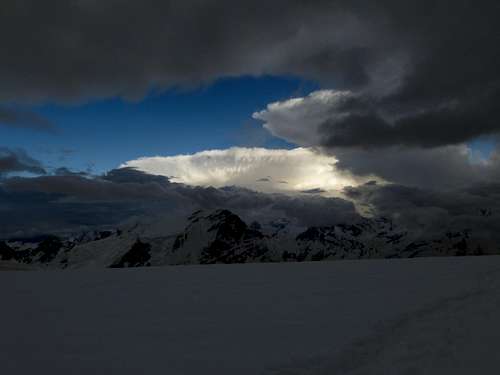
They reached the base of the mountain at 5pm but did not affect our camp, as they stayed below the Nun Kun massif.
Storms surround the massif
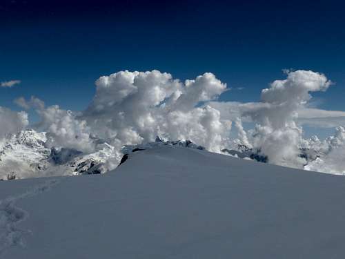
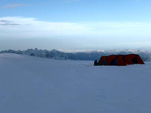
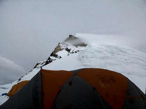
The Sherpas had already begun preparing Camp 3 for us. Camp 2 was indeed spectacular though, with views across the mountains for miles.
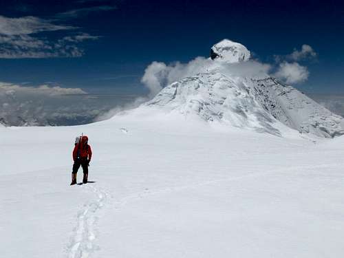
14 July – The next morning our team had a late start and walked to Camp 3.
Camp 2 and Nun
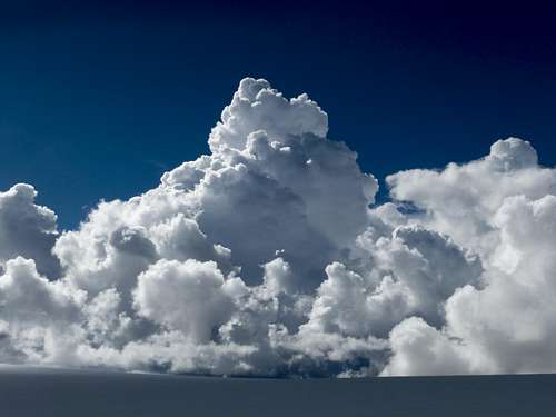
The walk was mostlylevel in clear conditions with a very small altitude gain of about 150m. Snowconditions were firm to softening as the day warmed, which slowed pacesomewhat, combined with the high altitude walking. The distance covered wasabout 2.8km to Camp 3. Later in the day the cumulus clouds gathered and more storms formed around the mountain.
Ken was suffering from a bad cough from a chest infection, which slowed him down but hestill progressed to Camp. It begansnowing intermittently later in the day. During the day, the Sherpas fixed someropes up the Kun summit ridge above us to about 6700m. They appeared to bemaking slow progress possibly due to soft snow and high winds on the ridge.
![Unnamed Image]() Sherpas fixing rope on the summit ridge of Kun
Sherpas fixing rope on the summit ridge of Kun
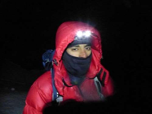
We rested at Camp 3 for a proposed summit bid that evening. At 11pm, after some preparation delays,we began climbing. Some distant electrical storms were noted to the east but were moving away from us. The wind had increased and it was snowing intermittently and getting colder.
The trail upward was straightforward with only a small bergschrund to cross which wasmade easier by a substantial snow bridge.
An ice wall of about 70 degrees was then climbed to the ridge line of Kun. Here at 6600m asmall valley sheltered us from the increasingly cold wind. The Sherpas ,Namgyal our guide, Lilian and Ken started up another ice wall but soon afterthe Sherpas reported that the winds were too strong up higher to keepprogressing. Ken was still having coughing fits but was able to climb on slowly. Vipul and I were about 60m behind them. Having assessed the conditionsto be too severe to continue upward, the Sherpas told us to return to Camp 3 at 3am.
Our highest point reached :(
Vipul at our turnaround point
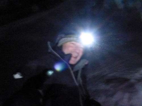
Christian , 3 am its freezing at 6600m
but hey this is good
We returned to Camp 3 just before dawn at 5am.
15 July - The weather had deteriorated and high winds and thick clouds could be seen blowing off the summits of Nun and Kun. The camp was in white out conditions.
We made an assessment of the overall physical condition of the team, and the ongoing weatherconditions, and decided it would not be wise to make a second attempt thesummit the following night.
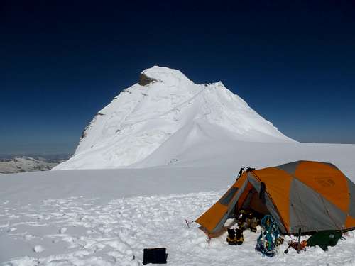
Camp 3 with Kun putting on its pouty face
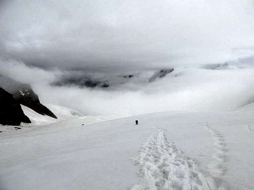
We left Camp 3 at about 11.30 am andset off return to Camp 1. The abseilingdown the first ice wall off the plateau was hard going as the snow was muchsofter and the crevasses had formed in many places. One the second lower stageof the ice wall the abseiling was much easier as the snow and ice combination was firmer.
The long abseil home
Below on the way back to Camp 1, some larger crevasses had begun to open up. None of themwere very large so it was mostly easy to avoid them. Although it was a long day, the group decided to continue past Camp 1 and return to the comfort ofBase Camp. We arrived at Base Camp by 5.30pm
16 July Wespent the day resting at Base Camp, as some porters from Rangdum had to beorganized to carry the equipment back to Shafat. This was because ponies couldnot be used in the glacial moraine.
17 July – We walked back out to Shafat noting some large landslides that had occurred during the stormy weather during our time on the mountain.
18 July – We returned by car to Kargil , then the next day back to Leh where the expeditionofficially ended.
Observations and Conclusion
Weather was a major influence on this expedition. Snowfall had been heavier than in some previousyears. An avalanche on the approach to Kun some 2 years earlier meant that theprevious route up the ice wall had to be altered. The team was well acclimatizedalthough some viral illness in one team member and poor conditions on summitnight (and ongoing bad weather after) meant that a summit bid was terminated at6600m.
The decisionto turn back, while being so close to the summit, was a difficult one, butconsidering the circumstances at the time, was the correct thing to do toensure the safety of the expedition as a whole.
The glacierapproach had also altered and landslides were evident on the return through it.
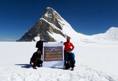
Despite the setbacks, the team was in good spirits and enjoyed the expedition and all are making plans to climb to similar altitudes in the future.
We used the climb to raise $2175 AUD for the Nepal Earthquake Appeal, being run by the Australian Himalayan Foundation. We have a number of Nepali people as our team so our efforts seemed to be appreciated.
We are very thankful to the team at White Magic Adventure Travel (based in New Delhi) , whose expertise and helpfulness made the expedition run very smoothly despite the many challengesalong the way.
Christian Wilson , August 2015
Access is via Shafat, in the Suru Valley. The entry road to Suru Valley is from Kargil. Security is fairly tight in the region but not a threat (in our case anyway).
We used an Indian expedition company so they handled the red tape very well. Some issues with porters and ponies in the Shafat glacier crossing.


Comments
Post a Comment