According to the proposal of Route-rating by
Vid:
GENERAL DATA
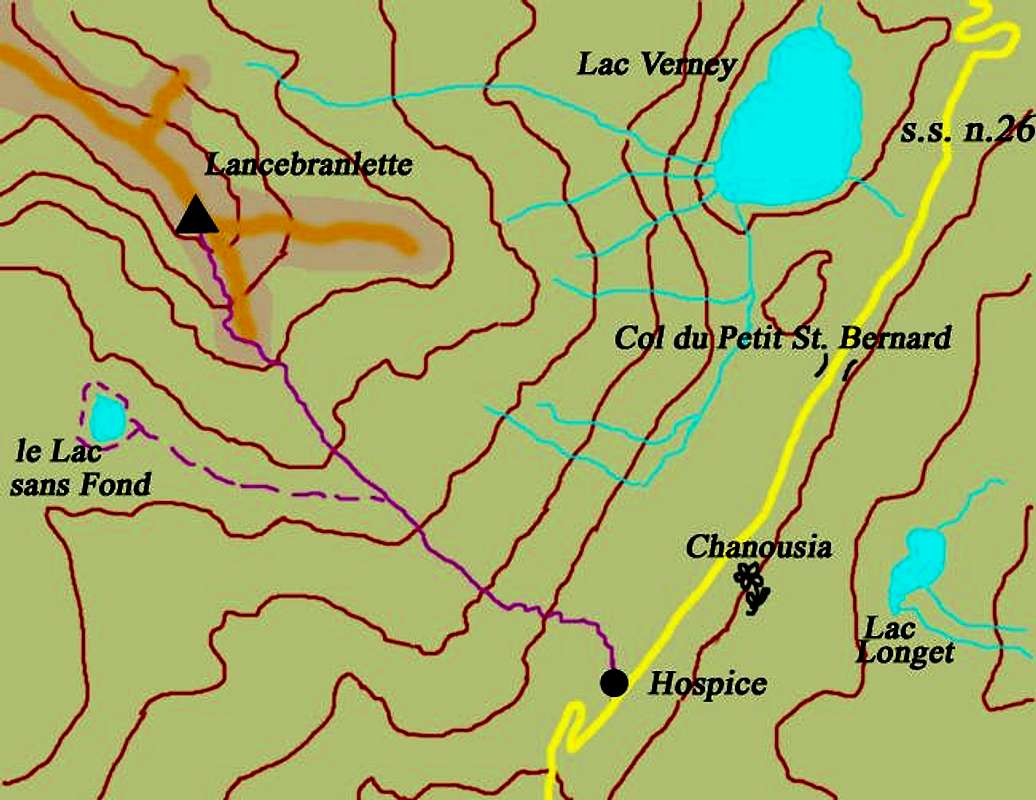
- Start altitude: about
2160 m
- End altitude:
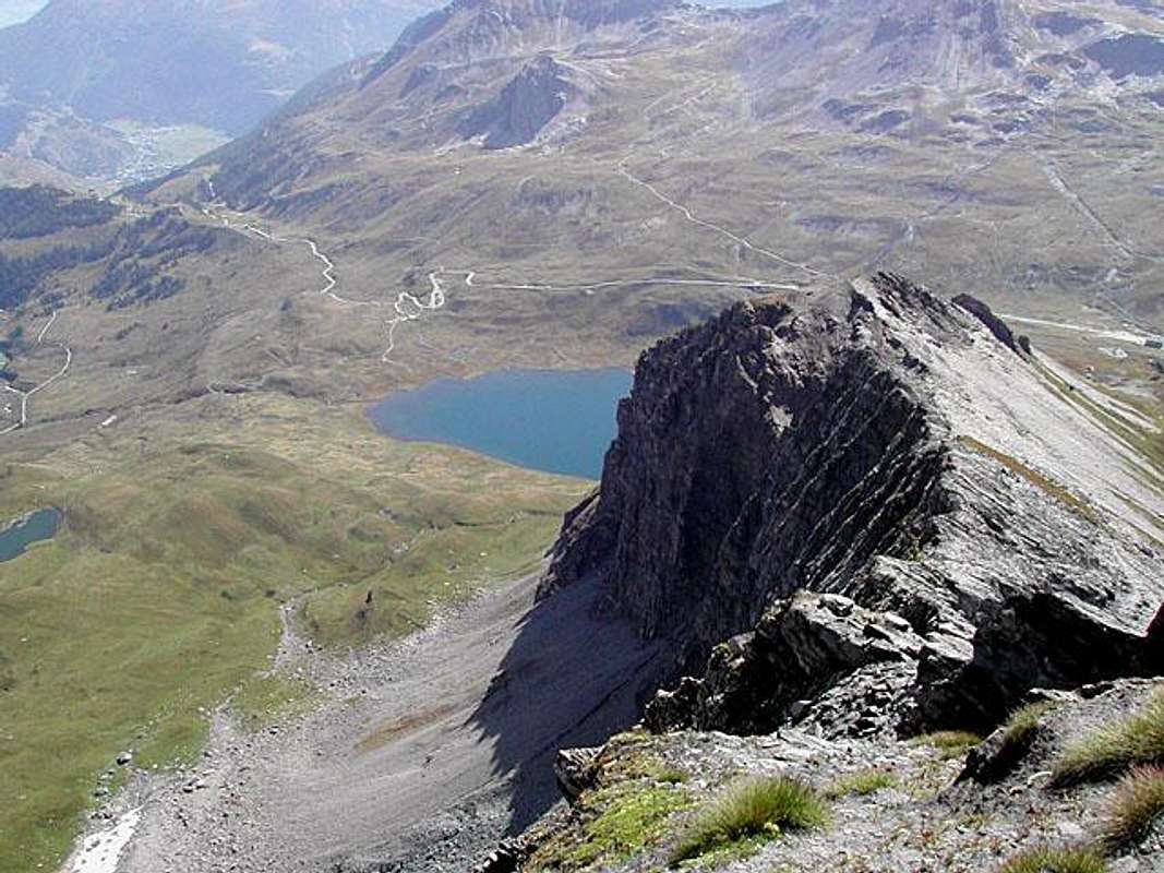
2927 m (it's the height of the summit)
- Prevailing exposition: S
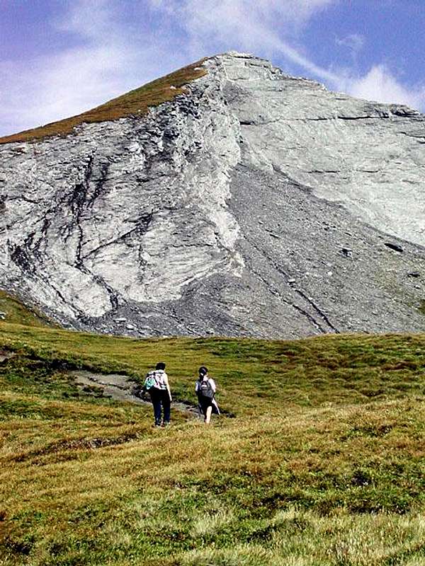
- Type: meadows, schistose ground, grassy slope in succession
- Protection: it is not marked (only a sign at the junction with the route to le Lac sans Fond) nor protected, but there is usually no difficulty (may be in the case of rain on the schistose ground)
- Gear & remarks: Usual hiking gear should be sufficient in summer months.
Remember that the height of the summit is near to 3000 m and sudden weather changes are always possible.
In addition the Petit Saint Bernard zone is often windy.
1. EFFORT (ascent): it needs two / two and a half hours for an altitude difference of about 800 m (2160 m-2927 m)
2. POWER 1- no difficulties
3. PSYCHE 1- no difficulties
4. ORENTATION 1- no difficulties
- OVERALL SCALE - very easy


 5547 Hits
 74.01% Score
 4 Votes