
-
 32559 Hits
-
 85.26% Score
-
 20 Votes
|
|
Area/Range |
|---|---|
|
|
42.35043°N / 105.5896°W |
|
|
Hiking |
|
|
Spring, Summer, Fall, Winter |
|
|
10274 ft / 3132 m |
|
|
Overview
The Laramie Range is located in southeast Wyoming. It is lower in elevation than the surrounding ranges, but is still considered part of the Central Rocky Mountain chain. The mountains extend southward from Casper and run between Laramie and Cheyenne. North of the range, the gap between the Laramie Range and the Bighorn Mountains provided the route for early settlers on the Oregon Trail. Bordering the east side of the range is Interstate 25 and the towns of Douglas, Glenrock, and Wheatland. The west side of the range is less populated and includes the town of Laramie, the Snowy Mountains, and the Hanna, Shirley, and Laramie Basins. The Laramie Mountains are managed by the Medicine Bow National Forest.
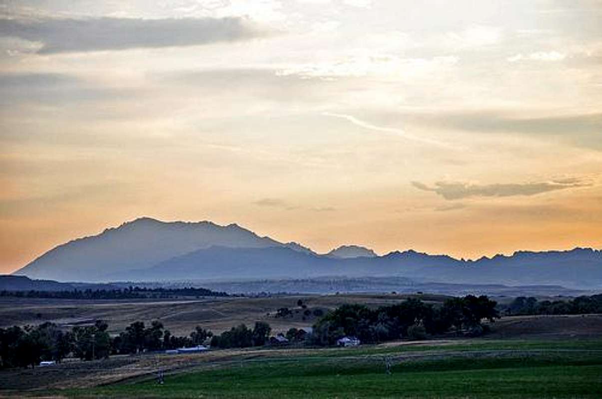
Laramie Peak, Wy
Geology/Elevation
The Laramie Range is appx. 130 miles long and 20 - 25 miles wide. The rock is composed of Precambrian granite that rose up some 50 - 70 million years ago. The highest peaks (above 8,000 feet) are much smaller than the high peaks of the mountains to the west and south. The highest point in the Wyoming part of the range is Laramie Peak (10,274 feet), located in the center of the range. The highest point in the range lies in the Colorado part of the mountains and is called South Bald Mountain at 11,003 feet. The general elevation for most peaks is about 7,000 feet. The east side of the range is more dominant in elevation, rising 3,000 feet above the plains, while the west side rises about 1,500 feet. The lowest point in the range is found on the North Platte River at 4,500 feet. The entire mountain range lies below treeline.
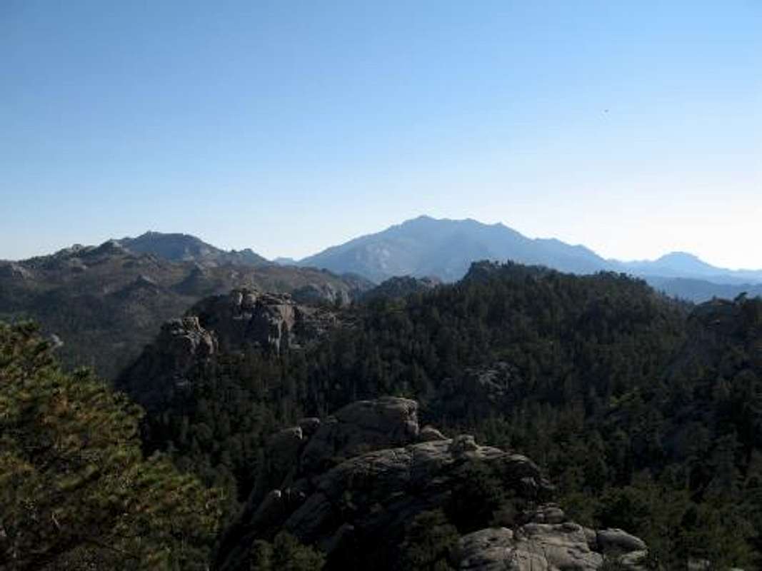
View of Laramie Peak and surrounding mountains
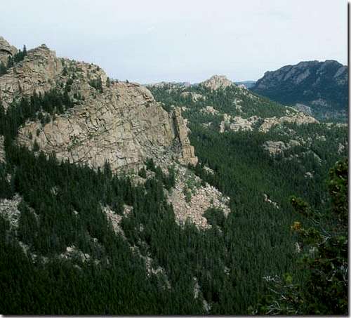
View of the rock formations on Laramie Peak
Peaks of the Laramie Mountains
South Bald Mountain 11,003 feet
Laramie Peak 10,272 feet
Black Mountain 9,949 feet
Warbonnet Peak 9,414 feet
Casper Mountain 8,200 feet
Twin Mountains 8,146 feet
Mount Margaret 7,957 feet
Black Mountain 7,860 feet
Ice Cave Mountain 7,773 feet
Greyrock Mountain 7,613 feet
Roads
There are several roads that roll through the Laramie mountains. Casper, Glenrock, Douglas, Wheatland, Cheyenne, and Laramie all have roads that travel in and around the mountains. The only paved road through the range is the 52 mile long Highway 34 from Wheatland to a valley just north of Laramie. This, however, is not the most scenic road through the range.
For the best scenery, the Laramie Mountains have to offer, you will have to take the road to Laramie Peak. For this drive you will want to go to the small town of Esterbrook. Esterbrook can be accessed from exit 111 on I-25 at glendo or driving south from Douglas on Hwy. 39. 18 miles west of Esterbrook is the Friend Park Campground and the trailhead for Laramie Peak.
If you continue west on this road past the Friend Park Campground, you have the option of going north to Douglas, southwest to the town of Rock River, or south and then east to Wheatland. These roads can be traveled in a car, but if muddy or rainy conditions are present, it may be hard going at times. The roads in the area are, for the most part, lightly traveled. As any outdoor adventurer should already know, be sure to bring plenty of water and fill up your gas tank before venturing in to the mountains.
Camping
Some of the camping in and around the Laramie Mountains include:
Yellow Pine Campground
18 Miles from Laramie, 8,400 feet, 19 sites
Tie City Campground
10.5 miles from Laramie, 8,600 feet, 15 sites
Cambell Creek Campground
40 miles SW of Douglas, 6,200 feet, 8 sites
Curtis Gulch Campground
38 miles SW of Douglas, 6,600 feet, 6 sites
As some of the Laramie Mountains lie in the Medicine Bow National Forest, other parts lie on private land. It is sometimes almost impossible to tell if you are on private or public land in some areas. It is best to contact and obtain a map from the BLM in Rawlings.
1300 North Third Street
Rawlings, WY 82301
307-328-4200
Fax- 307-328-4224
More Information
For more information on the Laramie Mountains and the Medicine Bow National Forest contact:
USDA Medicine Bow-Routte National Forest
2648 Jackson Street
Laramie, WY 82070
307-745-2300
Medicine Bow USDA Forest Service website
hgrapid - Nov 1, 2009 11:36 am - Hasn't voted
Some minor issuesI am glad you posted this page. This is an interesting mountain range that is overshadowed, and without good access. I think it is a worthwhile place to visit. However, I wouldn't consider this range to be in the "Southeast corner". I would say southeast. Casper is not in the "Southeast corner" of Wyoming. I know, I have stayed there. Also, check your spelling. In the first section, you write "Larmaie Range". Also, I don't think "Vedauwoo" is in the Laramie Mountains, is it?
climber555 - Nov 1, 2009 6:07 pm - Hasn't voted
Re: Some minor issuesThanks for the feedback. I get ahead of myself, even while double checking my spelling. You are right about the location.....As for vedauwoo, I know it is in the Medicine Bow-Routt National Forest, but im not sure if it is in the Laramie Mountains or not. P.S.- You have some awesome pictures......Happy Climbing
musicman82 - Nov 22, 2009 4:35 pm - Voted 10/10
Re: Some minor issuesVedauwoo is not in the Laramie Range; it is in the Sherman Range, so you should detach it from this page... Tim
hgrapid - Nov 8, 2009 10:55 am - Hasn't voted
Thanks manThanks for the compliment on my pictures. I just put up a new page of a really cool mountain in Nevada. Nobody's voted on it yet. It is Virginia Peak.
dblaramide - Feb 8, 2022 8:53 pm - Hasn't voted
Few geographic details regarding the Laramie RangeFirst off Vedauwoo is technically right in the middle of the Laramie range(east/west) Kind of half way between Laramie and Cheyenne but closer to Laramie of course. North/South distribution(Laramie range)puts it mostly in Wyoming ~85% with a small portion in extreme northern Colorado. The extreme northern extent is the area between Casper mountain and Bessemer mountain. Was the result of the Laramide orogeny(mountain building event)close to 80 million years ago. These are very "new, youthful" as far as mountains are concerned. Pre-cambrian intrusive granite technically referred to as "Sherman granite". No such thing as the Sherman mountains. Spent quite a bit of time in this area while living there for close to 6 years. Climbed a bunch of routes at Vedauwoo, Blair, and Reynolds hill. Access is moderate, very rugged in places, less rugged in others.