
-
 2155 Hits
-
 79.04% Score
-
 10 Votes
|
|
Area/Range |
|---|---|
|
|
42.00200°N / 105.428°W |
|
|
Hiking, Trad Climbing, Sport Climbing, Toprope, Bouldering, Scrambling |
|
|
Spring, Summer, Fall |
|
|
7000 ft / 2134 m |
|
|
Overview
Encompassing nearly 40,000 acres in all, the Laramie Peak Wildlife Habitat Management Area includes much of the southern portion of the Laramie Mountains in central Wyoming.
Despite the name, Laramie Peak itself is actually not in the WHMA. Laramie Peak is about 15 miles north of the area.
The WHMA was purchased and established for the management of wildlife, with an emphasis on bighorn sheep, elk, pronghorn, and fisheries. The Wyoming Game and Fish Department, BLM, and U.S. Forest Service all help manage the lands.
|
|
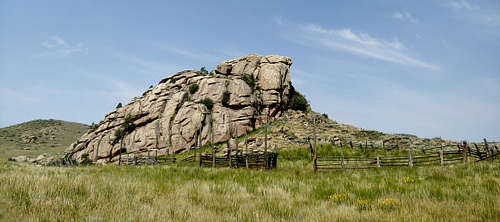
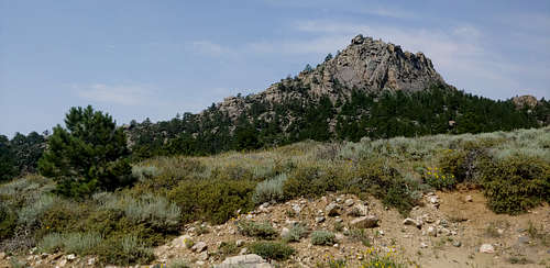
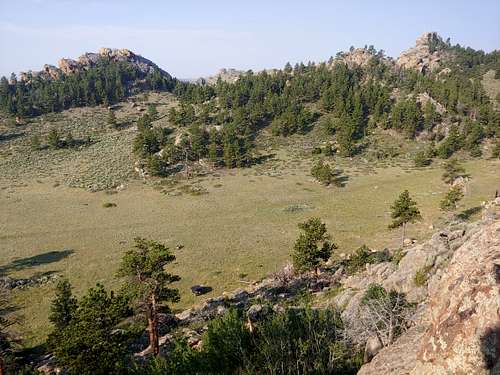
For the most part, the area is remote, and high clearance and 4wd are recommended. Once out there, you will enjoy a wilderness feel thanks to the long drives in, the poor roads, and a lack of established hiking trails and marquee destinations. Basically, it's a vast area of meadows, forests, and granite peaks, outcrops, and cliffs.
Activities open to humans include hunting, fishing, trapping, hiking, camping, and rock climbing.

|

|

|
The WHMA contains more than 200 climbs on solid granite from 1 to 3 pitches, though most of the area has just single-pitch climbing, both sport and trad.
For a look at the different climbing locations, see the MP page.
Getting There
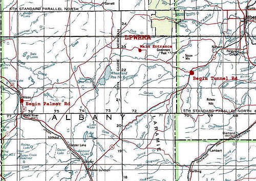
The main entrance is in the southern section of the WHMA. There are 2 main ways to get there:
1. Three miles north of Rock River on U.S. 287, turn onto the Fetterman/Palmer Road. After about 25 miles, you will reach a junction where there is a row of mailboxes. Left keeps you on Palmer Road. Right puts you on Tunnel Road. Both provide access to the 4wd roads that penetrate the area.
2. From Wheatland, exit the interstate onto State Route 34. After about 36 miles, turn onto Tunnel Road, which is paved for the first 4 miles. The scenery just gets better and better from there.
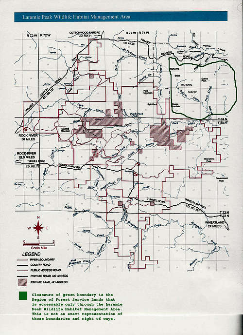
The maps below are public, but they were annotated by Dennis Horning, who submitted the MP page linked to above.
|
|
Red Tape
The area is closed to human presence from February 1 through April 30. Not exactly prime times for climbing in Wyoming, anyway. Off-road travel is restriced to 25' from roads.
There are parcels of private property within the WHMA. It is your responsibility to identify and stay off them.
Camping
There are no established campgrounds, but dispersed camping is allowed as long as it is not on provate property.