
Comments
No comments posted yet.
|
|
Trip Report |
|---|---|
|
|
45.53274°N / 122.08781°W |
|
|
Download GPX » View Route on Map |
|
|
Jul 4, 2023 |
|
|
Hiking, Mountaineering |
|
|
Summer |
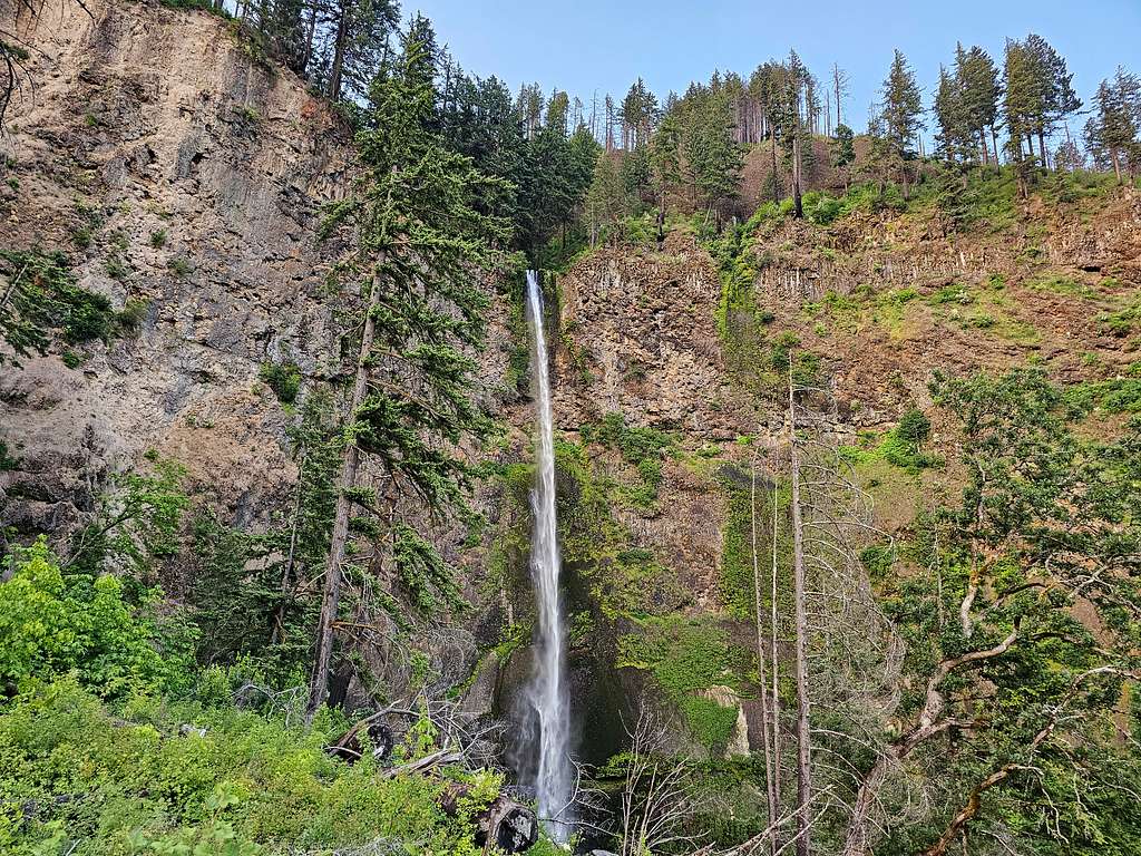
The 4055 ft Larch Mountain rises on the south side of Columbia River George to the east of Portland, Oregon. A road goes to the summit of Larch Mountain where an observation deck at a place named Sherrard Point can provide you with great views of the surrounding mountains. You are likely to share the summit with those who have driven there. A true hike to the top of Larch Mountain, however, starts at the famous Multnomah Falls or the nearby Wahkeena Falls at an elevation of less than 50 ft.
Multnomah Falls is a very popular tourist destination. When I visited the area in July of 2023, parking at Multnomah falls after 9 AM, required a permit. To avoid the regulations, I parked at Wahkeena Falls Trailhead and started my hike at 5:20 AM. A 0.7-mile hike took me to Multnomah Falls where, to my delight, I found no one else at that early hour. A walk up a steep paved pathway took me to the top of Multnomah Falls at an elevation of 630 ft. I then followed the trail up the Multnomah Creek Canyon past at least three other waterfalls, through burnt and intact forest to reach the 4055 ft summit of Larch Mountain. For the return trip, once down to an elevation of 1150 ft, I went on Wahkeena Trail which took me 350 vertical feet up where I had great views of the Columbia River before descending into Wahkeena Drainage going by beautiful waterfalls until I was back at my starting point.
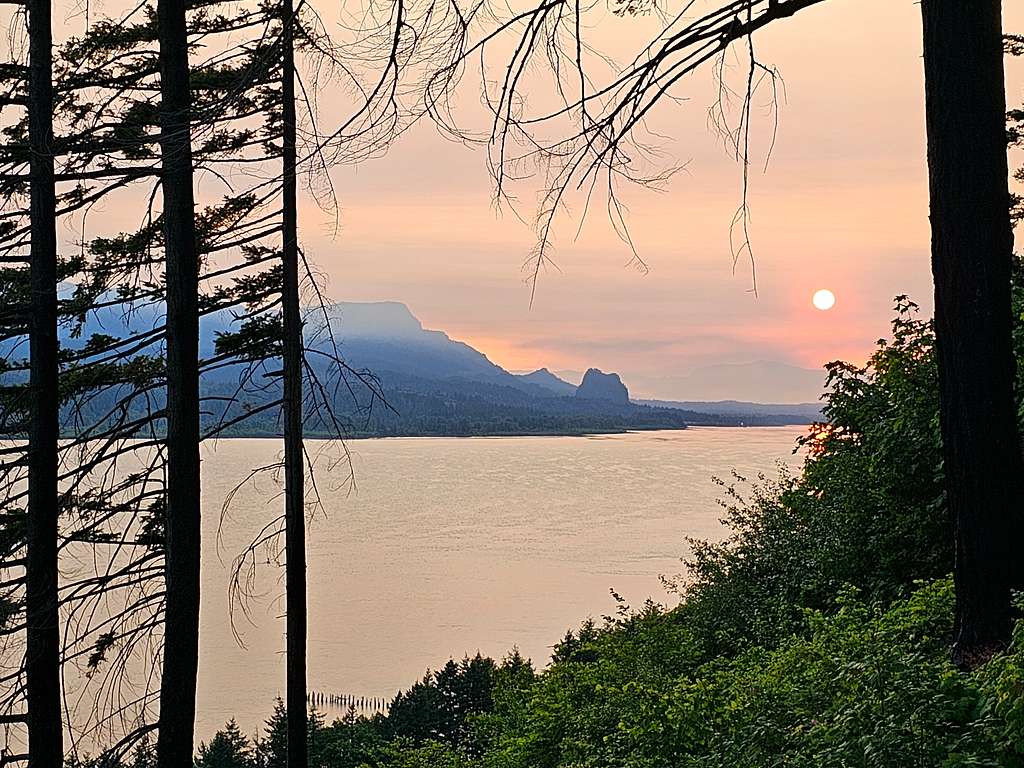
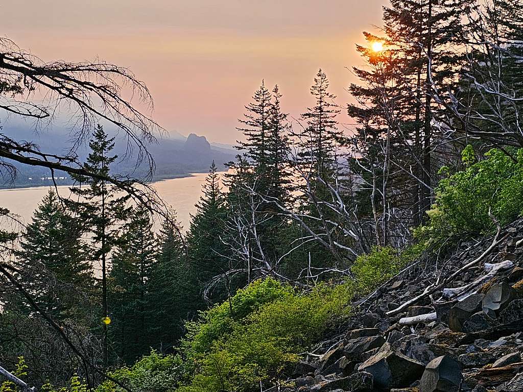
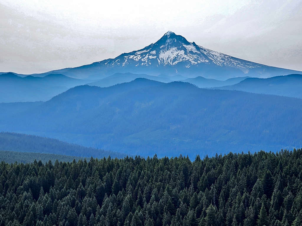
Unfortunately smoke from the “Tunnel 5 Wildfire” that erupted 2 days prior to my hike obscured the views from the summit.
Hike Length: 17.0 miles
Lowest Point (Multnomah Trailhead): 45 ft
Highest Point (Summit of Larch Mtn.): 4055 ft
Total Ascent: 4625 ft
July 4, 2023
Got up at 3:45 AM in the vacation rental house in Dallesport, Washington (sunrise 5:25 AM). While driving on I-84, for a few seconds, I got a glimpse of the raging flames of the “Tunnel 5 Wildfire” across the Columbia River in the twilight.
To avoid dealing with the parking regulations at Multnomah Falls, I had planned to start my hike at Wahkeena Falls Trailhead. Reached the small parking area around 5:15 AM and found a few parked cars but I did not see any people until I was near the summit of Larch Mountain.
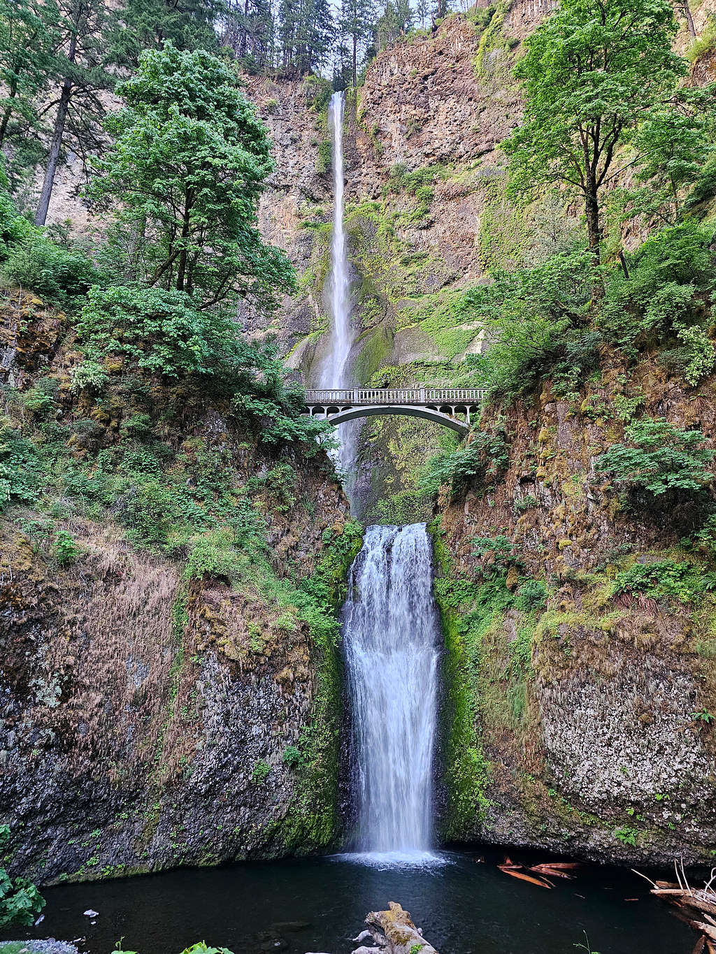
Started my hike at 5:25 AM. Got on the trail that went parallel to the Historical Columbia River Highway until after 0.7 miles and an elevation of 45 ft, I reached Multnomah Falls Trailhead. Nobody was there. I could not believe that I had the usually very crowded touristy place all to myself.
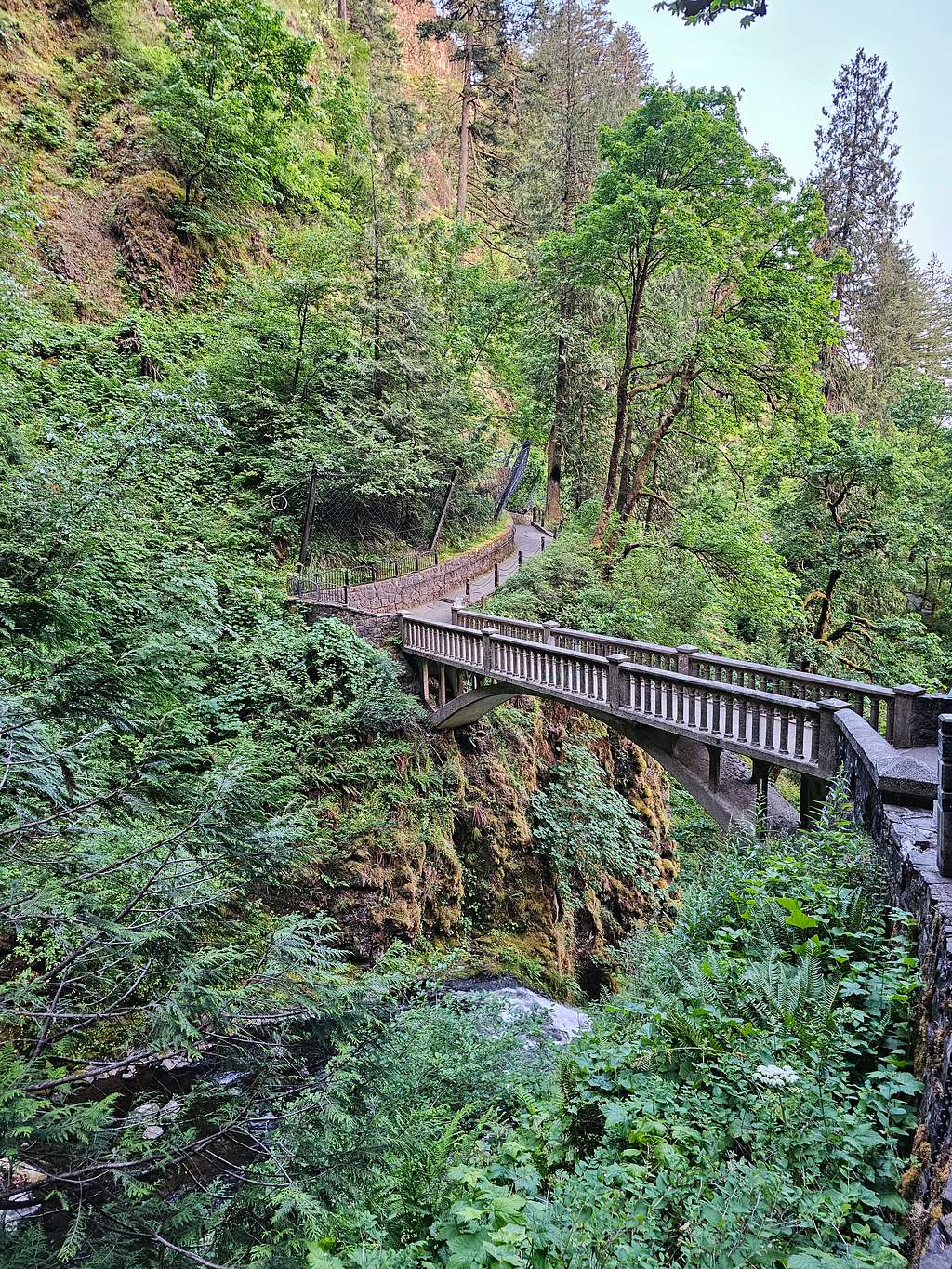
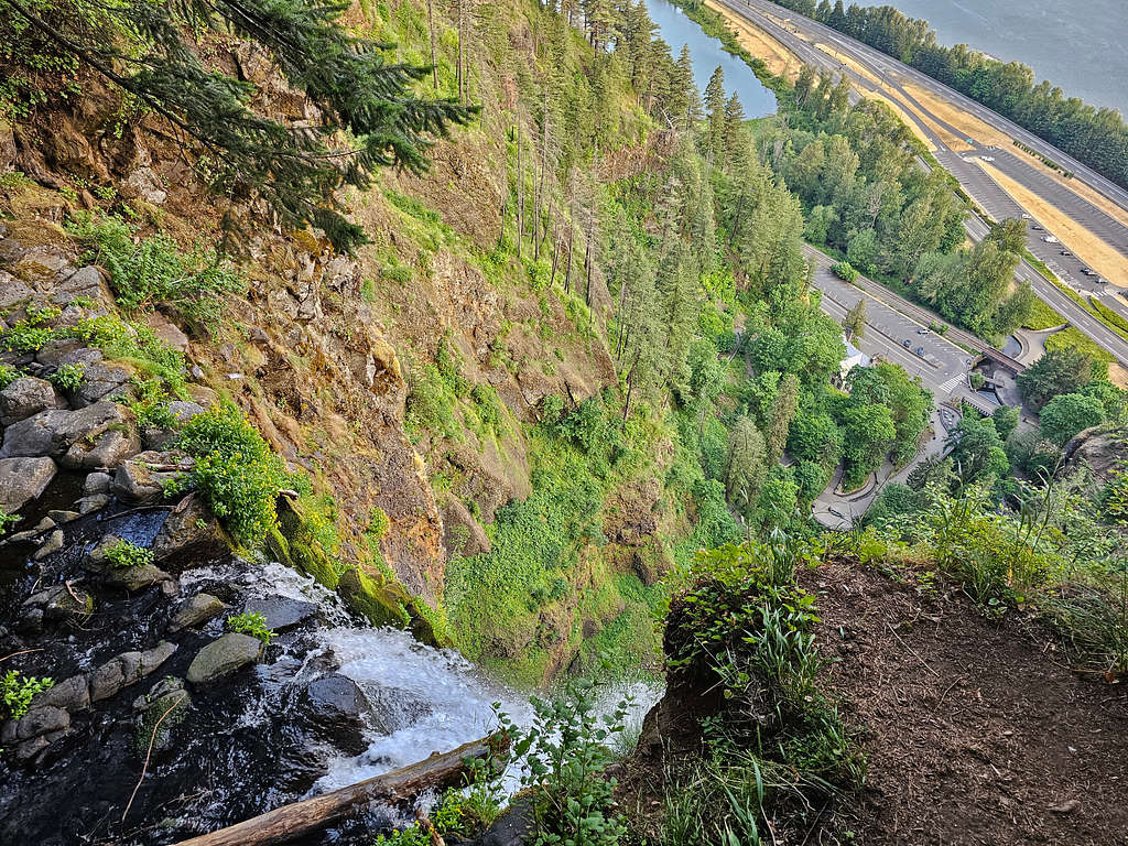
Got on a paved pathway that took me up to Benson Bridge. Views from Benson Bridge.
Looking back at Benson Bridge.
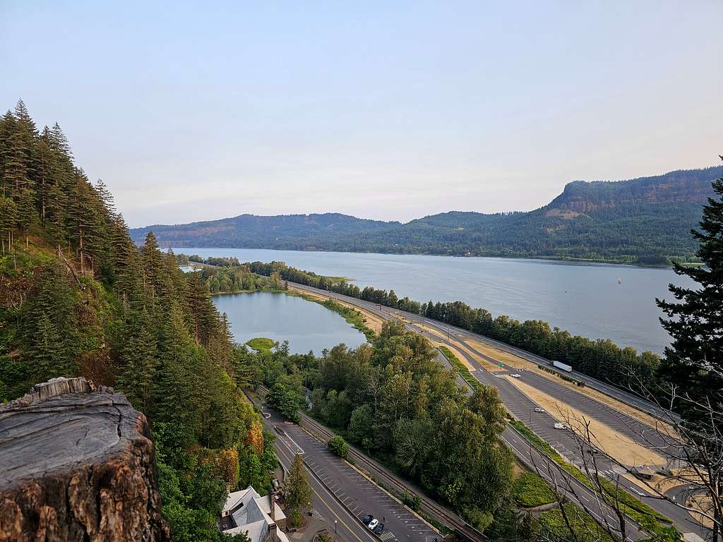
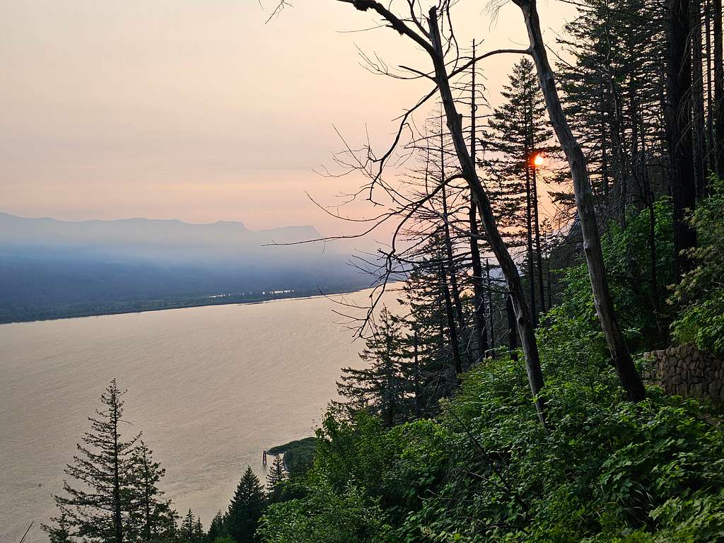
The paved pathway began to make switchbacks going up steeply giving me great views of Columbia River Gorge. The smoke-filled gorge and the rising sun created dramatic scenes. I was starting to feel hot and was concerned about overheating since the high temperature was supposed to go into the mid-90s degrees F. The 4.3 liters of water that I had brought with me made my backpack feel heavy.
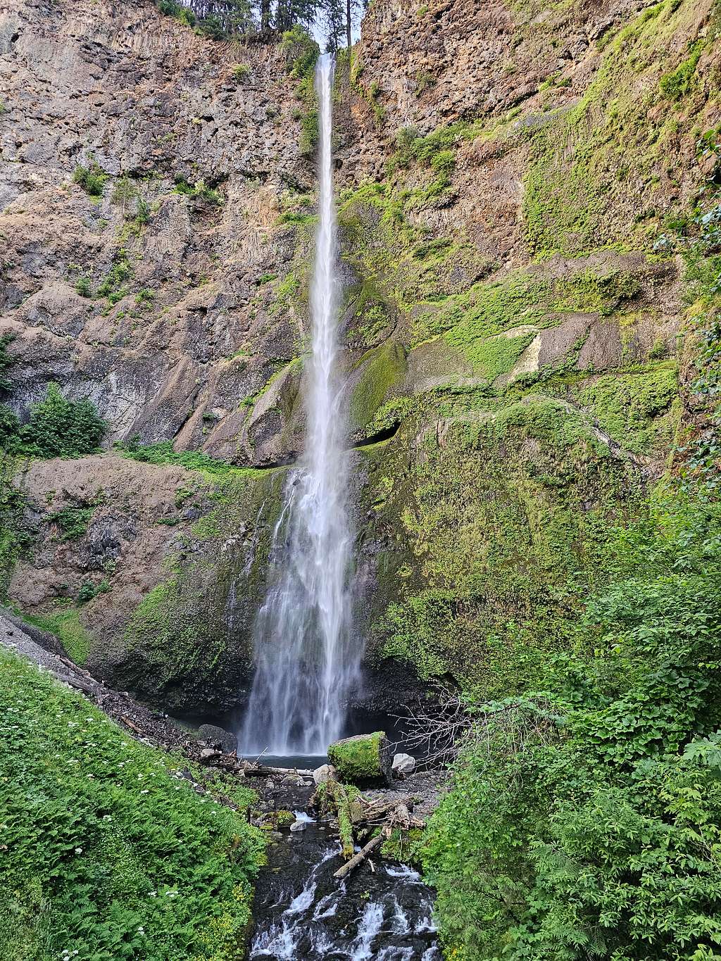
Another view of Multnomah Falls.
At 1.85 miles and 820 ft elevation, I was on top of the switchbacks. The trail then began to go downhill until I got on a 0.1 mile long spur trail that took me to an observation deck at the upper edge of Multnomah Falls where I reached at 6:25 AM and an elevation of 630 ft.
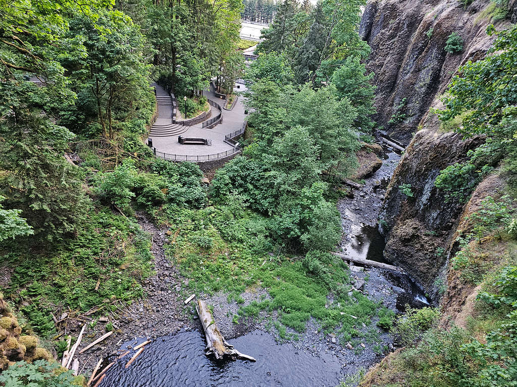
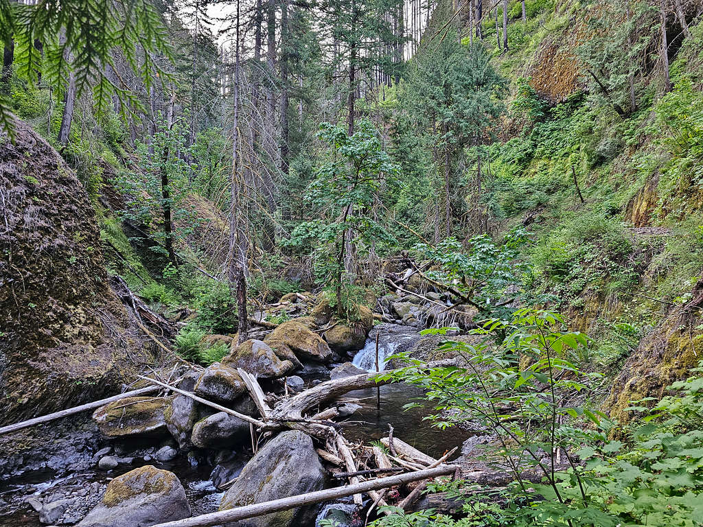
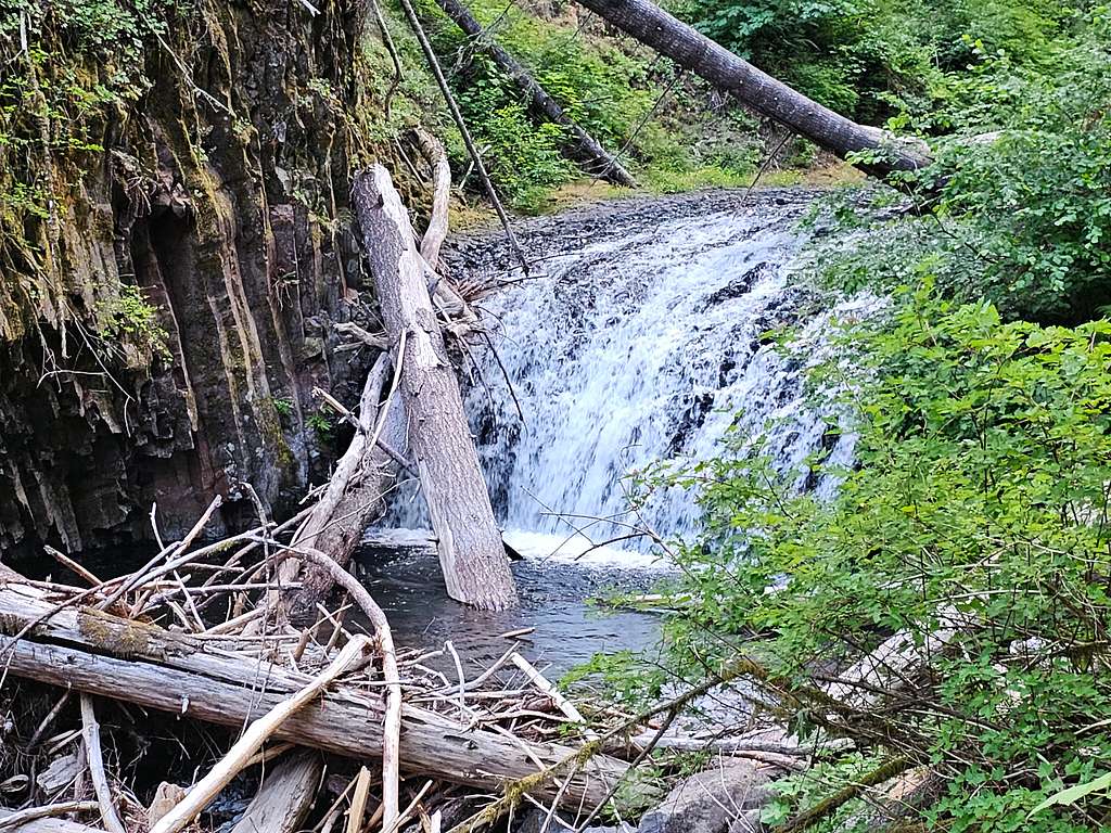
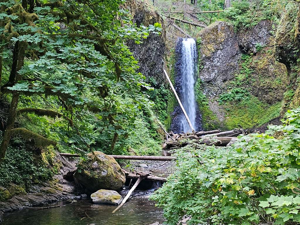
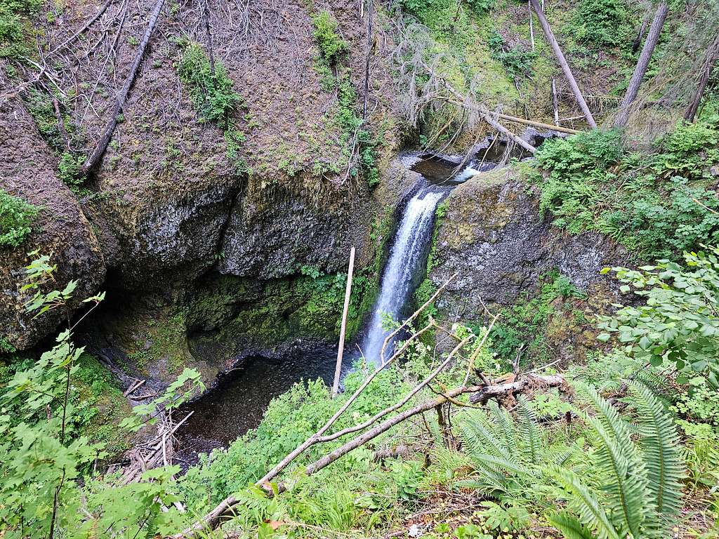
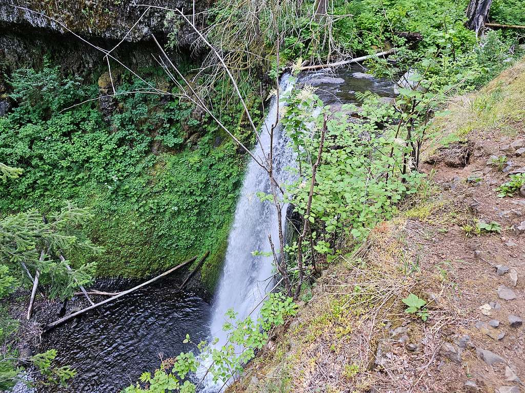
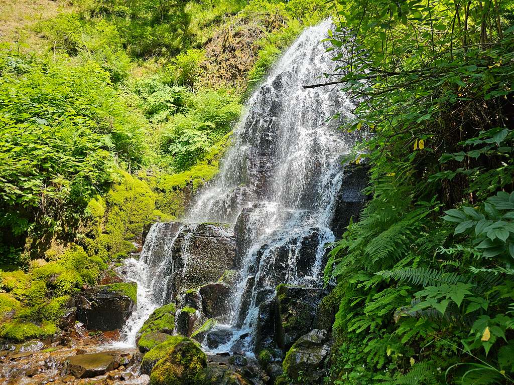
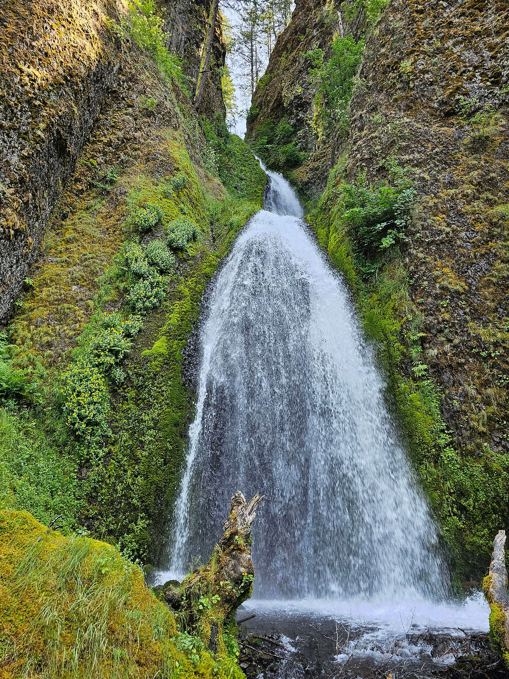
Went back to the main trail. The pavement ended and I entered a nice cool gorge. More waterfalls in the gorge.
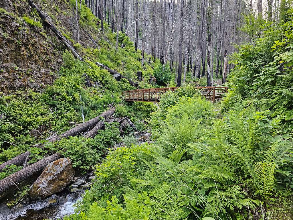
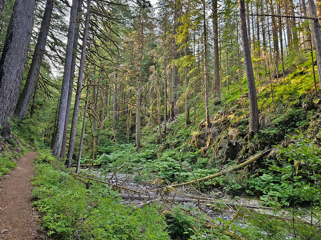
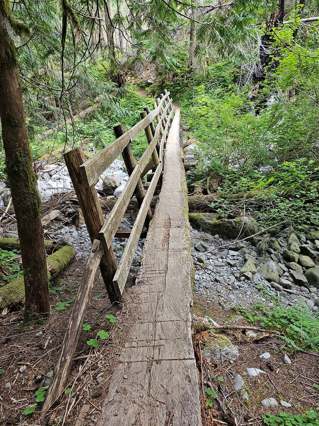
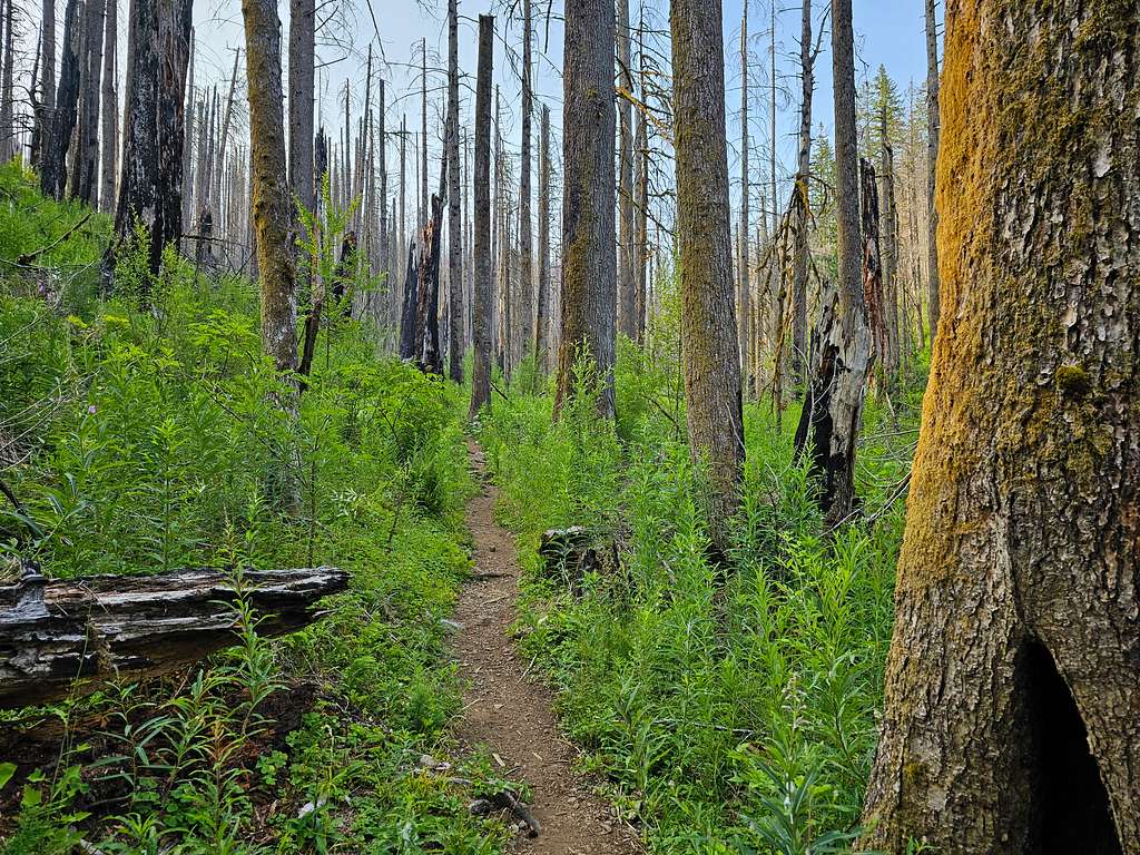
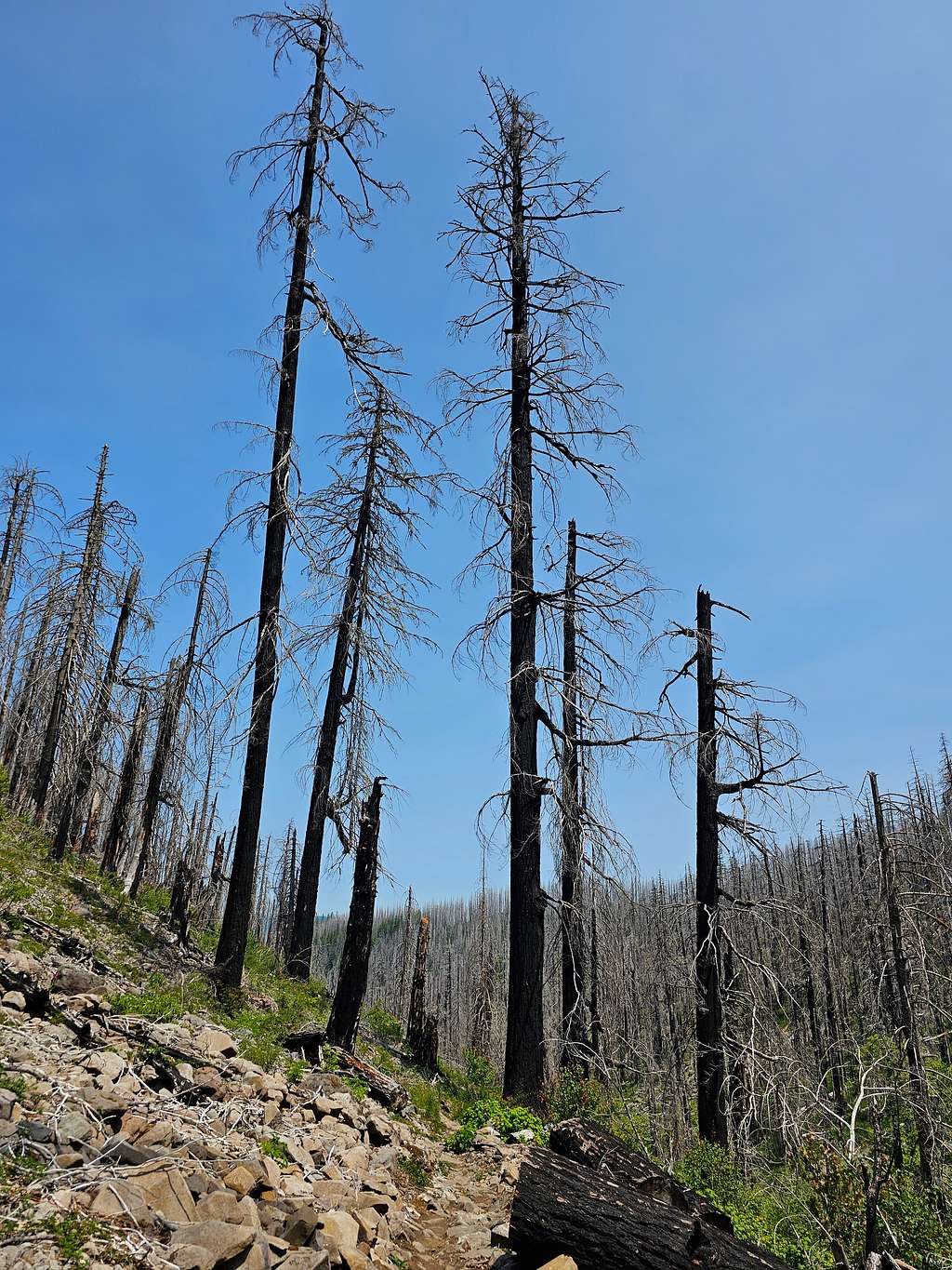
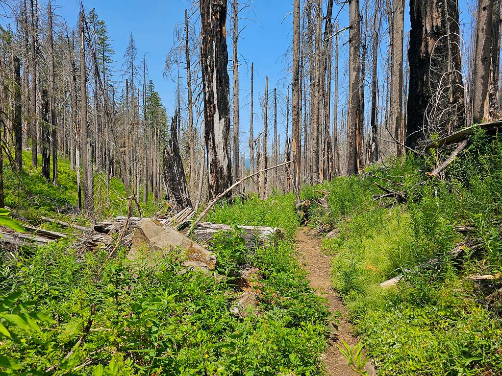
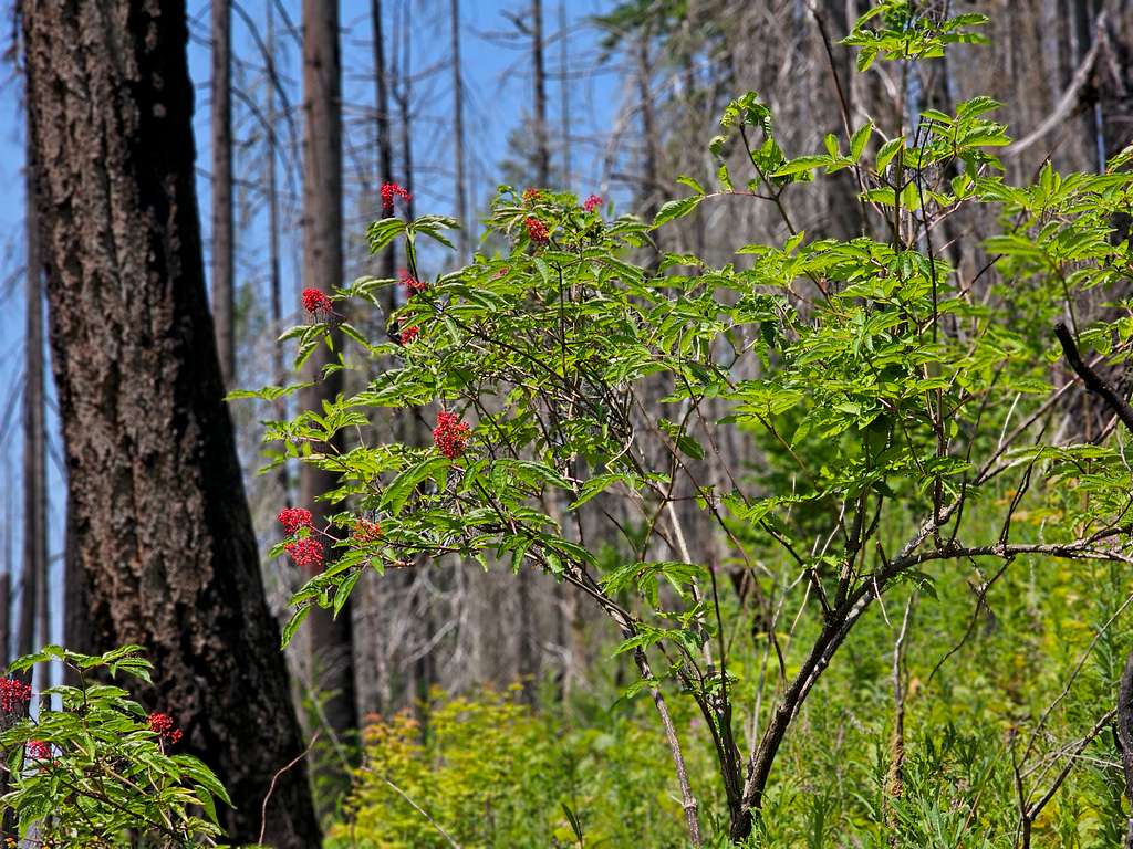
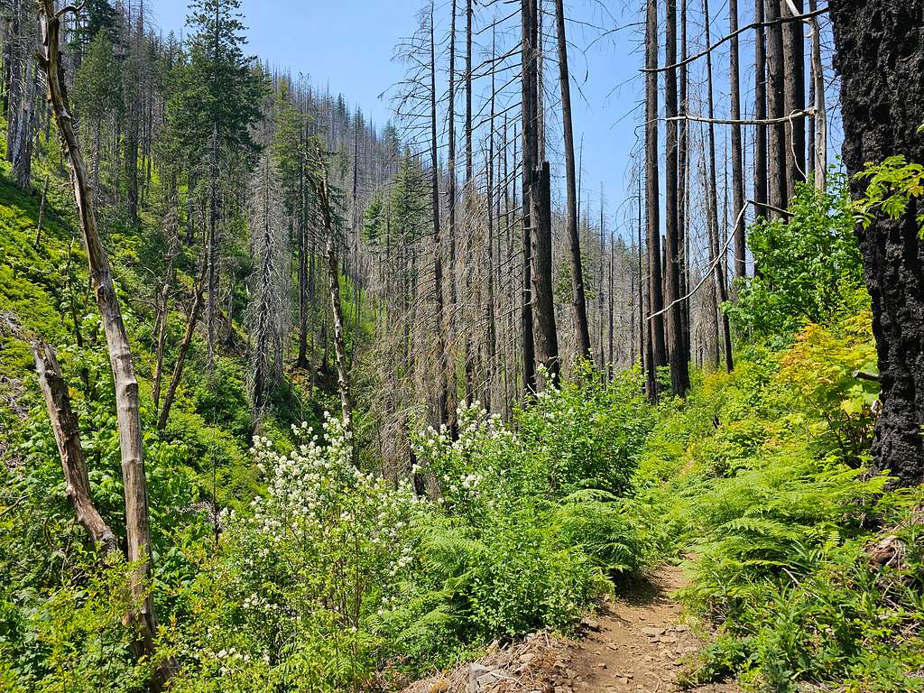
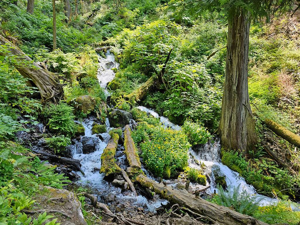
At 3.1 miles and 1150 ft, I reached the junction with Wahkeena Trail, where I planned to go on the return leg of my hike. Continued up Multnomah Creek Gorge on Larch Mountain Trail. Soon I was in a forest of burnt standing trees getting concerned about hot sun exposure later in the day. At that hour, however, I was still in the shade. Bridge over the creek.
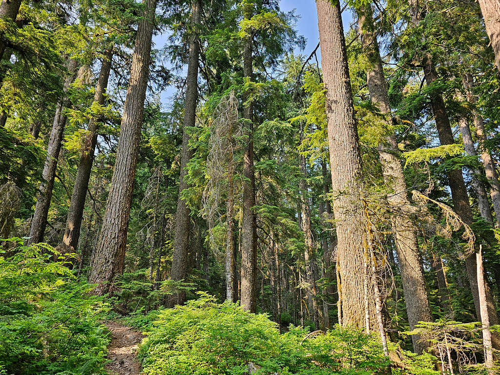
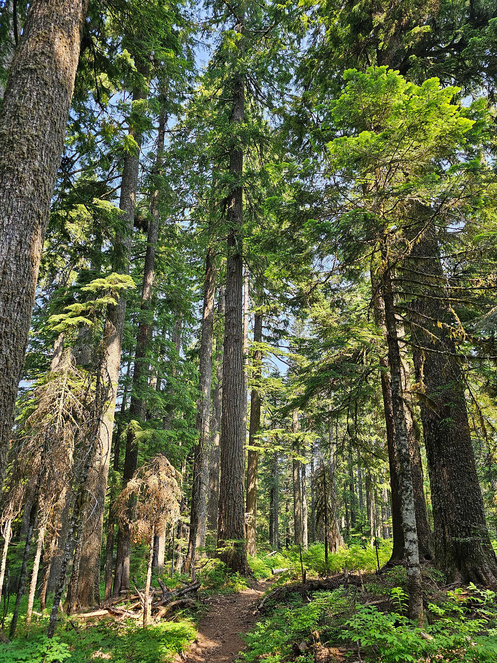
Was glad to enter an area of intact forest at around 1550 ft elevation.
Another bridge.
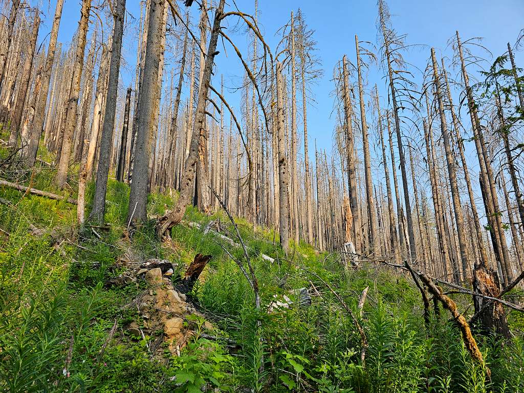
At 2200 ft, I was back in the burnt forest. Crossing another bridge, I got onto a slope where the sun was shining on me. The trail took me far above the bottom of the valley away from where the creek ran.
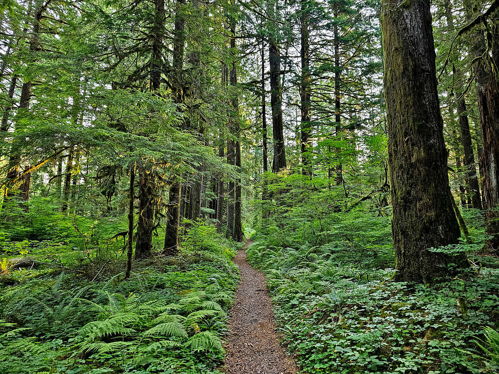
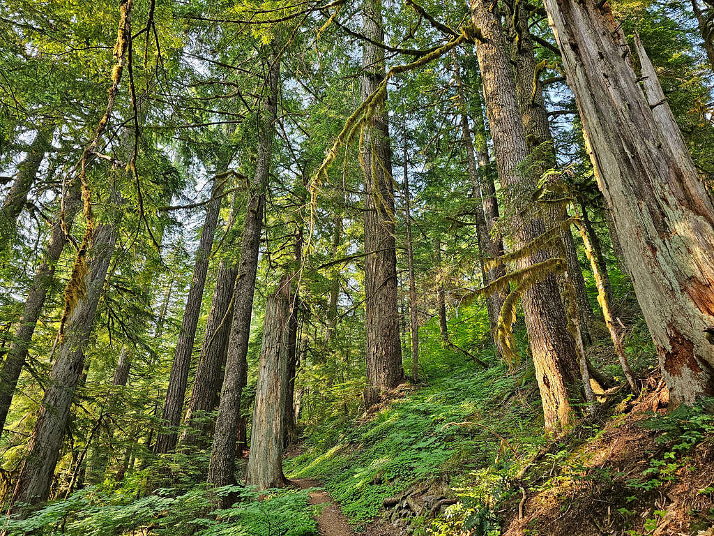
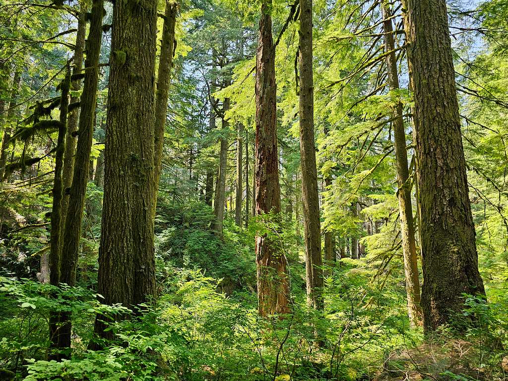
At 2600 ft elevation, I was back in an unburnt forest which continued all the way to the summit. The trees at that spot appeared primeval. I was filled with joy.
Was up to around 2900 ft when I saw a person coming down the trail and shortly after that a couple of hikers coming down. Those were the first people I had seen all day. I knew that I was getting close to Larch Mountain Road.
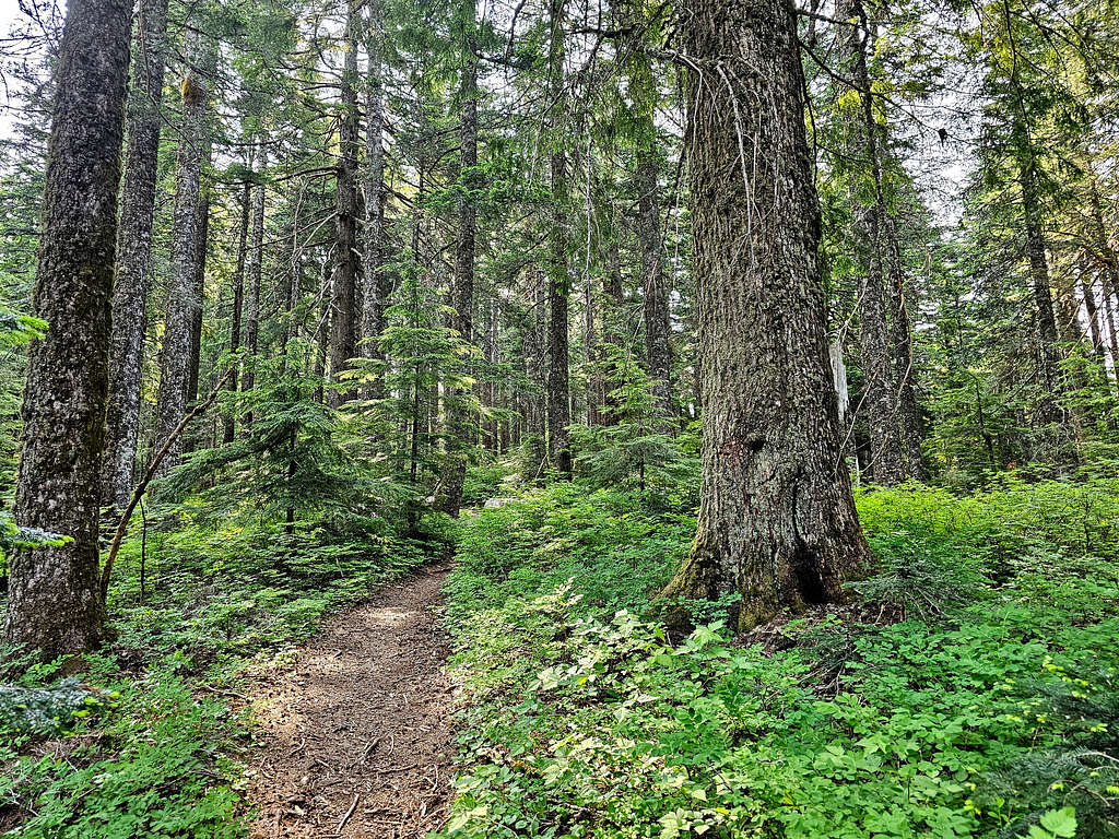
An absolutely beautiful spot with tall trees.
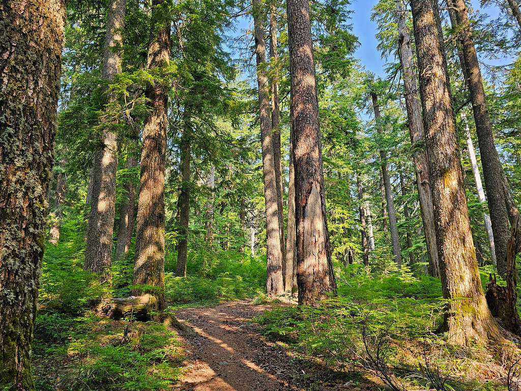
After 6.8 miles of hiking and at an elevation of 3200 ft, I reached a connector trail that went a short distance to reach a trailhead on Larch Mountain Road. Talked to a group of people who had come from there. Did not see anyone after that again until I was on the summit. Continuing up, in some places, the trees appeared old growth.
The forest blocked my view of the summit. At an elevation of 3950 ft, I reached a trail junction. Straight probably went to the parking area at the end of the road. I turned left going toward the summit.
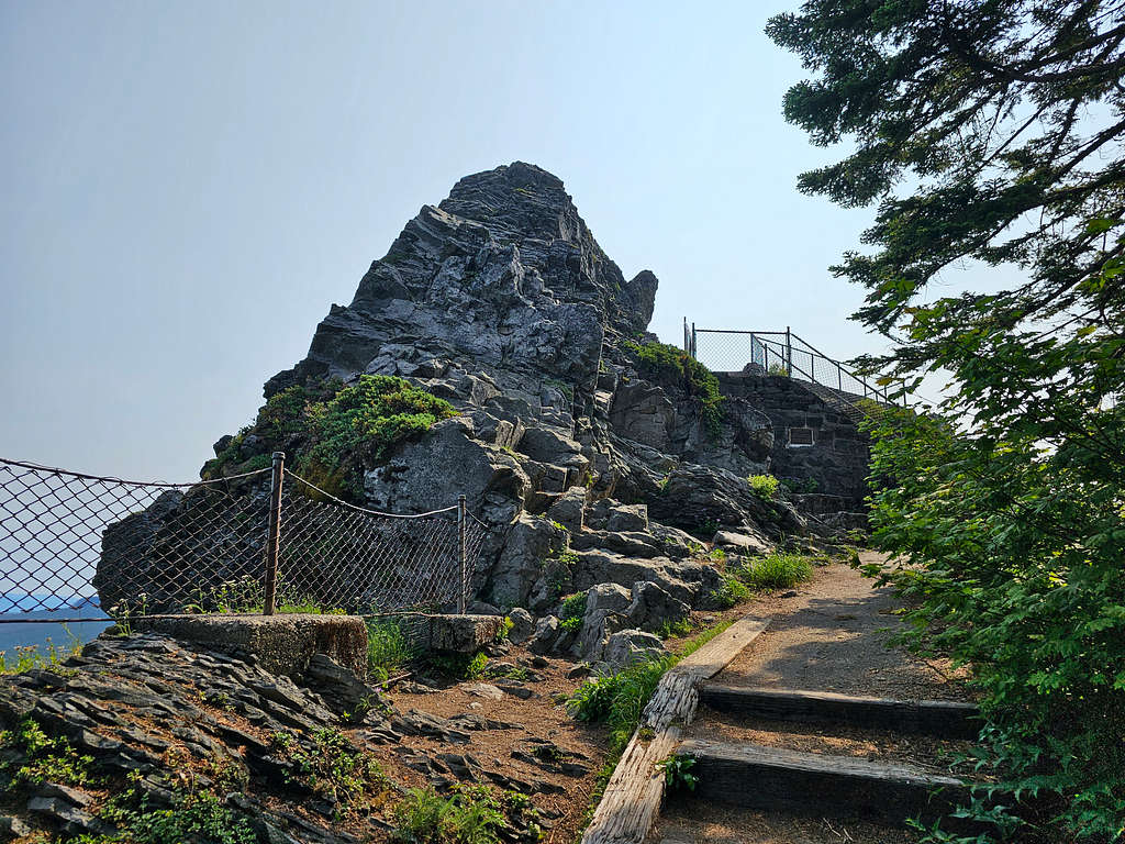
Got onto a walkway that took me toward an observation deck on top of a cliff known as Sherrard Point.
On the very top, I was expecting to see a lot of people who had driven there but to my pleasant surprise, nobody was there. How many times could I get lucky today? It was 10:00 AM, 4055 ft elevation and I had hiked 8.5 miles. Smoke from the wildfire unfortunately blurred the views.
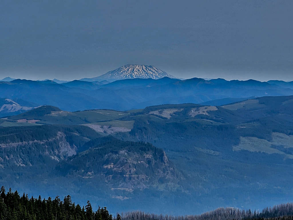
Zoomed and un-zoomed view of Mt. St. Helens.
Mt. Rainier was too far and there was too much smoke. I took a zoomed picture, but it came out too blurred to post here.
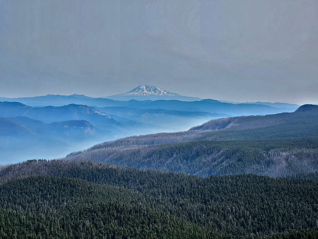
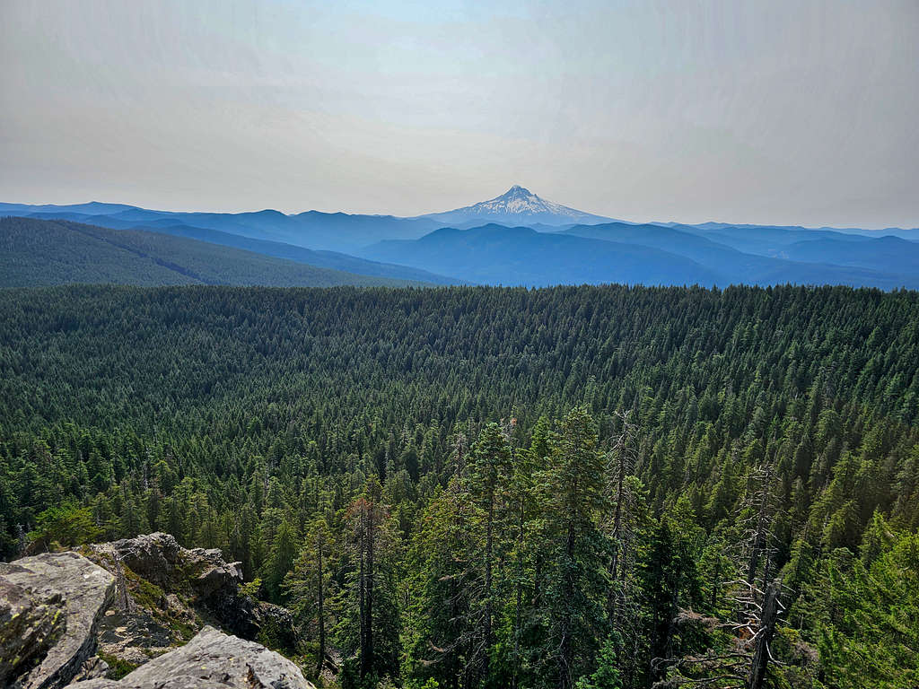
Mt. Adams and the smoke-filled Columbia River Gorge. The cliffs of Table Mountain that I hiked two days prior to this hike and Hamilton Mountain (that I hiked 3 days later) seen.
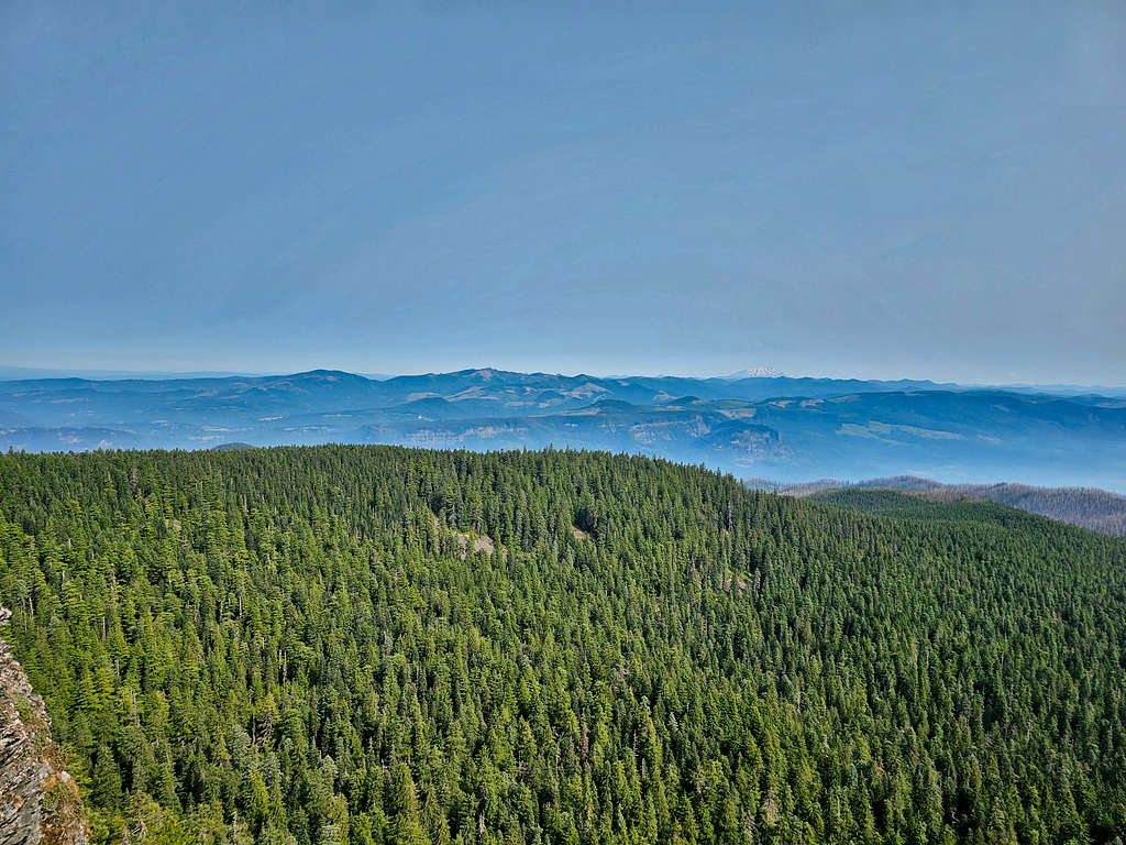
Views of Mt. Hood.
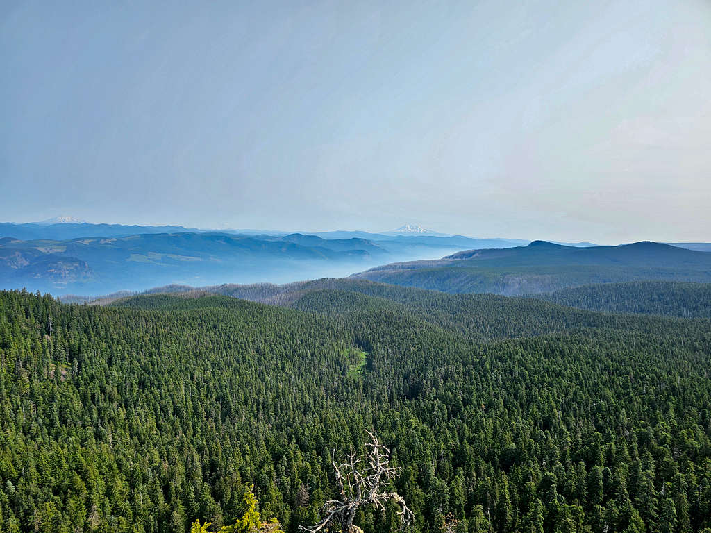
Mt. Jefferson came out blurred too.
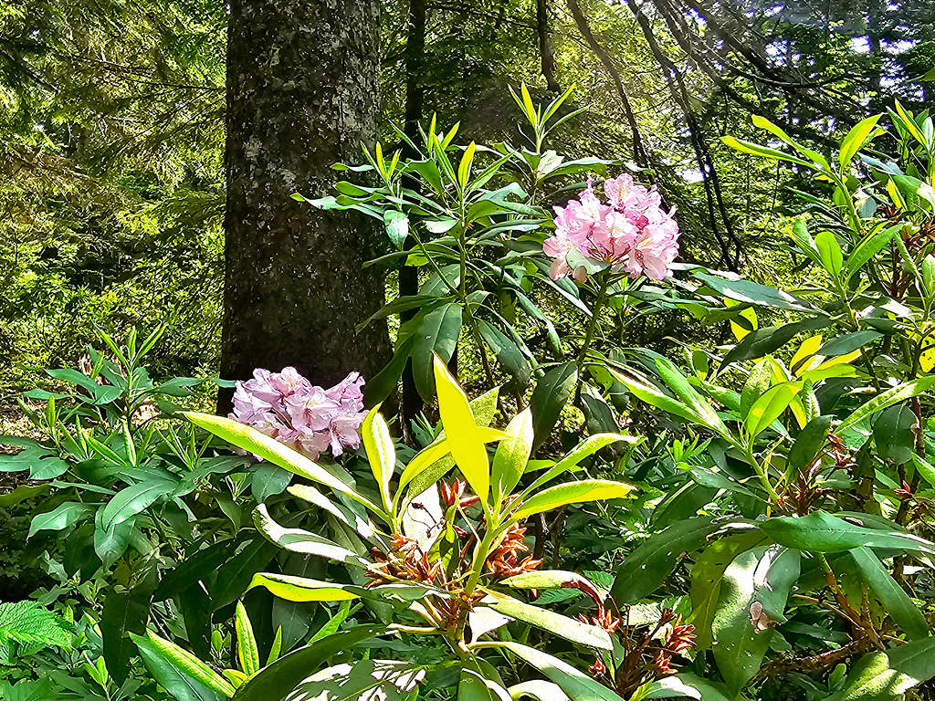
Soon a couple of people came. I left the deck and went down a few steps to sit under a tree to have my lunch. Over the half hour that I was there, only 3 couples came and went. Left at 10:32 AM retracing my way down the mountain. Really enjoyed the forest. At 3200 ft, at the junction with the spur trail, ran into 2 groups of people but after that, I again did not see anyone until I was on Wahkeena Trail. At 2600 ft, before entering the burnt forest, I sat down to eat and enjoy the primeval trees.
Under the hot sun in the burnt forest. Once I reached the creek at elevation of 2100 ft, I washed my face and soaked my hat, arms and legs.
The small stretch of unburned forest was a relief.
Burnt forest again. I cooled down in the creek two more times.
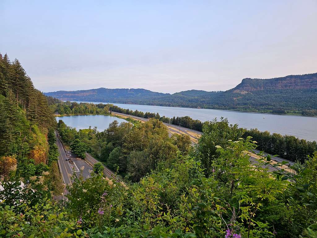
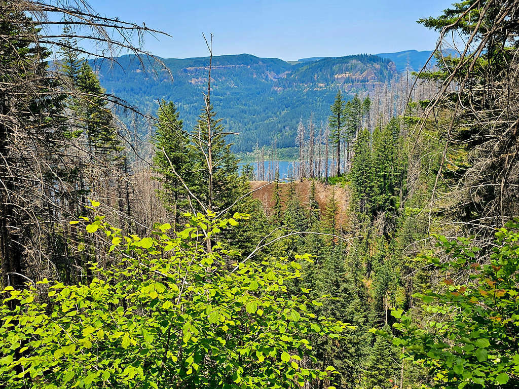
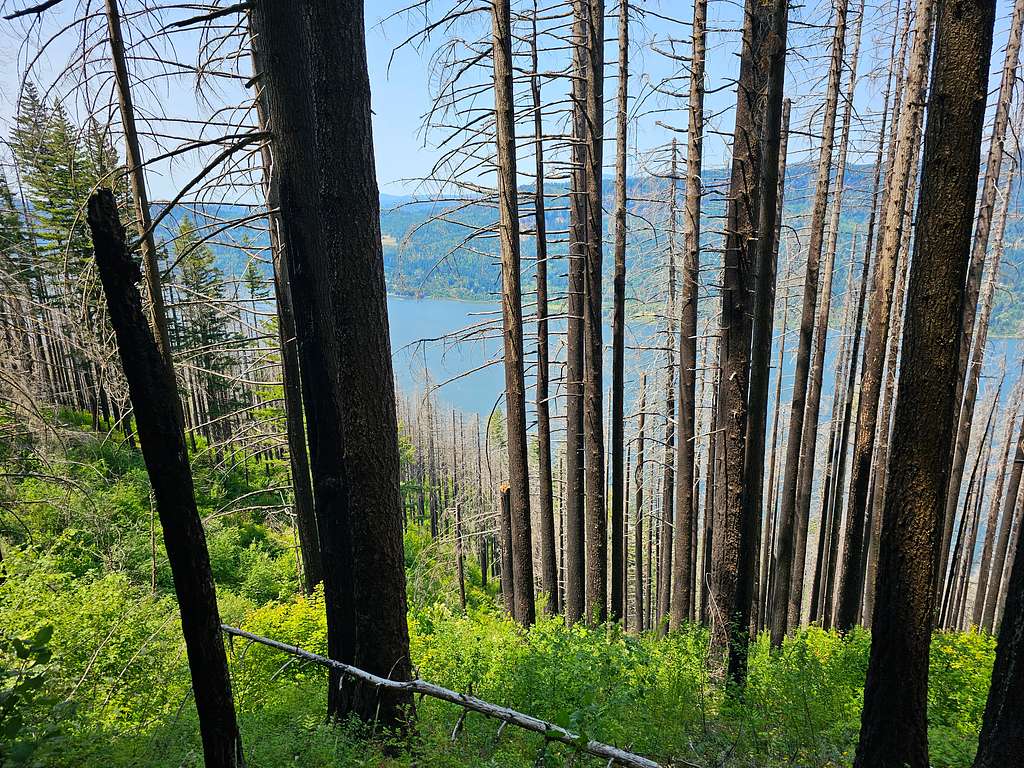
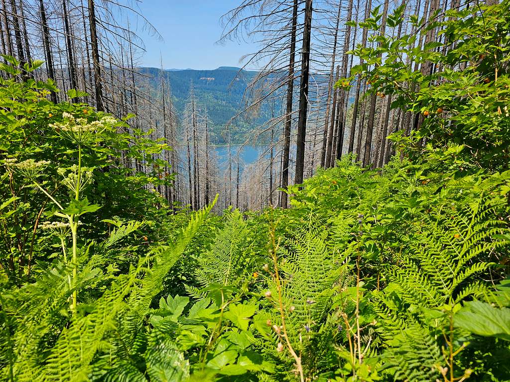
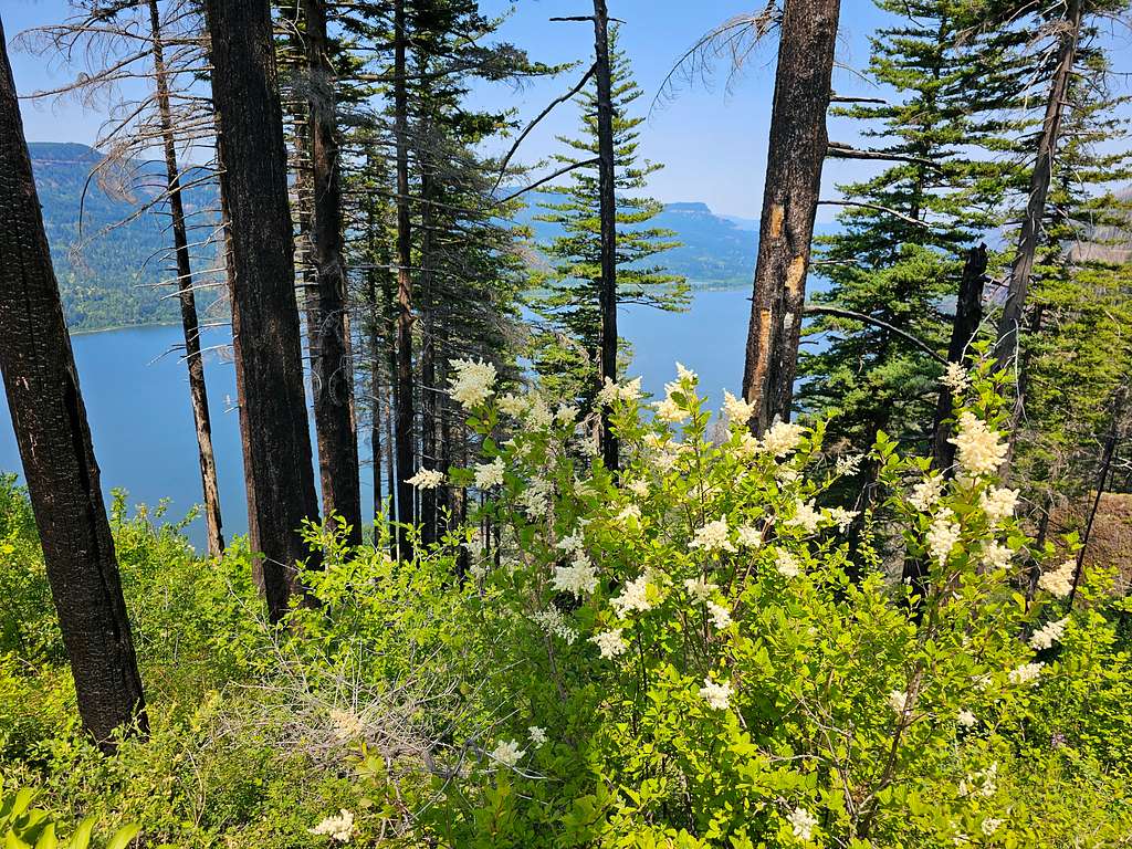
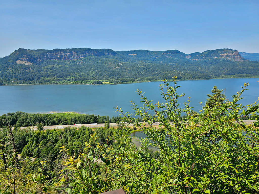
At 1:44 PM, 14.0 miles and 1150 ft elevation, I reached the junction with Wahkeena Trail. Left Larch Mountain Trail and began to follow Wahkeena Trail which went up 350 vertical feet taking me out of the Multnomah Creek Canyon. Views of Columbia River appeared. I also began to run into people every now and then.
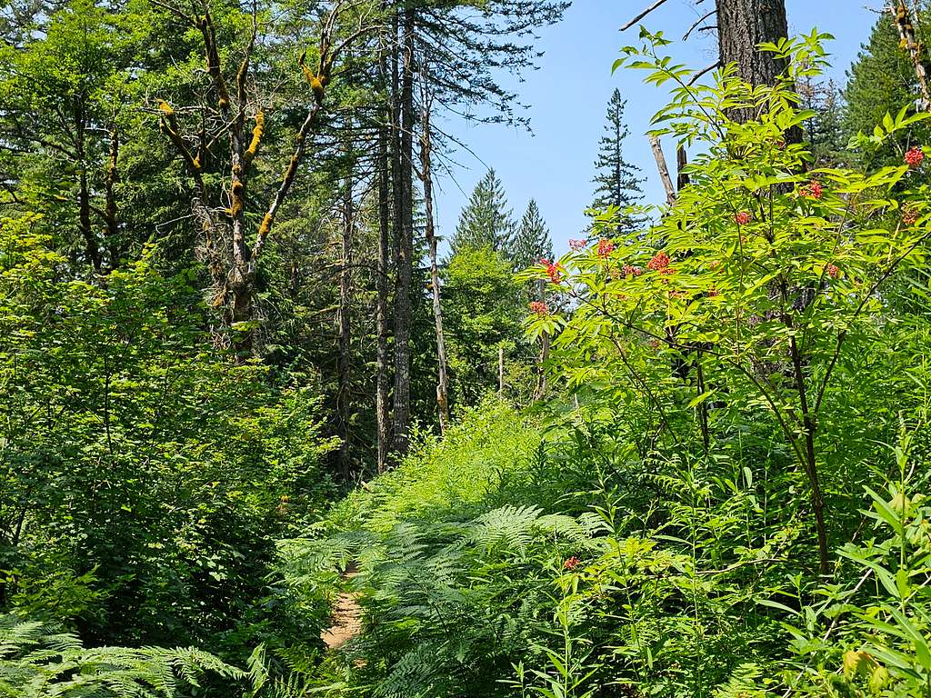
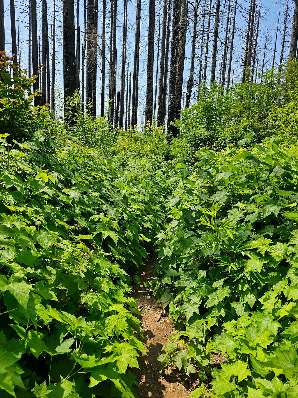
Overgrown trail.
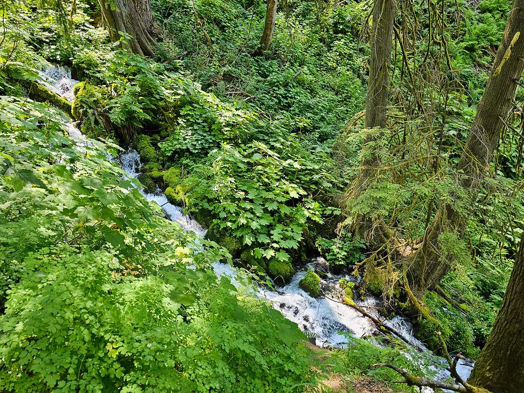
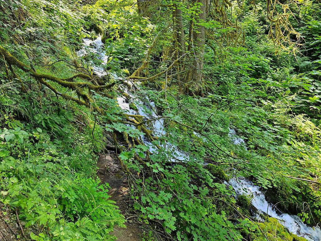
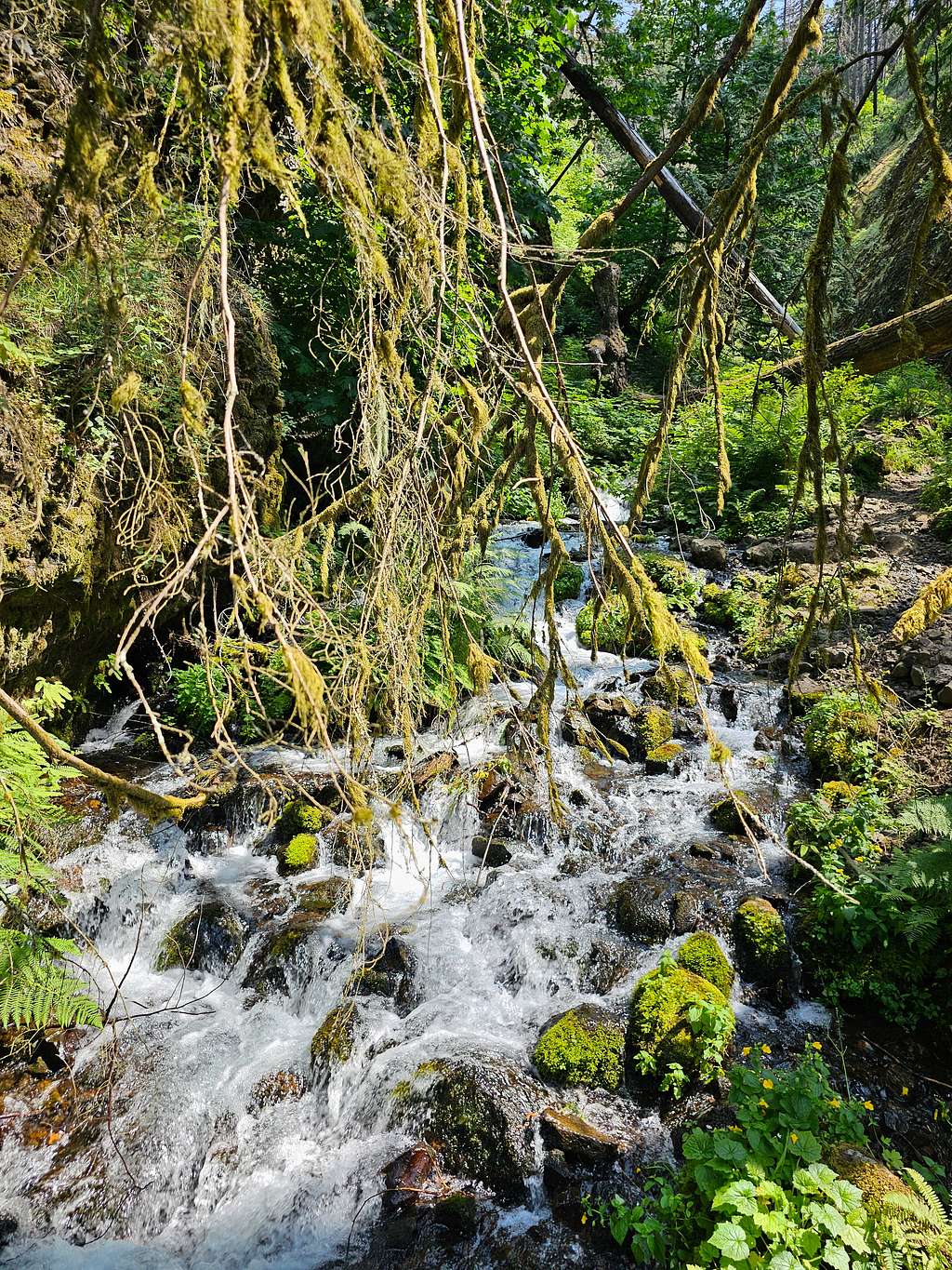
Began to go downhill until I was at the bottom of Wahkeena Creek Canyon, a lush canyon with an almost continuous series of falls/cascades.
At 16.15 miles and 600 ft elevation, I reached Lemmons Viewpoint.
The trail became paved and began to make tight switchbacks going down a steep forested slope until I was at the base of Wahkeena Falls.
Shortly after that, at 3:27 PM, I reached my car at Wahkeena Falls Trailhead. Was very happy that I had done such a long, beautiful hike.