
-
 602 Hits
-
 80.49% Score
-
 12 Votes
|
|
Canyon |
|---|---|
|
|
46.56186°N / 13.10892°E |
|
|
Hiking |
|
|
Spring, Summer, Fall |
|
|
- The name is in some sources written also Las Callas or Las Caläs.
- This page could also be a route page or simply only one chapter on the page of Monte Zermula.
Overview
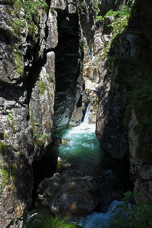
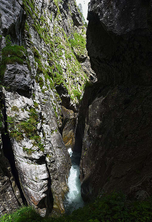
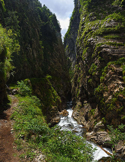
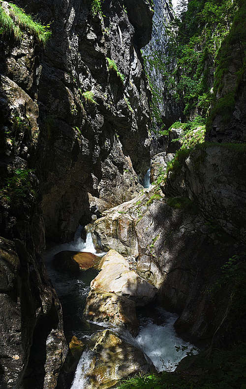
In Carnic Alps there are many spectacular gorges - in the Austrian and in the Italian part. To the landscape beauty, the area adds also incredible geological features. The rocks of the Carnic range are up to twice as old as for example the rocks of Dolomites or some other Southern Alps. Las Callas is wild, very narrow, with vertical rocks up to 200 m tall. But running in the N-S direction, it's also lit by the sun - on a nice day, of course. And last but not least, the gorge is attractive due to its easy, safe secured trail. It's very exposed but suitable for every visitor not suffering from vertigo.
|
|
|
Geografic Outline And Geology
Torrente Chiarsò (creek) is the main water stream, flowing from below the main Carnic crest southwards and through the town of Paularo. Where it cut its way between the massif of Monte Zermula (on the east) and Monte Dimon (on the west) the narrow gorge was made. But I guess it's not the product of only erosion by water, but must be also a geological fault, as the rocks of the two named massifs are completely different. Las Calas gorge is only the most narrow part of the canyon, in the length of some good 500 metres. Above and below it, the valley is narrow and nice, but far from being so spectacular.
During the walk we can observe interesting rocks. Already on the descent we shall pass crags, formed of late Devonian limestone. In the gorge, there are more of those rocks. A bit younger are the slates of Hochwipfel formation which we see best when leaving the gorge in its upper part. Interesting are also strongly folded layers of rocks, indicating huge forces, acting in the course of the Hercynian (upper Carboniferous) and the Alpine (still in course) orogeny.
The History
For the people of Paularo the small town in a sunny, very remote mountain cauldron, the trade route along the Chiarsò creek was always important. Over the Passo del Cason di Lanza now a narrow mountain road runs. It's always a challenging drive, connecting Paularo and Pontebba. In the past it was a trade route, which the people of Paularo so bravely defended against the Turkish raids.
But the Chiarsò creek was important also because of its water power. On the place called Stua Ramaz, a bit above the Las Calas gorge, people were collecting big amounts of logs and also holding the water of Torrente Chiarsò. Then they let all the logs go down by the rushing water, all the way to Paularo. Have in mind that, when observing the narrow gorge! Also the toponym (Las Calas) owes its origin to the fact that woodcutters descended those walls with ladders and ropes to free the trunks which, cut in the mountain woods, were transported downstream by the waters of the Chiarsò.
Then in 1950 plans were made to build a dam for a power plant on the creek. Fortunately those plans were not realised. But workers already did cut an artificial ledge through the gorge. Nowadays it serves to hikers.
Getting There

We park (for free) at the ex Nelut restaurant, at 1102 m, on the road Paularo - Passo del Cason di Lanza. To Paularo we drive from the south from Tolmezzo by the valley of the river But and then to the right (towards the NE) by the Incarojo valley (of Torrente Chiarsò). The approaches from the other sides, from Pontebba and from Paluzza, are much longer.
From Paularo we continue by the narrow road northwards - to the parking place on Plan di Zermula.
Coordinates: 46.56382094648182, 13.11477190613856
Route Description
Difficulty grading on the Swiss Hiking Scale: T3/T2. It's really easy, T2, the T3 grade may be there only due to exposure. Time for the whole round tour: 1.5 - 2 hours. Marks: 442c. Gear: You can do the tour in sport shoes, if slippery, sturdy hiking shoes are better. In winter conditions: Normally the tour can be done only, when there is no ice on the ledge. In hard winter better don't go there, in any case consider the proper winter equipment! Orientation: It's just easy, see the embedded online map. Best day time: Around noon. From the parking lot we go a few minutes more towards the north by the main road. Two marked trails deter from the road to the left down into the Chiarsô valley. I recommend you take the first one, so that you will do the round tour in the clockwise direction. On a sunny day you will have (around noon) the sun behind you back when hiking. A good, marked trail descends southwards down. On some 905 m we reach the trails branching. To the left goes the trail No. 442 to Paularo, while we keep right, descending all the way down to the creek - on some 880 m. There the trail turns to the right and starts ascending along the creek. We need some 5 minutes to reach the lower mouth of the gorge. There the trail ascends steeply, until reaching the distinct artificial ledge. It goes all the time high above the creek, by the eastern side. It's very exposed, but broad, safe and comfortable. Through the gorge you will need some good 30 minutes - or more due to admiring and photographing the scenes. The gorge ends on the altitude of some 950 m, where the trail is able to start climbing up the forested slopes. These are still quite steep, so also there the path is secured by a few cables. Carefully when slippery, even if the path is wide and well beaten. In some 25 minutes you gain the road, turn right and walk southwards to the parking place. |