Toggle navigation
Mountains
Routes
Images
Trip Reports
Forum
What's New
People
Areas & Ranges
Articles
Trailheads
Canyons
Huts & Campgrounds
Albums
Logistical Centers
Fact Sheets
Lists
Custom Objects
Gear
Plans & Partners
WELCOME TO SUMMITPOST
SIGN IN
REGISTER
Laurel Creek Trail
Additional Parents
Image
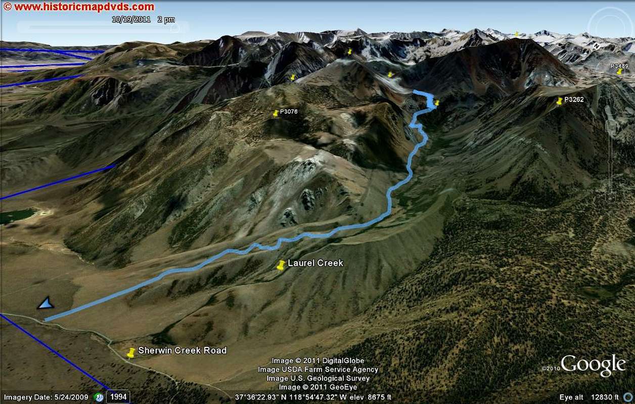
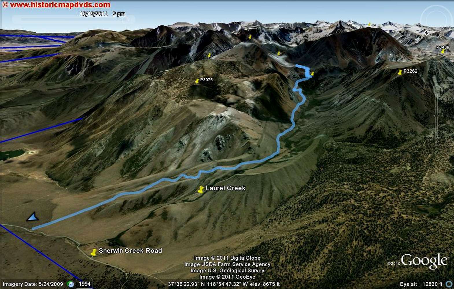
Laurel Canyon - Google Earth
View High-Resolution Image
Laurel Canyon - Google Earth
Google Earth rendition (part 1) of the Laurel Creek trail near Mammoth Lakes.
« PREV
NEXT »
SoCalHiker
on
Nov 11, 2011 2:31 pm
Comments & voting
Other parents
Image Type(s):
Hiking
Image ID:
759445
3002 Hits
75.81
% Score
6
Votes
Log in to vote
Comments
No comments posted yet.
to post!
Don't have an account?
Laurel Creek Trail
(Route)
« PREV
Viewing
#24 of 24
GALLERY
You are at
the Last
Image
SoCalHiker's Image Gallery
« PREV
Viewing
#2251 of 3483
GALLERY
NEXT »
My Google Earth Images
(Album)
Loading....
×
You need to login in order to vote!
User Name
Password
Remember me
Forgot your password?
Log me out when I close my browser.
Keep me logged in all the time.
sign in as a user
Don't have an account?
Register now for FREE
Rating available
Suggested routes for you
People who climb the same things as you
Comments Available
Create Albums
Register Here


