
-
 10801 Hits
-
 83.1% Score
-
 16 Votes
|
|
Mountain/Rock |
|---|---|
|
|
38.86630°N / 106.021°W |
|
|
Chaffee |
|
|
Hiking |
|
|
Spring, Summer, Fall, Winter |
|
|
10132 ft / 3088 m |
|
|
Overview
 Mount Antero from FS 376
Like views?
Limestone Ridge serves up delightful views in all directions, but the big-country panoramas of the mighty Sawatch to the west make the effort to reach the rocky outcrops of Limestone Ridge more than worth your while.
Limestone Ridge is an approximately 3-mile long hockey-stick shaped mountain east of Buena Vista, Colorado. Along the spine of this mountain are four humps rising above 10,000 feet, with the highest of these being the hump furthest to the north. The true summit is indistinct, difficult to locate on the broad summit plateau, but the sheer southwest-facing cliff bands provide for dramatic views of the surrounding landscape.
Colorado Rank: 2236th highest peak in Colorado
Prominance: 392 feet
USGS Quad: Buena Vista East
Trails Illustrated Map*: #129 (Buena Vista / Collegiate Peaks)
Rank & Prominence: Lists of John
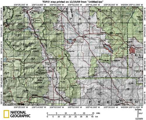
*The area surrounding Limestone Ridge is not completely covered by Trails Illustrated Map #129 (the eastern reaches, including the bottom of the hockey stick of the mountain, are cut off the map). As a result, a custom map (from National Geographic Topo or MyTopo, for instance) is recommended.
Getting There
of Buena Vista, Colorado, in the San Isabel National Forest.
Red Tape
 North toward Buffalo Peaks
 Looking south from Limestone Ridge
There is plenty of private property, including the Newett Quaries, on the gentle eastern slopes of and approaches to Limestone Ridge from FS 309. Save yourself the hassle and approach the peak via the Forest Service land surrounding Limestone Ridge to the west and north. There are no use fees to enjoy this area.
Camping & Lodging
 Sawatch Views from FS 376
 North across the summit plateau
 West from the summit area
Near the mountain
There is a rustic camping area at the junction of FS 305 and FS 376. Note that this is a dry campsite, meaning you must haul in all of the water you will need for your stay. Additionally, this is a moderately high-traffic 4x4 area in the warmer months, so set your expectations for solitude accordingly.
Arkansas Headwaters Recreation Area Campgrounds
The AHRA operates six campgrounds in the Arkansas River valley, two of which are located in reasonable proximity to Limestone Ridge. Be aware that these campgrounds are popular with white water rafters in the warmer months and are used as take-outs / put-ins for boaters.
Railroad Bridge Campground
North of Buena Vista on County Road 371
• 14 campsites (each consists of tent pad, fire grill and table)
• Two vault toilets
• Two changing areas
Ruby Mountain Campground
South of Buena Vista on County Road 300 via CR 301
• 22 campsites (each consists of tent pad, fire grill and table)
• Four vault toilets
• Two changing areas
Buena Vista hotels, B&Bs, cabins and commercial campgrounds
A variety of lodging options are available in the nearby town of Buena Vista, skewing toward the simple and affordable. Visit the Colorado Vacation Directory Buena Vista page or the Trip Advisor area guide for more details.
 Regal Mount Princeton
Weather & Seasons
 Sawatch views from the norther slope
 Antero & Princeton from northern slope
This moderate elevation peak is a year-round objective.
Fall: Autumn would be a perfect time to visit this peak, when the Aspen are ablaze in bright golds against the blue Colorado sky and the summertime crowds have begun to wane. Be mindful of elk hunters in the area and wear bright colors for safety.
Winter: Limestone Ridge makes a delightful snowshoe outing. The earlier in winter you visit the further you will be able to drive, meaning the shorter the walk will be. For the most part, you should find you have this area all to yourself in the winter. Be mindful of elk hunters in the vicinity and wear bright colors for safety.
Spring: Deep and rotten late-season snow could make Limestone Ridge an arduous outing in the Spring.
Summer: This lower elevation area east of Buena Vista gets somewhat hot and sun-baked compared to the high country to the west. Crowds of off-roaders and mountain bikers will thicken and the seasonal opening of the Lenhardy Cutoff (FS 376) would make the hike to the summit almost silly short.


Sweet canine companion Lela (100 pounds / 45 kilograms)
at the saddle between Limestone Ridge and UN 10350.