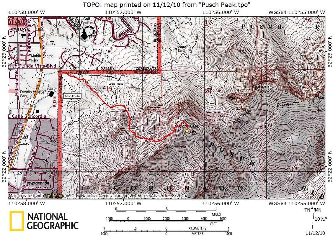
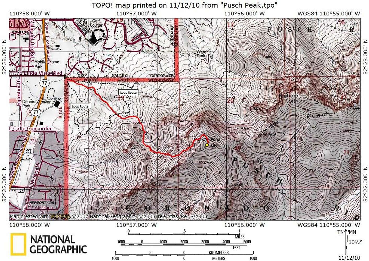
This route starts on a gentle walkers trail, then forks off on its own steep climbers’ route to ascend a canyon. The route is entirely on-trail, but upon forking off and leaving the desert trail, the route is steep, narrow and rocky, gaining most of the 2,700 feet total vertical gain in the final 1 ½ miles.
Map designed November 2010


