
-
 5604 Hits
-
 78.27% Score
-
 9 Votes
|
|
Route |
|---|---|
|
|
32.37200°N / 110.939°W |
|
|
Hiking, Scrambling |
|
|
Spring, Fall, Winter |
|
|
Most of a day |
|
|
Class 3 |
|
|
Overview
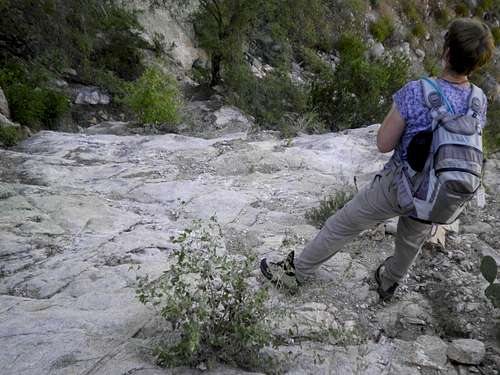 This section is steep, but the YDS rating can be kept to 2+ with careful route-finding.
This route starts on a gentle walkers trail, then forks off on its own steep climbers’ route to ascend a canyon. The route is entirely on-trail, but upon forking off and leaving the desert trail, the route is steep, narrow and rocky, gaining most of the 2,700 feet total vertical gain in the final 1 ½ miles.
The beauty of this route is how quickly it carries you into peaceful wilderness. One minute you are parking your vehicle in the suburbs of Tucson, Arizona. Soon you are strolling through delightful Sonoran desert scenery. After just a few minutes of travel, upon reaching the turnoff, you begin a steep climbers trail up a canyon. Rounding a corner, the city and suburbs seem to melt away and it’s just you, the canyon and Push Peak.
• Roundtrip Distance: 4 miles
• Elevation Gain: 2,700 feet
Getting There
 Trailhead Map
Follow the dark/solid pink trail across the desert floor to the mouth of the canyon
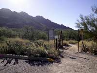 At the trailhead
From I-10
• Take the Ina Road exit (#248) northbound.
• Turn left / head north on Oracle Road
• Turn right on Linda Vista Road (at stoplight)
• Travel only ¼ mile west on Linda Vista to a small parking area on your right
Note: The Linda Vista trailhead has only a few parking spots, but is paved and suitable for all passenger vehicles except very long trucks.
Route Description

 Lower reaches of trail
 Turnoff into the canyon
 Looking up-canyon
 Canyon walls loom above
The desert floor here provides a system of gentle hiking trails that generally form a loop. There is a simple trail map at the trailhead. Trying to describe every twist and turn of this well-trod, but mostly unmarked trail system, would do more harm than good. Your job at this stage is the follow the main trail across the desert floor heading southeast toward the mouth of the canyon.
• Keep your eyes open for a rusted, blank metal sign at the head of a rugged trail. This is your turnoff. From here it is roughly 1 ½ miles to the summit of Pusch Peak.
• Follow this rugged but mostly obvious trail as it winds up the west side of the canyon.
• Less than a mile after your turnoff, stop to admire a smooth desert pour-off in the center of the canyon.
• Continue above the pour-off on-trail, as the canyon eventually gives way to the slopes of the greater Push Ridge structure.
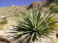
• The trail begins trending east, contouring below the ridge, carrying you across a fantastic desert rock garden of cactus and shrubs.
• The trail continues climbing to the rocky, wide-open summit of Pusch Peak. The views from here are astounding!
 Nearing the summit Nearing the summit |  Descending from Pusch Peak Descending from Pusch Peak |  Descending back to the trailhead Descending back to the trailhead |
Essential Gear
 Upper slopes of Pusch Peak
 Upper reaches of Pusch Peak
• Plenty of water
• Salty snacks
• Sunscreen and a hat
• Some may enjoy the protection of scrambling gloves and low desert gaiters
• Trail map: Green Trails #28865 Santa Catalinas