
Comments
No comments posted yet.
|
|
Trip Report |
|---|---|
|
|
42.72910°N / 116.1049°W |
|
|
Download GPX » View Route on Map |
|
|
Apr 29, 2021 |
|
|
Hiking |
|
|
Spring |
Little Jacks Canyon is one of the many canyons that carve the high desert plains of southwestern Idaho’s Owyhee County. Reaching Little Jacks Canyon requires driving on dirt roads. From the mouth of the canyon at the end of a dirt road, I crossed the canyon and then went 750 vertical feet up the slopes and followed the southeastern rim of the canyon to a random spot where I decided to turn back. I chose the southeastern rim (and not the northwestern rim) because I do my hikes early in the morning. That way, I did not have to look into the rising sun to see the canyon. On the southeastern rim, I ran into free roaming cattle who had littered the area with their droppings. I also came across an unhappy cowboy who had assumed that I was responsible for leaving a gate open while I had nothing to do with it.
I had looked at satellite photos and had entered my planned drive on the roads into my GPS so that I would not get worried about taking the wrong turn on nameless dirt roads.
From the intersection of Route 78 and Mud Flat Road, 2.1 miles southeast of Grand View, Idaho, I turned south onto Mud Flat Road and went 7.5 miles, then turned east onto Shoofly Cut Off Road, a wide smooth dirt road. After 2.6 miles, I turned right (southwest) onto an unsigned two track which did have a fairly decent surface and went over the desert toward the hills to the south. The two track did intersect with other nameless two tracks but I stayed on the main path for 7.6 miles util I turned left (southeast) onto another nameless two track which had a much rougher surface (still did not need to use 4 wheel drive but was driving a rental Jeep Wrangler). After 3 miles, I reached another intersection where I started my hike.
Hike Length: 8.15 miles
Lowest Elevation: 3540 ft
Highes t Elevation:4705 ft
Total Ascent: 1690 ft
I was at the mouth of the main canyon just below the slopes that went up to form the northwestern rim of the canyon but as mentioned above, I wanted to be on the southeastern rim. Knew that the road went further down, a short distance, to near the bottom of the canyon but did not want to drive on a potentially difficult road.
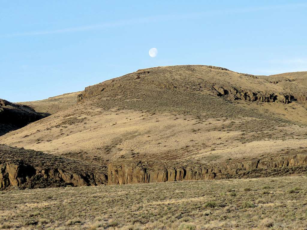
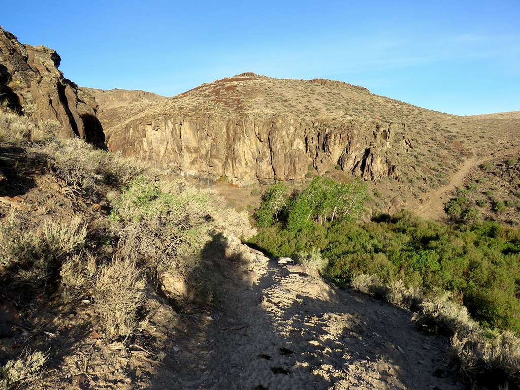
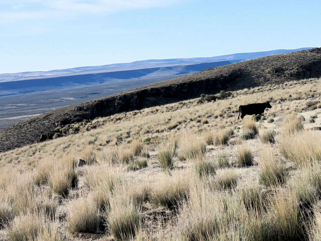
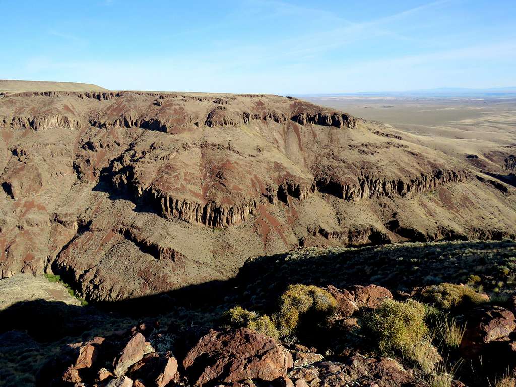
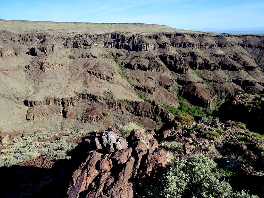
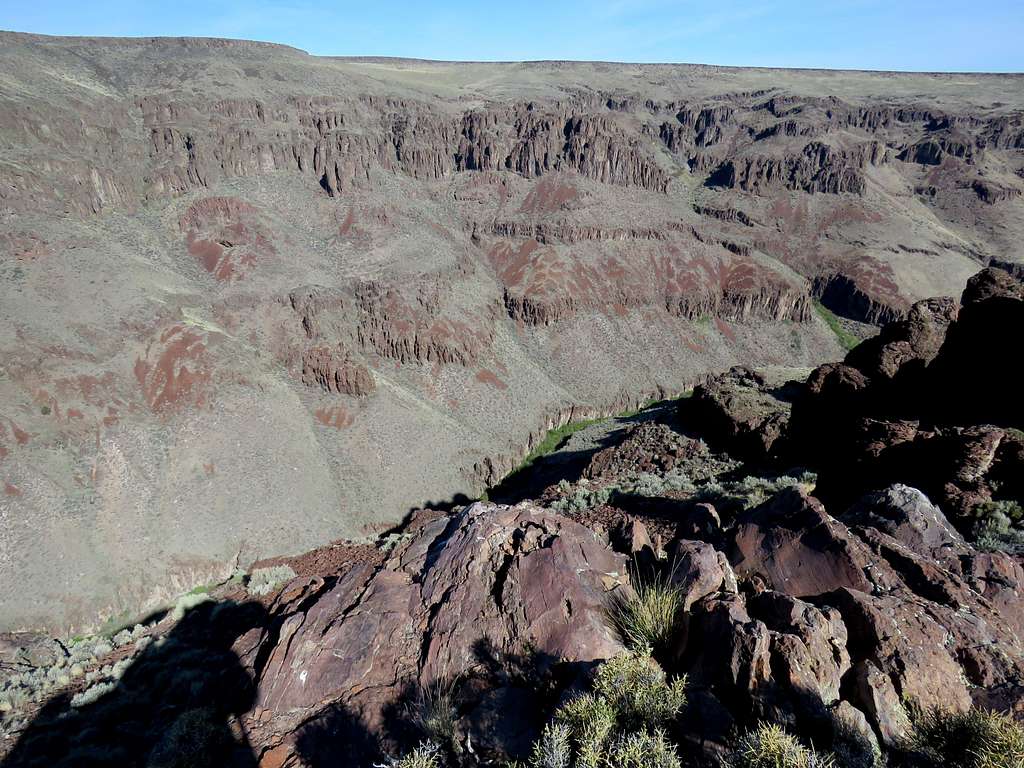
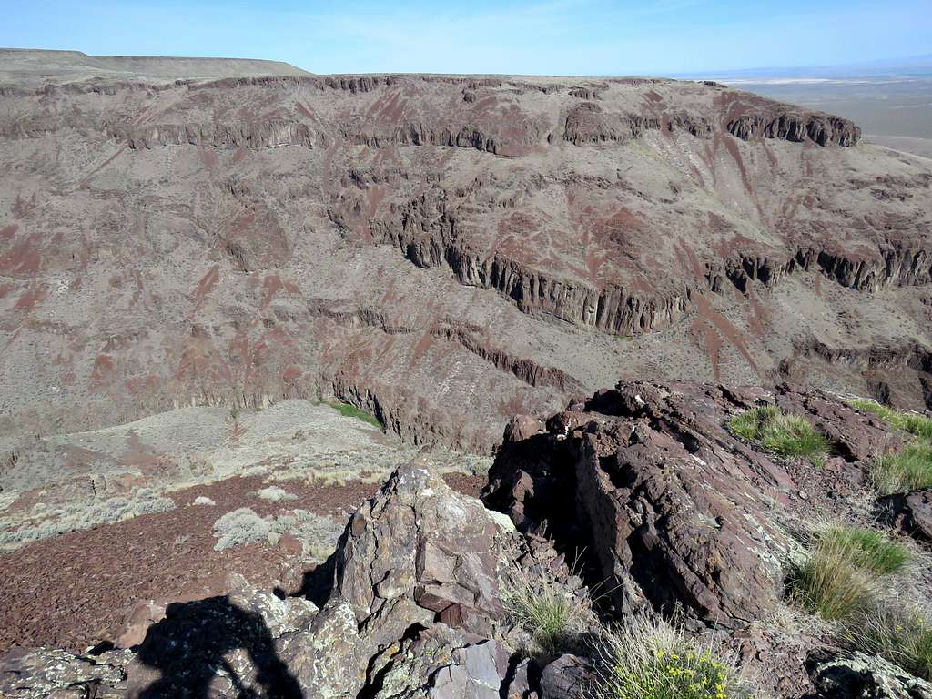
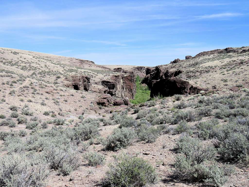
View of the southeastern rim and the slopes that I had to climb.
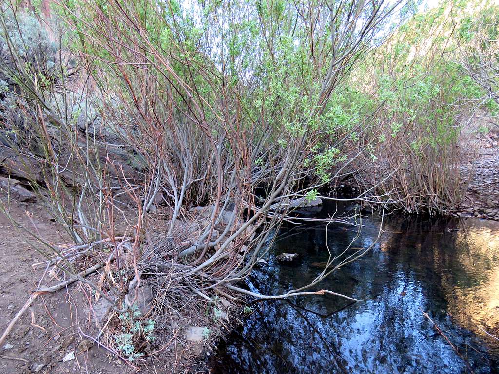
Started my hike at 7:27 a.m. Elevation was 3770 foot and temperature was 52 degrees F. Followed the road southeast going down until the road ended and then got on a trail that went down toward the bottom of the canyon. There was a narrow ribbon of green at the bottom of the canyon in the otherwise yellow-brown desert environment.
Down to 3540 ft elevation, I crossed the stream at the bottom of the canyon.
Then followed a multitude of beaten paths up the other side. Looking back into the canyon.
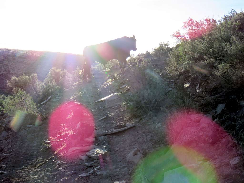
I soon noted large amounts of what I assumed were horse droppings all over the place and wondered why people would go through the trouble of bringing horses to that spot to ride them. I then saw a cow blocking the trail and realized that the droppings belonged to cattle. Despite its big body, the cow was quite timid and ran away.
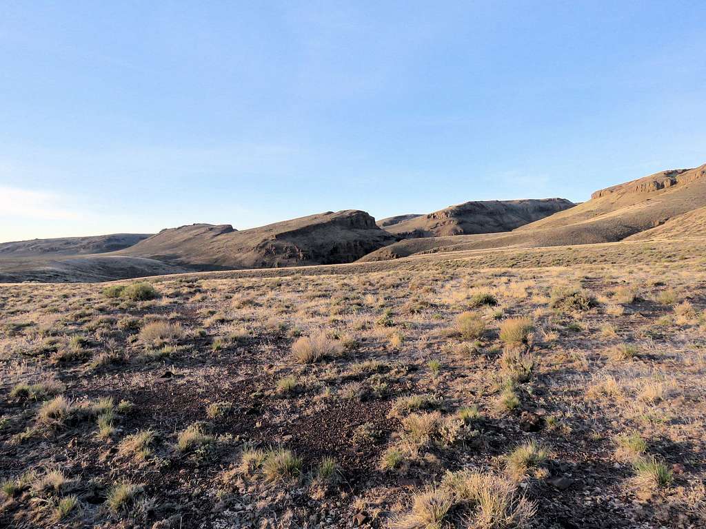
Followed a trail up the east side of the canyon to a plateau at 3750 ft elevation, then left trail and began to go up sage covered slopes to a 3910 ft saddle between two hills. I could then look south to see my path down 50 vertical feet followed by up 500 vertical feet to reach the southeastern rim of the canyon.
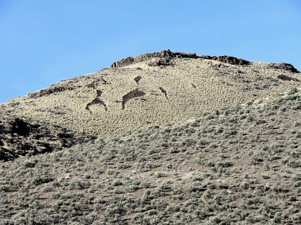
Strange marking on a hill.
As I went up the slope, I saw a herd of cattle near the top. They began to sound and appear agitated. Where there were cows, there were sure to be cowboys. I did not want to come across a cowboy telling me that I was walking somewhere I should not have been walking but the map clearly indicated that I was in Little Jacks Wilderness. What were all those cattle doing in the “Wilderness”? As I went higher, a gently sloped plateau appeared in front of me to the southwest. The cattle kept moving further back except for a lone one that I assumed was the leader but she too got scared and moved away. They were big and multiple and I was alone and small. Why would they not get together and attack me? Well if they were that smart, they would not have become hamburgers by the billions.
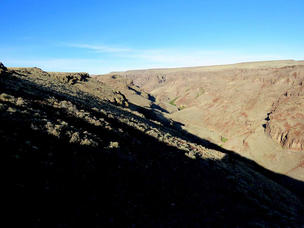
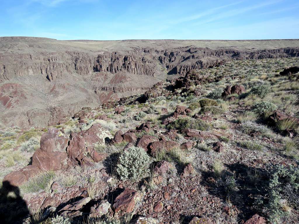
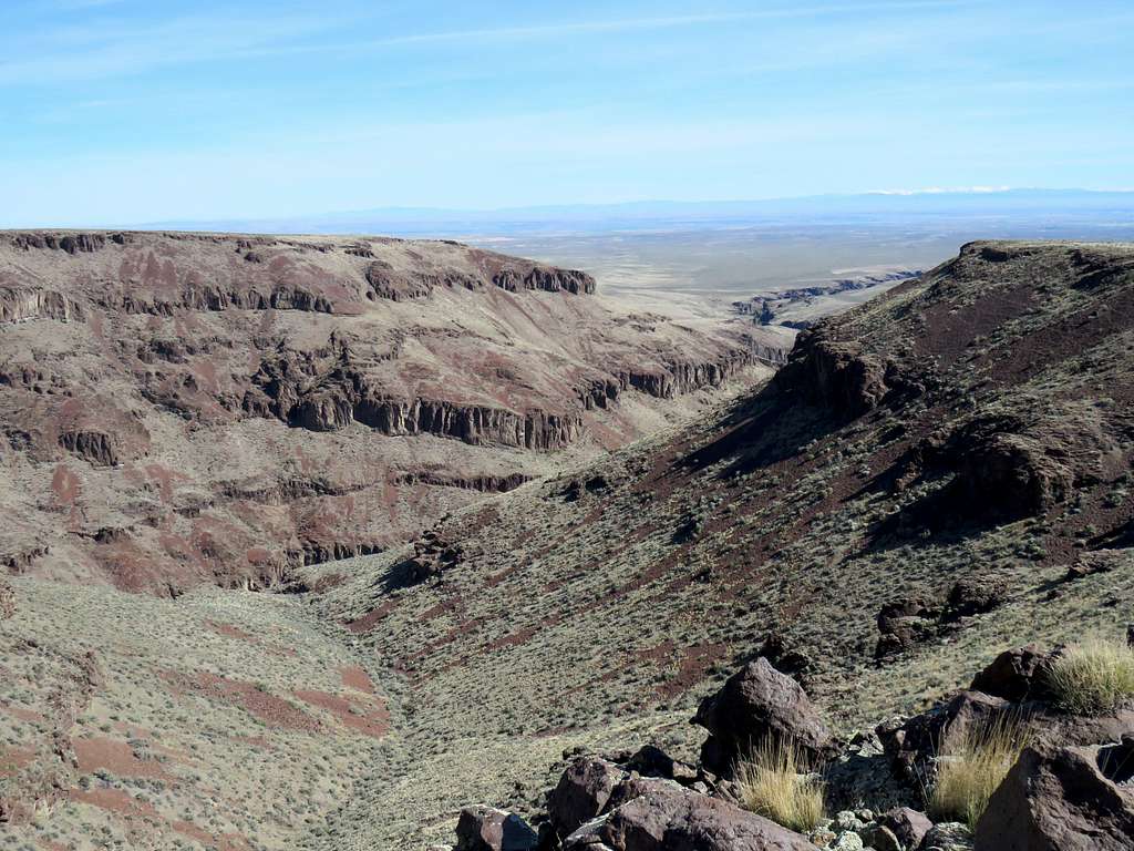
At an elevation of 4250 ft, I went to the edge and got my first look into the canyon.
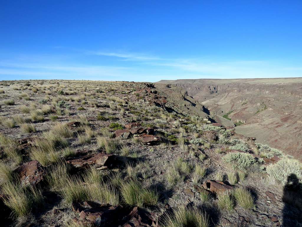
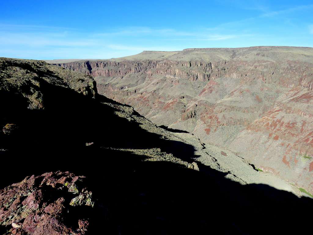
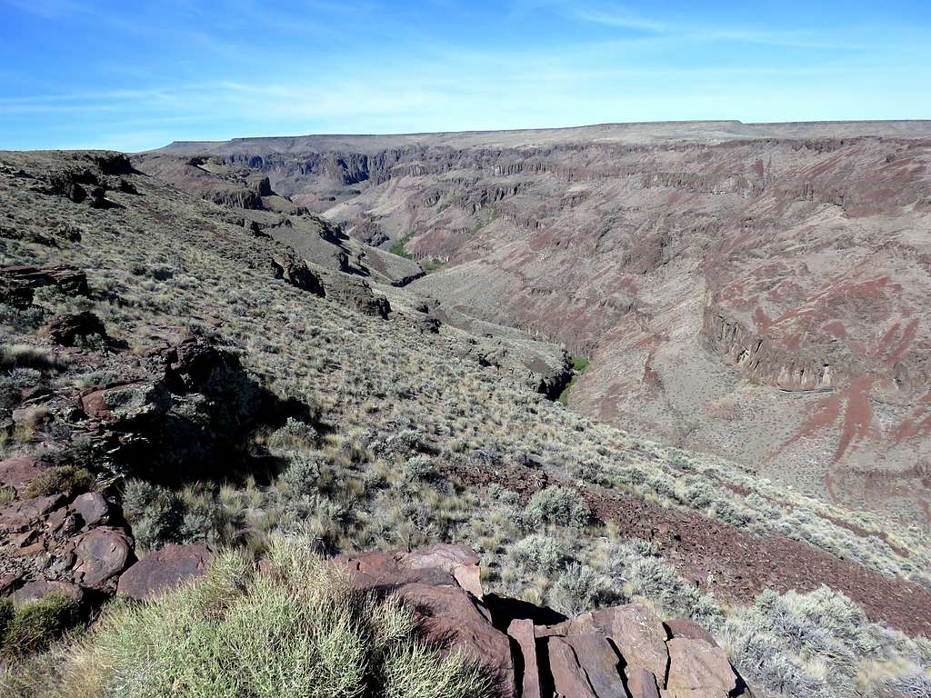
Continued southwest along the rim going slowly higher in elevation.
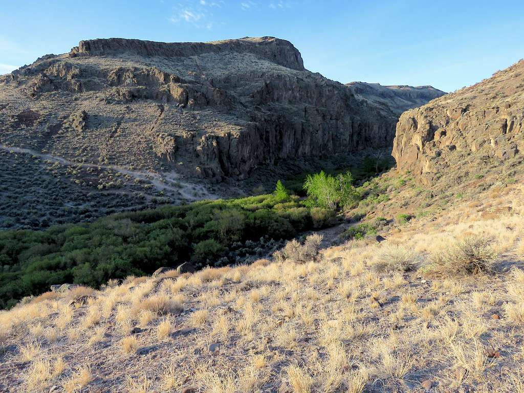
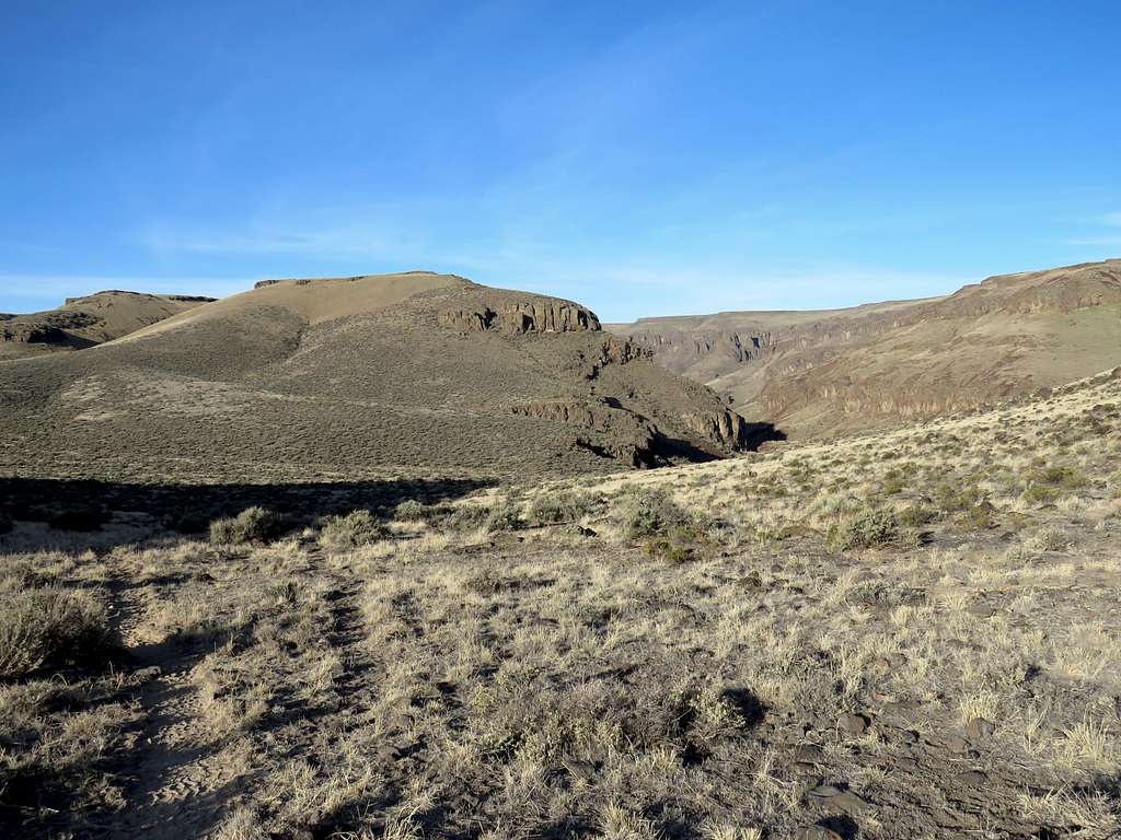
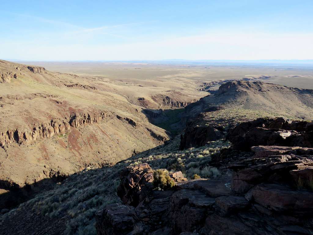
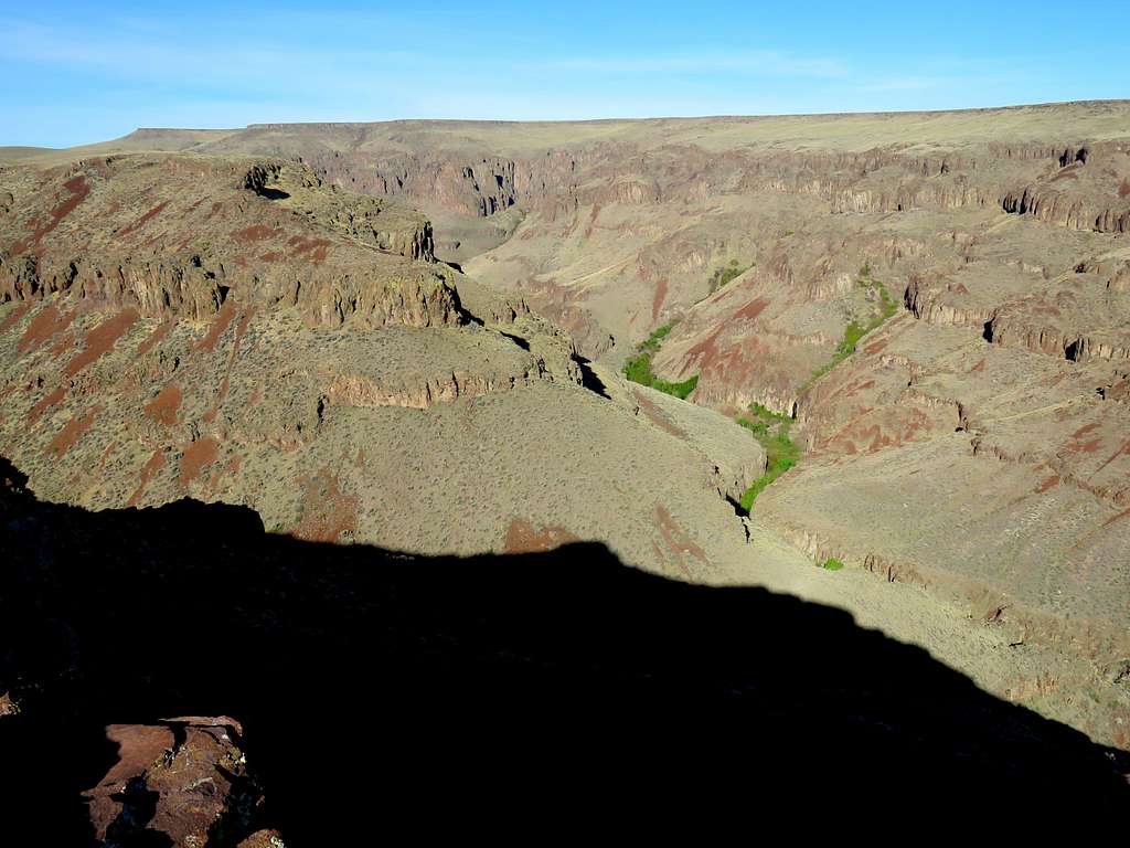
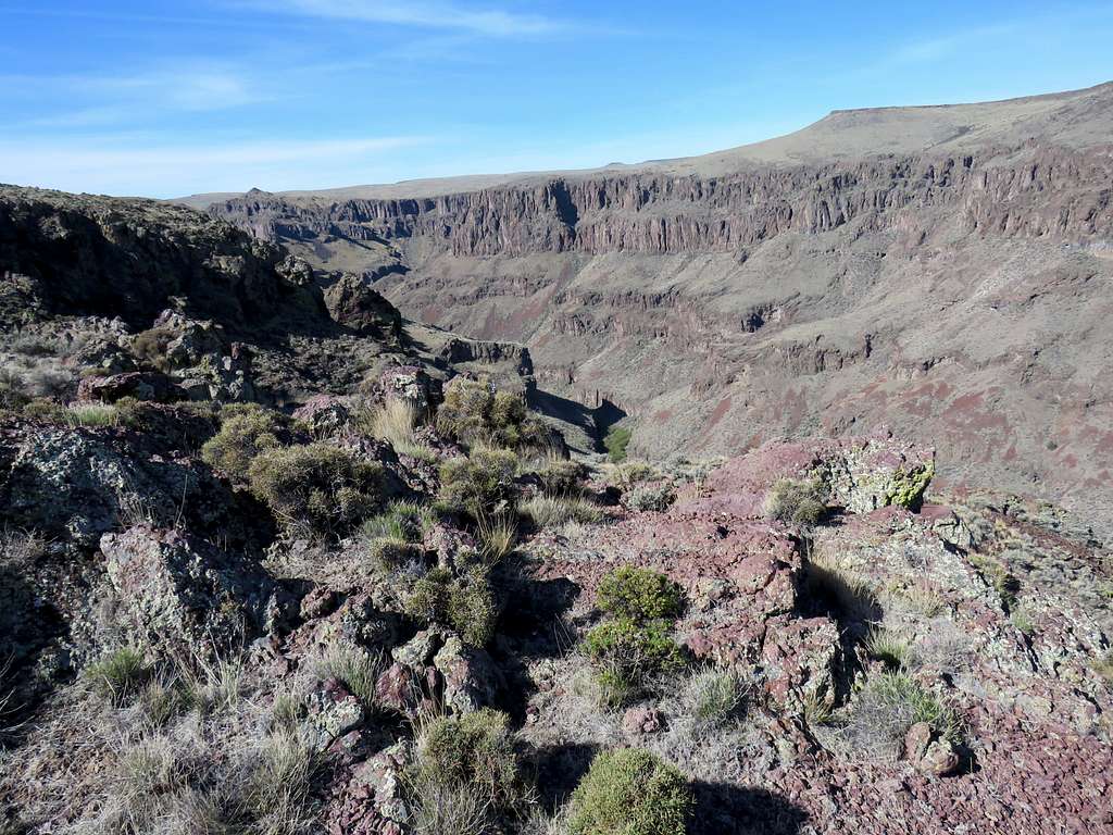
Plateau and the canyon.
A side canyon made me go away from the rim for some time.
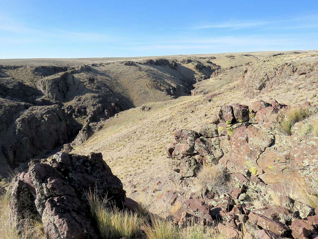
There was a smaller canyon to the east. I went that way and took a couple of pictures.
Was then back to the rim of the main canyon. Was starting to feel hot.
At 9:41 a.m. and 4.18 miles of hiking, I went toward a rocky outcropping on the rim where I sat to eat, rest and enjoy the views.
Left at 10:10 a.m. and began to retrace my way back.
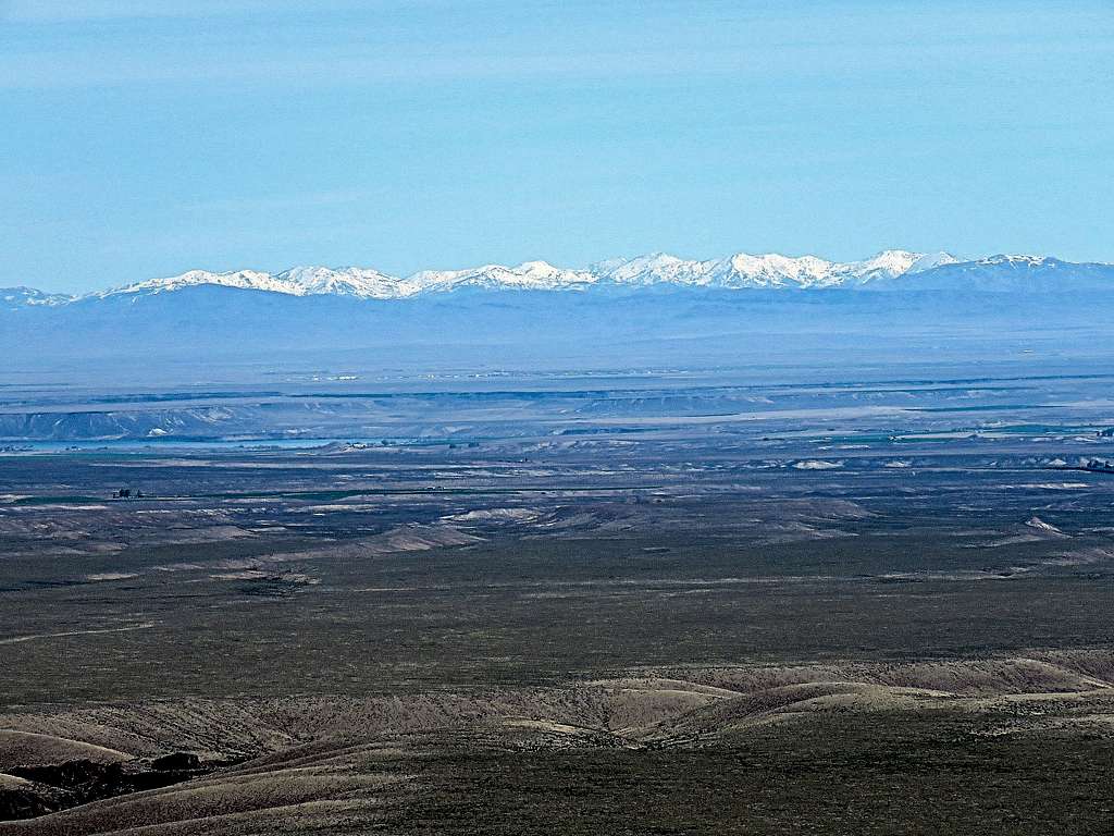
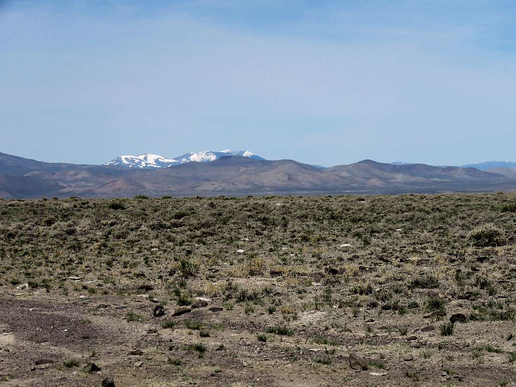
Zoomed view to the northeast showing snowy mountains around Trinity Peak 70 miles away and Snake River 20 miles away.
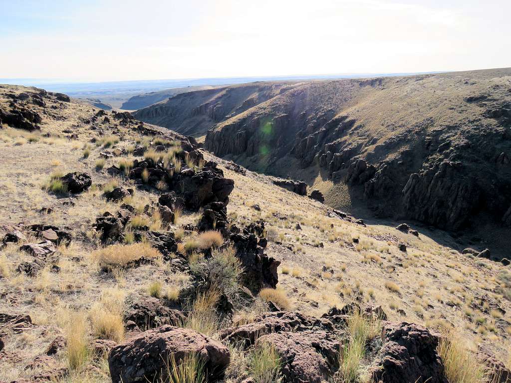
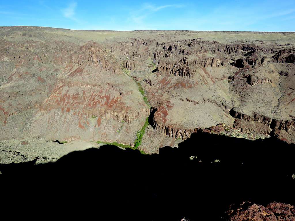
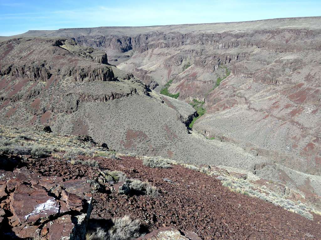
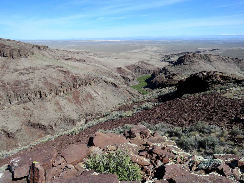
Last looks into the canyon.
When I reached the top of the steep slope, I saw a man riding a horse coming up. As I suspected, he was a cowboy and said was going to roundup the cattle. We exchanged a few words and then I was on my way down the slope. I could see another cowboy at the 3910 foot saddle in the far distance with a few cows near him. Getting closer to the cows, they got scared and began to move away but the cowboy rode toward them and pushed them back. I went out of my way to keep my distance from the cows and then reached the cowboy. After saying hi, he asked if I had left the gate open. I said I had not seen a gate (in my mind thinking of a gate that swivels open and shut) and asked where the gate was. He said on the other (west side) of the creek and said how finding cattle that move beyond the gate is time consuming and a potential financial loss. He was nice about it. I expressed sympathy and said I usually pay attention to that. I then went down to the bottom of the canyon and crossed to the west side of the creek where I found the “gate” he was talking about. A wire fence ran across the trail and you had to untie a rope causing the fence to collapse. When I had come in the morning, the gate must have been open and the wire removed from the surface of the trail. I made sure to close the gate behind me.
I then had a 230 vertical feet uphill to reach where I had parked. At the place where the trail turned to road, I saw a beat up old SUV with 3 people next to it. A guy asked what the view at the bottom of the canyon was and I told him I had gone up to the rim. He then got on the trail going toward the bottom of the canyon. I told him to make sure he closes the gate. Was then worried that he might not do so causing the cowboy to think that I left it open again. Was then walking up the road toward where I had parked. Could see the continuation of the canyon on the desert floor.
Reached my Jeep at 12:06 p.m.. Temperature was 73 degrees F. Zoomed view of Quicksilver and Hayden Mountains 31 miles away.