-
 2947 Hits
-
 73.06% Score
-
 3 Votes
|
|
Route |
|---|---|
|
|
28.15181°N / 17.33528°W |
|
|
Hiking, Scrambling |
|
|
Spring, Summer, Fall, Winter |
|
|
Half a day |
|
|
Hike and Scramble |
|
|
Overview
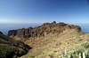
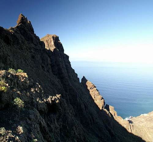
 The Tejeleche Range as seen from the traverse through the west face of Lomo de Carreton The Tejeleche Range as seen from the traverse through the west face of Lomo de Carreton |
To reach Tejeleche from Arure you have to descend from 900m to about 450m before heading up towards the Tejeleche palteau via its north face. The route is very panoramic with the red basalt faces of Lomo de Carreton contrasting beautifully with the wild Tejeleche range.
The first part of the route is a traverse through the west face of Lomo de Carreton, along ledges which lead you directly underneath the beautiful basalt faces. The second stage is a steep descent to the road which connects Taguluche with the rest of the world, then a traverse of the Tejeleche east ridge. Finally you head aaround to the Tejeleche north face and follow an overgrown path which heads through the steep slopes beneath the faces. Orientation is a bit tricky here.
|


Getting There
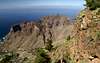
 Tejeleche Range with La Palma in the background
Follow the instructions n the main page which will lead you to Arure. The trailhead is at Mirrador Ermita del Santo, a very popular spaot. If you come with a car, there is ample parking space about 200m further down the road from the regular parking lot at the mirrador.
Route Description
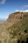
 Tejeleche summits
- Start altitude: 900m
- Summit altitude: 600m
- Prevailing exposure: W, later N
- Type: 2-3h
- Protection: None
Starting at the Mirrador del Santo at Arrure a path heads northward from the lookout platform near the Ermita. After a few steps a marked path turns off to the left. It heads down to Taguluche. Stay on the straight path instead, which leads onto a ledge in the west face of Lomo de Carreton. Over the next half hour you will hike underneath several beautiful reddish basalt faces which make up the upper part of Lomo de Carreton's west face.
After having reached the end of the concave face the path quickly descends towards the road which connects Taguluche with the rest of the world. It joins the road at the saddle which the Tejeleche east ridge forms. Cross the road and hike the east ridge towards the intersection of the Ajolera and Taguluche routes to Tejeleche. Stay on the ridge, hiking towards the east face of Punta de Tejeleche. Before you reach it the path turns north, avoiding the face and heading for a lookout platform above Ajolera instead.
From the platform you can see the next stage of the route - a slope traverse through the lower parts of the Tejeleche north face. A barely visible path crosses the slope and heads for a notch in the north face which separates Punta de Tejeleche from the main summits of the range. In the notch the route from Punta de Tejeleche joins. Negotiating several spurs the path slowly winds its way along the plateau and reaches a gully which heads up to a saddle. Be sure to climb to this saddle for breathtaking views to the wild coast underneath. Return for some 100m, then turn south and you circle the main summits of Tejeleche reaching another plateau to the south of the main summit. There's a lookout summit from which you have a great overview across the whole range.
|