
|
|
Route |
|---|---|
|
|
42.97800°N / 73.072°W |
|
|
class 1+ |
|
|
A long day |
|
|
Walk-up |
|
|
Approach
The closest road is USFS 71 which is accessable from Stratton-Arlington Road (a.k.a. Kelly Stand Road), however that crossing really is not a trailhead. Also nearby is the large and ever popular Stratton Mountain trailhead. Both those spots are accessed by traveling west from Stratton, VT or east from Arlington on the road of the same name.
USFS 71 is 8.9 miles from the summit. Stratton Mtn TH is 10.9 miles away.
Route Description
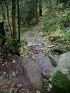
This trail is completely wooded and offers limited views. Watch the trees change as you gently ascend.
Mileage to landmarks
0.0 Stratton Trailhead
0.9 bridge over black brook
2.0 USFS 71
3.6 Story Spring Shelter
7.4 Caughnawaga Shelter (Kid Gore just beyond and down a short side trail)
10.9 Summit
 |
Essential Gear
Winter hikers will want snowshoes and poles of course, but summer hikers can get by with the usual basics. Caughnawaga should be considered an overflow shelter for the beautiful Kid Gore. If you are planning on staying at the Goddard shelter on the south side of the summit be prepared to camp out anyway if it is already filled with people. It can be very popular.
Miscellaneous Info
If you have information about this route that doesn't pertain to any of the other sections, please add it here.