

Steve Larson - Jun 13, 2006 1:44 am - Hasn't voted
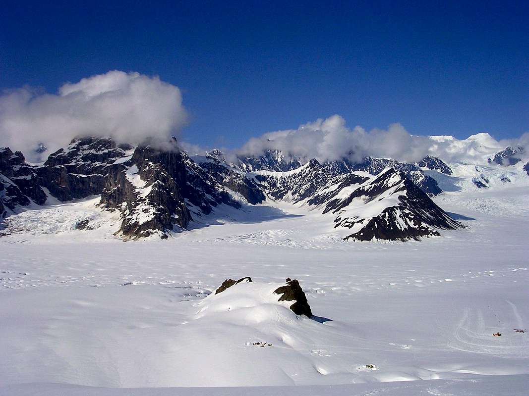
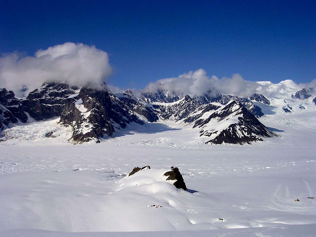
You're on Mt. BarrillYou can't see the hut from Dickey...

PellucidWombat - Jun 13, 2006 8:42 pm - Hasn't voted
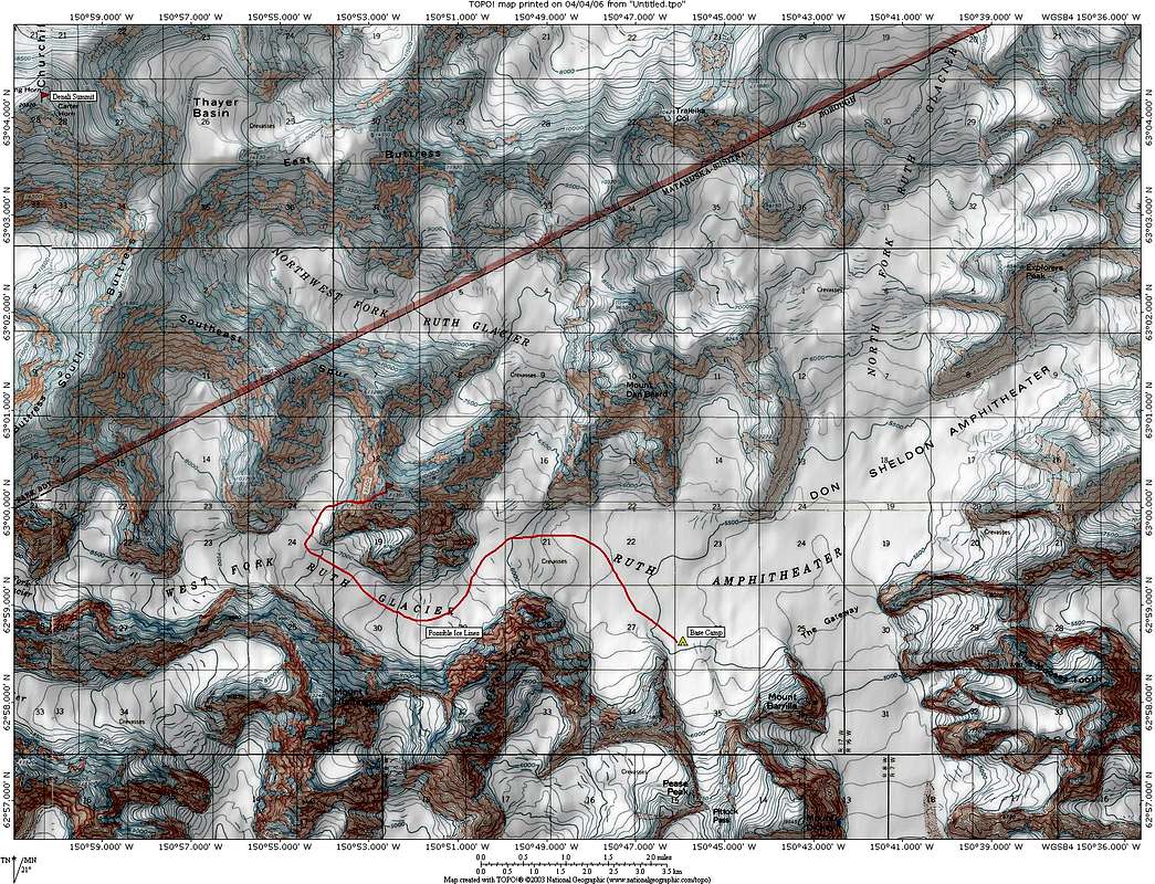
Re: You're on Mt. BarrillI beg to differ (or clarify). You can't see the hut from the top slopes of Dicky, but Dickey has a northern buttress that drops right down onto the ridge that runs to the mountain hut. You can see the mountain hut from the base of this buttress, which was about 400 vertical feet above our camp. You can see this in the topo. Our tent was just north of the #35 on the map (not where labeled on the map).
Steve Larson - Jun 14, 2006 12:04 am - Hasn't voted
Re: You're on Mt. BarrillThat stretches my definition of where one peak begins and another begins a little farther than I'd be willing to go. At what point on the west ridge of Barrill does it stop being Barrill and start being part of Dickey?
PellucidWombat - Dec 30, 2008 10:16 pm - Hasn't voted
Re: You're on Mt. BarrillIf you look at this photo, the west ridge of Barrille enters from the left to merge with Dickey, while what I'm calling the NW Buttress is marked by the green line in the photo. I figured the distinct pass to the left gives it enough prominence/isolation to say that it is clearly a part of Dickey and not Barrille.
Cheers.


Comments
Post a Comment