Toggle navigation
Mountains
Routes
Images
Trip Reports
Forum
What's New
People
Areas & Ranges
Articles
Trailheads
Canyons
Huts & Campgrounds
Albums
Logistical Centers
Fact Sheets
Lists
Custom Objects
Gear
Plans & Partners
WELCOME TO SUMMITPOST
SIGN IN
REGISTER
Aneroid Mountain
Additional Parents
Image
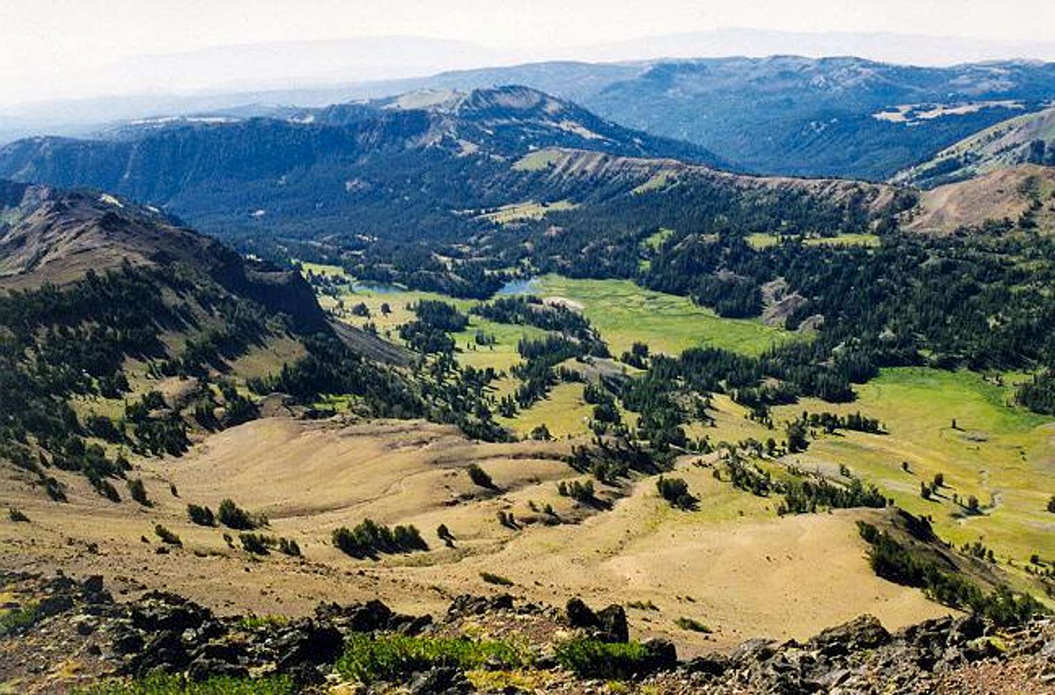
Looking down from the summit...
View High-Resolution Image
Looking down from the summit...
Looking down from the summit to the basin on the southeast. The drainage is the Middle Fork Big Sheep Creek.
And see sheep I did!
The Bonny Lakes are also visible. August 18, 1998.
« PREV
NEXT »
Klenke
on
Nov 9, 2004 11:50 pm
Comments & voting
Other parents
Lat/Lon:
45.20330°N / 117.1736°W
Image ID:
77646
3048 Hits
72.6
% Score
3
Votes
Log in to vote
Comments
No comments posted yet.
to post!
Don't have an account?
Aneroid Mountain
(Mountain/Rock)
« PREV
Viewing
#30 of 67
GALLERY
NEXT »
Klenke's Image Gallery
« PREV
Viewing
#2979 of 5376
GALLERY
NEXT »
×
You need to login in order to vote!
User Name
Password
Remember me
Forgot your password?
Log me out when I close my browser.
Keep me logged in all the time.
sign in as a user
Don't have an account?
Register now for FREE
Rating available
Suggested routes for you
People who climb the same things as you
Comments Available
Create Albums
Register Here


