Toggle navigation
Mountains
Routes
Images
Trip Reports
Forum
What's New
People
Areas & Ranges
Articles
Trailheads
Canyons
Huts & Campgrounds
Albums
Logistical Centers
Fact Sheets
Lists
Custom Objects
Gear
Plans & Partners
WELCOME TO SUMMITPOST
SIGN IN
REGISTER
Leatherman Peak
Additional Parents
Image
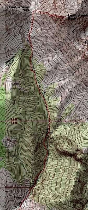
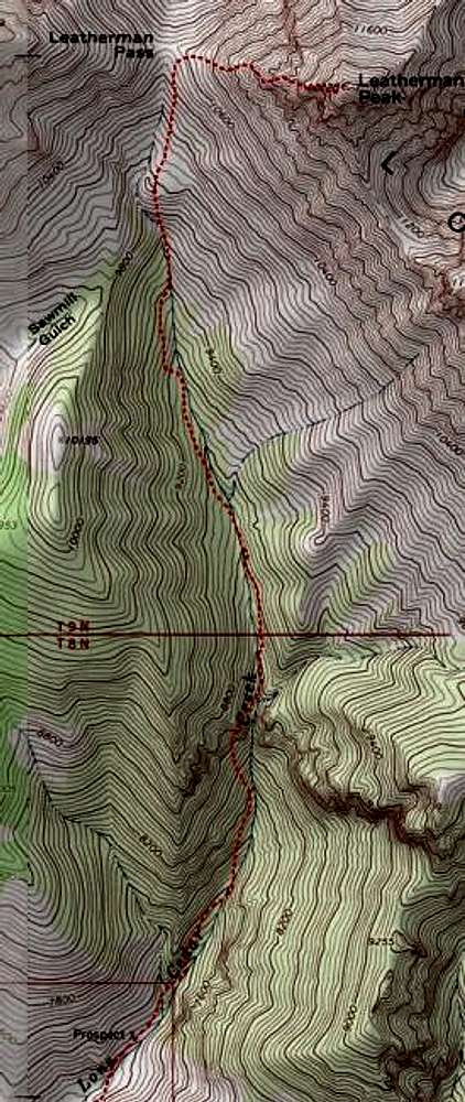
Map showing the Lone Cedar...
View High-Resolution Image
Map showing the Lone Cedar...
Map showing the Lone Cedar access
« PREV
NEXT »
IdahoClimber
on
Nov 24, 2003 5:18 pm
Comments & voting
Other parents
Lat/Lon:
44.08200°N / 113.733°W
Image ID:
33953
4824 Hits
77.48
% Score
8
Votes
Log in to vote
Comments
No comments posted yet.
to post!
Don't have an account?
Leatherman Peak
(Mountain/Rock)
« PREV
Viewing
#52 of 87
GALLERY
NEXT »
IdahoClimber's Image Gallery
« PREV
Viewing
#40 of 87
GALLERY
NEXT »
Southwest Face
(Route)
Loading....
×
You need to login in order to vote!
User Name
Password
Remember me
Forgot your password?
Log me out when I close my browser.
Keep me logged in all the time.
sign in as a user
Don't have an account?
Register now for FREE
Rating available
Suggested routes for you
People who climb the same things as you
Comments Available
Create Albums
Register Here


