Toggle navigation
Mountains
Routes
Images
Trip Reports
Forum
What's New
People
Areas & Ranges
Articles
Trailheads
Canyons
Huts & Campgrounds
Albums
Logistical Centers
Fact Sheets
Lists
Custom Objects
Gear
Plans & Partners
WELCOME TO SUMMITPOST
SIGN IN
REGISTER
Mali Vrh
Additional Parents
Image
Map
View High-Resolution Image
Map
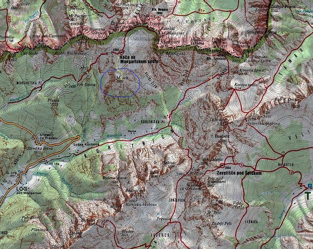
The part of
TRIGLAV NATIONAL PARK
map.
Mali Vrh (1991 m)
is inside of blue marked ring. The route from
Mangartska Koca (1906 m)
to Mali Vrh is marked with yellow color. Click on the map to resize it!
« PREV
NEXT »
vvujisic
on
Aug 27, 2006 9:59 pm
Comments & voting
Other parents
Image ID:
219742
3253 Hits
72.08
% Score
2
Votes
Log in to vote
Comments
No comments posted yet.
to post!
Don't have an account?
Mali Vrh
(Mountain/Rock)
« PREV
Viewing
#24 of 24
GALLERY
You are at
the Last
Image
vvujisic's Image Gallery
« PREV
Viewing
#2011 of 2579
GALLERY
NEXT »
×
You need to login in order to vote!
User Name
Password
Remember me
Forgot your password?
Log me out when I close my browser.
Keep me logged in all the time.
sign in as a user
Don't have an account?
Register now for FREE
Rating available
Suggested routes for you
People who climb the same things as you
Comments Available
Create Albums
Register Here


